Updated 03.15.23 @ 6:58a
Let’s start with the good news and that’s today’s forecast. Despite a bitterly cold start (most are waking up to temperatures between 18° and 22°), expect plentiful sunshine today. Though it’ll be unseasonably chilly, that March sun angle will go a long way in making it feel a lot better by this afternoon.
Clouds will increase overnight and Thursday morning and eventually give way to light rain by afternoon. We anticipate rain to reach the city, itself, between 2p and 3p.
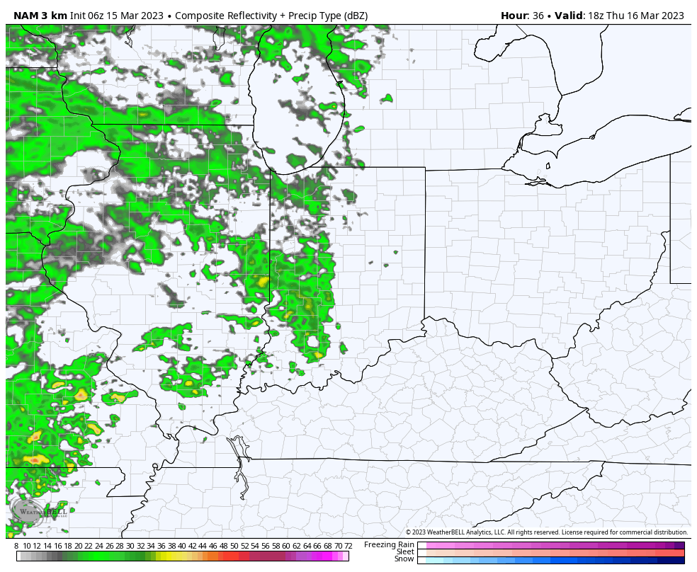
Rain will become steadier and more widespread as we progress through the evening and Thursday night.

Precipitation may end as a brief period of snow Friday morning, but “brief” is the key word. In general, heaviest rain is expected to fall across the southern half of the state, mostly along and south of the I-70 corridor. This is a 0.25” to 0.75” type event for most.
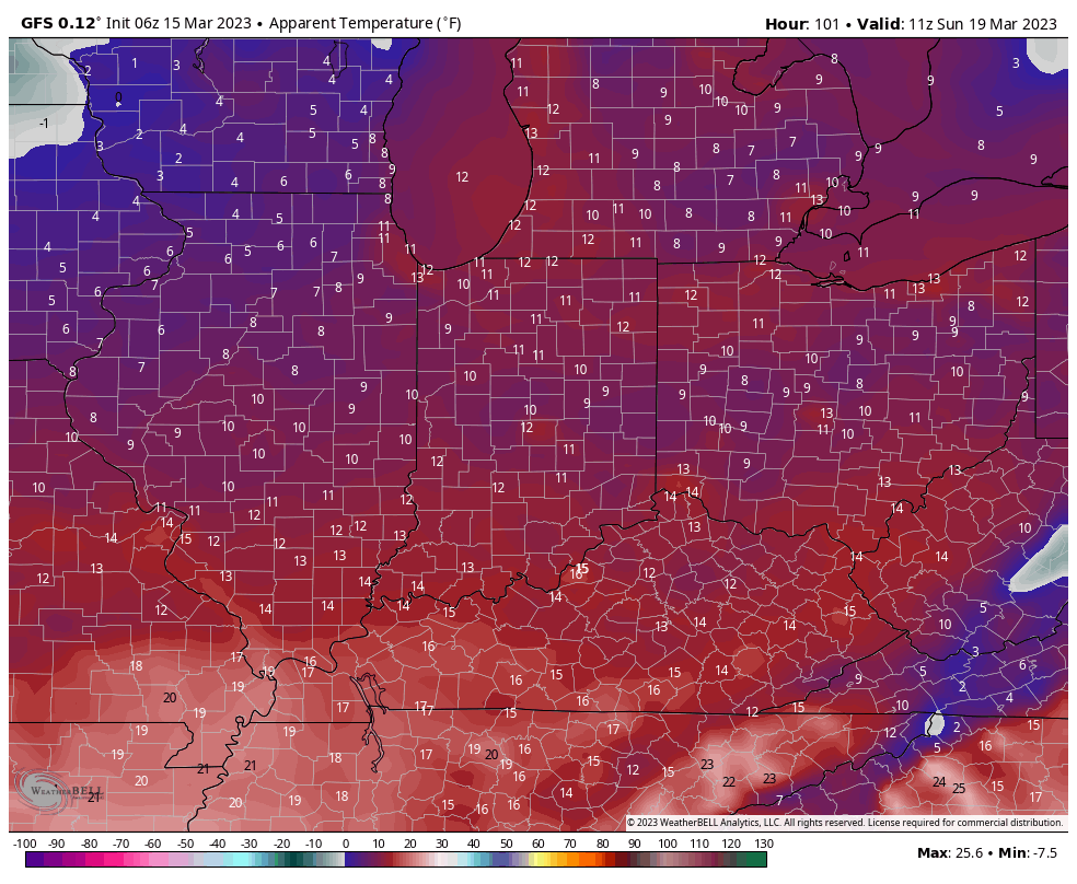
The bigger story comes in the form of another late season arctic “jab” behind the frontal passage. Highs both Saturday and Sunday will remain stuck in the 30s with overnight lows once again dropping into the upper 10s to lower 20s. Wind chill values will fall into the single digits to lower 10s.