
Updated 03.07.23 @ 6:05p
The highly advertised pattern shift is upon us. The downright balmy February and open to March will reverse in significant fashion in the coming days and weeks, and an active storm track is expected to accompany the chillier times.
Of course, this time of year, that doesn’t mean the active pattern will yield snow and winter storms. Ironically, this year, Mother Nature looks to be saving the best opportunity though of cashing in on wintry “fun and games” for the 1st month of meteorological spring- yes, in the face of the challenges that higher March sun angle presents. It’s important to note you need heavy precipitation rates and/ or wintry precipitation falling at night to get any sort of significant accumulation. At the very least, the next 2-3 weeks (at least) sure will make for frustrating times for those longing for true “stick and hold” spring.
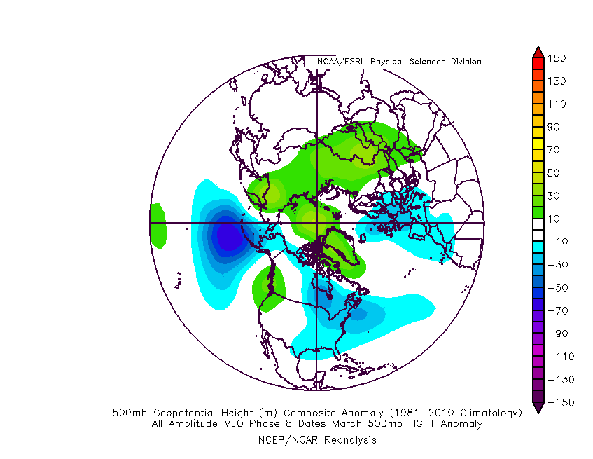
The Madden Julian Oscillation (MJO) will amplify right into the textbook cold phases over the next couple of weeks.

The composite March analogs for phases 8 and 1 show the trough taking up residence across our part of the country, including the increased likelihood of high latitude blocking. That blocking is important as it will not only serve to “bog the pattern down,” (meaning 1 or 2 storms should try and deepen as they roll towards the East Coast, as opposed to the energy flying by so quickly things can’t phase). The blocking also can be attributed to more of a persistent nature of below normal chill (obviously not in terms of “absolute” temperatures) compared to what we’ve really seen all winter.

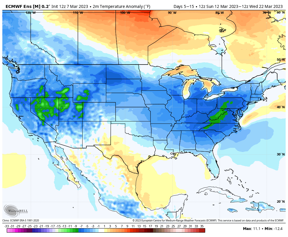
Ensemble guidance shows this plan coming together nicely:
As the high latitude blocking becomes established, forecast models will likely have to correct south a bit with the ‘mean’ storm track (compared to what is shown today). While I still don’t anticipate this doing much, if anything, with Friday’s system across immediate central Indiana, this does make for more interesting times early next week.
Today’s 12z European provides the most likely picture of what I feel will take place with the system in the Sunday-Monday time frame. The reason for such is that the upper level pattern should promote a healthier system (more organized than what the GFS shows) that bowls under the block and puts the Ohio Valley, eventually into the eastern chunk of the country (Mid Atlantic and Northeast) in play for snow and/ or a wintry mix. Once we get closer, I envision a system that may resemble what we’re looking at Thursday into Friday morning, just further south, thanks to the block becoming more established.

There will likely be additional storm systems that pose a similar wintry threat beyond this system as we look towards closing out March.
Looking back over the years, a return of winter is almost a given around these parts as March Madness looms, so I guess we shouldn’t be surprised…