
Updated 03.19.23 @ 12:40p
I. By late-March standards, we’re looking at another downright frigid day (yes, even with that increasingly high sun angle these days). Overnight lows bottomed out deep into the 10s this morning. We’ll, thankfully, begin to moderate this afternoon and that same trend will carry us into the 60s by Thursday. Hang in there.

II. Unfortunately, that moderating trend will also come with renewed unsettled weather. While the work week will get off to a nice start, rain returns Tuesday night as an increasingly moist southwesterly air flow takes hold.

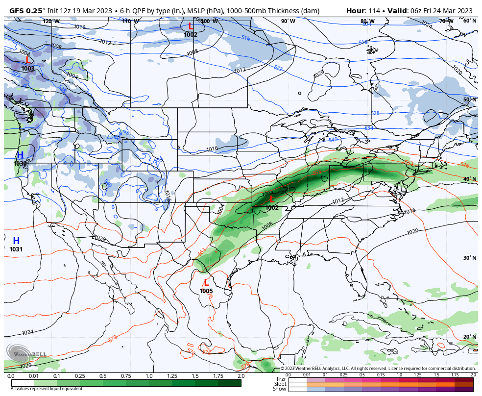
III. It still doesn’t appear as if the lead wave of moisture Tuesday night and Wednesday morning will be a big deal but it will set the tone for what lies ahead to close the work week. We continue to circle Friday as the day that will bring heaviest rain and an associated flood threat. Widespread 3”+ rain amounts remain on the table and we’ll be able to hone in on more specific placement and amounts as we get through the next 24-48 hours.
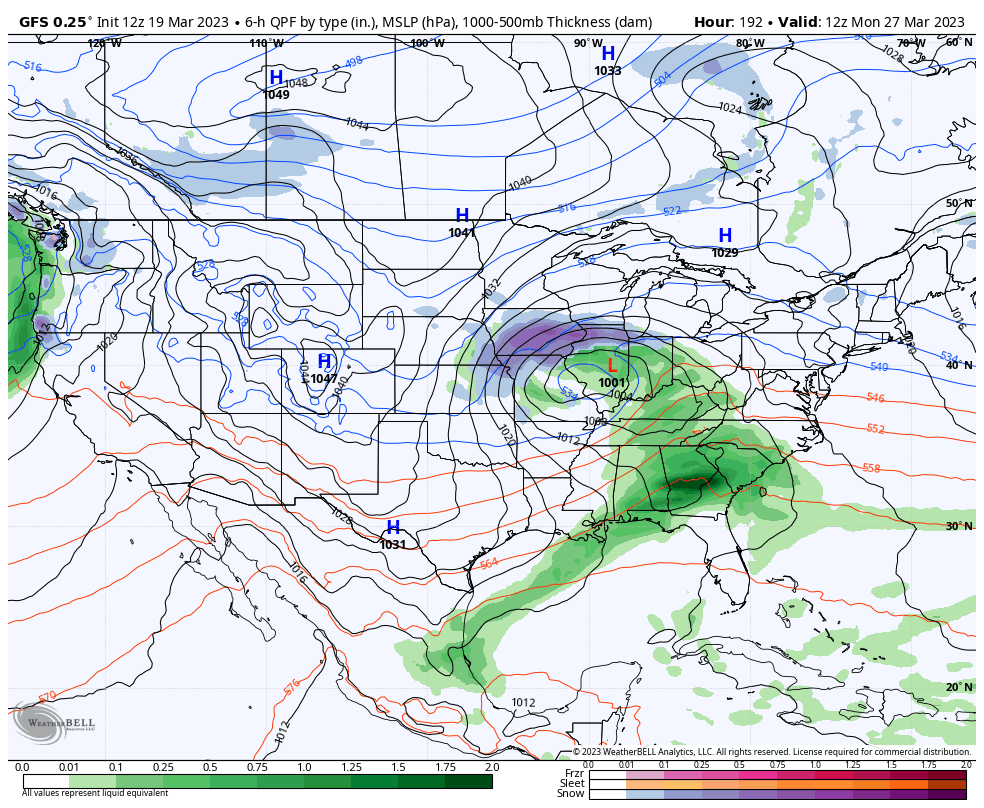
IV. If that’s not enough, guidance brings another organized system through the region late next weekend, as well. Needless to say, well above normal precipitation is expected over the course of the upcoming 7-10 days and flood risks will have to be monitored closely as this pattern evolves.

V. A reinforcing chilly airmass will likely follow next Sunday’s system.

Side note: Monday’s normally scheduled client video discussion will be posted Monday evening due to travel. I apologize for any inconvenience and look forward to reviewing fresh 12z guidance concerning the items above (and more) tmrw evening.