Updated 05.18.21 @ 8:31a
You must be logged in to view this content. Click Here to become a member of IndyWX.com for full access. Already a member of IndyWx.com All-Access? Log-in here.

May 18
Updated 05.18.21 @ 8:31a
You must be logged in to view this content. Click Here to become a member of IndyWX.com for full access. Already a member of IndyWx.com All-Access? Log-in here.
Permanent link to this article: https://indywx.com/video-the-heat-is-on-2/
May 17
Updated 05.17.21 @ 4:51p
You must be logged in to view this content. Click Here to become a member of IndyWX.com for full access. Already a member of IndyWx.com All-Access? Log-in here.
Permanent link to this article: https://indywx.com/evening-video-stormy-at-times-now-but-a-drier-trend-develops-for-the-2nd-half-of-the-week-mjo-plays-a-big-role-to-close-may-open-june/
May 17
Updated 05.17.21 @ 7:51a The transition to a more summer-like regime is being kicked off with showers and embedded thunder this morning. As we look forward to the rest of…
You must be logged in to view this content. Click Here to become a member of IndyWX.com for full access. Already a member of IndyWx.com All-Access? Log-in here.
Permanent link to this article: https://indywx.com/unsettled-open-to-the-week/
May 16
Updated 05.16.21 @ 7:40a
Scattered light showers are scooting across central Indiana this morning but our airmass still will take some time to saturate throughout all levels. As such, we don’t expect widespread heavy rain and embedded thunder until we get into the new work week. You’ll notice an increasingly muggy time of things Monday and Tuesday. Note the Gulf connection below. This will send dew points well into the 60s. Temperatures will also be on the rise (low/mid 80s) which will have things feeling very much like summer by mid and late week.
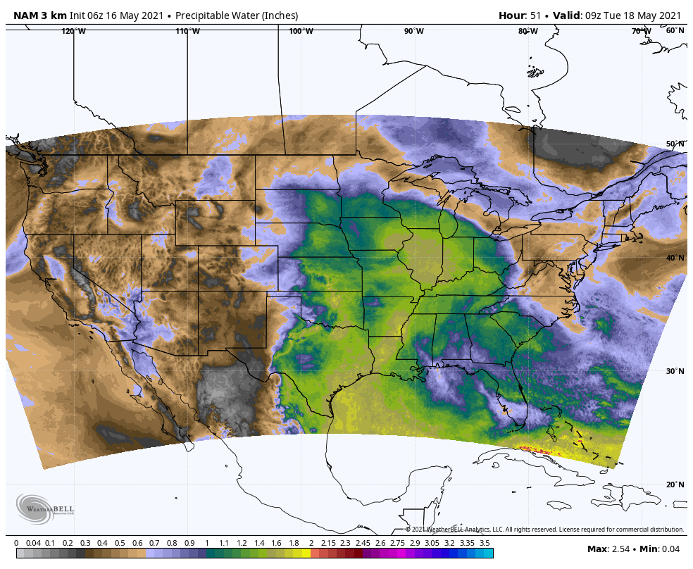
The transition of air masses will lead to a stretch of unsettled weather. We note model guidance has trended wetter over the past 24 hours for immediate central Indiana. We’re now honing in on Monday evening into Tuesday morning offering up the most widespread heavy rain and embedded thunder. Locally heavy rain will be possible during this timeframe. Some central Indiana rain gauges may pick up more than 2” of rain during this time period. Widespread 1.25” to 1.75” amounts can be expected.
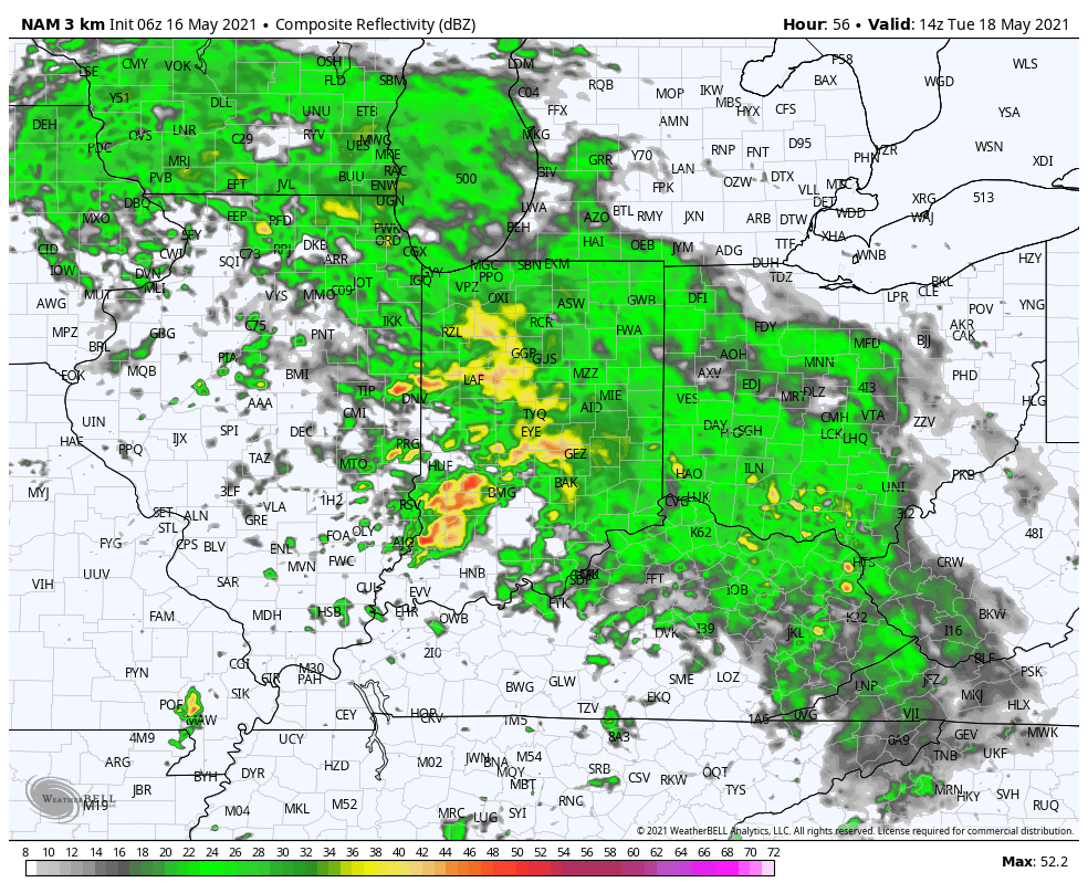
Scattered, “splash and dash” storms will remain in our forecast into midweek before high pressure nudges itself into place and promotes a drier regime for the 2nd half of the week.

Permanent link to this article: https://indywx.com/change-is-on-the-horizon/
May 15
Updated 05.15.21 @ 7:29a
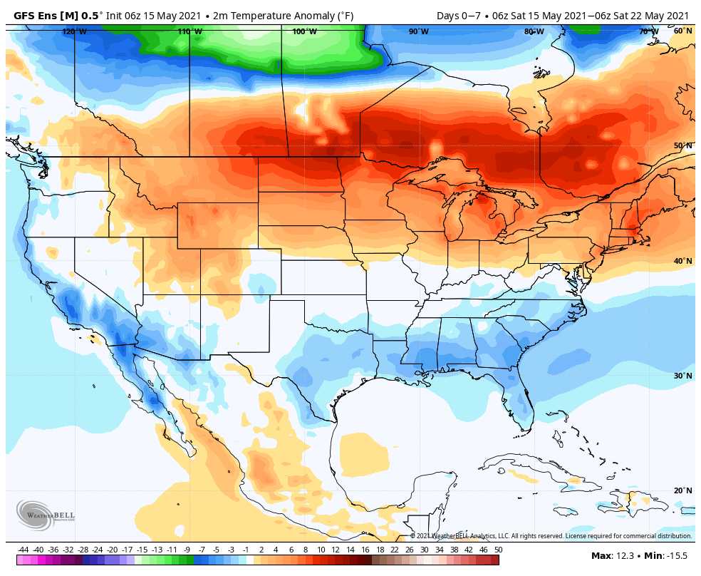

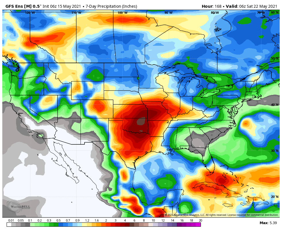
Forecast Period: 05.15.21 through 05.22.21
Change is ahead over the upcoming week towards a pattern more typical of what we’d come to expect this time of year. We’ll say goodbye to the cool, crisp air in the short term period and replace it with an increasingly warm and muggy feel of things. Scattered showers and thunderstorms will accompany this transition. While the chances of widespread heavy rain are diminishing, we will see scattered to numerous showers and storms during the early and middle part of the work week. These will be of the “splash and dash” variety and certainly won’t require any cancellation of outdoor plans. High pressure appears like it’ll nudge its way into the region Wednesday night, allowing us to enjoy another stretch of dry conditions as we close the work week and head into next weekend.
Permanent link to this article: https://indywx.com/weekly-agwx-and-severe-weather-outlook-30/