
Updated 05.23.21 @ 9:26a

Forecast Period: 05.23.21 through 05.30.21
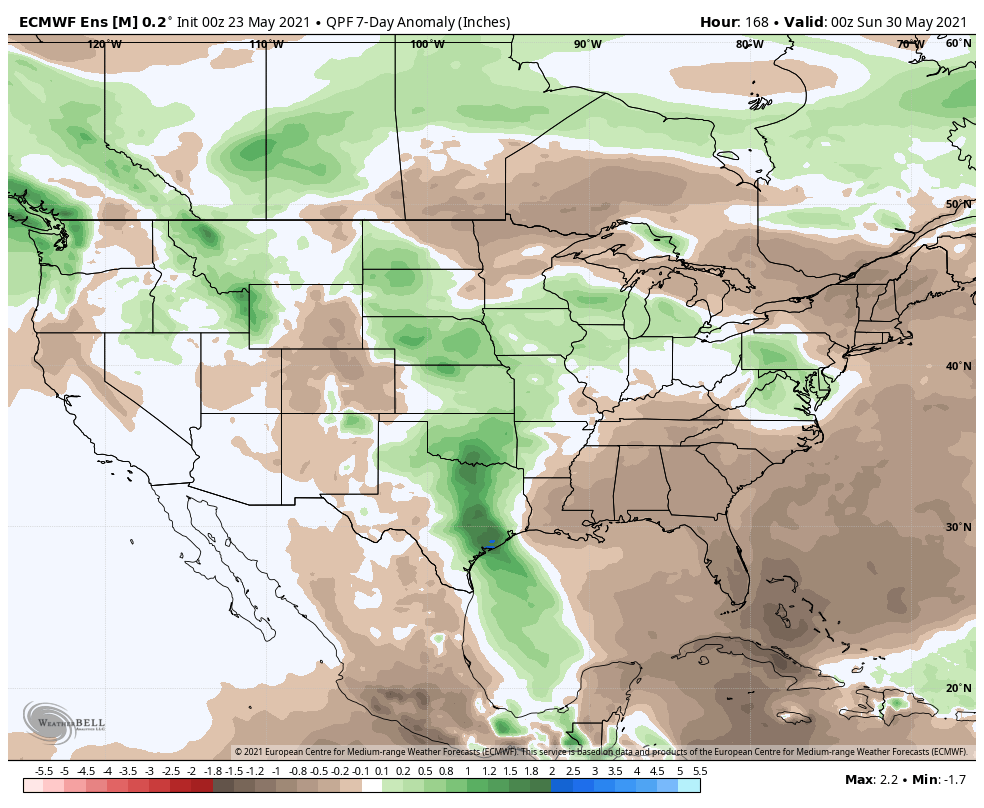
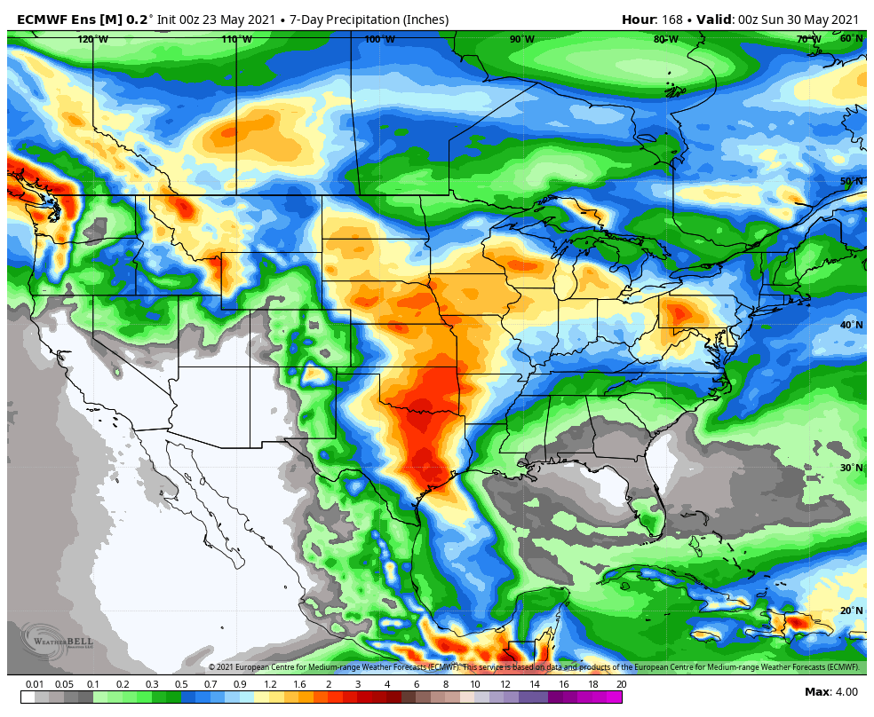
A ridge of high pressure will continue to dominate our weather through the early week period. With high pressure in control, we can expect a continuation of mostly dry and unseasonably hot weather through Tuesday. That will all begin to change by midweek as the ridge breaks down and an approaching cold front creates better chances of showers and thunderstorms. This frontal passage will be followed by a wave of low pressure that will push through the Ohio Valley Thursday night and Friday. This low pressure system will likely feature a renewed opportunity of moderate rain and thunderstorms to close the work week. The good news is that model consensus keeps the all-important Saturday through Monday period rain-free (finger’s crossed that holds) and much cooler.