
The pattern into the medium range period continues to look like a broken record: excessively wet. Unfortunately, flood and flash flood warnings will continue to likely be issued over the next 7-10 days on an almost daily basis for at least portions of the immediate viewing area.
Current Flash Flood Guidance can be found below:

In most cases across central and southern Indiana, we’re only talking about rainfall of 1″ to 1.5″ in an hour’s timeframe that will cause flash flooding. 3 hour guidance is in the 1.5″ to 2″ range.
Tuesday will feature less overall aerial coverage of showers and thunderstorms (widely scattered) as compared to the past few days. However, we’re tracking (2) surface waves that will result in more widespread heavy rain and thunderstorms Wednesday afternoon into Thursday and again over the weekend into early next week with a moisture-rich, tropical southwesterly air flow in place.
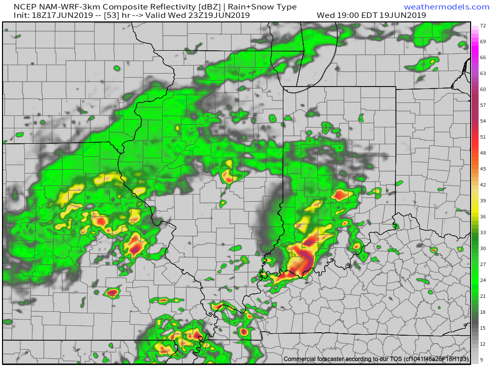
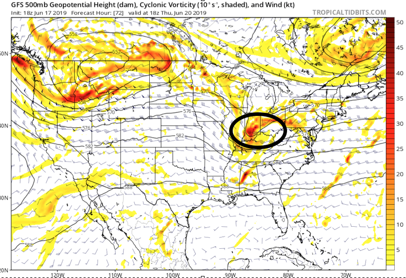
As mentioned above, severe weather is possible Wednesday afternoon and evening as vigorous upper level energy accompanies the surface wave scooting across the lower OHV. This will warrant our attention over the upcoming 48 hours and will likely lead to the Storm Prediction Center expanding the current Slight Risk further northwest with future updates.
Fingers are still crossed for briefly drier conditions Friday before we reload the moisture with a persistent southwesterly air flow this weekend. This will promote additional concerns for heavy rainfall over the weekend.
At times, this moist southwest flow will help precipitable water values exceed 2″. Needless to say, concern will remain very high for additional flooding problems over the weekend into early next week.
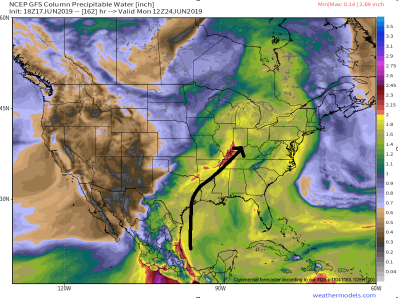
Widespread additional rainfall of 2.5″ to 3.5″ is a good bet with locally heavier amounts over the upcoming week.
More on the long range pattern into the Weeks 3/4 period tomorrow!