June 10, 2019 archive

Cool Now, But What About Late-June?

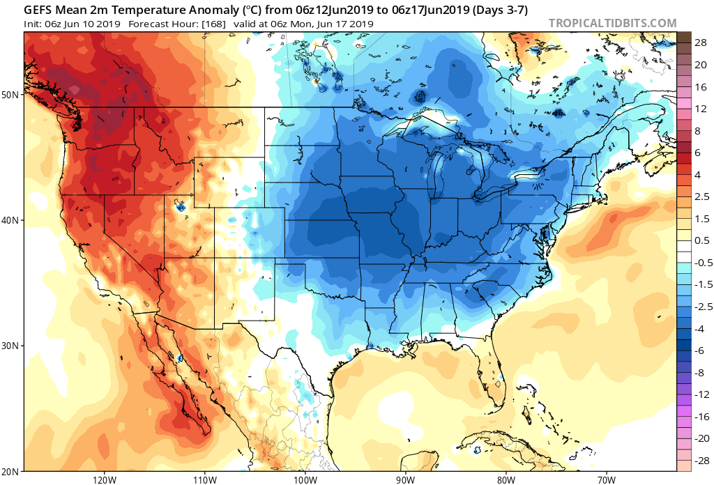
Unseasonably cool, almost fall-like, weather will dominate our area this week, but what awaits as we move into the latter part of June?

We continue to see a highly amplified MJO and it’s forecast to swing into Phases 4-5 in the coming weeks.

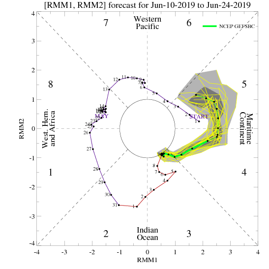
Neither of these phases argues for any sort of significant or long-lasting warmth anytime over the next few weeks across our immediate region.

To no surprise, the latest long range data continues to indicate an overall seasonable to cooler than average theme to close out the month of June. The European ensemble agrees.

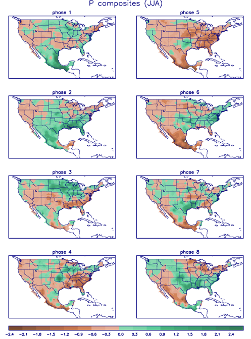
What about precipitation as we progress through the last couple weeks of the month? Phase 4 remains wet before things take on a drier theme during Phase 5. (It’s important to note though that if the MJO continues the overall high amplitude, unfortunately we would head into the wetter Phases 6-7 as we head towards the mid way point of summer).

Permanent link to this article: https://indywx.com/2019/06/10/cool-now-but-what-about-late-june/

Weekly #AGwx And Severe Weather Outlook…

Forecast period: 06.10.19 through 06.17.19

7-Day Precipitation: Rainfall is expected to run above average through the period.

7-Day Temperature Outlook: Temperatures are expected to run well below average through the period.


Severe Outlook: Widespread severe weather isn’t anticipated through the period. With that said, we’ll keep an eye on the potential of a couple gusty storms Wednesday as vigorous upper level energy and an associated cold front blow through the state.

Summary: After a wet close to the weekend, drier air will return today and Tuesday, along with increasing sunshine from west to east by this afternoon. Our next system of note arrives Wednesday in the form of a cold front. This will serve to reinforce the unseasonably cool air in place across the region for late week, but also may provide a few gusty storms as it moves through the area. Shower coverage will be scattered to widespread Wednesday. Another system will approach over the weekend with unsettled conditions expected both Saturday and Sunday.

While temperatures will run below normal throughout the period, the coolest day of the week appears to be Thursday with highs only in the mid to upper 60s and lows in the upper 40s to lower 50s.

Permanent link to this article: https://indywx.com/2019/06/10/weekly-agwx-and-severe-weather-outlook-2/

IndyWx.com