
You must be logged in to view this content. Click Here to become a member of IndyWX.com for full access. Already a member of IndyWx.com All-Access? Log-in here.
June 2019 archive
Permanent link to this article: https://indywx.com/video-craving-more-traditional-summer-weather-youre-in-luck-but-better-enjoy-while-we-have-it/
Jun 24
VIDEO: Drier, Warmer Window Opens Into Early July…
You must be logged in to view this content. Click Here to become a member of IndyWX.com for full access. Already a member of IndyWx.com All-Access? Log-in here.
Permanent link to this article: https://indywx.com/video-drier-warmer-window-opens-into-early-july/
Jun 23
All-Access Video: July Outlook…
You must be logged in to view this content. Click Here to become a member of IndyWX.com for full access. Already a member of IndyWx.com All-Access? Log-in here.
Permanent link to this article: https://indywx.com/all-access-video-july-outlook/
Jun 23
Bumpy Ride Possible This Afternoon And Evening…
While the weather is currently quiet across central Indiana, that will likely change in a significant way as we progress into the afternoon and evening hours.
As we look at the current radar, note the widespread showers and thunderstorms off to our southwest. More importantly, the latest couple of frames indicate a strengthening line of storms beginning to “bow” out along the eastern flank (along the MO/ IL state line).

The environment in place upstream into southern and central Indiana remains one that would tend to favor these storms strengthening further in the coming hours.
We note the Storm Prediction Center has nudge the Slight Risk further north to encompass more of southern and central Indiana with their latest update and we would agree with this.
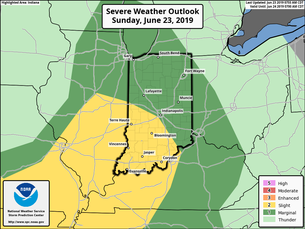
We think storm coverage (and intensity) will really begin to ramp up after 3p and the latest HRRR shows this nicely:
Greatest concern with any severe storms that develop has to do with strong and potentially damaging straight line winds. It’ll be important to remain weather-aware this afternoon into the evening hours.
*More later this evening, including our finalized July Outlook.
Permanent link to this article: https://indywx.com/bumpy-ride-possible-this-afternoon-and-evening/
Jun 23
Weekly #AGwx And Severe Weather Outlook…
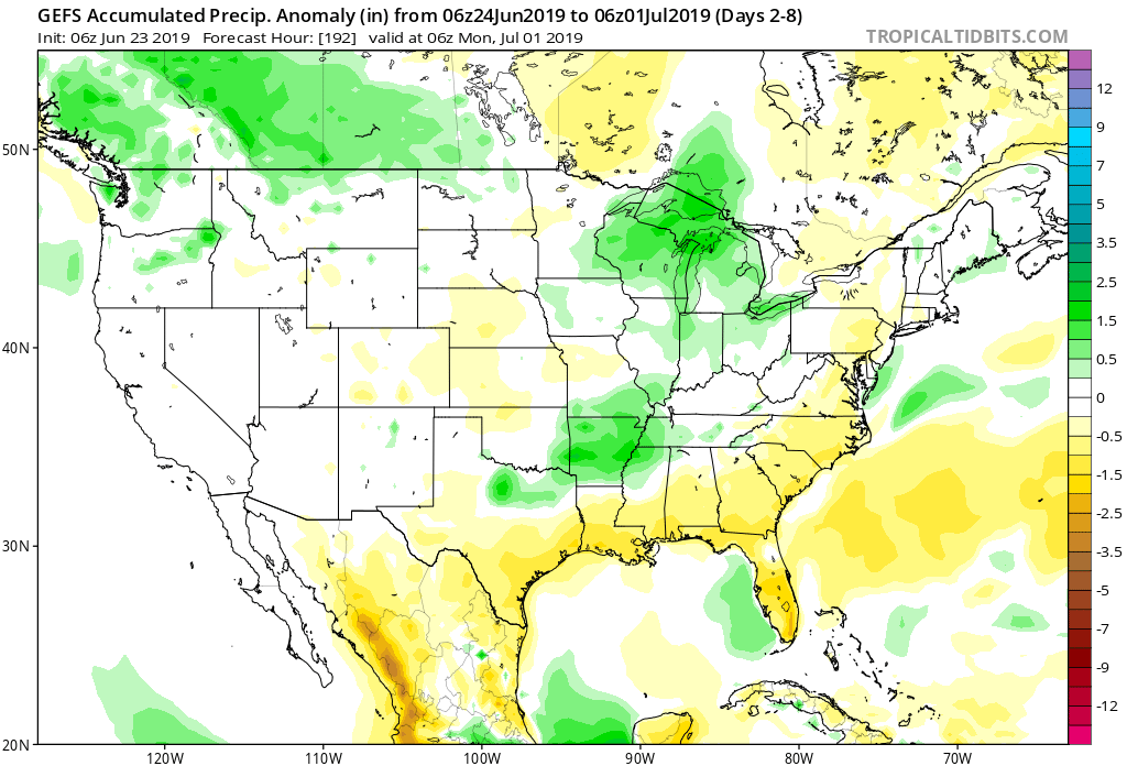
Forecast period: 06.24.19 through 06.30.19
7-Day Precipitation: Rainfall is expected to run near to slightly above average through the period.
7-Day Temperature Outlook: Temperatures are expected to run above average through the period.

Severe Outlook: While a couple of strong storms are possible during the period, widespread organized severe weather isn’t anticipated during the above forecast period.
Summary: The forecast period will feature an overall drier and warmer theme than what we’ve been used to of late. Scattered showers and thunderstorms will linger to open the work week before high pressure builds overhead and results in an overall dry forecast Tuesday. Upper level energy will allow scattered storms to return Wednesday before we dry things out again Thursday and Friday. As we look ahead to next weekend, a “backdoor” cold front will likely result in an uptick in rain chances Saturday followed by a cooler push of air by the 2nd half of next weekend.
Permanent link to this article: https://indywx.com/weekly-agwx-and-severe-weather-outlook-4/