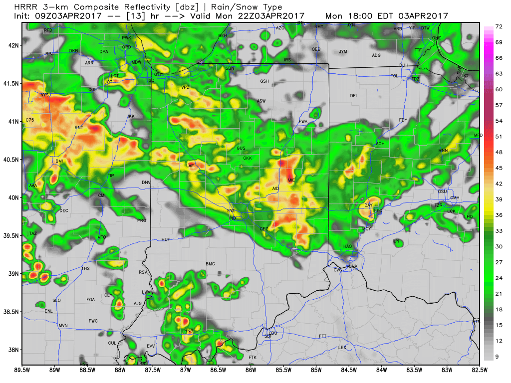
1.) Showers moved through the region early this morning and we’ll go through several dry hours before dealing with our next round of rain and thunderstorms by evening. Most widespread coverage of showers and thunderstorms appears to come in the 5p-7p range.
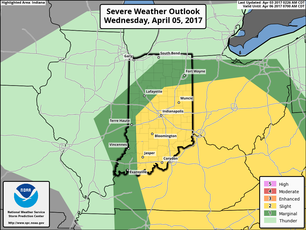
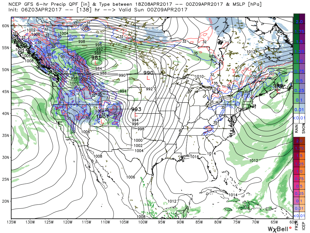
 2.) We’ll get a breather on Tuesday, but our next storm system will move in quickly and begin impacting central Indiana during the day Wednesday. A couple strong to severe thunderstorms are possible Wednesday and will require our attention over the next day, or so. We’ll have more details with our updated 7-day later today.
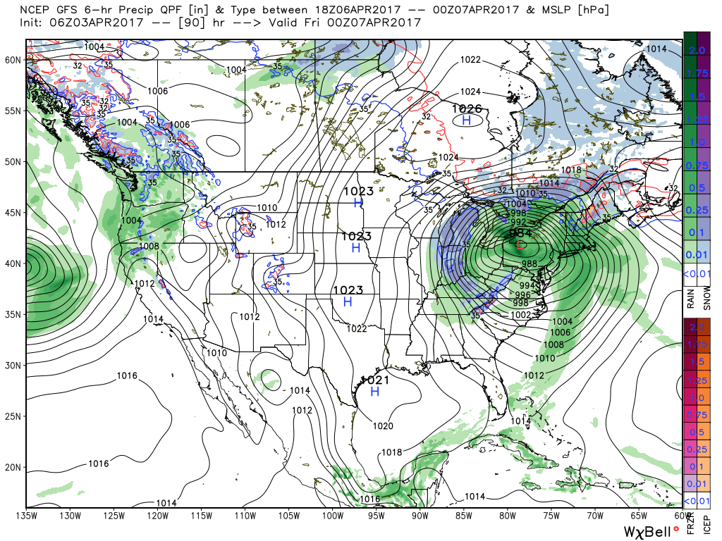
 3.) We’ll get into the colder side of the storm to close the work week and thoughts will shift from storms to snow. Wind-whipped snow showers will be a good bet in the unseasonably cold air Thursday into Friday morning.
 4.) Timing will once again be our friend as we push into the weekend. Weak high pressure will arrive on the scene and help ensure dry conditions. After a cold start Saturday, a moderating trend will develop.
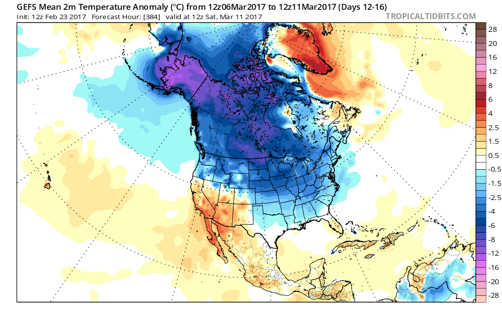
 2.) Speaking of cold, to-date, March is running slightly colder than average (by 1.1°). Note the spring and summer-like warmth across the SW. “Pieces” of that warmth will eject northeast in modified fashion late March into April.
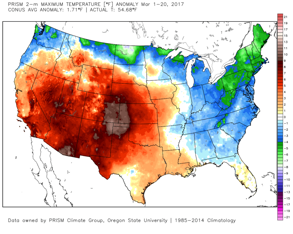 3.) High pressure will supply a dry, but cold Wednesday. Highs will run close to 10° below average (lower 40s), but at least we’ll enjoy the sun!
 4.) Temperatures will begin to warm as we progress through the latter portions of the week. We’ll be near seasonal norms Thursday (low 50s), and above normal Friday into the weekend (mid-upper 60s). With the warmer air, rain and storm chances will also be on the increase. As of now, we target best rain chances late Saturday into Sunday. A couple thunderstorms are also possible. Rainfall totals of 0.50″-1.00″ seem like a good bet with locally heavier amounts.
 5.) This is just the beginning of an active stretch of weather to wrap up the month of March. (3) additional storms will have to be monitored next week. Accordingly, precipitation anomalies will run above normal.
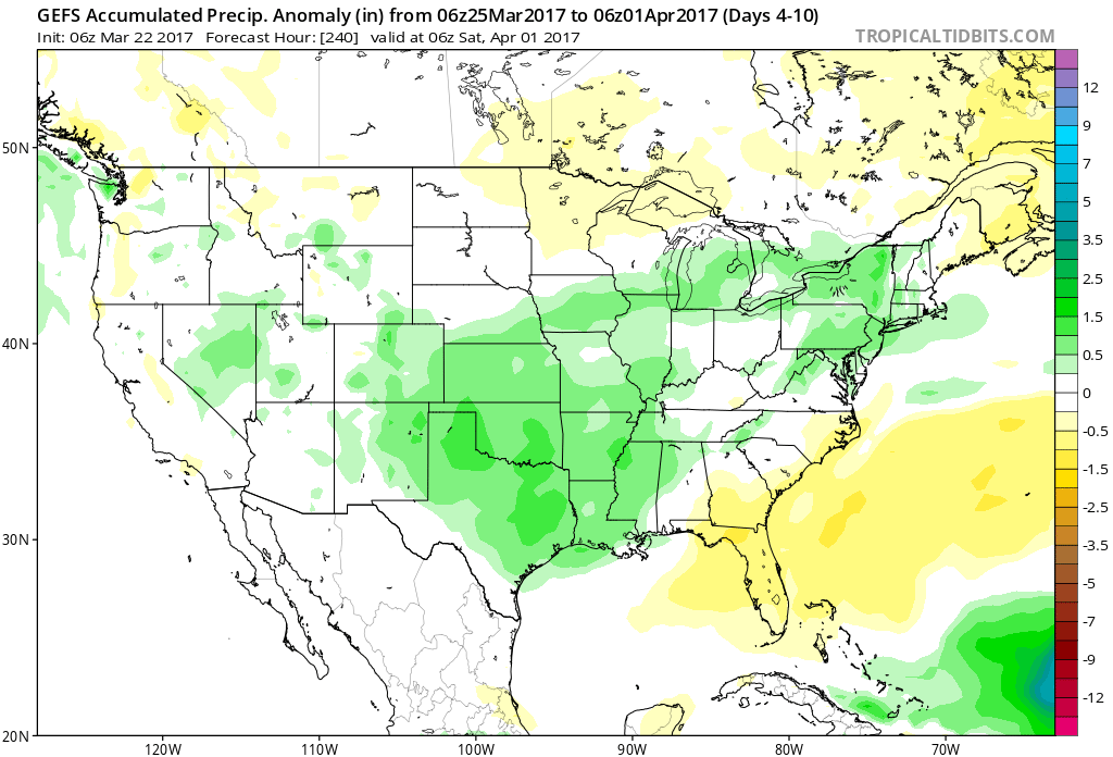


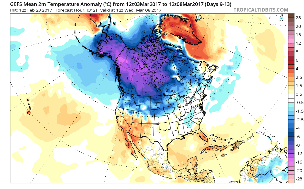
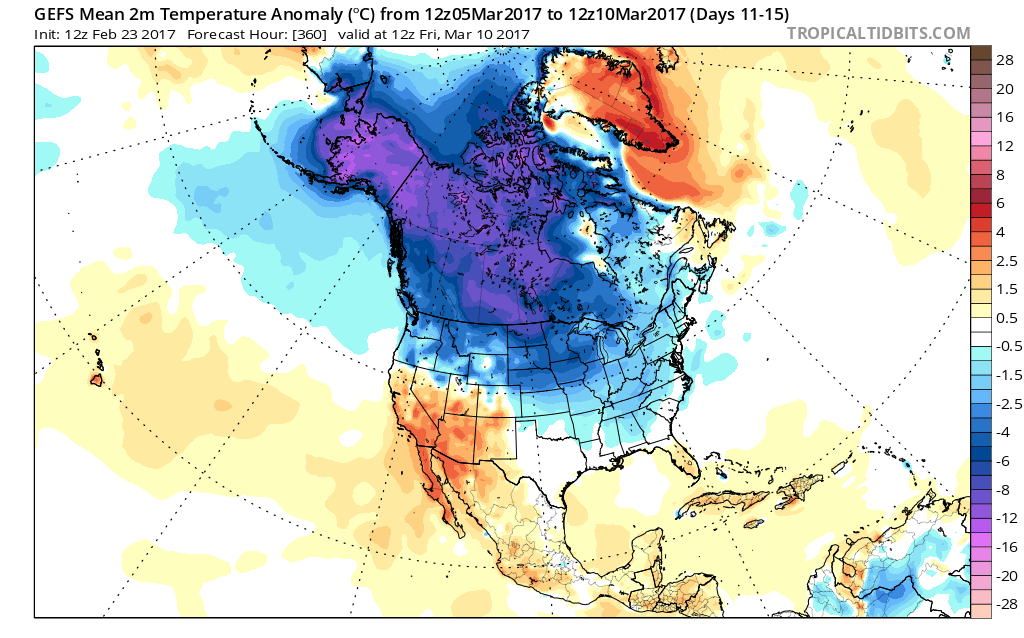
 Longer-term indications would suggest the period of chilly, wintry-like, air has a window to take over, but the window is small. Trends would seem to yield warmer solutions once past mid-month, with perhaps a “stick and hold” spring regime taking over.
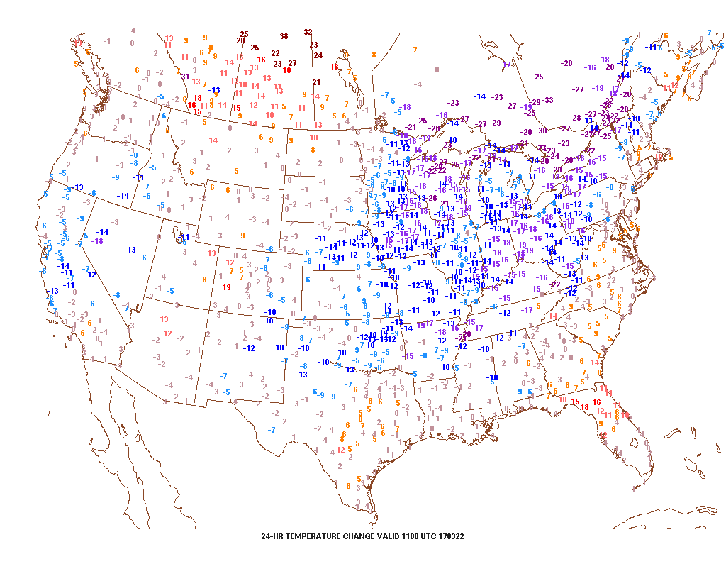
 Despite the lack of sunshine this morning, temperatures continue to run much milder than average. We’re currently running nearly 20° above where we should be at the 9a hour.
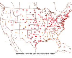 A quiet start to the work week is ahead as high pressure dominates early on. That said, a weak storm system will scoot through the state Monday night and Tuesday morning and this will help offer up the chance of showers and perhaps a rumble of thunder.
 The next (more significant) storm system will pose a severe weather risk to close the week. We continue to keep a close eye on Friday and the Storm Prediction Center is as well, with western IL, IN, and western KY in their Day 6 Outlook. It’s still early, but the primary focus with the severe potential this storm may pose will be large hail and damaging straight line winds. Stay tuned as we continue to analyze the latest data.
 We’ll turn sharply colder Friday night and Saturday. Though it’ll feel much colder, we’ll really only “chill” to seasonal levels, including a gusty northwesterly breeze Saturday.
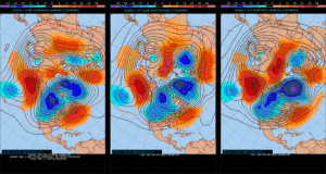
 Longer-term, we’re rumbling into a much more active weather pattern through the mid range period. As the mean trough sets-up position in the west, the ridge will flex it’s muscle across the east yet again during early portions of Week 2. This will set the stage for a repeat of what we deal with Friday and, accordingly, we’ll have to monitor early next week for portions of severe weather yet again.