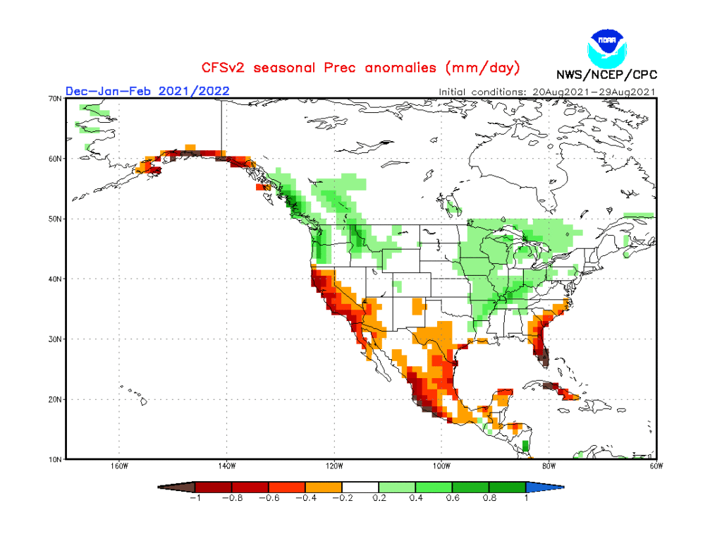
As the first strong autumn cold front takes aim on the region, it’s time to start thinking more about what lies ahead in the December-February time frame. This morning’s video dives in with some initial thoughts around just that. Is the CFSv2 seasonal precipitation projection an indication of the active winter storm track ahead? We think so…
We have one more day of humid conditions, but a wholesale pattern change will have things feeling much different around these parts beginning tomorrow, and continuing for the foreseeable future.
Note the drier air beginning to invade northern portions of IL, IN, and OH this morning. While dew points are still stuck in the mid-upper 60s, locally, that less humid air is heading south.
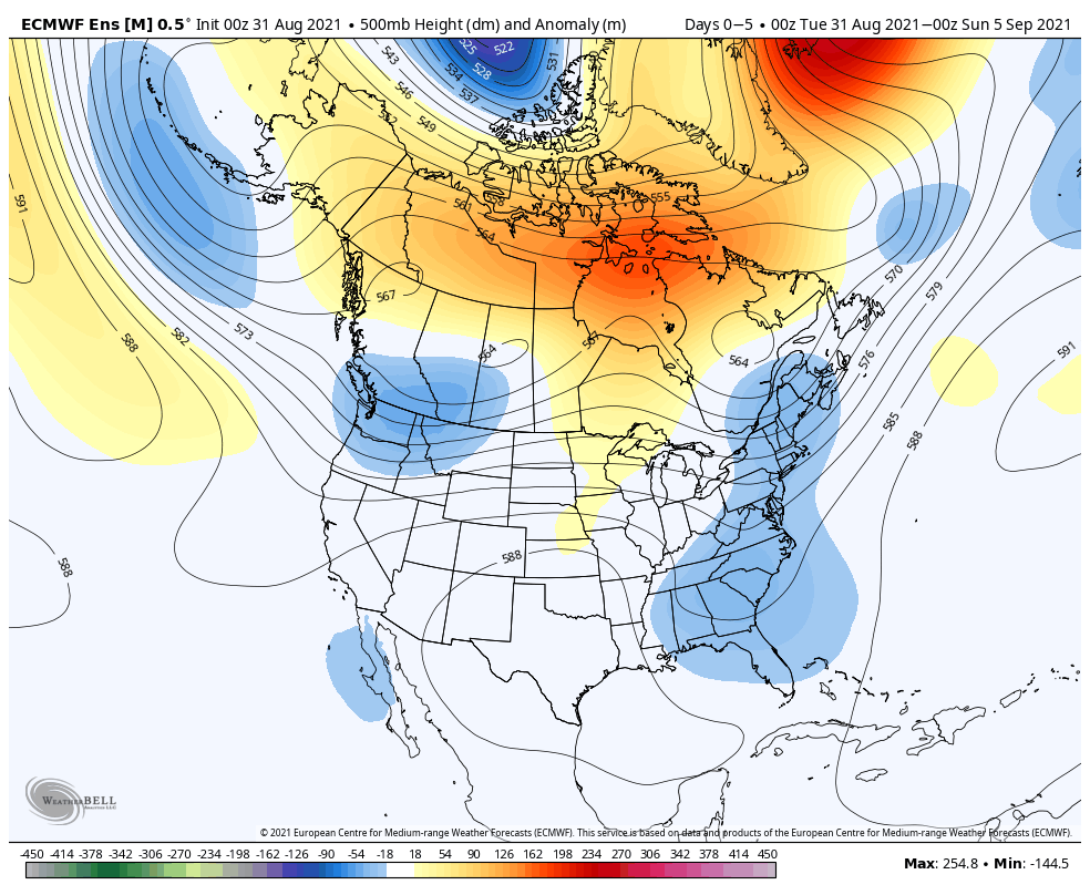
Note how the trough really amplifies next week across the eastern portion of the country. This will pull down an extended stretch of cooler, less humid air as we move through the better part of the first half of September.
A reinforcing cold front will sweep through here Saturday (yes, we’re giving in to building rain and storm chances into our Saturday forecast) with unsettled conditions.
This is likely going to set the stage for an overall wetter, cooler stretch of weather next week. Additional rain chances will arrive Tuesday and Thursday of next week.
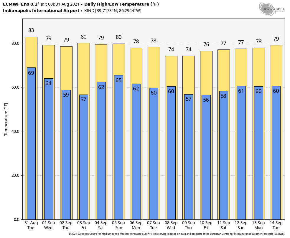
8 of the past 10 days featured highs at or above the 90° mark, and was easily the hottest stretch of the summer. Looking ahead, a “hint” of fall shows up on the medium range charts just in time for us to kick off meteorological fall (officially, tomorrow).
Updated 06.19.21 @ 7:58a (We’ll have a full video discussion posted later this morning, but here are some headlines grabbing our focus into early July). I. Tropical, Soupy Airmass Remains…
You must be logged in to view this content. Click Here to become a member of IndyWX.com for full access. Already a member of IndyWx.com All-Access? Log-in here.
Updated 03.25.21 @ 5:45p So far, Indiana has made it through today without little in the way of significant weather. Unfortunately, that won’t be the case through the evening and…
You must be logged in to view this content. Click Here to become a member of IndyWX.com for full access. Already a member of IndyWx.com All-Access? Log-in here.
Before we dive into the challenges late next week, the potential is still very much alive and kicking for a period of slick conditions to develop Sunday evening/ night. While we’ll likely be in the middle 30s during the majority of the time this light precipitation is falling, the concern remains, given the duration and magnitude of the cold air (ground is now reported frozen “8 to 12”), that any liquid precipitation that falls will freeze on untreated area roadways and sidewalks. If you have travel plans Sunday night, plan to give yourself plenty of extra time.
Light rain should arrive between 8p and 10p (west to east across the state) Sunday before ending as a bit of light snow (little to no accumulation expected as of now). Total precipitation should be 0.20″ or less for most with this event.
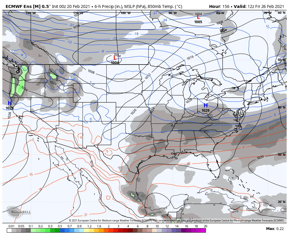
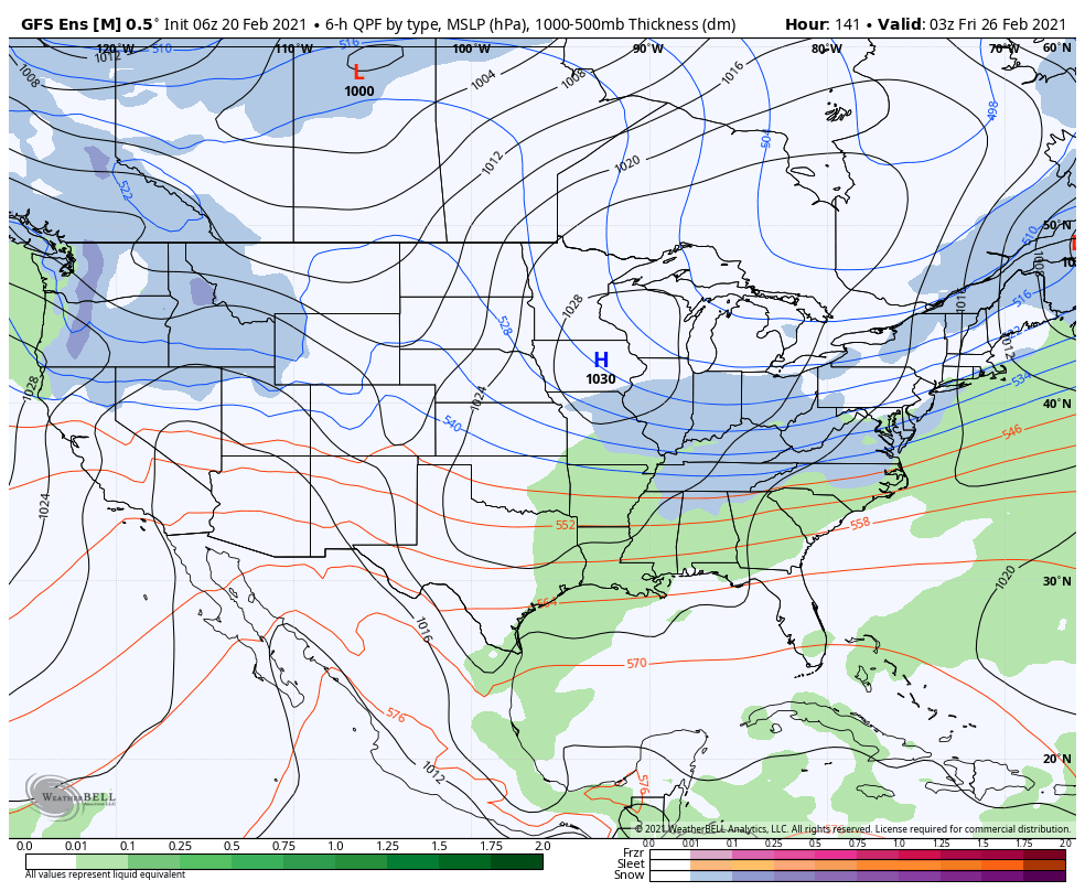
As we look ahead, the next item of possible trouble awaits for mid and late week. A cold front will push south of the area Wednesday night into Thursday morning. While this may generate a brief period of light rain transitioning to light snow, it’s what follows that’s of more interest.
Operational guidance (both the European and GFS) suggest this late week system will present a winter storm for our friends in the TN Valley, but we advise to tread with caution for now.
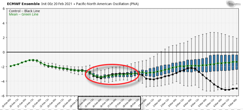
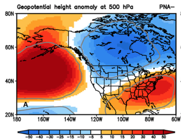
The reason? A strongly negative PNA.
You know the drill by now. This should lead to a more stubborn southeastern ridge and subsequent further north storm track.
Height anomalies during a (-) PNA period.
Over time, I’d suspect we’ll see just that- the models trending further north with this particular storm system.
As it is, ensemble guidance is already significantly further north than their respective operational counterparts. At the very least, another interesting case study is in front of us…