Dinnertime Rambles: Talking Thanksgiving Weekend And December…

Updated 11.20.23 @ 5:30p

I. The weather pattern will turn progressively colder as we move through the Thanksgiving holiday. This isn’t anything earth-shattering by any stretch, but temperatures running 4° to 8° below normal is pretty stout. There’s also still the potential of an early season arctic “jab” prior to us getting out of the first 3-5 days of December, but that likely comes after this weekend- if at all.

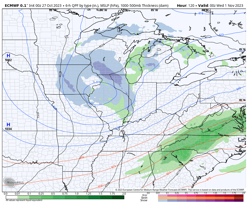
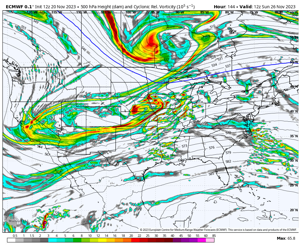
As a whole, it’s a dry pattern that will accompany the chill, but we will want to continue keeping an eye on energy that will eject off the Rockies over the weekend. At times models can underplay these features only to have to correct stronger as we grow closer to the potential event. Will that be the case this time? Impossible to say from this distance- just something we’ll continue to monitor with such a busy travel period. As it is today, modeling wants to “string” the energy out which would essentially be a light or non-event.

II. While the pattern drivers all are aligned for a cold open (first few days) of December, there’s reason to believe a period of milder than normal air will take foot just after- say sometime between 12/5 and 12/8, or so. That said, we’re in a bit of a fork in the road so to speak.

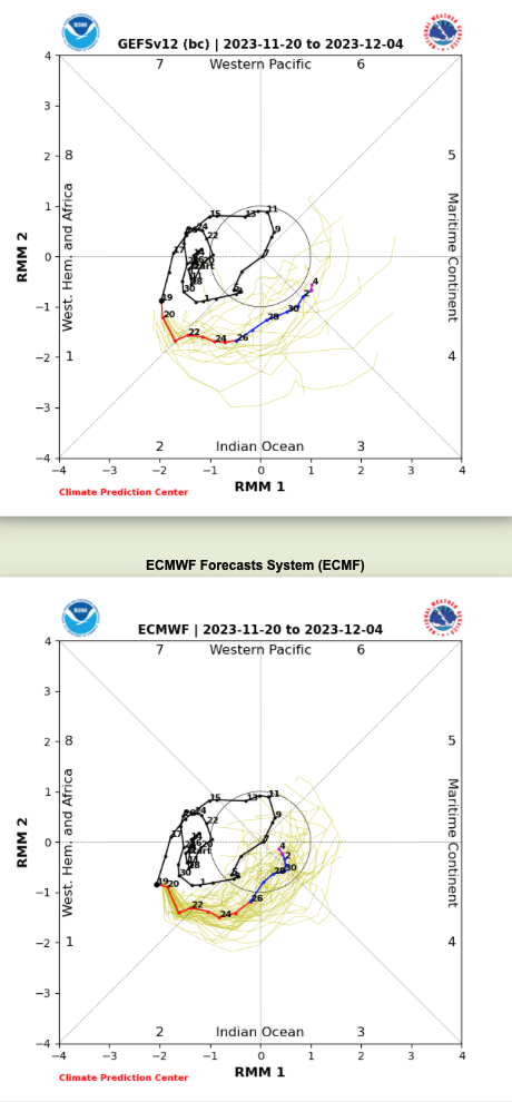
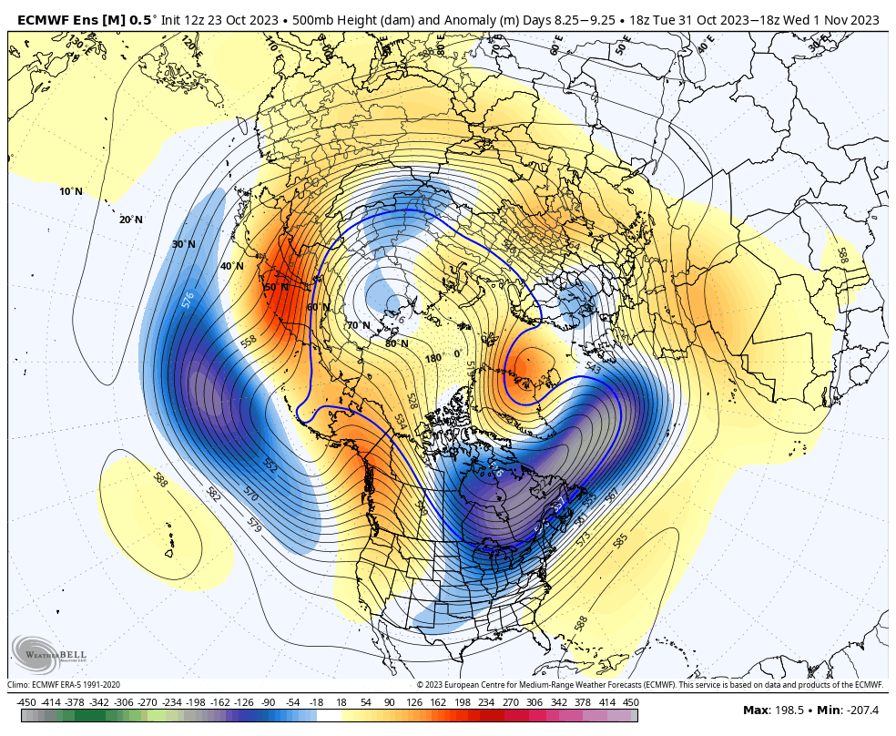
The East Pacific Oscillation (EPO) is going to pop positive at least for a period of time prior to mid-December. This strongly argues for a relaxation of the cold regime that we’ll endure to open the month. Guidance differs on the handling of the MJO, however. Should the American guidance be correct in taking things into Phase 4, when combined with what we see transpiring with the EPO, then we’re off to the races for at least a 7-10 day period of much warmer than normal temperatures. That said, European guidance collapses the MJO into the “null” phase and even hints at things emerging again in the colder phases come mid December. While we still have time to sort through this “mess,” the idea here is that the cold open to the month will moderate to slightly to moderately above normal for a 7-10 day period leading us into mid-month. Thereafter, I’m becoming increasingly bullish for a renewed cold pattern developing towards the Christmas and New Years holidays…

It’ll be important to closely monitor the MJO as we head into early-mid December as this will have big impacts on our overall weather pattern.

Saturday Morning Rambles…

Updated 11.04.23 @ 8:35a

I. November has opened on a chilly note. Through the 1st few days of the month, Indianapolis is running a whopping 6° below average. Warming will take place in the days ahead and we’re not finished with the 70s just yet. Wednesday stands the best shot at 70° warmth but it’s an admittedly tricky forecast with a wavy front hanging nearby.

After a cold start, November will take a milder turn.

II. A cold front and associated area of low pressure will offer up the best chance of widespread rain midweek, but we’re still not talking about any sort of heavy rain amounts. The bigger deal will be the cooler air moving in behind this system for late week and next weekend.

III. The type of air mass behind the boundary, though cooler, won’t have the same arctic nature to it that our last cold spell included. We’re talking a few days of highs in the 45° to 50° range and overnight lows in the lower 30s. An upper level ridge should return for mid month along with an unseasonably mild pattern. After midweek, the pattern as a whole is also a dry one into mid month.

Pre-Dinner Rambles: Halloween Snow And New Winter “Tidbit”…

Updated 10.30.23 @ 5:36p

I. Vigorous upper level energy will dive southeast and impact our Halloween weather. Many will see their 1st snowflakes of the season (at least those who didn’t today) tomorrow afternoon and into the evening. This is the type setup that will lead to localized heavier squalls within the broader area of snow showers and I imagine this will carry deep into Tuesday night- longer than what most high resolution guidance currently suggests.

II. Cold and wind will also make for bitter conditions by Halloween standards. Trock or treaters will certainly need the layers under those costumes tomorrow night as wind chills fall into the 10s at times. Gusts up to 30-40 MPH will also create for “spooky” conditions at times.

III. New long range, “seasonal” data continues to suggest we’re heading for a Modoki Nino event. If this does, indeed, verify then we’ll look for colder and potentially snowier trends to take hold (certainly compared to a “traditional” Nino event) towards late December and on into the middle of winter. To no surprise, this should also play into some other drivers that suggest we should see more in the way of high latitude blocking periods this winter, compared to the past few. Stay tuned.

Friday Morning Rambles: Blast Of Arctic Air; Halloween Night Snow And More On November…

Updated 10.27.23 @ 7:09a

I. Most of our Friday will be rain-free and unseasonably pleasant. Enjoy as time is ticking. A cold front arrives tonight with increasing shower and thunderstorm chances after dark, continuing through the overnight. Most area rain gauges will accumulate 0.10” to 0.25” with this initial wave of rain, but there will be a few lucky folks that pick up 0.50” +.

II. A second, more widespread, round of rain will push across central Indiana Saturday night and Sunday morning followed by a potential break through most of the daytime Sunday. One final round of rain will then arrive Sunday night into the predawn hours Monday. Look for nearly steady or slowly falling temperatures into the upper 40s Sunday and highs remaining stuck in the 40s area wide Monday.

III. As attention shifts to Halloween, itself, a vigorous piece of upper level energy will dive into the Ohio Valley. Originating in Alberta, this will officially be the season’s first Alberta Clipper.

This feature will offer up a round of gusty winds and snow showers Halloween night into the predawn hours Wednesday.

We’ll wake up to temperatures in the 20s and ‘chills in the 10s Wednesday morning.

IV. We’ll dive in to our November pattern in greater detail with a video this weekend, but as of now, the early call is for a fairly typical November with many “ups and downs” and an overall transitional regime through the bulk of the month. Again, more on this and the associated pattern drivers a bit later!

Make it a great Friday!

Dinner Time Rambles: Prospects Of HVY Rain On The Increase And Brief, Yet Potent Early Season Arctic Jab…

Updated 10.23.23 @ 5:45p

I. Today’s model suite continues to suggest quite the unsettled stretch of weather awaits for pre-Halloween festivities. I know, please don’t shoot the messenger. The culprit? A strong autumn cold front stalling out for a time in response to waves of energy riding along the boundary. The end result will likely be a widespread swath of 1″+ rains over the weekend with a more localized 2″+ band. Details will have to be fine tuned as we get closer, but folks with outdoor activities and ag/ harvest ’23 interests should plan on a rough stretch of weather in the Saturday through Monday timeframe.

Multiple rounds of moderate-heavy rain are becoming likely over the pre-Halloween weekend.

II. The coldest air so far this fall season will come rushing in on the heels of all of the aforementioned rain in the 8-10 day timeframe. Today’s European guidance is going all-in on a potent early season “jab” of arctic air, including highs around freezing and lows deep into the 20s. Perhaps extreme? Certainly, but this also has merit given where the pattern is. Though this will likely only be a brief intrusion of bitter air (at least by early November standards), I’d certainly go ahead and plan on the growing season coming to a screeching halt in just a little over a week from today.