Updated 10.14.23 @ 7:43a I. An upper low and trough of low pressure will lead to a return of cloudiness, additional nuisance variety showers along with gusty winds and falling…
You must be logged in to view this content. Click Here to become a member of IndyWX.com for full access. Already a member of IndyWx.com All-Access? Log-in here.
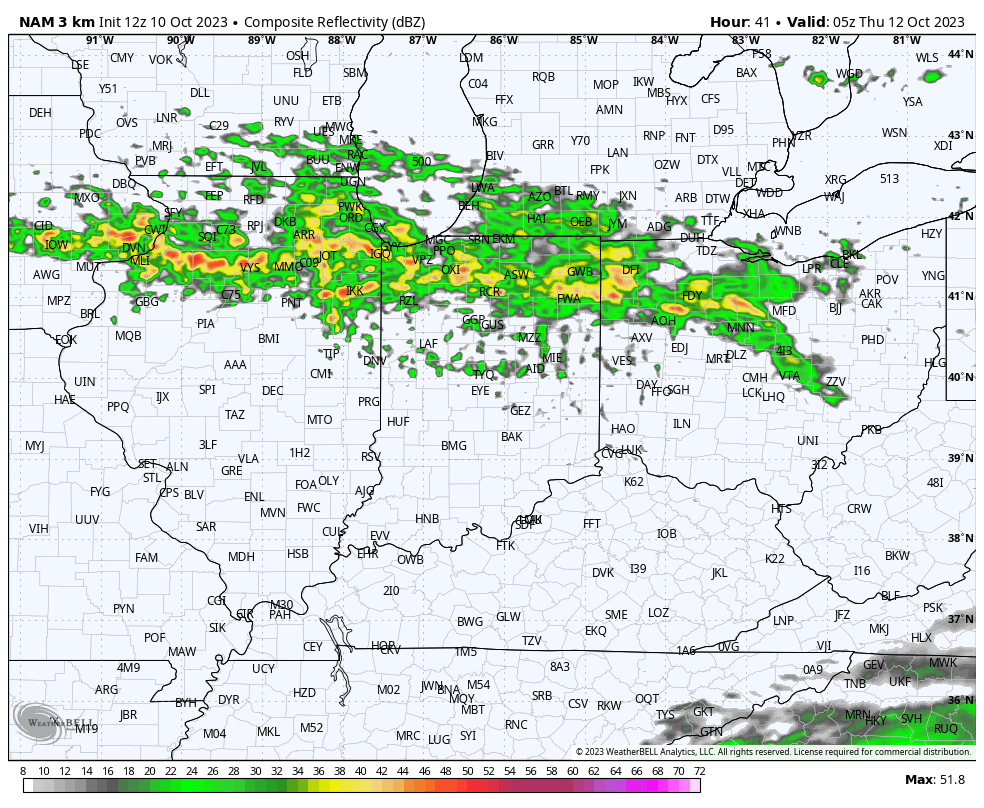
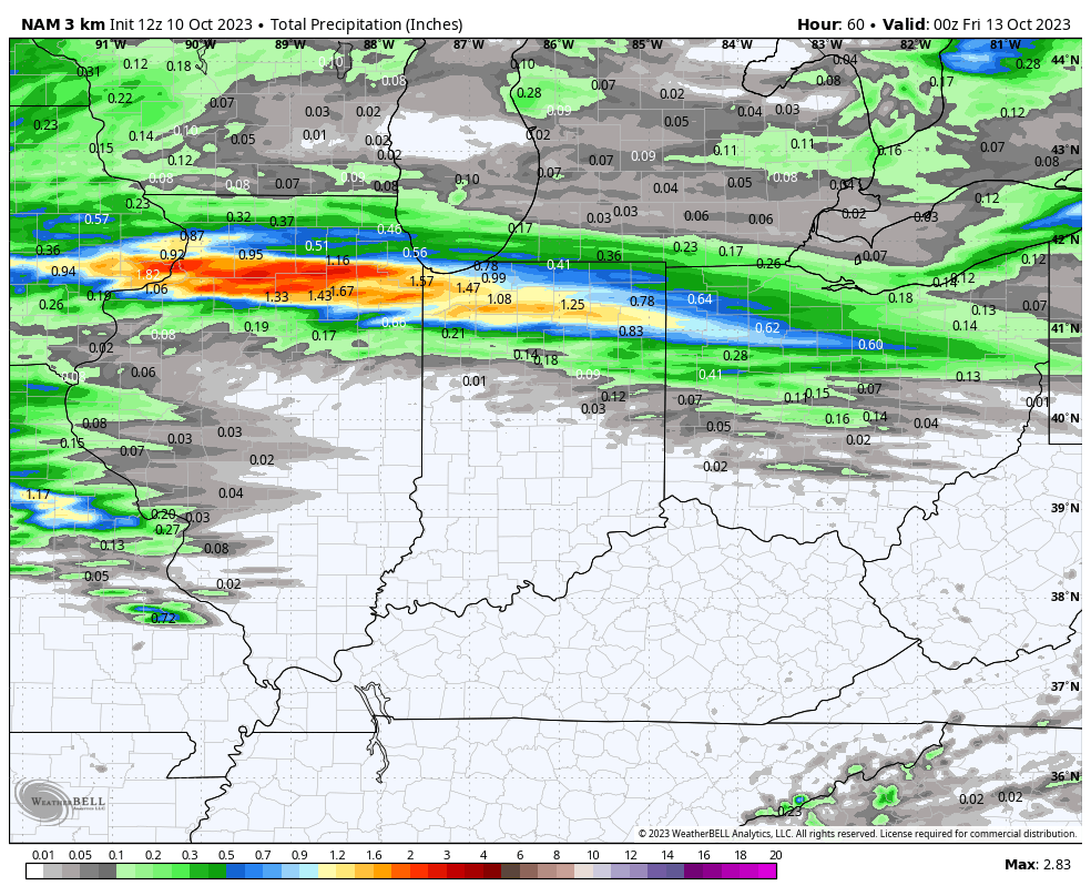
I. A warm front will lift north through Indiana Wednesday. This will serve as a focal point for locally heavy rain across the northern tier of counties Wednesday night into Thursday morning. Most high resolution modeling keeps central Indiana out of the heavy rain axis but a passing shower is certainly possible.
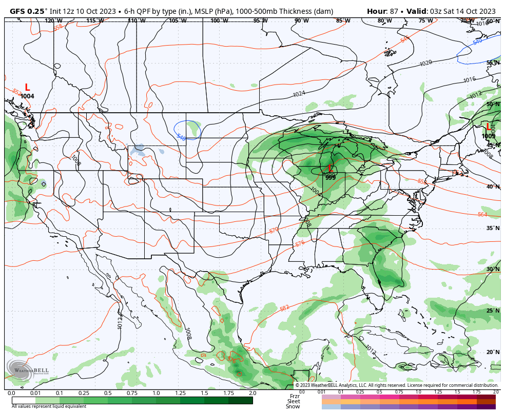
II. A cold front and associated area of low pressure will rumble across the Ohio Valley Friday with more widespread rain (embedded thunder) impacting central Indiana Friday evening and Friday night.
III. A cold core upper low will drop southeast Sunday into Monday. With the cold air aloft and just enough daytime heating, showers (potentially mixed with graupel) will develop. Otherwise, anticipate a “raw” close to the weekend and open to the new work week.
IV. Our recent chilly turn will only be reinforced that much further behind the passage of Friday’s cold front. Most of next week is looking below to well below normal. Time to start thinking about stocking up that wood pile. Long Range charts show another big blast of the coldest air so far this season the following week…
Just enough energy will be around today to keep scattered, mainly light, showers in the mix into the evening hours. Most area rain gauges won’t collect significant rain but a few thunderstorms could drop a quick downpour in isolated fashion later this afternoon into the early evening.
A secondary disturbance will approach from the northwest Tuesday and provide another opportunity for a few showers, primarily northwest of the city. Most of these should dissipate before moving into central Indiana. All in all, we’re looking at a very quiet week with a significant warming trend.
A calm, mostly dry week is in store for the region.Temperatures will return to well above normal levels this week.
Highs will run into the middle to upper 80s by the mid and latter part of the week with dry conditions.
Uneventful weather will carry the day through the weekend. While we’re watching a more significant storm system approaching early in Week 2, modeling differs on the specific handling. The European drives most of the energy well south of our neck of the woods and paints a continuation of our dry stretch. The GFS (shown below) is more excited about delivering rain early next week. We’ll watch how trends continue to evolve through the coming days. Make it a great Sunday!
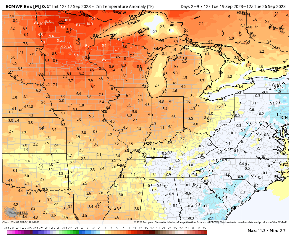
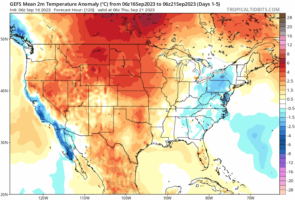
The pattern transition from the current cooler than normal regime to a warm September finish, compared to the norm, will get started the middle of next week. We still have several days to go with highs of 82°+ to close out the month. The pattern, as a whole, looks drier than normal. The exception to that general rule will come Sunday with scattered showers (the system that generates Sunday showers here will serve to ignite an early season ‘Nor Easter early week for the Mid Atlantic and New England. – A sign of the changing seasons) and we’re still tracking the threat of a more organized storm system in the early Week 2 period. The trend, however, has been for this being less of a player in our weather compared to a few days ago but we’ll continue to keep a close eye on things.
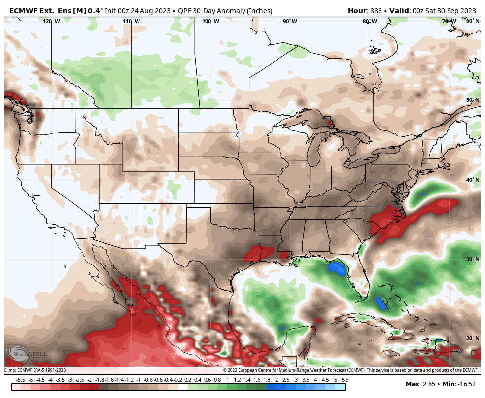
The pattern will transition warmer than normal for the 2nd half of the month.
As we flip the page into October, the pattern drivers from this distance appear to be lining up to drive a period of cooler air as we rumble through the first 1/3 of the month. The Madden-Julian Oscillation (MJO) looks to push into Phase 6. This typically favors the warmer anomalies across the west and Plains with at least a reflection of a trough across the East Coast.
The Pacific North America pattern (PNA) and East Pacific Oscillation (EPO) are working in tandem to also favor a cooler regime across our portion of the country. It’s fair to say that we believe the longer range warm “look” will be forced to cool over the course of the next couple weeks for early October.
The dry, relatively boring regime should begin to turn more active as we close out the month and move into October. The thinking here is that we should see a resurgent wet regime the deeper into fall we go before rolling into the drier than normal predominant winter pattern.
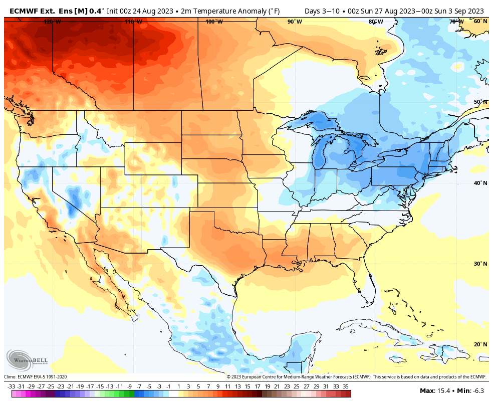
I. It’s about as oppressive as it gets around these parts out the door early this morning. Temperatures will only fall a couple more degrees between now and sunrise before another dangerously hot day ahead. Check out these temperature and heat indices at 4:45a:
II. We’re tracking (2) frontal boundaries that will put an end to this heat and humidity in the coming days. The first front slips through here Saturday and will break the heat wave with a secondary, more robust, push of dry, cool air early next week. While a shower or storm is possible with both FROPAs, widespread rain isn’t expected with either.
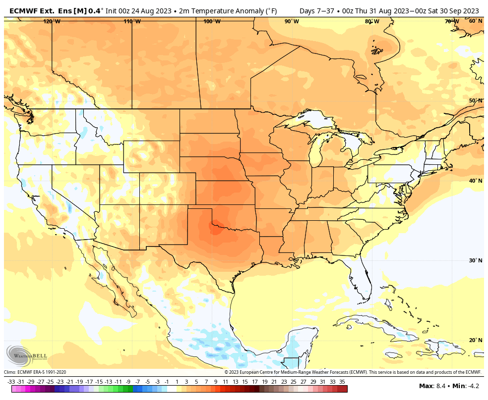
III. A taste of fall is on deck as we move through the middle of next week and get set to kick off the Labor Day weekend. How does overnight lows into the 40s sound with highs in the upper 70s? This breath of fresh air will hold into the early part of the Labor Day weekend along with anticipated dry conditions.
IV. We’re not expecting the cool, refreshing air to last as “endless summer” returns shortly after the open to September. In fact, we continue to believe a warmer than normal and drier than average September awaits as we push through the initial month of meteorological fall. The latest European Weeklies, updated last night, for September say the same: