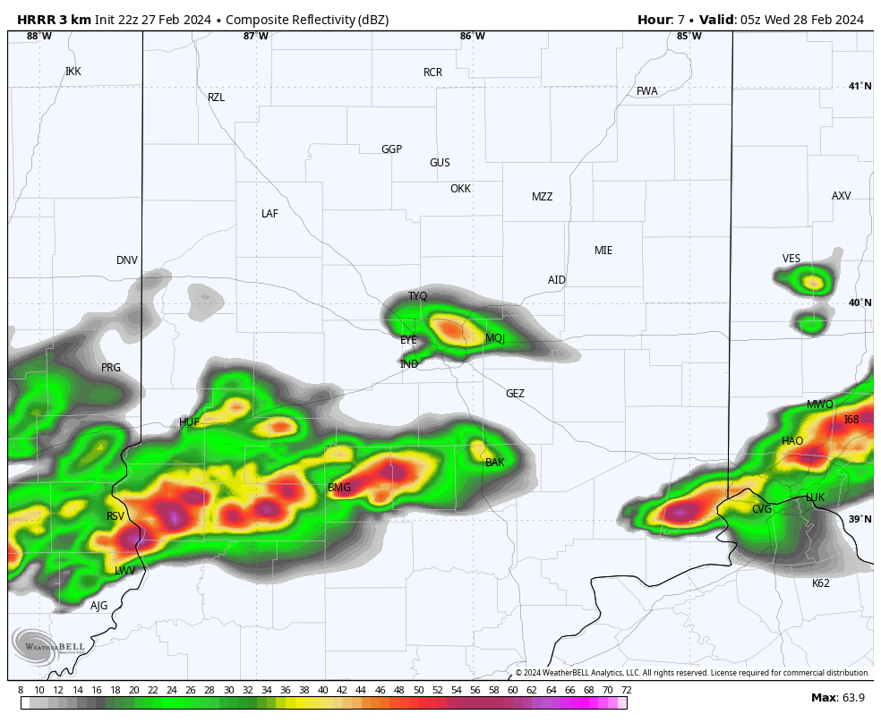
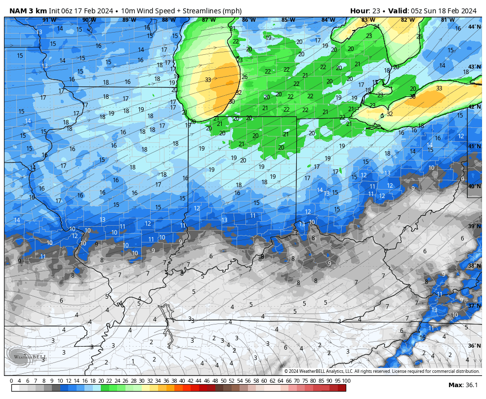
As we write this update, severe storms are firing across northern IL where a Tornado Watch has been issued until 11p (eastern). Meanwhile, all is quiet on the home front, thanks to strong “capping” in the mid levels of the atmosphere. Unfortunately, that cap likely won’t hold and we still anticipate scattered strong to severe storms to impact central and southern Indiana during the overnight.
All modes of severe weather remain on the table, including damaging straight line winds, large hail, and tornadoes. Initiation of convection across central/ southern IN should come around or just after midnight and end by 3a to 4a (west to east).
Please make sure you have a means to receive the latest severe weather alerts prior to heading to bed tonight.
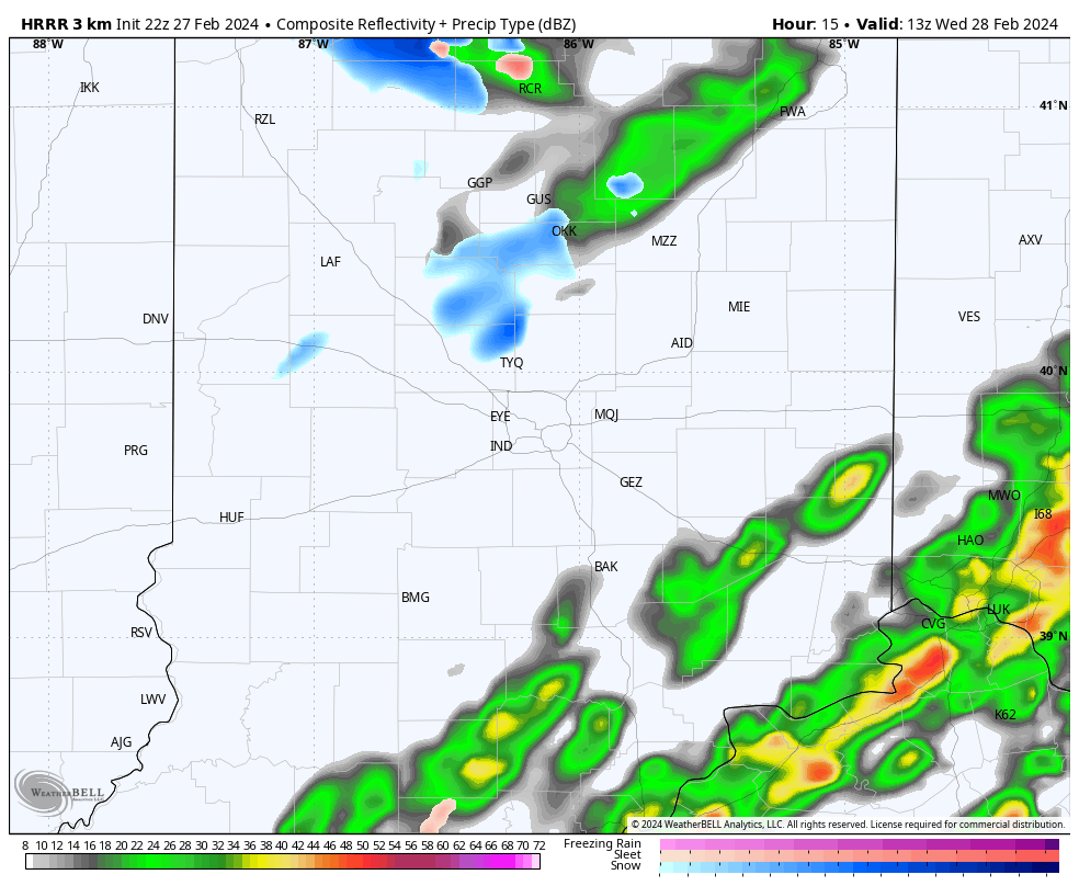
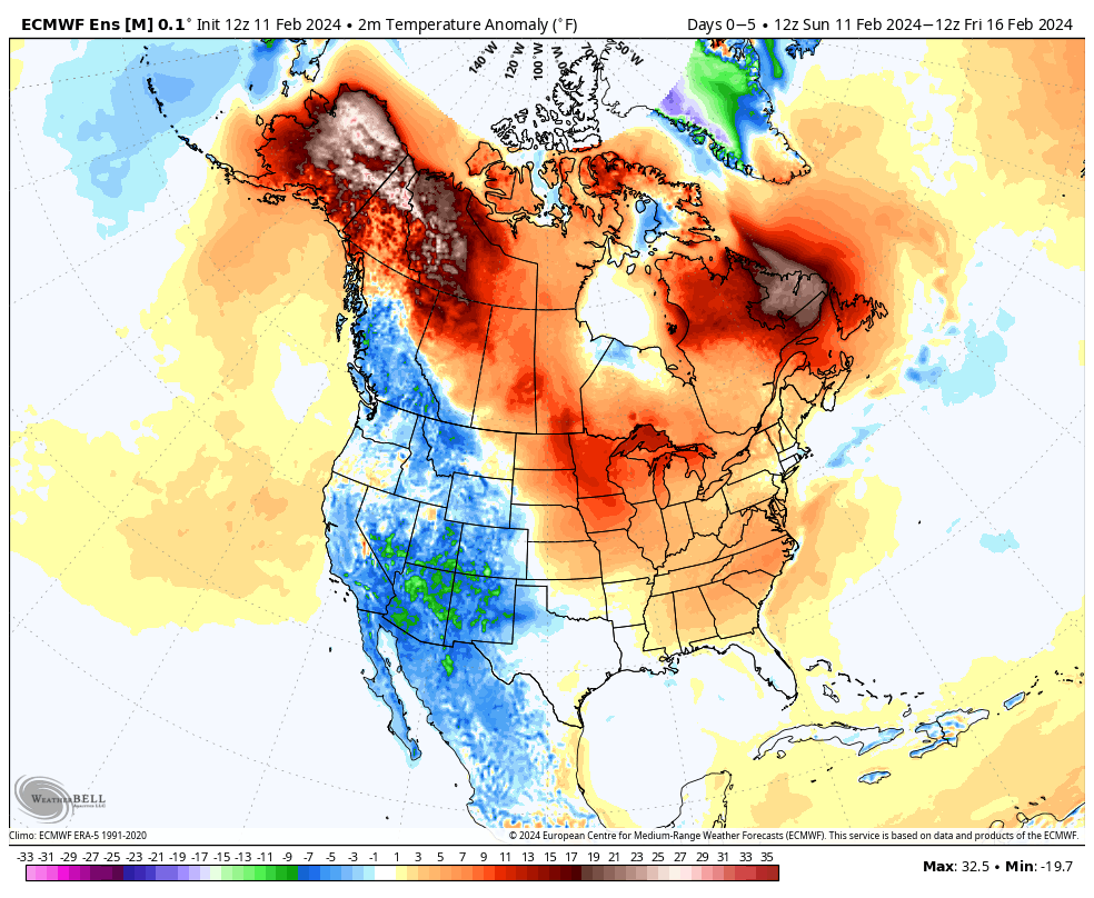
By the time most are waking up Wednesday, we’ll be talking about an entirely different array of conditions. Sharply colder air, light snow showers, and strong northwesterly winds will ensure to remind folks it’s late-February, after all.
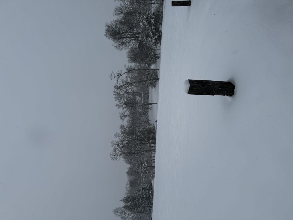
Yesterday’s snow storm was a sight for sore eyes, especially for my snow-starved central Indiana friends (you know who you are).
I took a couple of these pictures outside a cozy dinner at the Loft at Traders Point Creamery last night. “Serene” doesn’t begin to describe the evening.
Low clouds and lingering lake-driven snow flurries this morning should give way to a brightening afternoon sky. We’ll stay bitter today with the fresh heavier snowpack. Highs will struggle to make it into the middle 20s. Winds will remain gusty this morning before a bit of a “lull” and then pick up yet again overnight into Sunday morning.
Another round of gusty winds will arrive overnight into Sunday morning, this time out of the southwest.
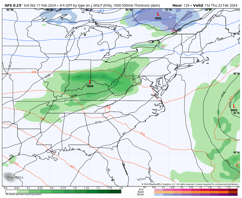
Those southwest winds will indicate a flip to milder times into midweek and overall dry conditions. Rain will return overnight Wednesday into Thursday, but doesn’t appear to be overly heavy from this distance.
After spring-like highs in the 60s midweek, another cold “jab” will take aim on the region going into next weekend. We use the term “jab” as this once again won’t be a cold air mass with staying power. We likely will quickly return back into the 50s and 60s next week after a day or two in the 30s over the weekend. Timing the cold and moisture may yet again produce a round of snow late next week and we’ll continue to keep an eye on that in the days ahead.
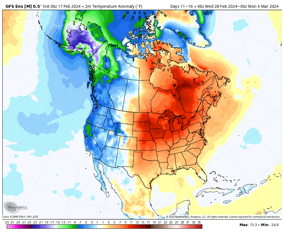
Overall, this will likely prove to reinforce the idea that any cold over the course of the coming couple weeks will be transient in nature. “Islands of cold in a sea of milder times.” We note ensemble guidance is particularly bullish on a spring-like pattern taking foot as we close February and open March. Far too early for details, but we may need to watch for the potential of an active severe weather setup during this time period, as well.
Updated 02.16.24 @ 12:14p Snow will continue to overspread the remainder of central Indiana through the afternoon and fall moderately at times. Localized banding should develop this afternoon and these…
You must be logged in to view this content. Click Here to become a member of IndyWX.com for full access. Already a member of IndyWx.com All-Access? Log-in here.
I hope this finds you enjoying a relaxing and fun Super Bowl Sunday afternoon! Before we talk longer range, trends this afternoon have been to shove the heavier snow banding potential further south tomorrow night. We’ll keep an eye on overnight model trends but the threat of accumulating wet snow is looking more likely to impact far downstate into portions of northern KY and even western and portions of north-central TN now.
Monday night’s system has trended further south today.
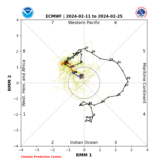
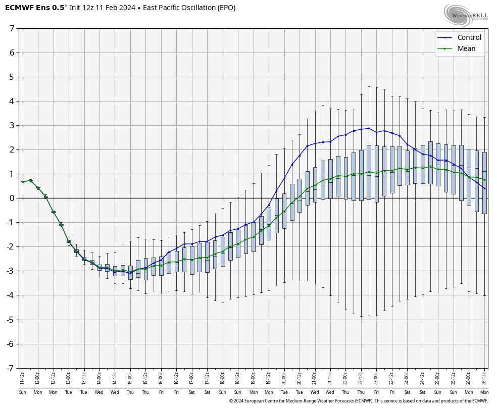
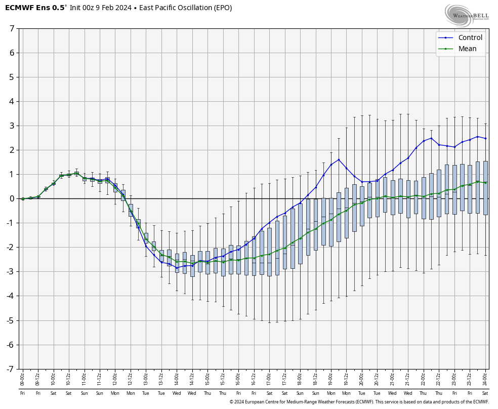
While we’ll trend at least closer to seasonal levels in the upcoming 10-day period (also need to keep an eye on the potential of late week snow and a brief arctic “jab”), the impact of a lack of MJO amplitude into the colder phases (8, 1) and the positive trends on the EPO late month suggest the once cold idea during the period here will be a fail.
In fact, latest ensemble guidance in today shows a milder than normal pattern to return during the last week, or so, of February.
Just a couple quick updates prior to the big game! Enjoy, friends!
Scattered showers/ embedded thunder overnight, opportunity for slushy, light snow accumulation, and long range rumblings highlight this evening’s rambles…
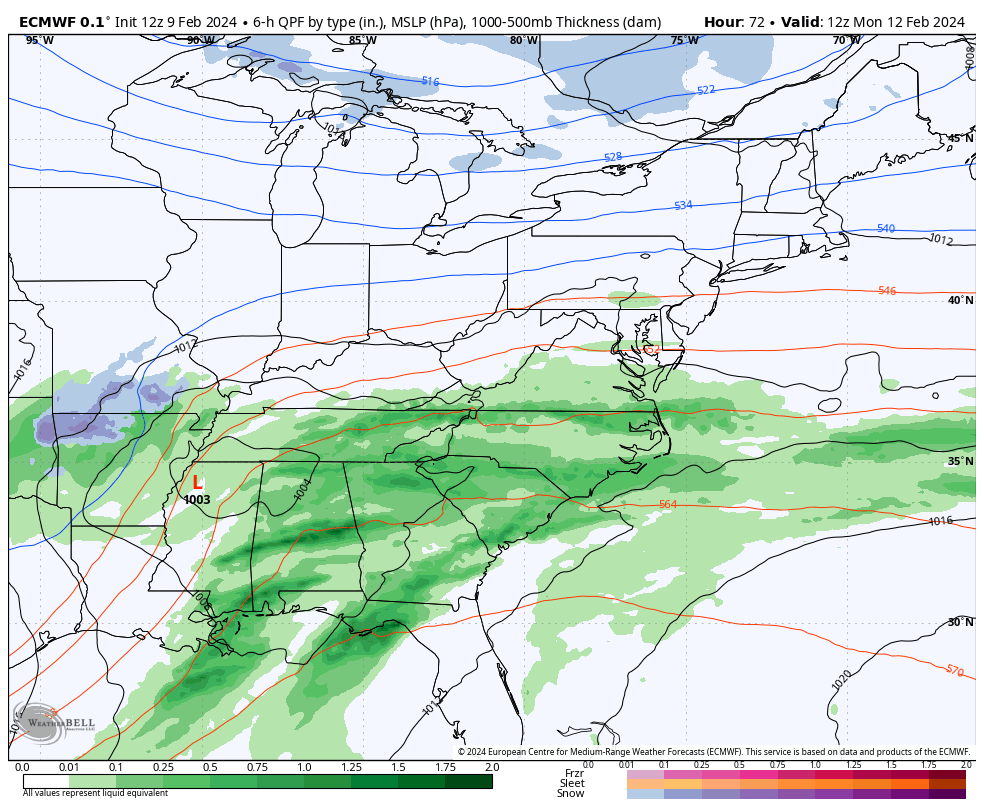
I. A thin line of broken showers and perhaps a rumble or two of thunder will push southeast across central IN during the predawn hours Saturday. More widespread, concentrated rain and embedded thunder will work across the southern 1/3 of the state overnight and early Saturday morning. Across central IN, rainfall amounts of 0.10″ to 0.25″ will be possible with this activity with more widespread 0.25″ to 0.50″ totals across the southern portion of the state.
The front will pass southeast across the region predawn Saturday with a northwest wind shift taking place from northwest to southeast prior to sunrise Saturday. Cooler (not cold by February standards) air will flow into the region over the weekend.
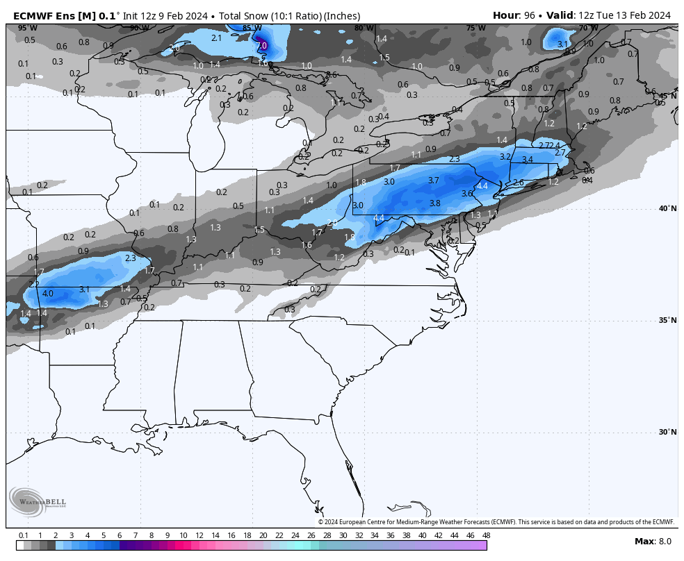
II. The second piece of energy that will lead to a significant rain and associated severe weather episode across the South and a big ole snowstorm for our friends across the Northeast early next week, still appears to mostly bypass our immediate region. It’s possible southern portions of the state (mostly south of Indianapolis) could see a light, slushy snow accumulation, but I think even in these areas the 1″, via today’s EPS is too “generous.” The reason? Snowfall rates, marginal temperatures, and the unseasonably warm ground. Further east, this will be a much different animal with a notable snowstorm anticipated for the central Appalachians into southern New England. Regardless, at least locally, Monday evening into Monday night would be the period to watch for the potential of the slushy wet snow accumulation potential.
III. The upcoming week will undoubtedly be much cooler than what we’ve grown accustomed to from February ’24 so far, but nothing overly cold for this time of year by any stretch of the imagination. We’ll watch for the threat of a couple of clipper systems that could deliver mixed rain/ snow or light snow, but significant snow makers aren’t on the horizon in the week ahead as of this evening. We’ll continue to closely monitor.
The opportunity is present for a shot of colder air behind one of these clippers next weekend.
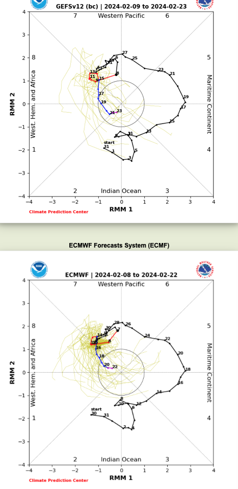
IV. The reason for “pause” this morning in the long standing idea here of a return to prolonged colder than normal weather into March came from a positive trend in the EPO and what at least appears (from this distance) any sort of MJO venture into Phase 8 will be very brief. If (still a bigger “if” than we prefer) we don’t keep that EPO negative and the MJO goes into the neutral phase, even a negative NAO won’t be able to impact the area with notable cold. Can the other players on the field at least keep the period closer to average or slightly cooler than normal? Yes, but any prolonged or significant cold would be highly unlikely if the EPO/ MJO combo doesn’t come to fruition. You better believe we’ll be watching trends carefully over the weekend into early next week.