Mostly Dry Weekend; Active Times Return Early Next Week…
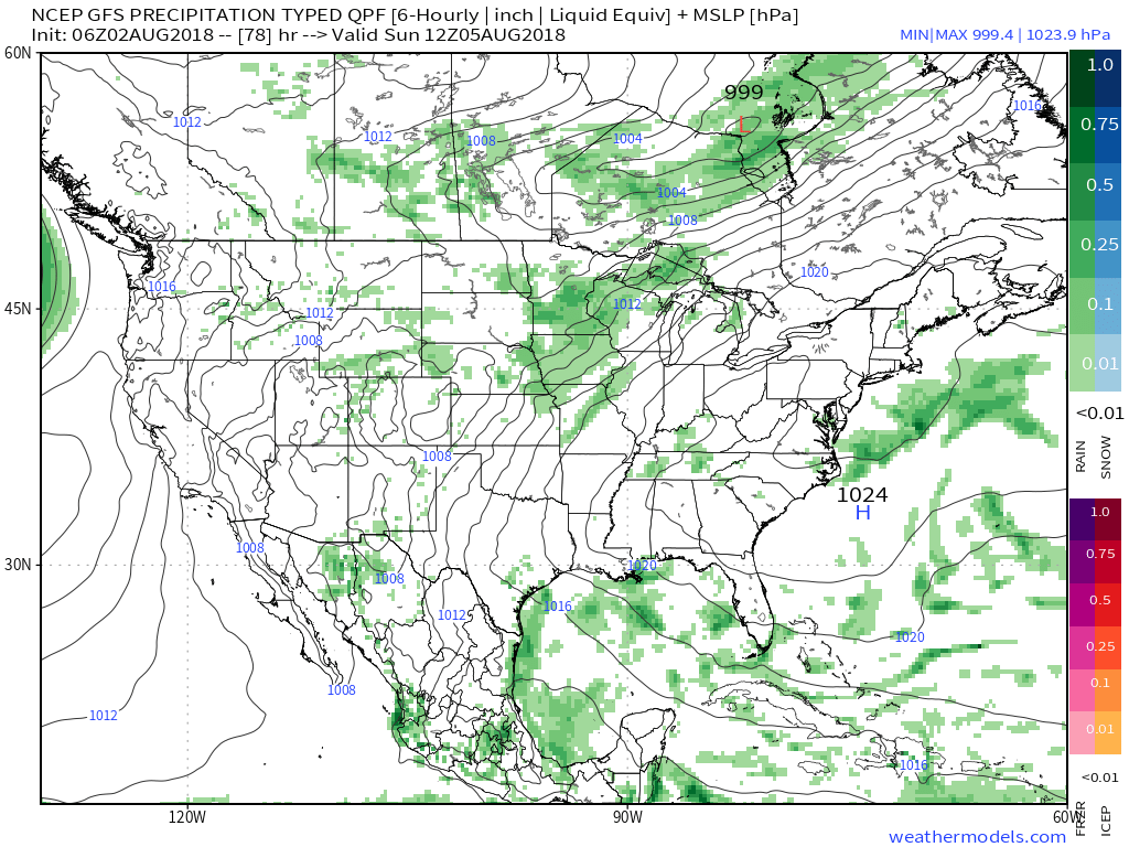
A summer-like feel will return as we move through the weekend. While the heat and humidity won’t be excessive by any means, you’ll certainly notice a different feel when compared to the cooler air we’ve enjoyed over the past 10 days, or so. We forecast highs in the mid-upper 80s with plentiful sunshine through the weekend. While an “isolated” thunderstorm is possible, most will remain rain-free until early next week. That said, best rain and storm chances will be confined to northern Indiana Thursday evening and forecast radar products are picking up on a skinny line of showers and thunderstorms.

This area of thunderstorms is forecast to diminish before it would impact central Indiana.

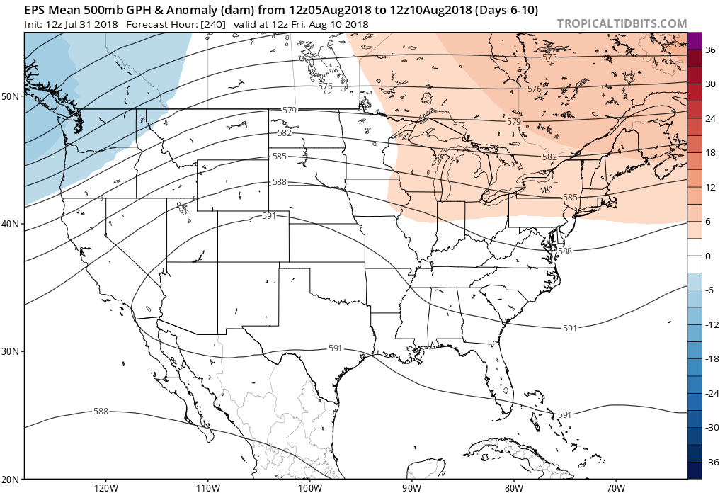
The weekend will be highlighted by plentiful sunshine with only isolated storm coverage and an increasingly muggy feel. Note the southwest air flow returning around an area of high pressure off the East Coast and our next approaching storm system to the northwest.
 That storm system will settle south and begin to impact central Indiana early next week with storm chances increasing Monday into Tuesday. With rich tropical moisture in place, locally heavy rain will be likely as the front moves in.
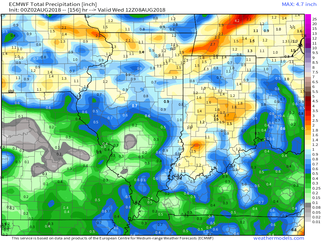
 Models are in overall agreement of additional significant rainfall early next week (widespread 1″ to 2″).
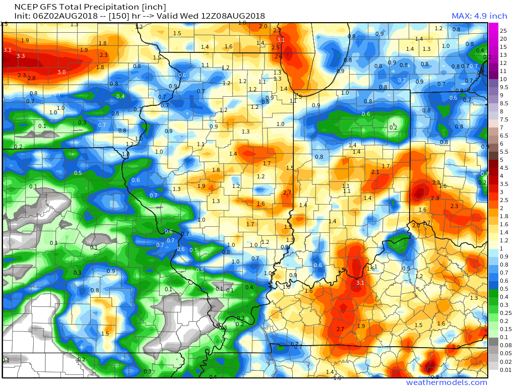