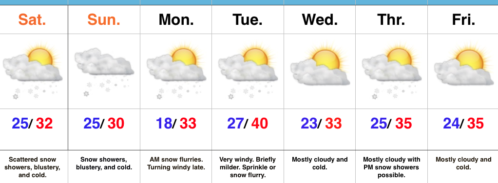
Wintry Weekend; Accumulating Snow Sunday…
 Highlights:
- Wintry weekend
- More widespread snow Sunday
- Reinforcing cold next week
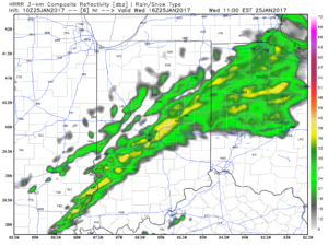
Scattered Snow Showers Turns To Steadier Snow Sunday…Upper level energy will continue to track across the region this weekend, setting off periods of snow showers and embedded heavier squalls (case in point this evening). The strongest upper level energy will pass Sunday evening and the result should be a period of more widespread snow Sunday- especially in the afternoon and evening. A light accumulation (1″-2″ potential) is possible.
The new work week will begin with early flurries Monday and then we’ll kick in a strong and gusty southwest wind Monday night, continuing into Tuesday. We’ll turn milder briefly Tuesday, but strong winds will remain. We’ll continue to monitor the Tuesday night-Wednesday morning period as some modeling wants to deliver a round of light snow with the reinforcing chill. We’ll give it another round of model runs, but we may need to hit snow a little harder in the Tuesday night period.
Another disturbance will race through the region Thursday with snow showers and then we’ll eye the potential of a stronger system next weekend…
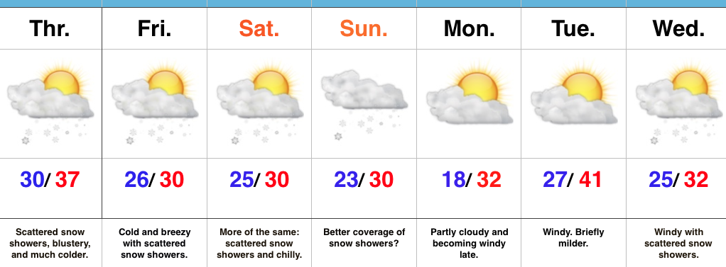
Upcoming 7-Day Precipitation Forecast:
- Snowfall: 1″ – 3″
- Rainfall: 0.00″
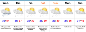 Showers will expand in overall coverage as we progress through the late morning hours, but shouldn’t amount to much (0.10″ for a few neighborhoods). We return to a drier theme this afternoon.
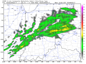
 Longer term, the GFS ensemble continues to show the cold growing deeper and stronger for the region as we progress into early February. Winter is far from over.
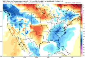

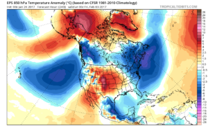
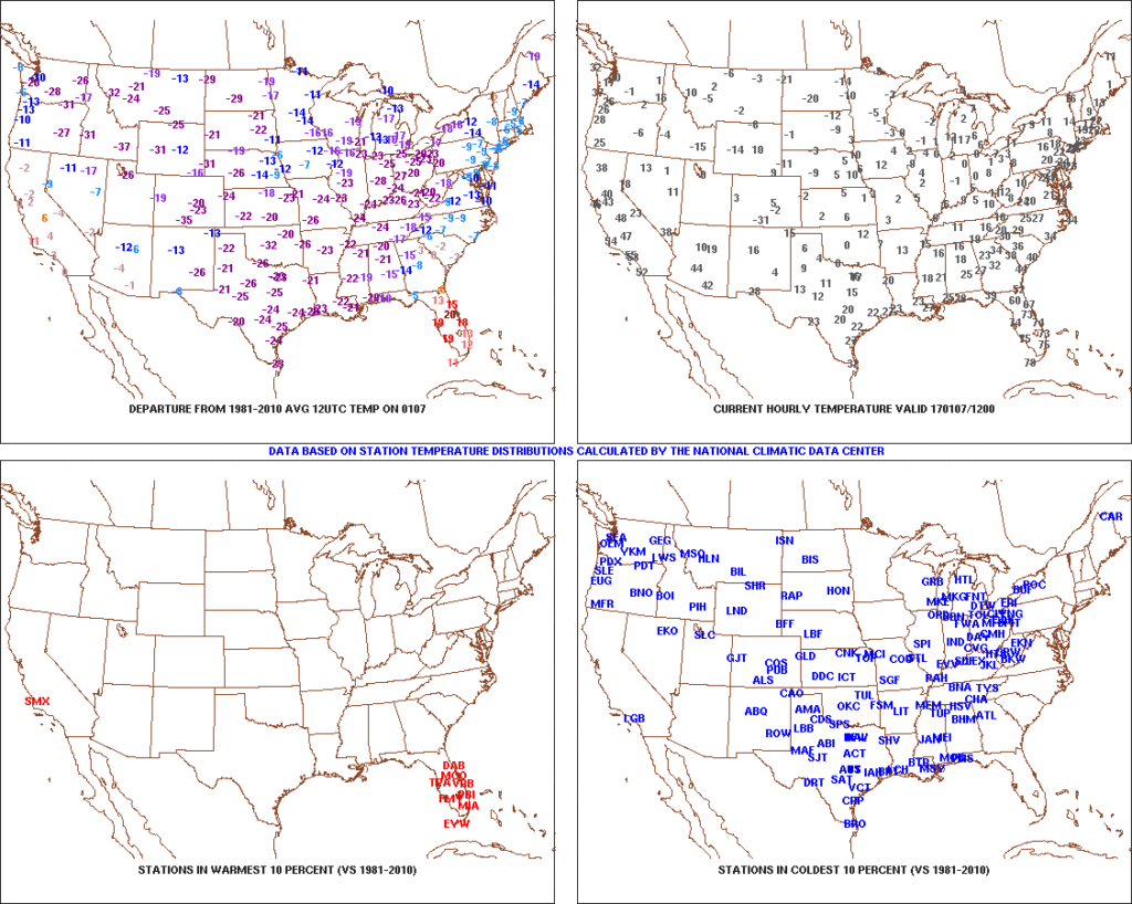 After the past week to ten days, that frigid open to the month seems like forever ago! The past 7-10 days has featured a significant January thaw, and temperatures now, MTD, are warmer than average across the Ohio Valley. Warmest anomalies can be found across the southeast region.
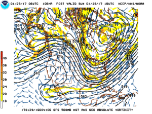
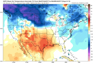
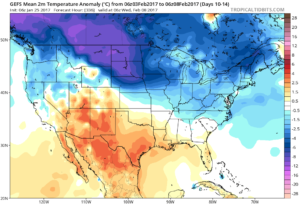
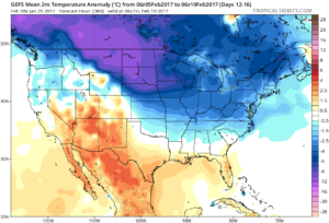
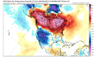
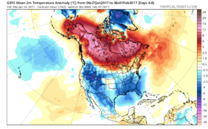
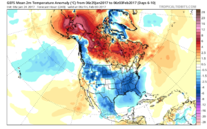
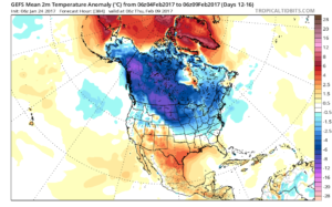
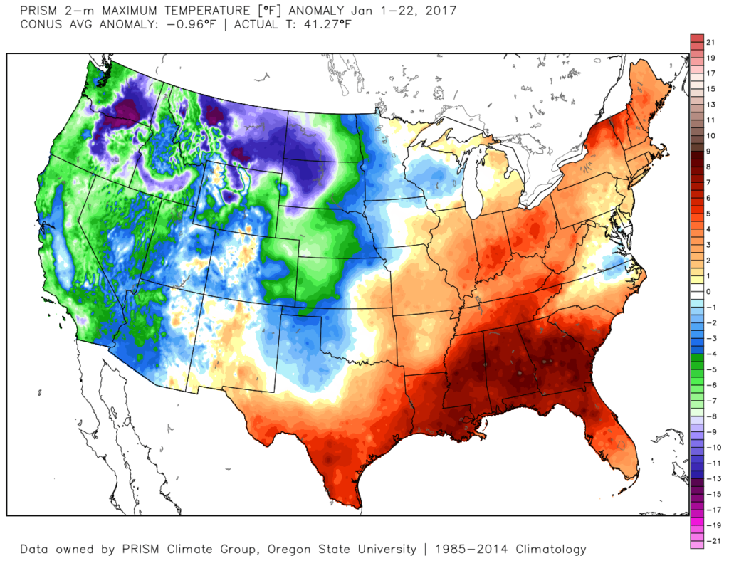 That said, the pattern is shifting back to winter for the last week of the month and while the duration, longer-term, can be argued, the next 2-3 weeks appear to offer an opportunity to play “catch up” in both the snow and cold departments. Note the developing eastern troughiness. This will bring colder air back into the east as we close January and open February. The GFS ensembles, courtesy of Tropicaltidbits.com, also develops an interesting “blocky” look towards the end of the period in Week 2. Should this verify, it would lead to a better chance of the cold, active pattern locking in.
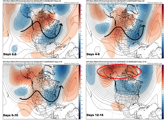
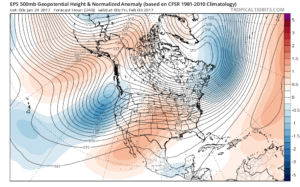
 Thinking here at IndyWx.com believes the European is likely rushing the warmer central look. Time will tell…