Looking At The Week Ahead…
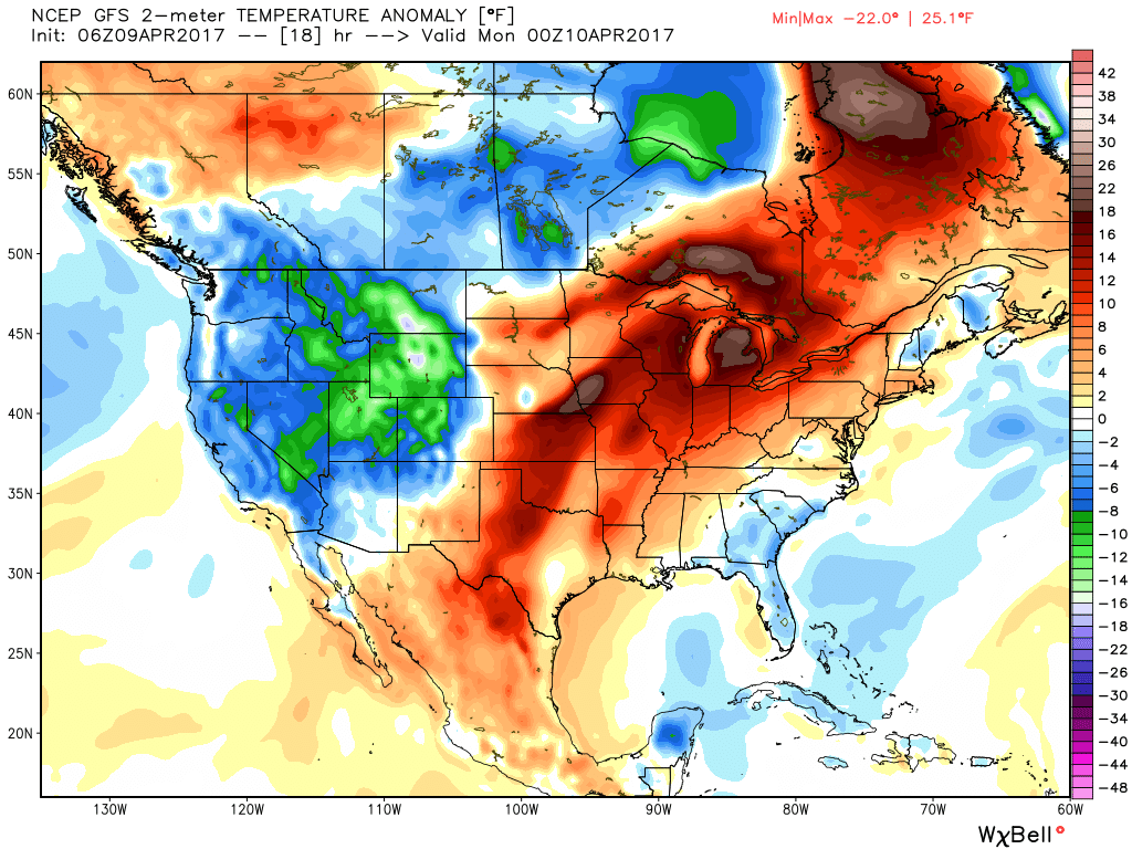
The second half of the weekend will feature beautiful weather, albeit breezy conditions at times. Strong southwesterly winds will gust upwards of 40 MPH this afternoon, but also aid in pushing mid to upper 70s northward into central Indiana. Despite the strong winds, we still recommend finding a way to get outside and enjoy this weather!
 Highs will run close to 15° above average this afternoon.
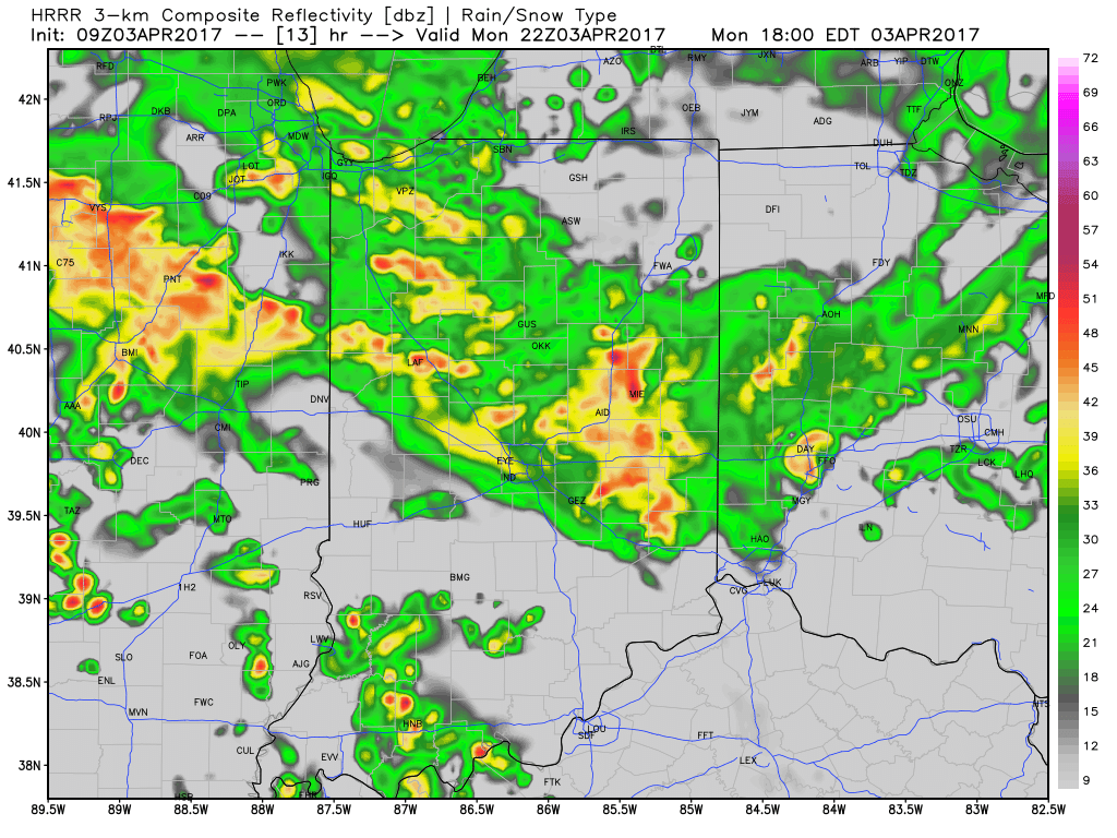
 Stormy weather returns Monday as a frontal boundary slips into the state. A couple storms may become strong or severe Monday afternoon and the Storm Prediction Center highlights northwestern portions of the state for a Slight Risk. Damaging straight line winds are of greatest concern with any severe storm that may develop.
 High pressure returns for midweek and supplies a dry regime, along with increasing sunshine and temperatures that will run slightly above average (mid-40s at night and 65°-70° during the day).
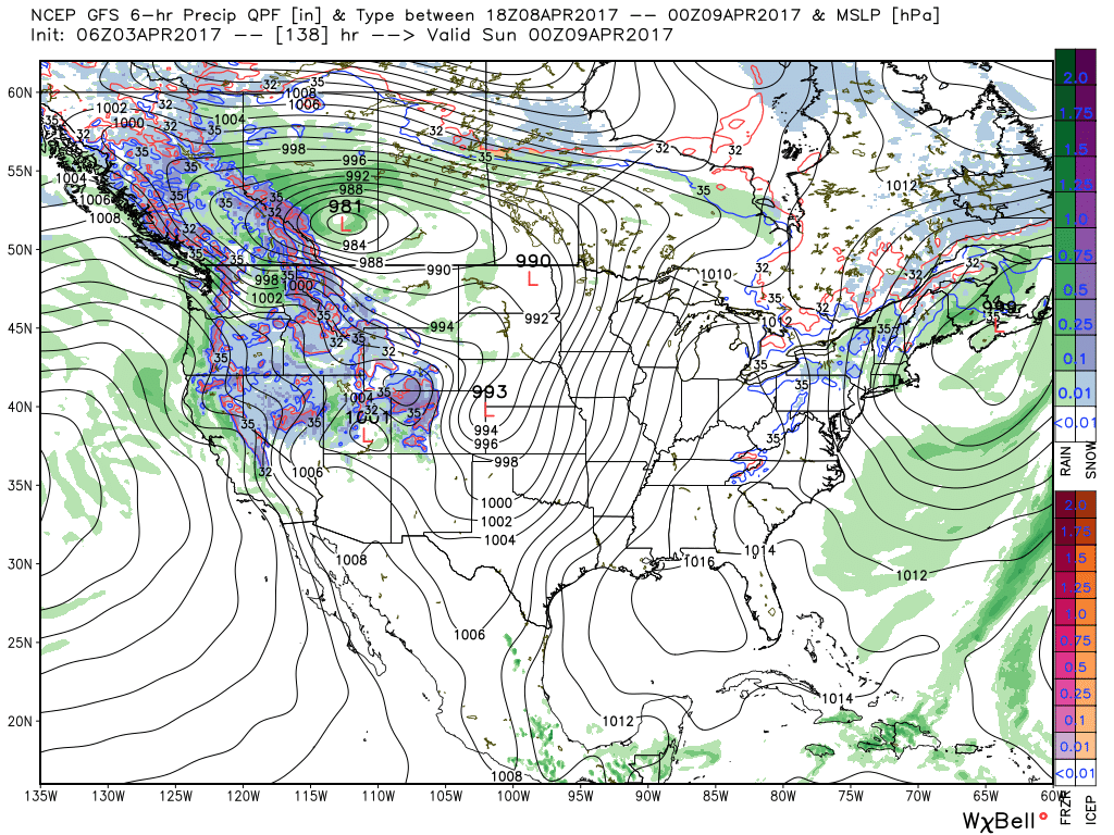
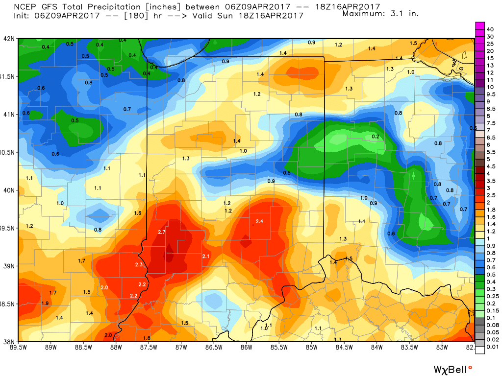
 There are questions once to the end of the period as the GFS and European handle the evolution of our late-week storm differently. The GFS brings energy out into the Ohio Valley and results in unsettled weather returning Friday, continuing into Easter weekend, while the European is slower. We’ll keep an eye on things over the next few days and update accordingly. The GFS suggests some localized heavier downpours would be possible in the Friday-Sunday period as the majority of the 7-day precipitation snapshot below falls within the timeframe.
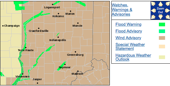
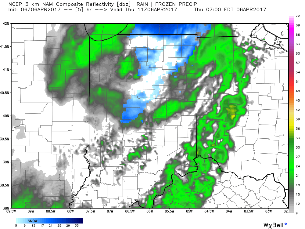 We’ll also add wind into the mix late morning through early evening, including gusts around 50 MPH. Factor in the much colder temperatures with gusty northerly winds and you have the makings for a truly “raw” day across the region. The National Weather Service has issued a Wind Advisory until 8pm.
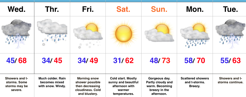
 We should finally get rid of the precipitation later tonight and after a chilly Friday, weekend improvements are coming. Lows both Friday and Saturday morning will be around freezing for most central Indiana neighborhoods. After a cloudy start Friday, sunshine should return Friday afternoon as drier air works into the region. With high pressure arriving this weekend, sunny conditions can be expected and with a southwest wind developing by Saturday afternoon, moderating temperatures are on deck as well.
 In fact, after that cold start Saturday, highs should climb into the lower 60s Saturday afternoon and all the way into the lower to middle 70s Sunday afternoon!
 Highlights:
 Highlights:
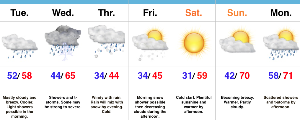
 2.) We’ll get a breather on Tuesday, but our next storm system will move in quickly and begin impacting central Indiana during the day Wednesday. A couple strong to severe thunderstorms are possible Wednesday and will require our attention over the next day, or so. We’ll have more details with our updated 7-day later today.
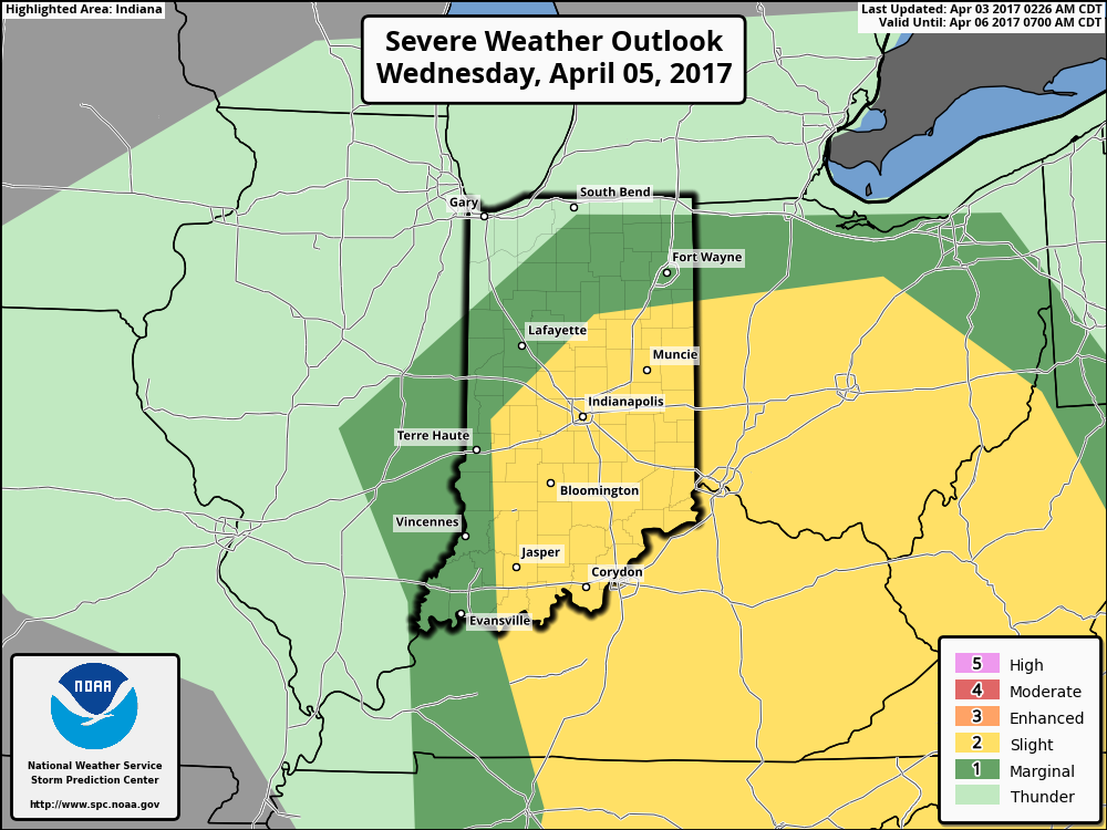 3.) We’ll get into the colder side of the storm to close the work week and thoughts will shift from storms to snow. Wind-whipped snow showers will be a good bet in the unseasonably cold air Thursday into Friday morning.
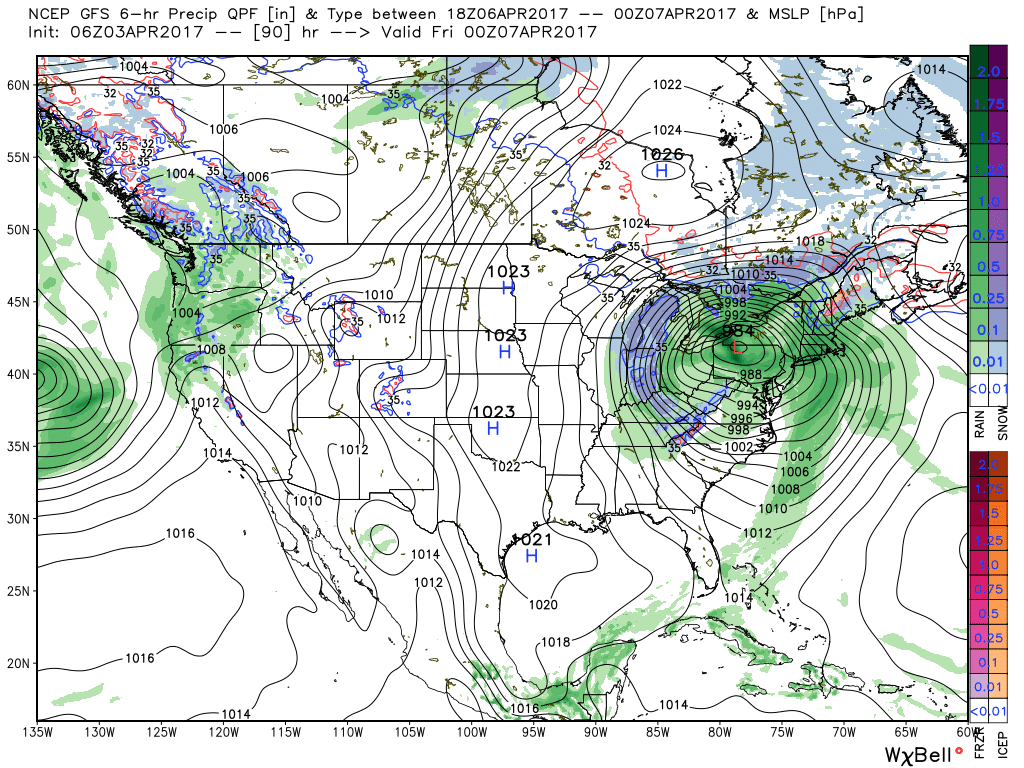 4.) Timing will once again be our friend as we push into the weekend. Weak high pressure will arrive on the scene and help ensure dry conditions. After a cold start Saturday, a moderating trend will develop.