Another Big Rain Maker; Unseasonably Chilly…
 Highlights:
- Limited sunshine
- Another big rain event awaits
- Prolonged period of chilly weather
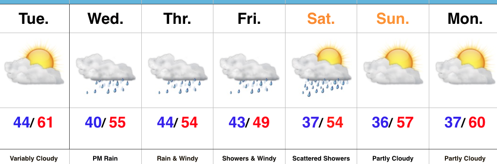
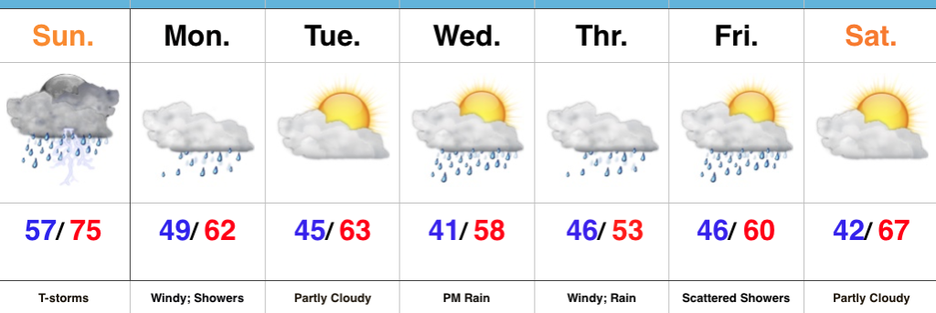
Jackets And Rain Gear Needed…Without question, Tuesday appears to be the “pick of the week” across central Indiana as we get into some briefly drier air. Enjoy it, as a new storm system will deliver heavy, wind-driven rain and unseasonably chilly air as we progress through mid and late week.
Clouds will lower and thicken Wednesday morning and give way to an expanding shield of rain as morning wears into afternoon and evening. As the surface low tracks closer to the region, an increasingly strong and gusty easterly wind will develop and combine with the chilly rain to lead to a truly “raw” period of weather to close the work week. It’ll feel more like early-March than early-May around these parts. Unfortunately, it still appears as if this next storm will deliver hefty rainfall totals on our already water-logged landscape. Data paints a widespread swath of 2″-3″ totals with locally heavier amounts. Flooding, once again, appears likely and if you live near a body of water, it’ll be important to keep a close eye on water levels Thursday into the weekend.
Widespread rain Friday should slowly give way to improving weather conditions over the weekend: scattered showers Saturday and dry, cool weather Sunday. Speaking of cool, temperatures will continue to run well below average, and lows Saturday through Monday mornings’ may result in patchy frost in outlying areas…
Upcoming 7-Day Precipitation Forecast:
- Snowfall: 0.00″
- Rainfall: 2.50″ – 3.50″
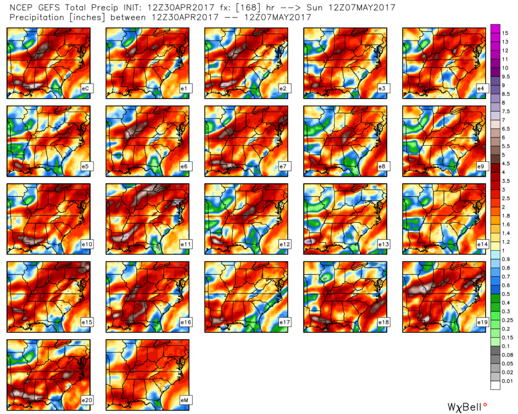
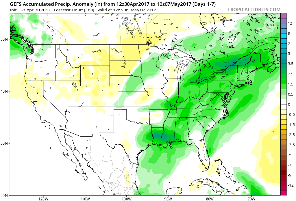 The individual GFS ensemble members are truly concerning, especially given just how wet we currently are. We note some members suggest additional 3″-4″ totals- with over 50% of that coming from our midweek storm.
 We’ll keep a close eye on model data over the next couple of days, but as of now, we suggest planning for additional hefty rain totals in the Wednesday night through Friday time frame. Also of interest will be the extreme cool associated with this storm. As previously mentioned, the majority of the day Thursday will be spent in the 40s (more like early-March than early-May). Factor in a gusty easterly breeze and we’ll have the makings for a truly “raw” weather day across the region.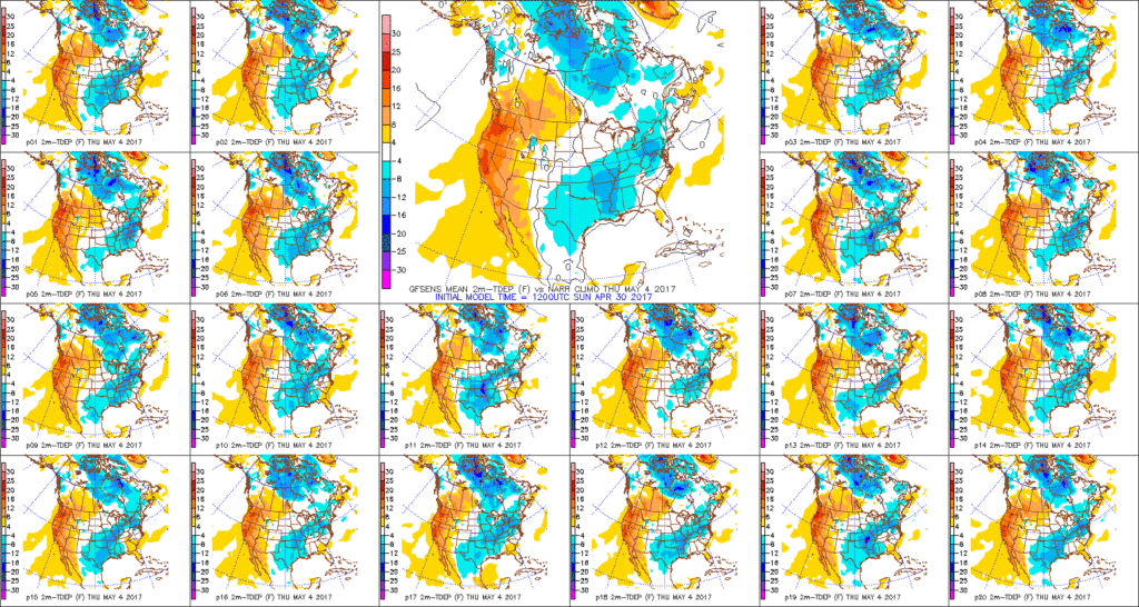
 Highlights:
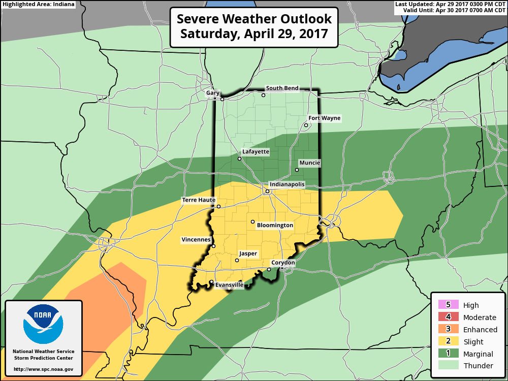 We think an eastward-advancing line of thunderstorms will blow into central Indiana later this evening (between 9p and midnight). Some of these may reach strong to severe levels with damaging straight line winds of greatest concern. Additionally, torrential downpours will occur within this line of storms.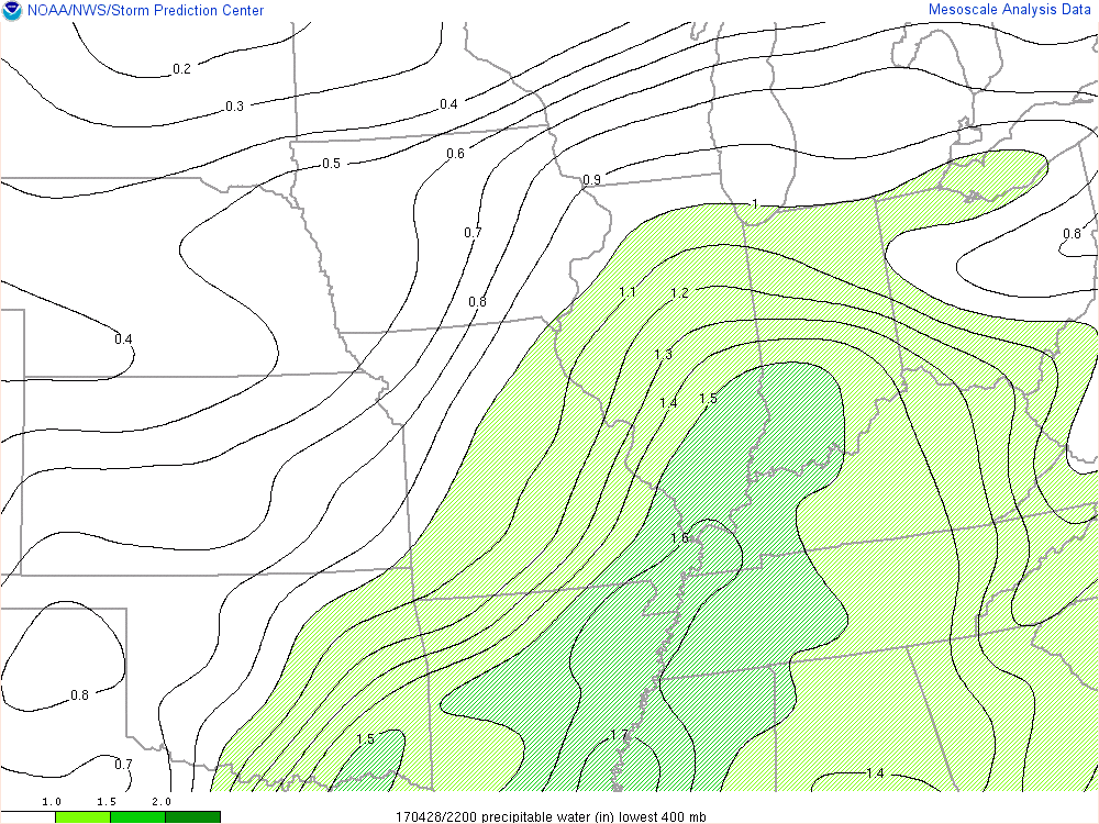
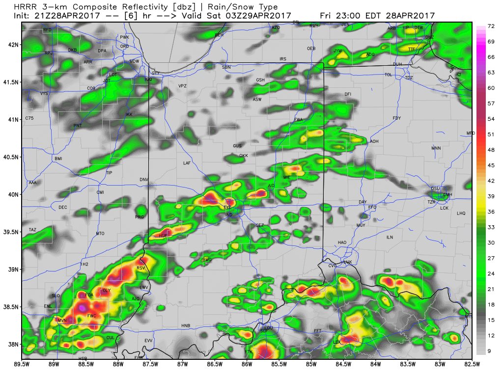
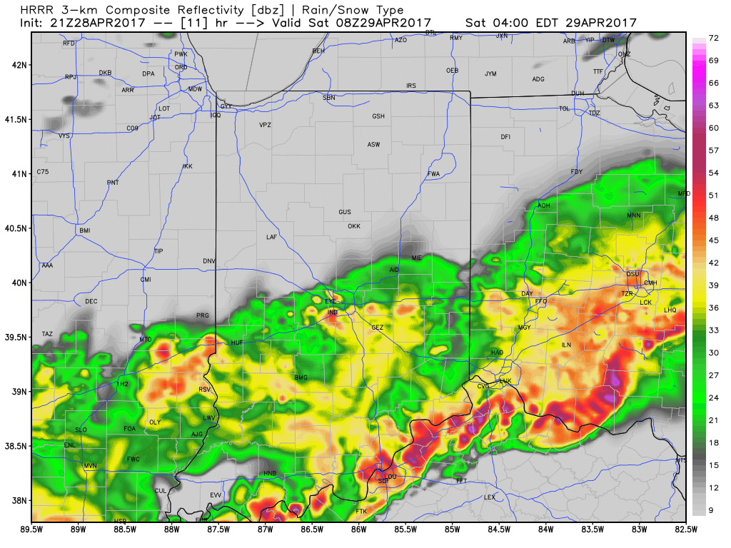
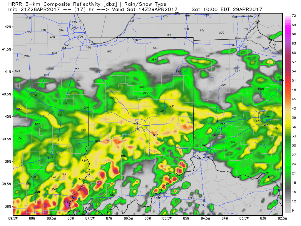
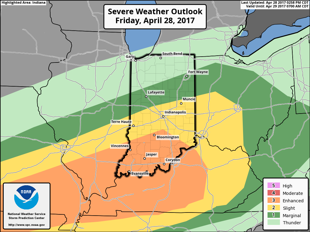
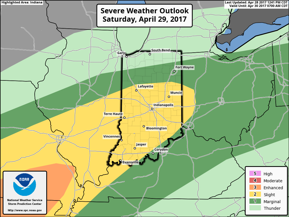
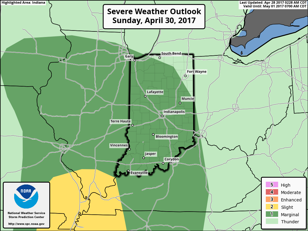 Once all is said and done, we anticipate widespread 2″-3″ rainfall totals through central Indiana, but also note there will be localized heavier amounts. Once to Monday we’ll look at a much cooler, windy, and “showery” regime. Look for falling temperatures through the day Monday and this will set the stage for the week ahead: MUCH cooler, overall…. More on that later this weekend!