
You must be logged in to view this content. Click Here to become a member of IndyWX.com for full access. Already a member of IndyWx.com All-Access? Log-in here.
Category: Unseasonably Cool Weather
Permanent link to this article: https://indywx.com/pleasant-weekend-on-deck/
Jul 14
Hot, Drier Pattern Awaits…
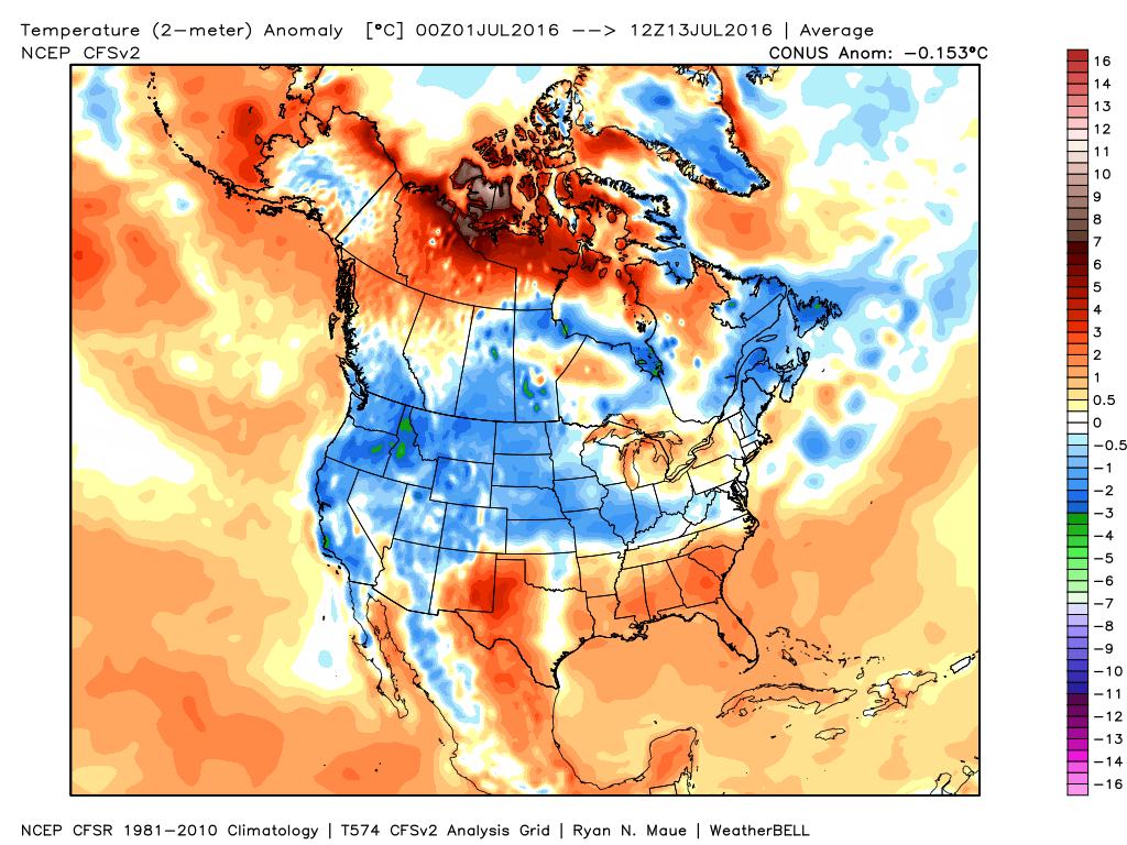
We’ve been relatively spoiled so far this summer- both in regards to temperature and precipitation. That said, as we approach the second half of July, things appear to be changing for the hotter and drier side of things.
July, so far, has been very pleasant, locally. BTW- another push of drier air is inbound that should lead to a nice weekend, including low humidity values.
 Ensemble data continues to suggest that the mean ridge position (hot dome) develops over the eastern portion of the country early next week before slowly retrograding northwest with time.
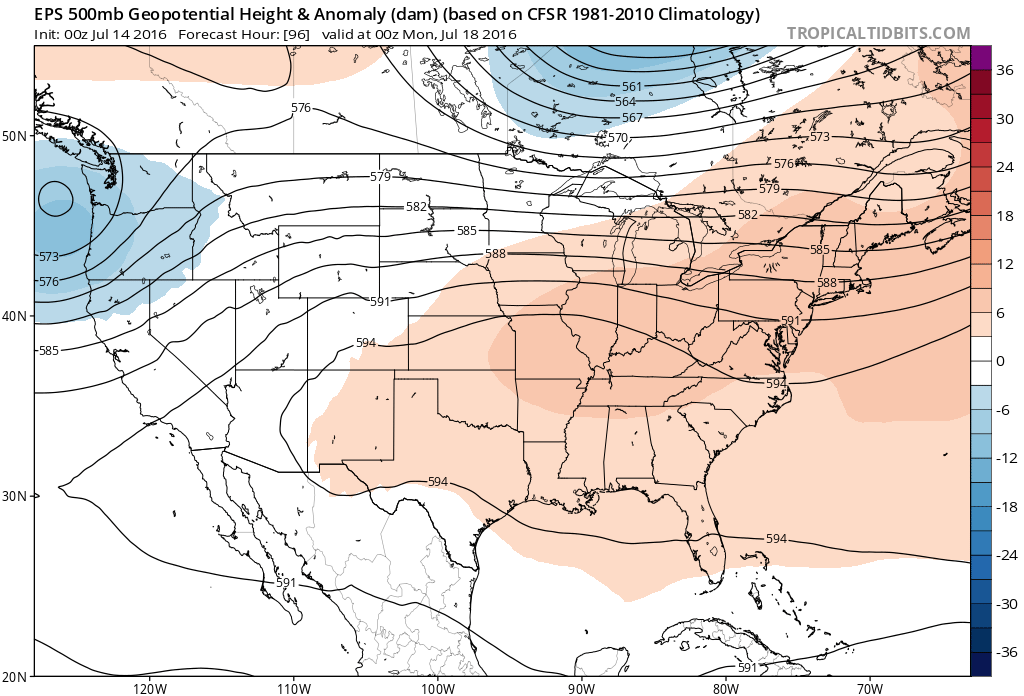 By the middle and latter portions of next week, the hot dome is set up in a position that will yield an extended stretch of hot temperatures across the state, including multiple mid-90 degree highs across central IN.
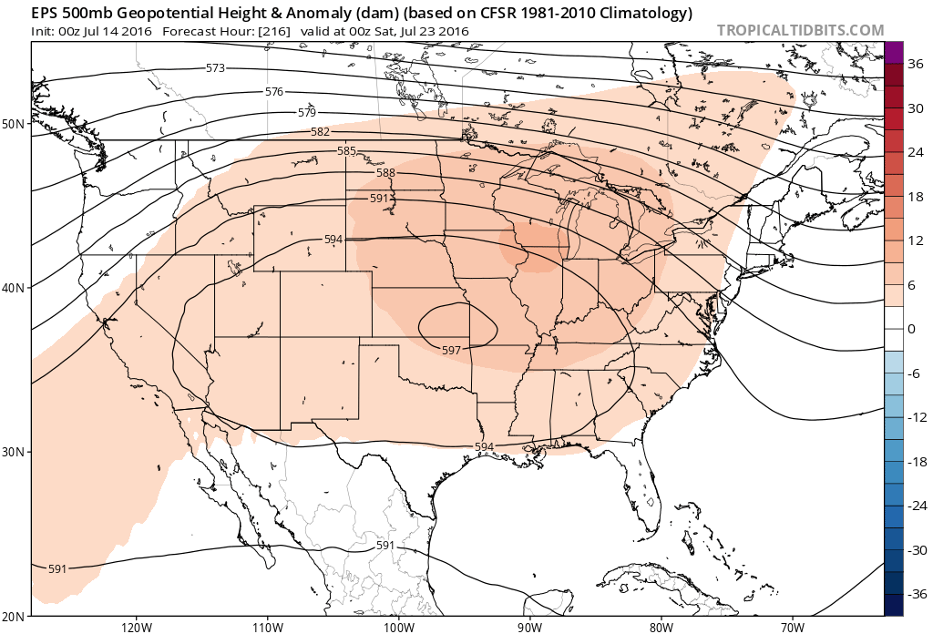
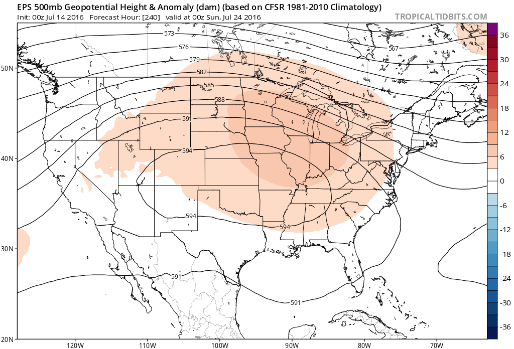 Given the current look of the ridge position, this would also be a rather dry pattern, as well, as the storm and rain track would shift north across the Canadian border into the northern Great Lakes states. (Follow that 588 line above for a good indicator of the storm track).
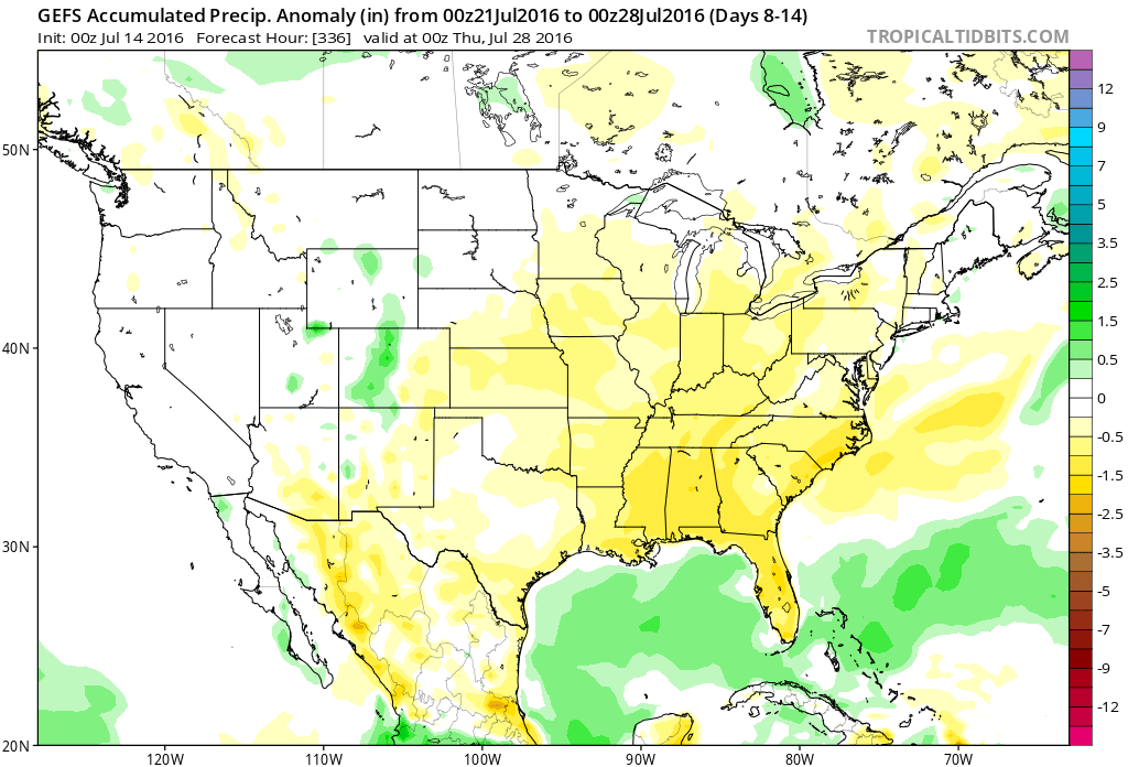 One always has to be careful in trying to predict the timing of the ridge breaking down/ overall placement this time of year (models can struggle), but for now it appears as if we really heat things up and dry things out as we move through next week- especially the middle and latter portions of the week.
Permanent link to this article: https://indywx.com/hot-drier-pattern-awaits/
Jul 09
Great Weekend Weather…
 Highlights:
- Dry and pleasant weekend
- Moisture and storms return next week
- Another push of cool air next weekend?
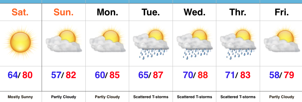
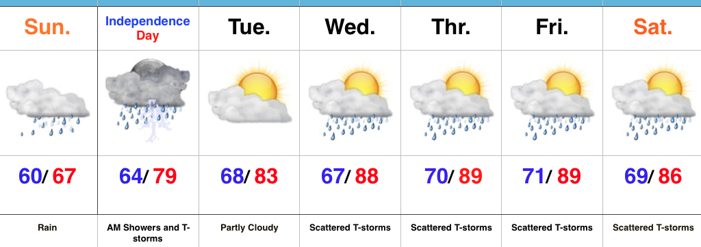
Sunglasses Required…What a great feel we’re greeted with out there this morning! Low humidity and pleasant temperatures will be with us through the weekend, along with lots of sunshine. Sunday morning will feature many neighborhoods in the middle to upper 50s across central IN. Mid-July, what?! 
Moisture will slowly return as we back our air flow around to the SW early next week. Additionally, we’re tracking multiple disturbances mid week that will promote increased chances of thunderstorms.
An early look at late week shows potentially another push of dry and cool air to set-up a beautiful close to the work week. We’re getting spoiled.
Upcoming 7-Day Precipitation Forecast:
- Snowfall: 0.00″
- Rainfall: 0.75″-1.50″ (locally heavier totals)
Permanent link to this article: https://indywx.com/great-weekend-weather/
Jul 08
Friday Morning Rambles…
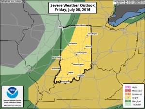
1.) We’ve got another warm, humid day dialed up and as a cold front moves in this afternoon, scattered strong to severe storms are possible. We think east-central Indiana stands the greatest threat at experiencing a severe storm later this evening.
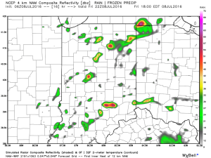 2.) The aforementioned cold front will sweep through the state tonight and allow a much drier and cooler air mass to push in for the weekend. We’ll enjoy a downright pleasant feel this weekend, including lots of sunshine. Enjoy!
 3.) Dry weather should continue into early next week, but wet and stormy weather will return as early as Tuesday, continuing into the latter portions of the week.
 This is the start of what should be a rather wet period for mid and late month.
 4.) This is also a continued “transient” pattern through the end of the month, meaning we really don’t see any sort of sustained dry, hot weather in the foreseeable future…
Permanent link to this article: https://indywx.com/friday-morning-rambles-3/
Jul 03
Unseasonably Cool; Heavy Rains…
 Highlights:
- Heavy rain
- Unseasonably cool
- Turning warmer
- Active, stormy time later in the week
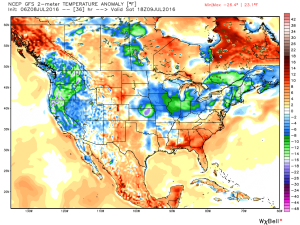
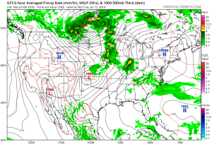
Jacket And Rain Gear Needed…The first of two rounds of widespread, soaking rains is pushing across central IN this morning. Periods of moderate to heavy rains will develop later tonight as round two arrives on the scene. Localized flooding is likely tonight and Monday morning. The overall set-up is one that features a stationary front draped across the region with ripples of energy (low pressure) moving along the boundary. In addition to the wet weather, this will also set up quite the temperature gradient across the state today. Here across central IN, jackets will be needed all day with highs struggling to climb much out of the middle 60s. Downstate, temperatures will zoom into the 80s with a severe component added into the mix tonight for southern IN (with the focus primarily being straight line winds).
Showers and thunderstorms will continue Independence Day, but we’re still hopeful in thinking we begin to dry things out for the afternoon and evening. That’s great news for the fireworks and festivities planned tomorrow evening.
We begin to heat things back up and add storms into the mix for mid and late week as the region gets into an active NW flow regime. The potential is there for a couple of rather noisy storm complexes later this week. We’ll keep a close eye on things.
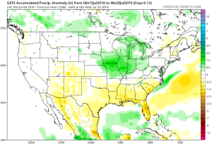
Upcoming 7-Day Precipitation Forecast:
- Snowfall: 0.00″
- Rainfall: 3.5″-4.5″ (locally heavier amounts)
Permanent link to this article: https://indywx.com/unseasonably-cool-heavy-rains/