Dreaming Of A White Christmas?
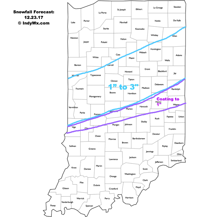
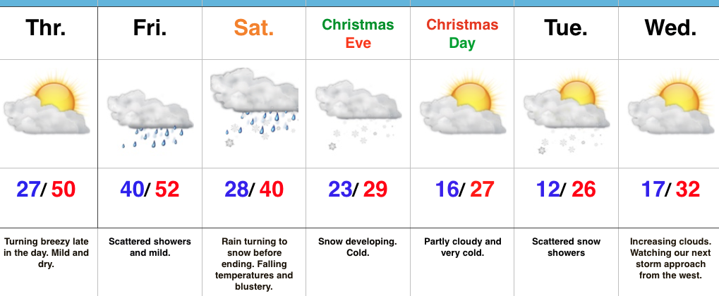
A busy winter pattern is on our doorsteps and the first of a series of accumulating snow events arrives Saturday morning for central Indiana. A cold front will settle south across the state this evening, allowing colder air to filter in. Meanwhile, a wave of low pressure will track northeast from the TN Valley into the lower OH Valley. This will result in more widespread moisture moving into the region overnight into Saturday morning. On the northern periphery of this precipitation, a changeover to wet snow is anticipated. A window of opportunity is present for a narrow, but heavy wet snow band to “thump” for a couple hours and potentially may make roads slick due to the intensity of snow within this narrow zone. Given the setup and dynamics in play, this type of event has bust potential written all over it, but this is our best idea for a first call.
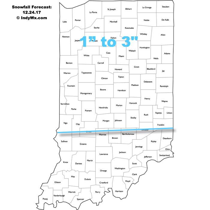
 A more widespread, “uniform” (easier to forecast, as well :-)) snow event will arrive Christmas Eve. Upper level energy will cross the Ohio Valley and combine with arctic air in place to maximize moisture production. We expect an expanding area of snow to encompass most of the state Christmas Eve, likely becoming most widespread Christmas Eve afternoon. With cold air in place, roads will likely get slick in spots so plan accordingly with your travels.
 The hits keep coming as we progress into next week. An additional accumulating snow event may arrive Christmas night into Tuesday, followed by a more widespread and potentially major event late next week…
More later!
 Highlights:
 II.) Additional upper level energy will rotate across the Ohio Valley Christmas Eve and this, combined with arctic air pushing into the region, should maximize moisture production and lead to a period of snow and snow showers Christmas Eve afternoon into early Christmas Day. This energy should feature some Christmas “magic” and be enough to provide a more widespread light accumulation across the region (when compared to Saturday).
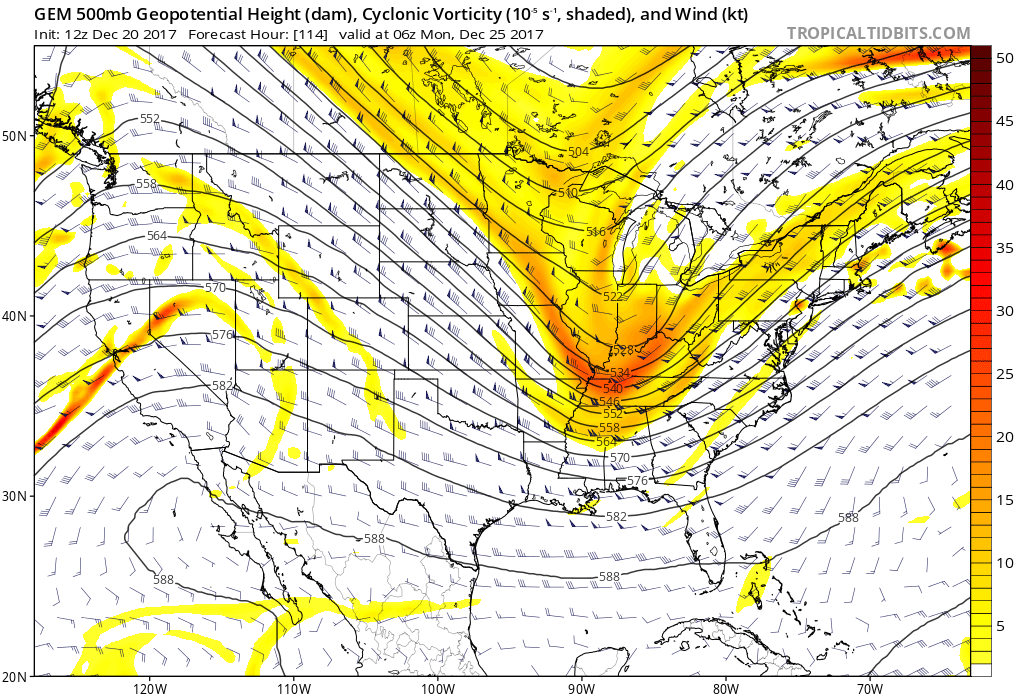 III.) As we look forward to middle and latter parts of next week, the pattern screams potential is on the table for a more widespread, significant winter storm (Plains to the Northeast). While obviously early on in the game, the overall pattern does back up the idea presented by modeling.
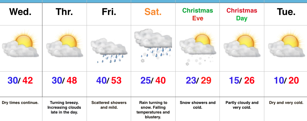 Highlights: