During wholesale pattern transitions, operational data will struggle at times, including some wild run-to-run swings. Earlier this week, the European wanted to put early next week in the lower 50s. At the same time, the GFS suggested lower single digits. Precisely, it was a difference of 46° between the two models for a high?! 🙂
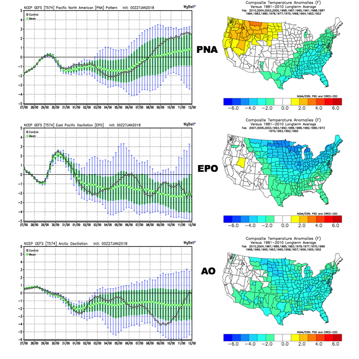
We note the teleconnections (in particular, the EPO) are aligning in a manner conducive for widespread cold.
 The GEFS might be a bit quick on dropping the arctic hammer, but the consistency of the model is impressive. Meanwhile, the European (even it’s ensemble data) has been much less consistent and has really been struggling the past couple of winters, overall, as a whole.
While we can argue as to just how cold it’ll get through the early part of February, the overwhelming message is that a prolonged colder than normal pattern will develop during this time period.
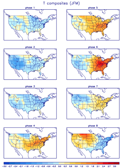
 Let’s also keep in mind that the initial cold onslaught is coming in the face of the MJO still rumbling through the warm phases. We note the European is consistently having to correct towards a more “amped up” MJO- swinging into the cold phases as we approach mid-month. And it’s mid-February that continues to have us concerned for the potential of truly nasty, severe cold.
 As for snow, it’ll come in this pattern. Again, don’t get caught up in the operational output, but understand that the pattern over the upcoming 7-10 days favors numerous fast-moving snow systems. While most of these will be light, we’ll have to keep a close eye on things as the potential exists for one of these waves to spin up a moderate event.
As we look ahead to Week 2, the potential is there for a more widespread significant phased interior threat prior to the dumping of the bitterly cold air for mid-month.
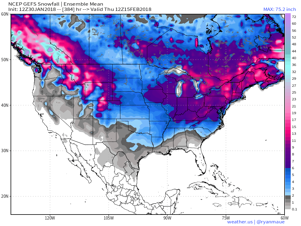
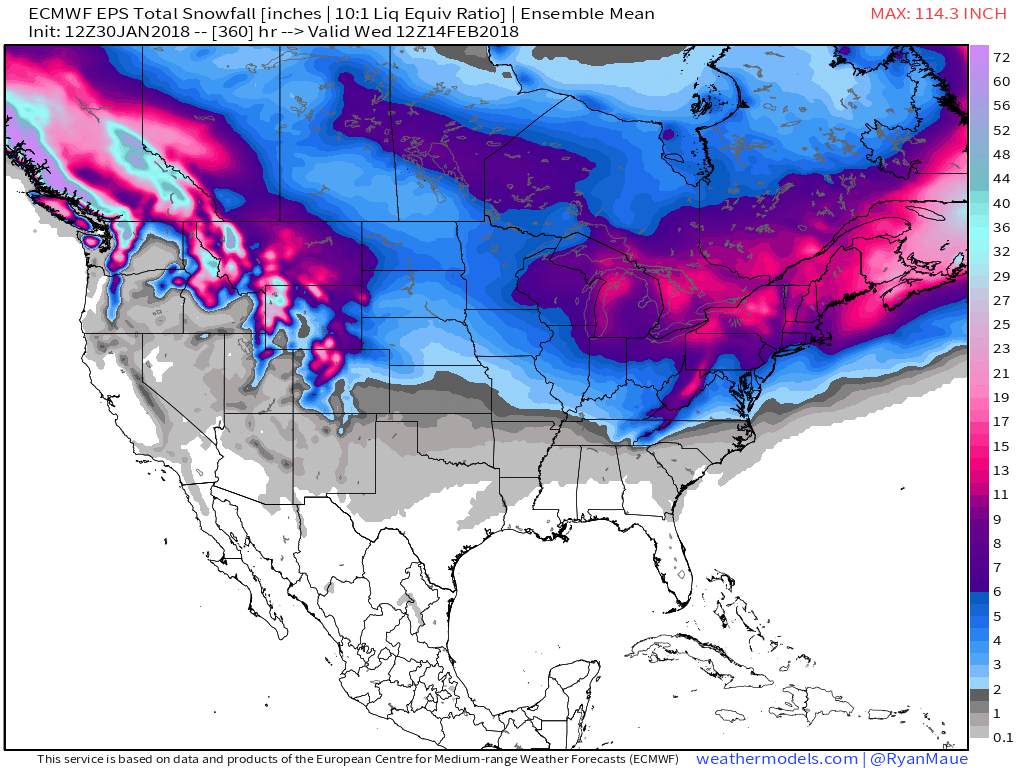
As it is, both the GEFS and EPS “mean” paint a bullish signal for piling snow up over the next couple weeks…
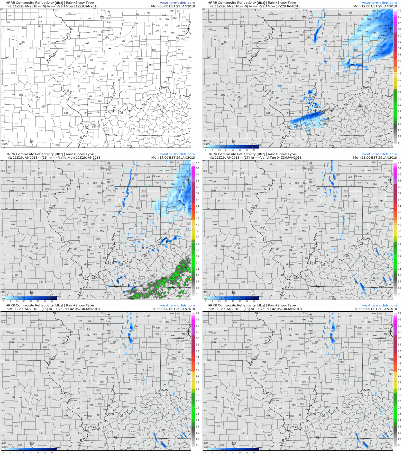 Cold high pressure will settle overhead Tuesday and Wednesday and supply a return of dry times, complete with sunshine. We’ll turn breezy in advance of our next storm system Wednesday.
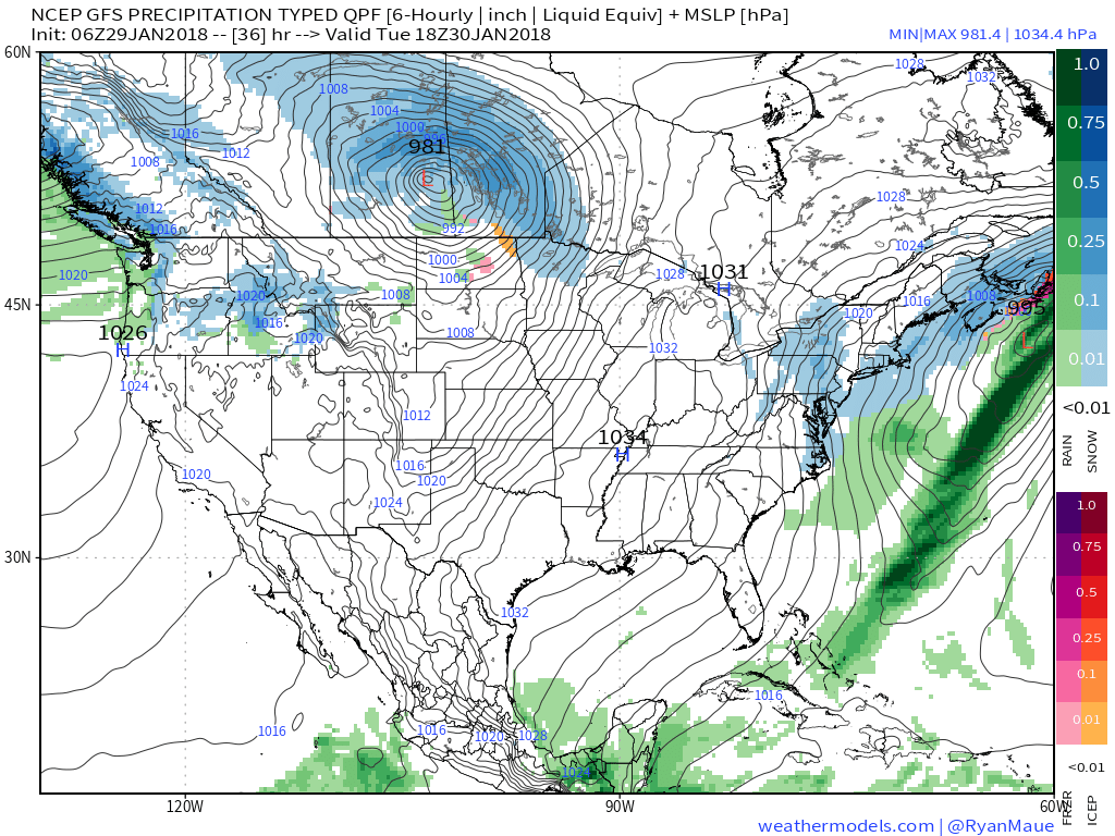 That next system will come in the form of a cold front that will settle south across the state Thursday. Light rain will overspread the region early in the day before mixing with and ending as light snow. This still doesn’t appear to be a significant event for our region at this time.
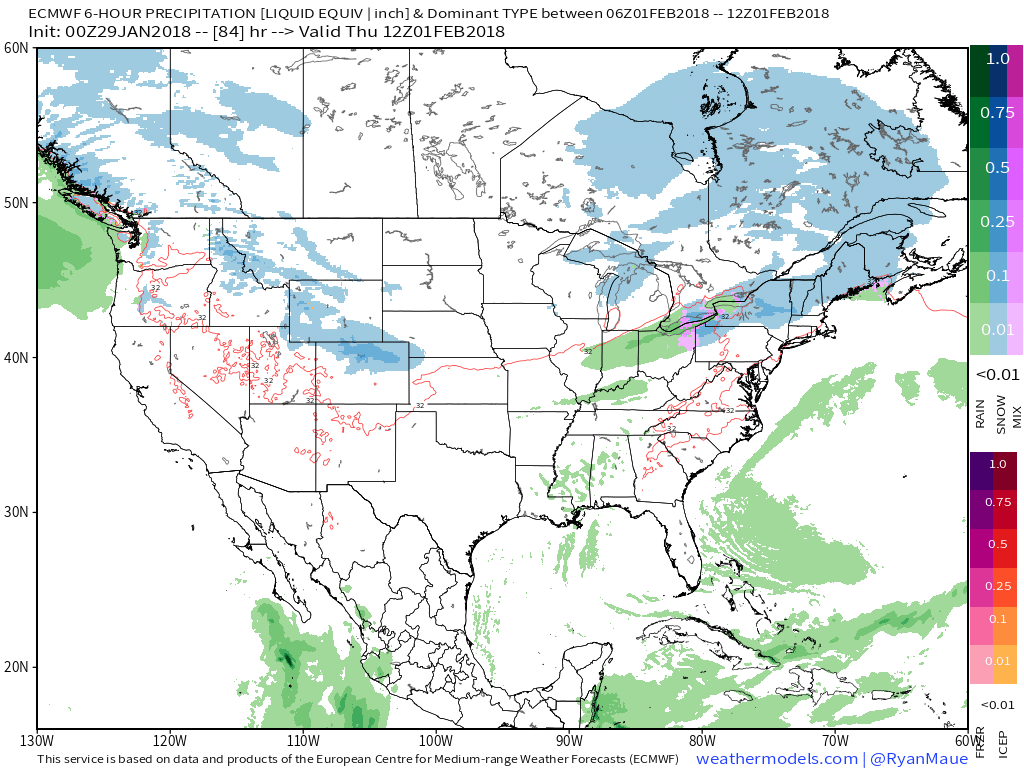 What may be a bigger deal is the event that looms this weekend. Clouds will increase during the day Saturday and a light mix of rain and snow should develop late Saturday night into Sunday morning before colder air wins out changing all precipitation over to snow.
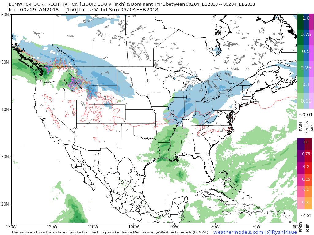 We’re getting into a pattern where the northern stream of the jet will dominate over the next 7-10 days (at least). Models will likely struggle handling individual systems and we’ll have to remain on our toes for the potential of last minute shifts with systems in such a pattern.
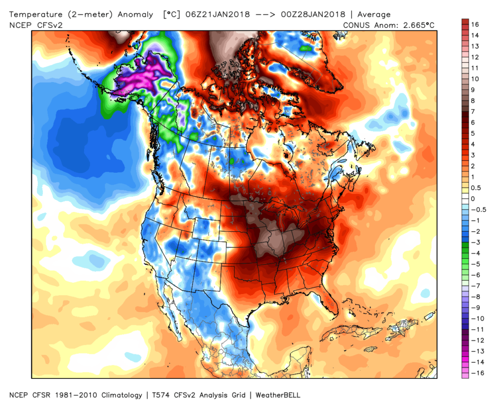 Despite the milder air over the past week, January, as a whole, is still running 4° below average at Indianapolis- a byproduct of just how frigid the first half of the month was.
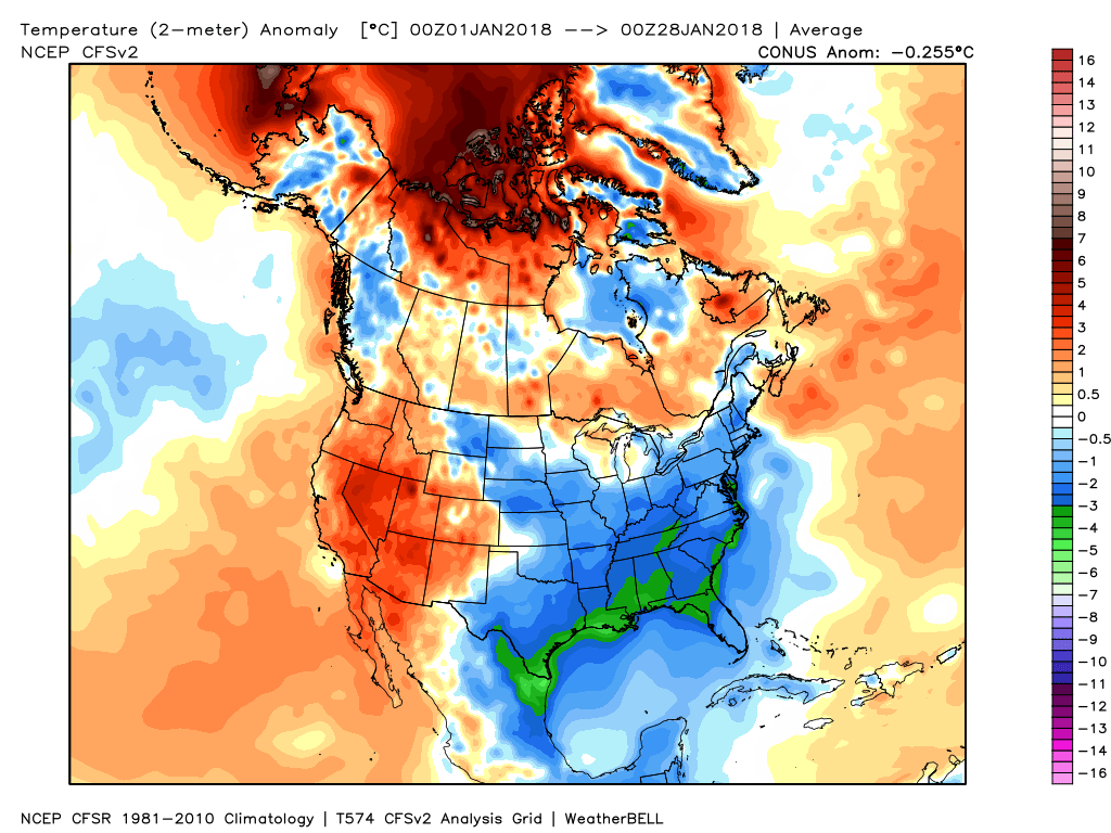 While the January thaw has been nice, times are changing and winter sure seems to be reloading for a very active second half.
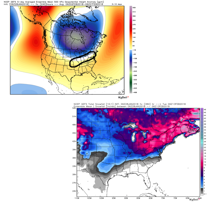 Once we get a snowpack laid down, arctic highs oozing southeast will likely lead to bitterly cold air. Recall our expectation for this pattern to yield at least (1) night of double-digit below zero lows, but it’s more towards mid-month that we think the severe cold takes hold.
 The Madden-Julian Oscillation (MJO) is forecast to rotate into the colder phase 8 as we rumble from early to mid February. Given the amplitude of the MJO, it should continue to rumble right through the cold phases of 1,2, and 3.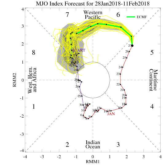
 All of these moving pieces that lead up to extended periods of cold, wintry conditions are part of a bigger outcome low solar, easterly QBO winters deal up. What we should experience with this setup is a 6-7 week period of wintry conditions, including times of severe cold. It appears to be a snowier version of what we went through late-December through mid-January. Hang in there, spring will come…eventually.