VIDEO: Heavy Rain Moves In…
You must be logged in to view this content. Click Here to become a member of IndyWX.com for full access. Already a member of IndyWx.com All-Access? Log-in here.
You must be logged in to view this content. Click Here to become a member of IndyWX.com for full access. Already a member of IndyWx.com All-Access? Log-in here.
You must be logged in to view this content. Click Here to become a member of IndyWX.com for full access. Already a member of IndyWx.com All-Access? Log-in here.
“Dumpster fire” is defined by Urban Dictionary 🙂 as a complete disaster. Simple. Right to the point, and sums up our forecast period of Feb. 1st through March 6th perfectly.
Long time followers of IndyWx know that I’m not one to usually wad up a forecast and throw it in the trash until the end of the given forecast period, but there occasionally (thankfully, few and far between) are times that call for it, and this is one of them.
While this certainly isn’t a “winter’s over” post, it is one to set the record straight on calling our forecast for the aforementioned time period a bad one…very bad. When we first published our expectations for the Feb. 1st through March 6th period of 15″-20″ and at least (1) night of double-digit below zero lows, I honestly thought that was conservative. There’s no reason to rehash all of our thinking behind those numbers (you can read those for yourself at the link included above). While places like Chicago and Detroit have cashed in on winter’s return after our January thaw, Indianapolis has watched one storm after another pass by just to the north. On February 12th we sit here with 1.4″ at IND and temperatures that are running 5° below average.
The primary reason for waving the white flag has to do with the MJO and it’s reluctancy to rumble out of Phase 7. As of late January, models projected the MJO to be entering Phase 8 now.
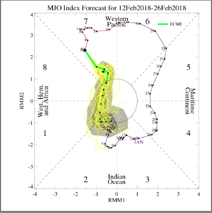
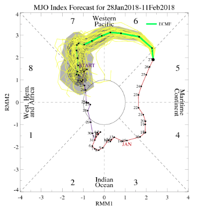 As we look at today’s MJO plot note how we’ve meandered about Phase 7 much longer than initially expected. Also (still) note the attempt to move into the colder phases towards the end of the period, which we’ll talk about here in a bit.
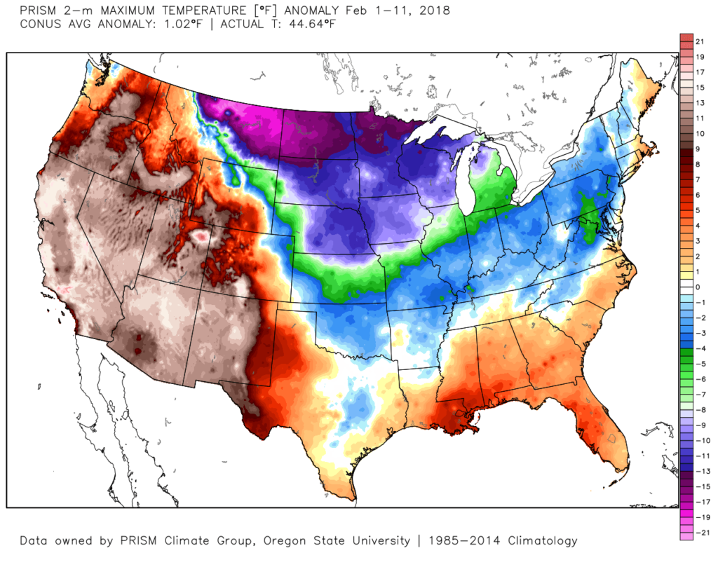
 The result has been a cold north-central that has “bled” into the Ohio Valley, while the immediate eastern seaboard and especially southeast has already gotten off to a warm to blow torch start to the month.
 Looking ahead, there’s no denying the overall warm pattern (relatively speaking) over the upcoming couple weeks. Phase 7 will continue to do work on the pattern.
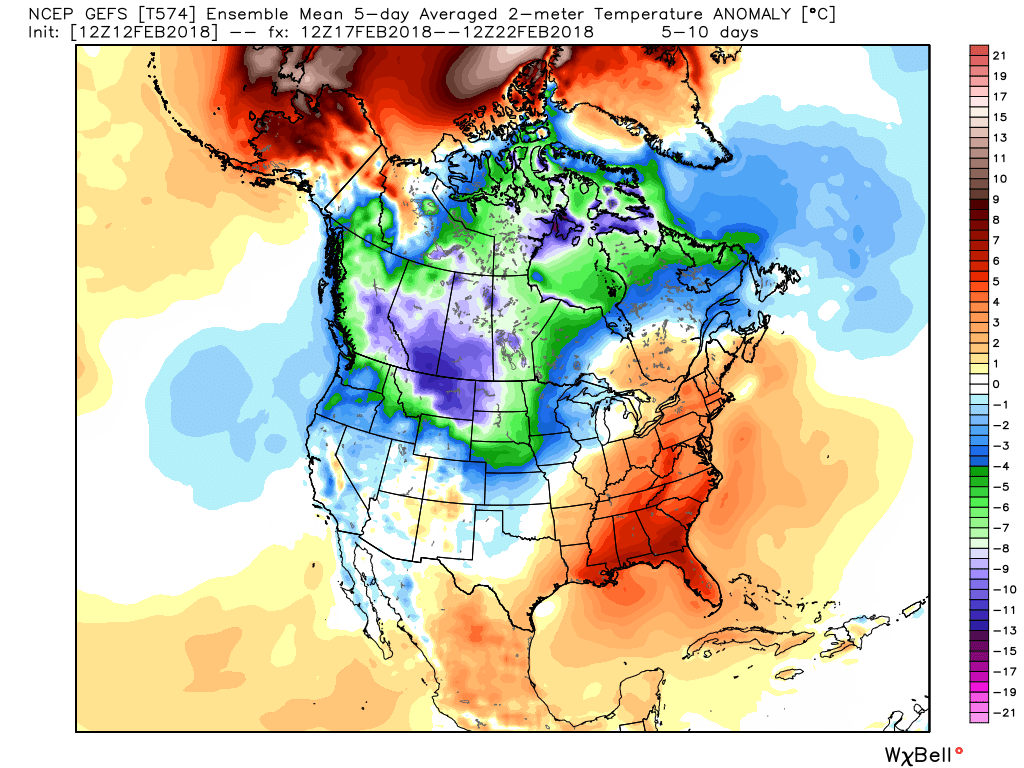
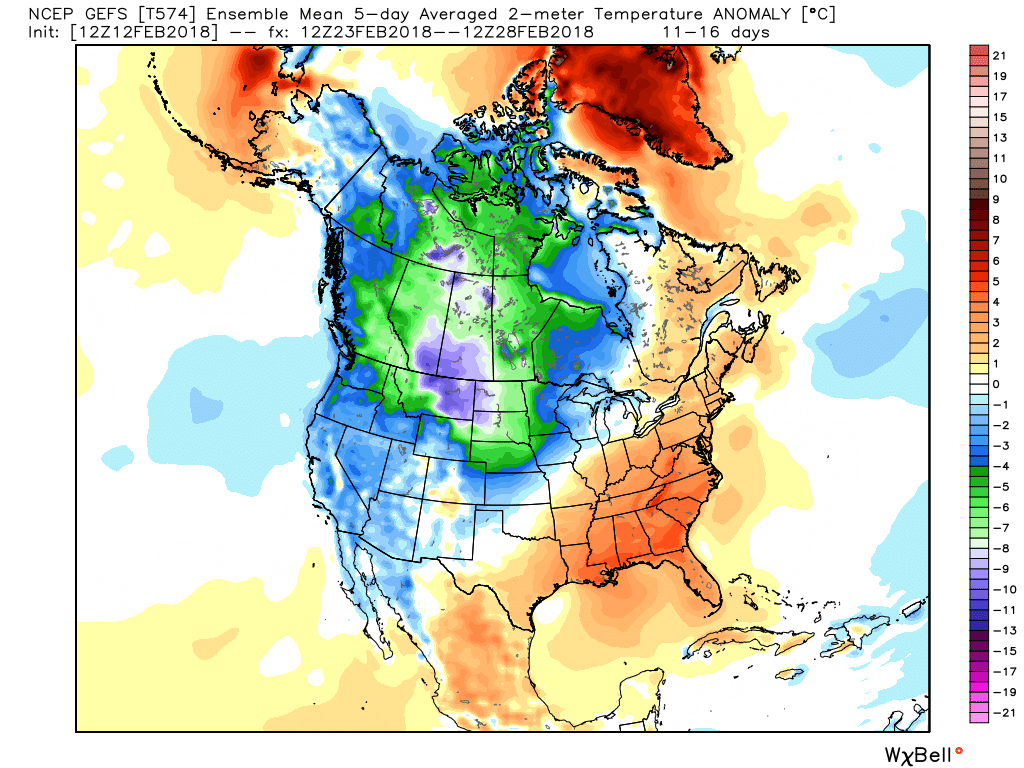 Obviously this is right in the heart of when we thought the colder MJO phases would combine with favorably cold teleconnection signals to produce a period of frigid weather. Instead, cold shots will be fleeting and any sort of winter weather threats of significance will be few and far between over the next 10-14 days. In short, Phase 7 will overrule the colder teleconnection signals that will evolve over the period.
Does this mean winter is over? Not so fast. While we’re going to be much slower to bite on the MJO swinging into the colder phases, there are indications it will at least attempt to do so once again as we close out February and head into March. Additionally, the large majority of teleconnections remain bullish for cold as we head into early March, locally. Perhaps fittingly, some of the data (will be interesting to see what the European Weeklies say later tonight) is trending colder as we open March. Maybe it’s a “delayed, but not denied” situation that will evolve, but considering we’re heading into March, the potential of severe wintry conditions to the magnitude we outlined in late January will be greatly reduced.
We’re opening the new work week on a cold, but sunny note! While temperatures will remain well below average today, a moderating trend does begin and will eventually take us close to 60° Thursday!
High pressure will keep us dry today and Tuesday. Look for highs in the upper 30s today, lows falling into the lower 20s tonight, and highs topping out in the mid 40s on Tuesday.
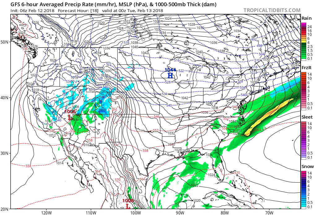
We’ll notice clouds on the increase Valentine’s Day and showers will arrive as early as the afternoon and evening hours. Coverage of rain initially will be greatest across southern and southeastern Indiana.
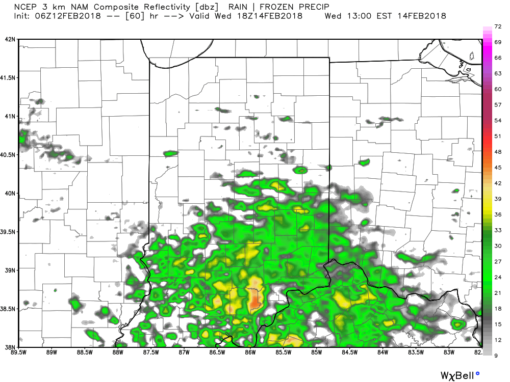
Surface low pressure will then track into the Ohio Valley Thursday and help lead to more widespread soaking rains as a cold front presses southeast. Eventually this front will deliver a colder close to the work week, but not before we squeeze out 0.50″ to 1″ of rain. Despite the wet conditions, Wednesday and Thursday will feature well above average temperatures: low 50s Wednesday and close to 60° Thursday.
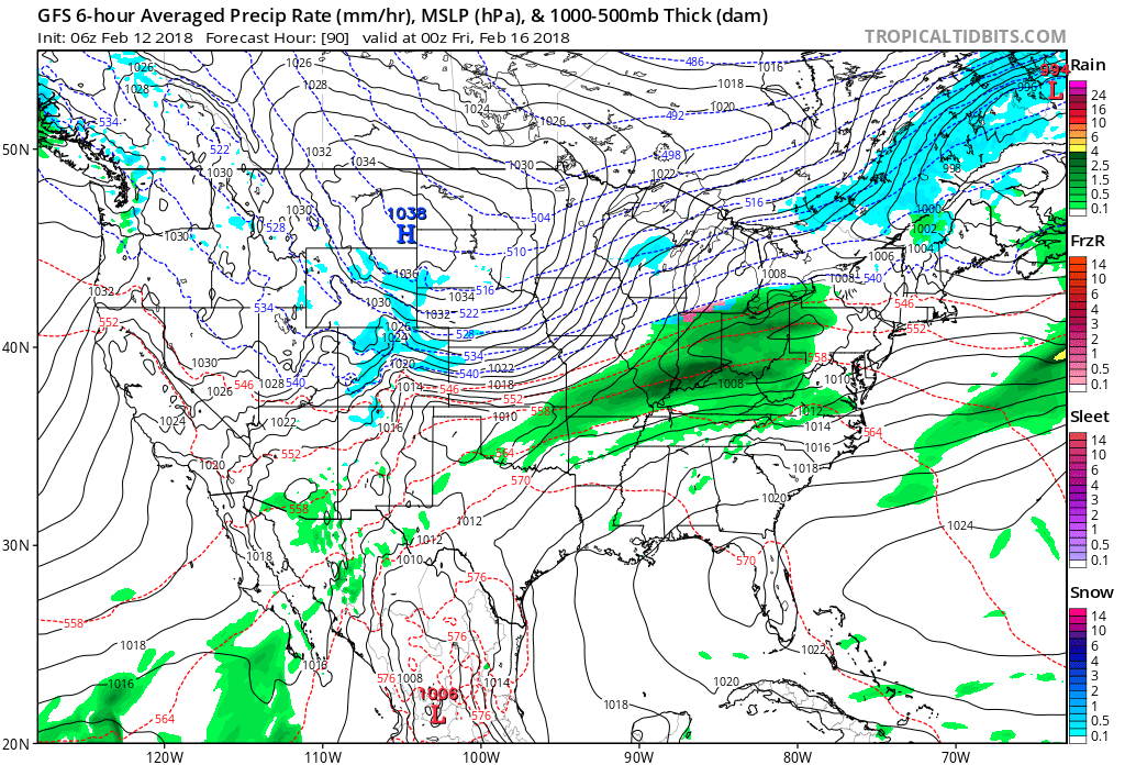
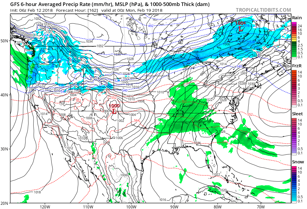
We’ll turn briefly colder Friday (nothing terrible for this time of year) before a new warmup takes place over the weekend. With that new moderating trend, moisture will return and make way for a gloomy Sunday, complete with overcast skies and showers returning.
You must be logged in to view this content. Click Here to become a member of IndyWX.com for full access. Already a member of IndyWx.com All-Access? Log-in here.