 Highlights:
- Moderating temperatures
- Not impressed with rain amounts with our front
- Much cooler weekend
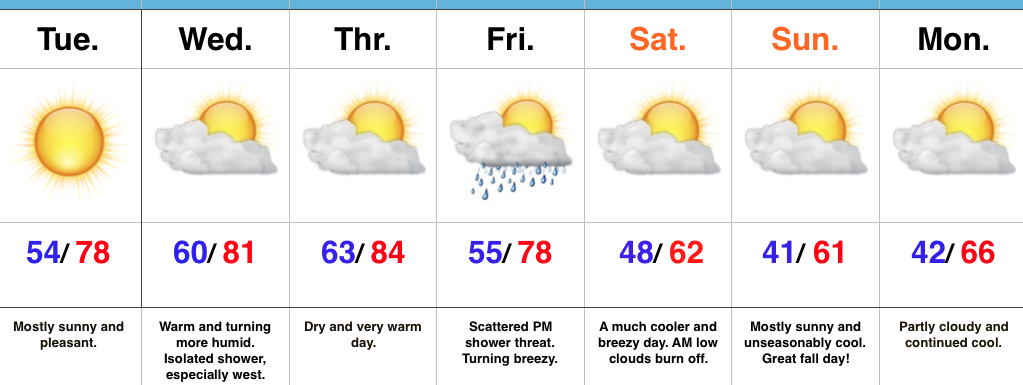
Lots Of Sunshine; Significantly Cooler Weekend…In the short-term, high pressure will supply central IN with a beautiful Tuesday, complete with pleasant conditions and lots of sunshine.
Moisture will begin to return Wednesday with an increasingly moist feel to the air mass as the day progresses. An isolated shower is possible, especially across western portions of the state, but most of the region should remain rain-free.
Our next opportunity of rain comes Friday as a cold front moves in to close the work week. As of now, we’re not impressed with rainfall amounts as the front crosses the state. Our wind will shift to the NW and turn gusty Saturday with much cooler air pouring into the region. A nice cool, crisp, autumn weekend awaits. The season’s coolest air thus far will greet us over the weekend.
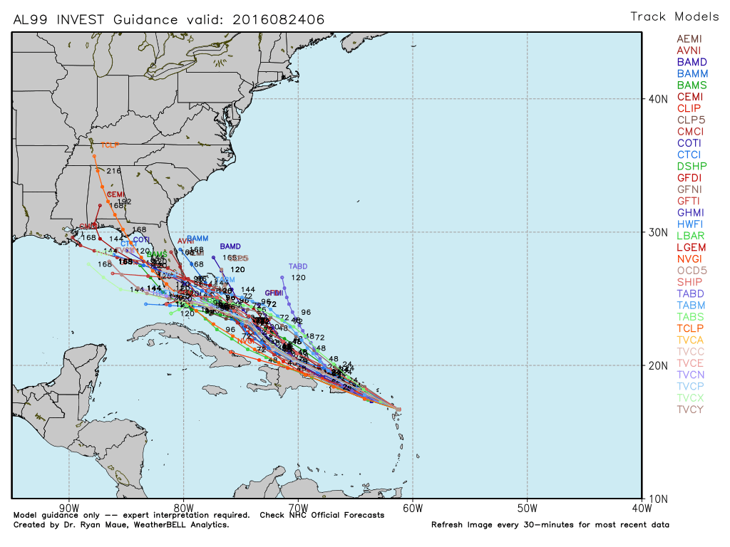
In the tropics, Hurricane Matthew remains at the forefront. Those who live along the East Coast (from the FL peninsula all the way up the eastern seaboard) should keep a close eye on forecasts and data over the next few days.
Upcoming 7-Day Precipitation Forecast:
- Snowfall: 0.00″
- Rainfall: 0.10″ – 0.25″
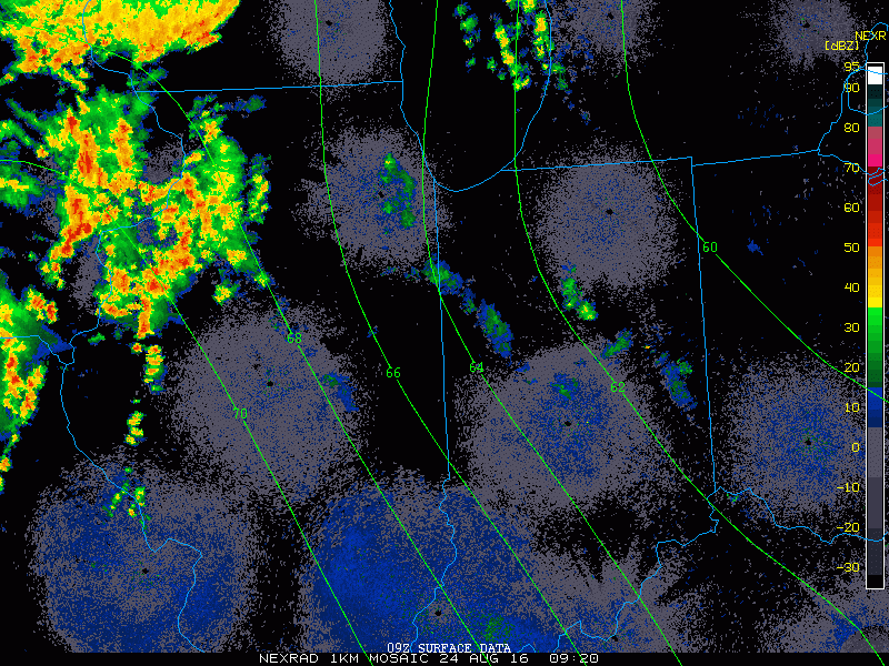 2.) HRRR futurecast radar delivers thunderstorms into central IN around the lunchtime hour.
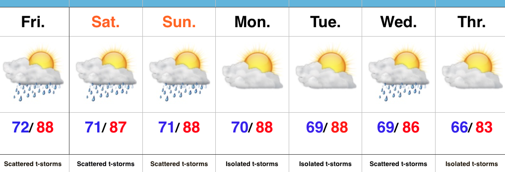
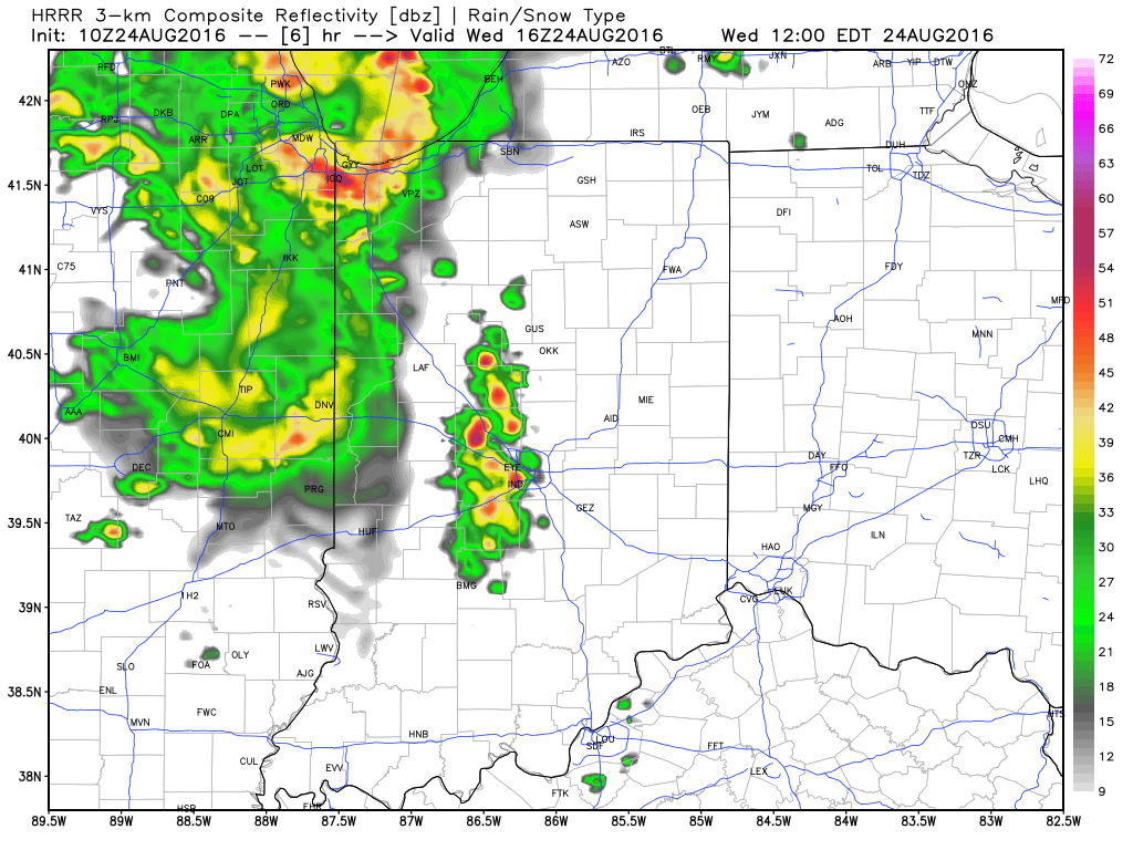 3.) Scattered thunderstorms remain Thursday (some strong to severe), but drier air will briefly push in across the northern half of the region Friday. We think from Indianapolis and points north, it’ll be a very pleasant end to the work week. That said, “briefly” is the key word. Moisture will surge north again Saturday and Sunday and isolated to scattered storms will follow suit.
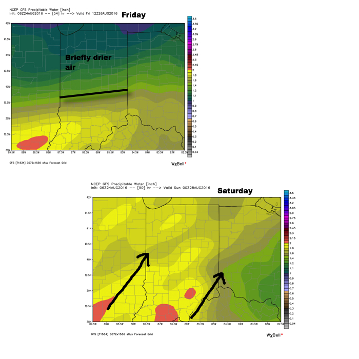 4.) Attention next week will shift to the tropics. There are many more questions than answers at this point, but understand the potential is there for significant tropical troubles next week. Intensity and track are far from etched in stone, but if your travels take you to the Gulf Coast, we suggest you remain abreast of the latest developments- particularly the southeastern FL coast and the north-central Gulf Coast.