VIDEO: Upcoming 10 Days Looks Warm And Dry, Overall…
You must be logged in to view this content. Click Here to become a member of IndyWX.com for full access. Already a member of IndyWx.com All-Access? Log-in here.
You must be logged in to view this content. Click Here to become a member of IndyWX.com for full access. Already a member of IndyWx.com All-Access? Log-in here.
You must be logged in to view this content. Click Here to become a member of IndyWX.com for full access. Already a member of IndyWx.com All-Access? Log-in here.
Quick video update for you coming live from Santa Rosa Beach, FL!
You must be logged in to view this content. Click Here to become a member of IndyWX.com for full access. Already a member of IndyWx.com All-Access? Log-in here.
So far this month, unseasonably cool conditions have set up shop across the eastern portion of the country (IND is running more than 4° below normal through the 16th) while the west has experienced a much warmer than average pattern.
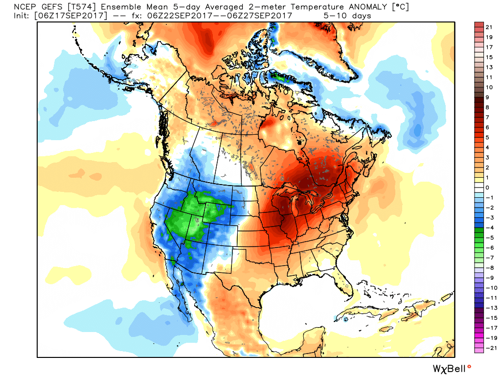
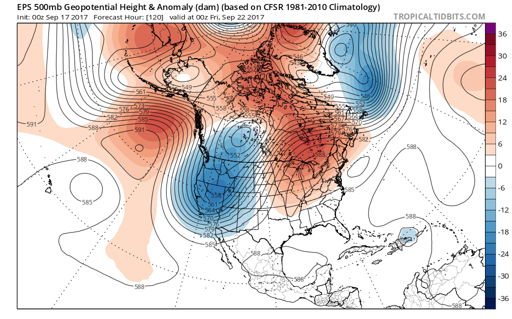
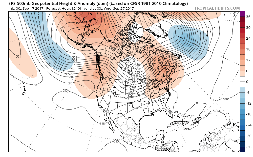
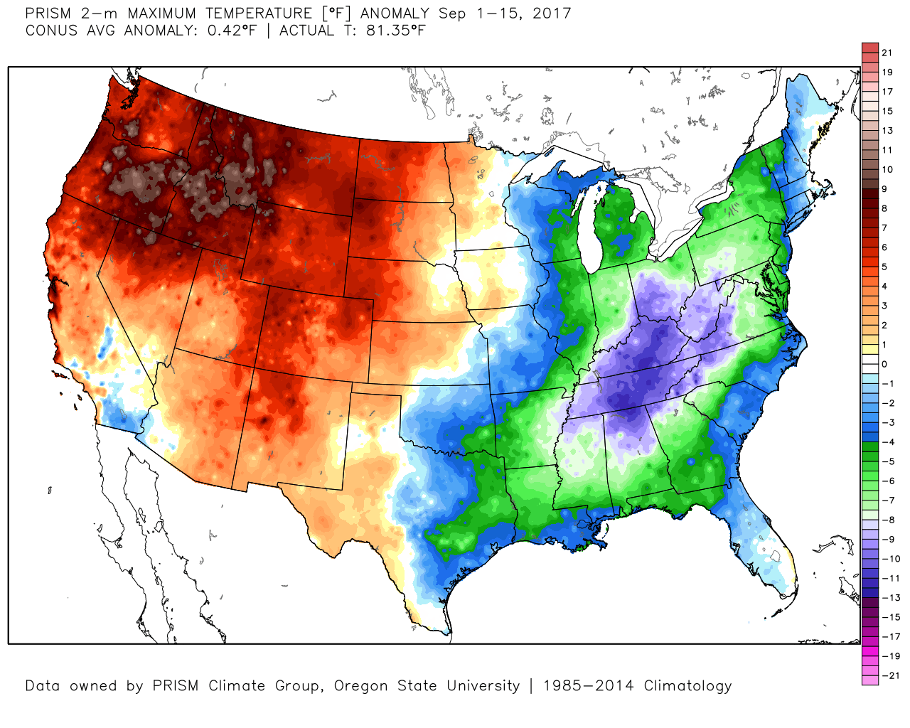 That will flip around in big time fashion this week as a highly amplified pattern takes hold. The mean trough position will shift into the west and lead to an early taste of winter, including mountain snow. Meanwhile, our region will make up for lost time in the summer department, including highs generally in the mid to upper 80s (around 10° above average).
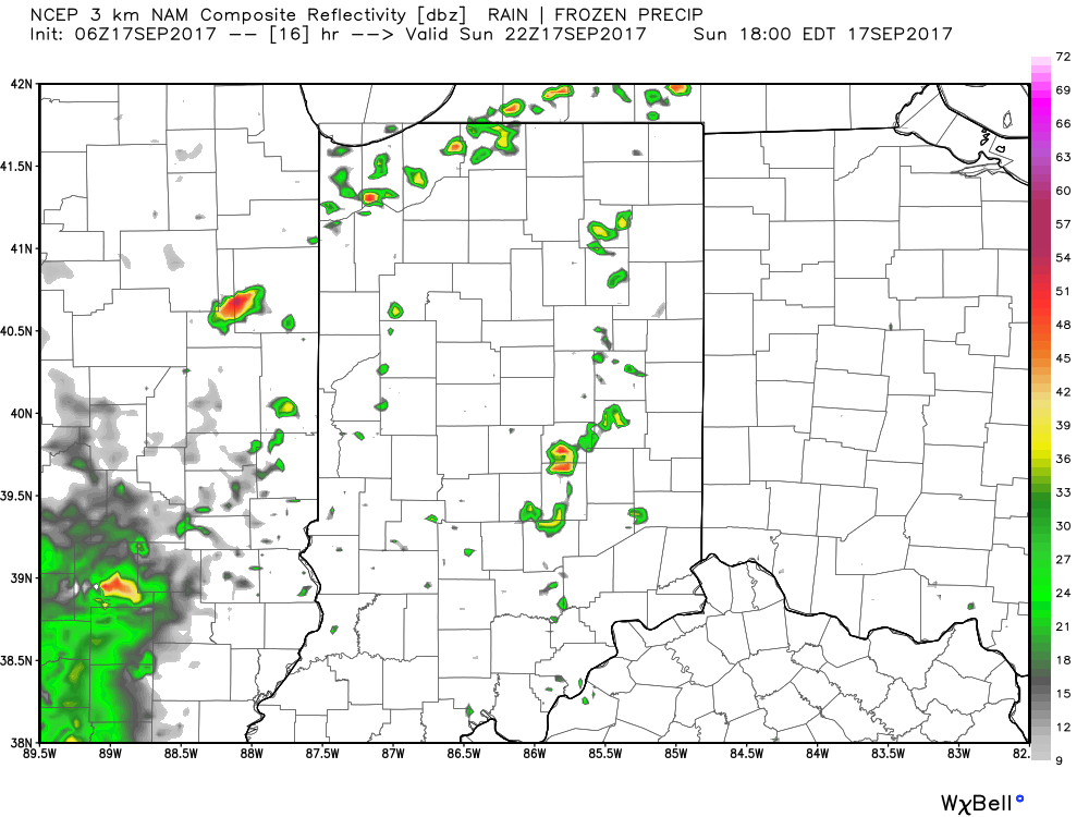
 Daily chances of widely scattered afternoon and evening thunderstorms will be with us beginning today through the majority of the upcoming week. Everyone won’t get wet, but there will be a couple of localized heavy downpours on area radars at times. As dry as we’ve been, we’ll take what we can get.
 Eventually, the pattern will “relax” (at least briefly) out towards Day 10. This will feature a more seasonable regime returning to the region, along with better chances of more widespread rains as a cold front approaches. We’ll also have to keep a close eye on additional tropical threats to the southeast region…
 Highlights:
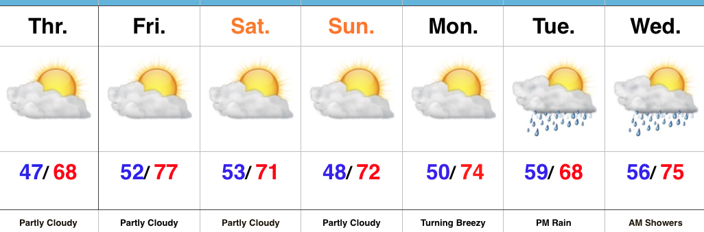
Unseasonably Cool; Irma Dominates Headlines…Upper level energy did, indeed, spark a couple of showers (even some small hail was reported in stronger showers) Wednesday evening. Here at IndyWx.com HQ, we picked up a quick half inch of much needed rainfall! While a couple of showers are possible once again this afternoon, these will be primarily confined to northern portions of the state. Otherwise, the balance of the upcoming forecast period is easy through the weekend: dry with reinforcing cool air arriving over the weekend.
Hurricane Irma will continue to dominate the headlines and will require our focus, locally, for potential impacts early next week. While we’ve built rain into our forecast Tuesday into Wednesday, it’s crucial to note this is an incredibly tough forecast and will require a great deal of fine tuning as we move forward. With that said, a blend of latest data and upper air analysis does suggest portions of the region (particularly eastern areas of the state) do stand a chance to get in on the action of Irma’s remnants Tuesday afternoon into Wednesday morning. Otherwise, breezy easterly winds are expected for the entire region beginning Monday evening. Stay tuned as we continue to analyze things. Thoughts and prayers are certainly with residents and family along the Southeast coast from southern FL to the Carolinas, including the southern Appalachian region. Speaking of, it should be noted Irma’s impacts will stretch well inland. Irma is forecast to remain a major hurricane wherever she comes ashore (window of opportunity for landfall up from the southern tip of FL all the way up to the Carolina coastline) and her forward speed into the southern Appalachians will combine with the rugged terrain and high elevations to create significant problems inland given the most up-to-date forecast track.
Upcoming 7-Day Precipitation Forecast: