Mid-October Weather…
 Highlights:
- Widely scattered storms this afternoon
- Well below average temperatures
- Overall dry pattern continues
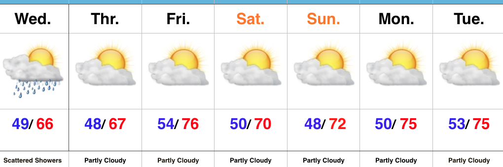
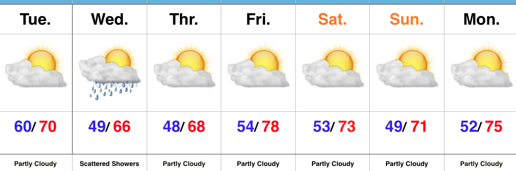
Jackets Required…Hoosiers are waking up to temperatures all the way down into the middle and upper 40s away from the city this morning (sure is hard to beat this crisp fall air). Sunshine will greet us out the door, but we’ll notice increasing cloudiness this afternoon and widely scattered thundershowers will follow. Most will stay dry, but enough upper level energy will interact with the cool air aloft to generate “pop corn” variety thundershowers this afternoon and evening. Additionally, highs in the mid 60s today and Thursday will be more like mid-October than early-September.
There’s no reason to waste a lot of pixels on the rest of the forecast period. Dry weather will dominate. Reinforcing cool air will arrive by the weekend and that cooler than average feel will remain throughout the forecast period. We’ll notice a gusty easterly wind at times late in the weekend and early next week as the pressure gradient tightens a bit between an area of high pressure to our northeast and Irma moving north into the Southeast.
Tropics: Irma continues to dominate the headlines, and rightfully so. This morning we have (2) additional storms: Jose and Katia. Jose is forecast to strengthen into a hurricane tonight, but should remain a “fish storm.” Katia will meander around the Bay of Campeche over the next few days and doesn’t pose a threat to the US.
Irma remains a category 5 beast this morning and overnight data continues to paint an ominous picture for the southeastern coast. Folks from the southern FL peninsula all the way up the coast to include the Carolinas need to remain abreast of the latest developments on Irma in the days ahead. Tropical storm conditions are expected to begin as early as Friday evening for southern Florida. Eventually, more of the southeast can expect impacts from Irma late weekend and next week, including interior areas such as the southern Appalachians…
Upcoming 7-Day Precipitation Forecast:
- Snowfall: 0.00″
- Rainfall: 0.00″ – 0.10″
 Highlights:
 MUCH cooler air will descend into the region as we progress through the week. Temperatures will be so cool, it’ll feel more like October rather than September, including multiple nights with lows settling into the 40s and highs not making it out of the 60s.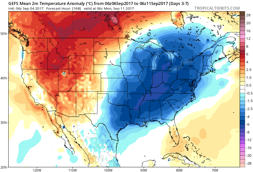
 Highlights: