Times, They Are A Changing…

Screen Shot 2015-09-30 at 7.14.53 AMHighlights:

  • Much cooler and breezy for mid week
  • Windy, chilly, and wet end to the week
  • Drier early next week

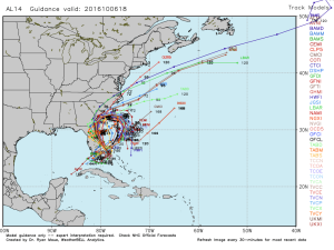
A complicated series of events will lead to a memorable week/ weekend of weather along the eastern seaboard.  Between the cold front that moved through here last night, Joaquin (well on it’s way to becoming a hurricane this morning), and energy that moved out of the Gulf of Mexico, the eastern seaboard is in for a major flood event, and long duration wind/ beach erosion event.

Before we discuss potential impacts closer to home, let’s talk the short term.  Showers will continue to push south this morning and a dry, breezy, and cooler day is coming.  Thursday will be breezy and cool, but dry also.

It’s when we get to the weekend that things begin to shift.  We know windy and chilly conditions are a given this weekend (you can take that to the bank).  We caution that much fine tuning will be required as we progress through the next couple days in regards to rainfall.  Here’s our best stab as of this morning.

1.) Showers pinwheel west Friday afternoon and evening as east winds strengthen- gusts 25-30 MPH.

2.) Steadier rains fall Saturday and Sunday with east and northeast winds gusting to 30-40 MPH.

3.) Steady rains diminish and give way to scattered showers Monday before we’re back to dry weather Tuesday.  Winds also begin to diminish during this period, but gusts to 20-30 MPH are still possible Monday out of the north.

Stay tuned, as the rainfall forecast is still up for much debate and will have to be fine tuned.

Upcoming 7-Day Rainfall Forecast: 0.25″ – 0.75″

Windy And MUCH Cooler; What About Rain Chances?

All eyes remain focused on Joaquin this evening and the eventual impacts dealt to the eastern seaboard, and, at least indirectly, back into the Ohio Valley.  Latest satellite imagery this…

You must be logged in to view this content. Click Here to become a member of IndyWX.com for full access.  Already a member of IndyWx.com All-Access?  Log-in here.

Weekly Highlights: Tropical Weather Headlines…

Highlights928104There’s a whole slew of new products we’re going to start rolling out over the next several weeks, including more videos, as well.  One of the new features is a nationwide weekly highlight map, helping showcase the big-ticket weather items that have our attention over the upcoming week.  While we could side with going with fancy graphics, we chose to go the route of a hand drawn map for old time sakes.  🙂 This will be posted on Sunday or Monday of each week.

1.) A cold front will move through the Mid West and Ohio Valley during the early to middle portion of the work week and be responsible for putting a temporary delay in #harvest15.  While rainfall won’t be particularly heavy, it’ll help to serve up a fresh chill to the air as we progress from mid to late week.  A significant temperature reversal can be expected from 10-15 degrees above normal to 10 degrees below normal from early week to late week.

2.)  A tropical disturbance is plaguing the Gulf Coastal waters with rough surf, gusty winds, and heavy rain to open the week.  As this disturbance moves northeast, heavy rains will encompass a large portion of the southeast, as well as southern and central Appalachians, on up the eastern seaboard.

3.)  Perhaps of more importance is the way things evolve over the coming couple days with TD 11 and the overall weather pattern off the eastern seaboard.  If you live along the East Coast, you’ll want to pay particularly close attention to the goings on.  At the very least, an impactful system is ahead from a heavy rain and erosion perspective, but there’s also the potential of something more severe from a purely tropical stand point.

4.)  An area of low pressure will drop south along the Front Range late in the period and offer up beneficial moisture to not only the Front Range, but the central Plains.

As always, you can follow us on Twitter (@indywx) or e-mail us at bill@indywx.com for more on the variety of weather consulting we provide.  Have a great day and God Bless!

Clouding Up; Saturday Showers Arrive…

Screen Shot 2015-09-24 at 10.23.01 PMHighlights:

  • Clouds increase to wrap up the work week
  • Tropical connection courtesy of the Atlantic this weekend
  • Midweek cold front

An area of low pressure is slowly tracking north along the SC coast Thursday evening.  A surge of tropical moisture will retrograde (that’s for you, Rick ;-)) northwest and result in “showery” weather around these parts to open the weekend.  We’re not talking a lot of rain, but expect periodic wet times for central and southern portions of the state Saturday.  We’ll maintain mention of a shower Sunday, but Sunday will be the drier of the two days.

We’re back to “high and dry” early next week, but a weak frontal boundary will move through here late Wednesday with a broken band of showers.  Not everyone will see rain Wednesday.  Slightly cooler air will arrive late next week.

Upcoming 7-Day Rainfall Forecast: 0.10″ – 0.30″

Thursday Weather Notebook…

Cool and Dry:       We’re off to a cool start this morning with many reporting sites in the lower 50s. Note the cooler than normal air extends all the…

You must be logged in to view this content. Click Here to become a member of IndyWX.com for full access.  Already a member of IndyWx.com All-Access?  Log-in here.