Category: T-storms
-
Filed under 7-Day Outlook, Forecast, Forecast Discussion, Forecast Models, Heavy Rain, Rain, Summer, T-storms, Tropics, Unseasonably Warm
-
May 30, 2014
|
Fri.
|
Sat.
|
Sun.
|
Mon.
|
Tue.
|
Wed.
|
Thr.
|
|

|

|

|

|

|

|

|
|
63/ 80
|
57/ 80
|
58/ 83
|
69/ 82
|
70/ 84
|
62/ 80
|
70/ 85
|
|
– – –
|
– – –
|
– – –
|
Light
|
Light
|
Light
|
Light
|
After a week of that famous summer “heavy” air mass filled with plenty of warmth and humidity, Hoosiers can breathe a sigh of relief this weekend as a much more refreshing northeast flow provides greatly reduced humidity levels. Also, we’ll enjoy plenty of sunshine for your weekend! All-in-all, we’ve lucked out with yet another beauty of a weekend! Get out and enjoy! As we flip the page into the new work week, showers and thunderstorm chances will increase as humidity levels do a rather abrupt face and return to the sultry levels we grew accustomed to this week. Locally heavy rainfall will be a possibility with such moisture content. A period of widespread, enhanced, rains may fall late next week. In unrelated weather news, we’ll also monitor the possibility of something “curious” down in the Gulf of Mexico towards the mid to late week period and the possibility of early season tropical mischief…
Permanent link to this article: https://indywx.com/much-less-humid-weekend/
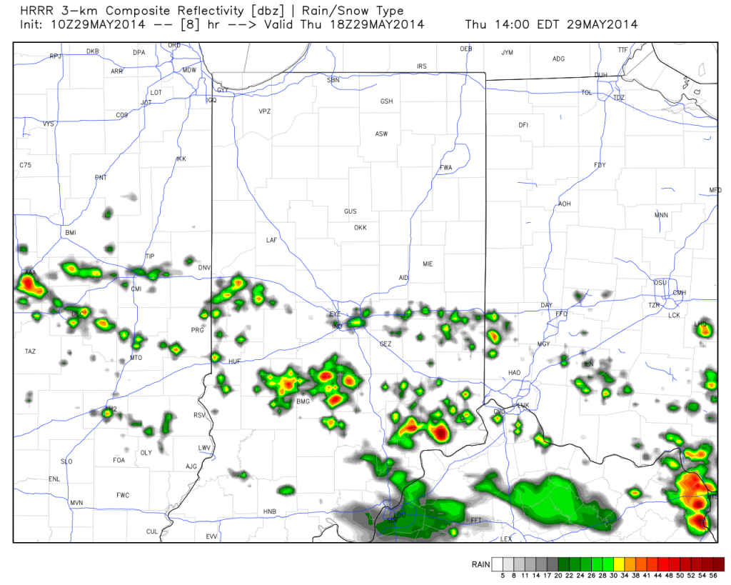
I-70 and points south will be the focal point today for shower and thunderstorm development. The video covers this and takes a look at that all-important weekend! Make it a great Thursday!

T-storms will ignite this afternoon, primarily south of the I-70 corridor.
Permanent link to this article: https://indywx.com/thursday-morning-video-update/
Wed. Thr. Fri. Sat. Sun. Mon. Tue. 67/ 81 64/ 80 56/ 80 57/ 81 59/ 83 68/ 84 70/ 84 Light Light…
You must be logged in to view this content. Click Here to become a member of IndyWX.com for full access. Already a member of IndyWx.com All-Access? Log-in here.
Permanent link to this article: https://indywx.com/locally-heavy-rain-producing-storms-this-afternoon/
-
Filed under 7-Day Outlook, Canadian Model, Forecast, Forecast Discussion, Forecast Models, GFS, Heavy Rain, Long Range Discussion, Rain, Summer, T-storms, Unseasonably Warm, Weather Rambles, Weather Videos
-
May 27, 2014
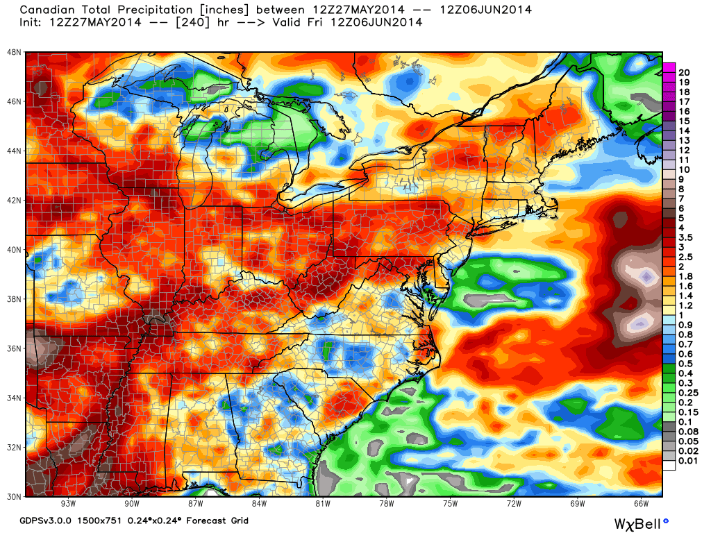
The upcoming 7-10 days looks unsettled overall and quite wet. That said, we’re set to enjoy another beautiful weekend with a refreshing northeast breeze in play. We discuss this and look deeper into the month of June in this evening’s video update below!

Latest model data suggests widespread 2-3″ of rain could fall across central Indiana over the course of the upcoming 7-10 days.
Permanent link to this article: https://indywx.com/another-nice-weekend-in-the-middle-of-an-unsettled-pattern/
Tue. Wed. Thr. Fri. Sat. Sun. Mon. 65/ 83 64/ 80 66/ 80 55/ 78 55/ 79 56/ 82 63/ 83 Light Light…
You must be logged in to view this content. Click Here to become a member of IndyWX.com for full access. Already a member of IndyWx.com All-Access? Log-in here.
Permanent link to this article: https://indywx.com/feeling-like-summer/


