Cool, Damp Open To The Weekend…
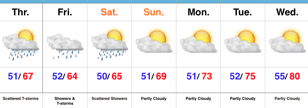
As we get set to open the weekend, our weather pattern remains unchanged from the past couple of days. The Ohio Valley will continue to be dominated by a cut off area of low pressure sitting and spinning overhead. Unseasonably cool air, along with periods of showers will be the result. Similar to Wednesday, stronger showers could contain small hail, particularly during the afternoon.
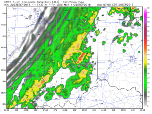
 Steadiest and most concentrated rain appears to come during the morning hours Friday. Here’s what the radar may look like predawn and mid morning Friday. Rain will be tracking west or southwest (pivoting around the upper low).

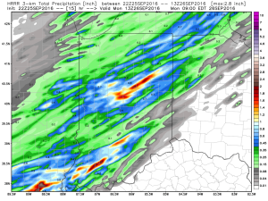
 Additional scattered showers and embedded thunder will remain in our forecast Saturday.

In general, additional rainfall should be in the 0.50″-1″ range, but there will be isolated heavier totals under more persistent rain bands.

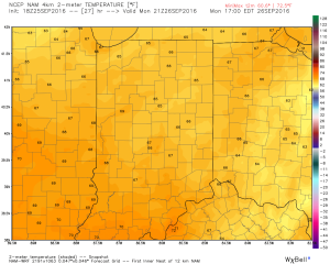
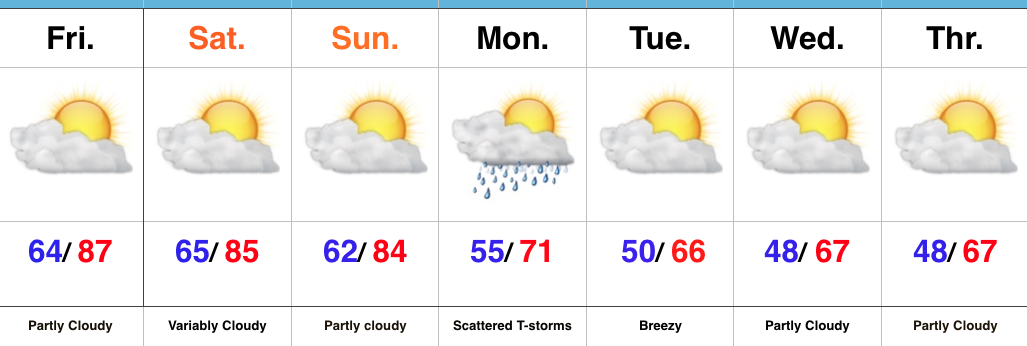
It’ll be a continued cool stretch with highs both Friday and Saturday in the mid 60s (at best).
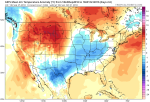
 The second half of the weekend certainly looks like the better of the two, but we caution that these cut off lows can be fickle and surprises can result in regards to timing. At any rate, a drier pattern will build in early next week, along with moderating temperatures.
Looking ahead, a significant storm system looms just beyond the 7-day that will require our attention in the days ahead.
 Highlights: