VIDEO: Colder Changes To Close The Week; Wet Thursday Ahead…
You must be logged in to view this content. Click Here to become a member of IndyWX.com for full access. Already a member of IndyWx.com All-Access? Log-in here.
You must be logged in to view this content. Click Here to become a member of IndyWX.com for full access. Already a member of IndyWx.com All-Access? Log-in here.
Before we talk about the warmth, we have some showers and embedded thunder to deal with across parts of the region today. Best rain chances today will be along and north of I-70, but a few showers could scoot south later this afternoon. We note most concentrated rain should fall through the early afternoon hours before moving out to allow for a dry evening.
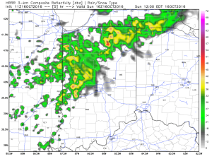
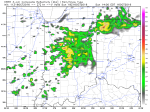
We get back to a dry pattern Monday and Tuesday. Along with the dry conditions, unseasonably warm temperatures can be expected. Along with the summer-like feel, very strong southwest winds will be noted (gusts to 30-40 MPH).
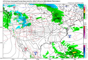
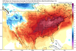
Highs Monday and Tuesday will top out in the lower to middle 80s and rival records across central IN. While that’s impressive enough, overnight lows of 65-70 are almost unheard of.
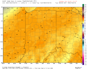
Cooler air will begin to move in by late week as a trough replaces the warm ridge. While we’re very confident on the much cooler feel, details in regards to the specifics around rain timing and amounts remain “muddy” at best. We’ll forecast best rain chances to arrive Thursday, but caution this may have to be fine tuned as we move forward. Highs that were in the 80s for early week will crash late week (upper 50s to lower 60s).
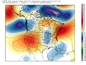
As of now, next weekend looks dry and cool, but it was only yesterday that rain chances looked like they may continue into the early portions of the weekend. Stay tuned. As previously mentioned, temperatures will be much cooler (upper 30s to lower 40s for lows and lower to middle 60s for highs).
Complete 7-day will be posted later!
You must be logged in to view this content. Click Here to become a member of IndyWX.com for full access. Already a member of IndyWx.com All-Access? Log-in here.
 Highlights:
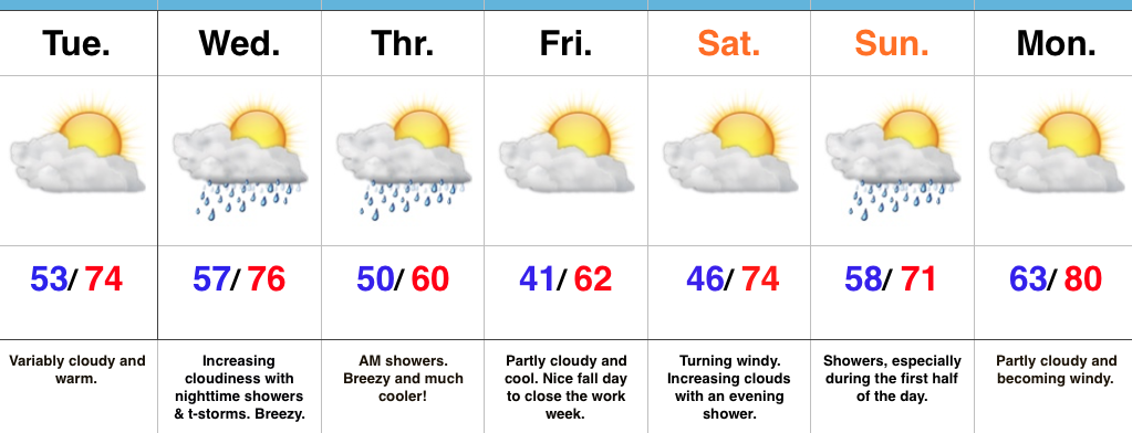
Nice Today Before Wednesday Night Storms…Mid and high level cloudiness will continue to scoot through the Ohio Valley today. While we noted a few sprinkles during the predawn hours, the air remains dry and we should be rain-free today with increasing PM sunshine.
Wednesday will turn increasingly breezy as the day progresses and a cold front will help kick up scattered showers and thunderstorms Wednesday night into the early morning hours Thursday. Behind the front, the coolest air so far this season will press southeast and set us up for a chilly close to the week.
The cool air won’t stay around long as we flip our air flow back to the south over the weekend. Showers are a good bet Sunday followed by a gusty south wind and a summer-like high in the lower 80s Monday.
A couple of notes: It’s beginning to be that time of year again when we have to get used to the wind. As the jet continues to mature, storm systems will become more frequent as we go deeper into fall. Strong winds are a given and the increasingly busy nature of the pattern is a signal of changes brewing. While we’re still a couple weeks away from a wholesale pattern change, don’t be surprised if we undergo a rather dramatic flip in the pattern as October gives way to November. This sure doesn’t look like last year in any way, and, in fact, it’s easy to argue it’s the exact opposite when it comes to early season cold and potentially wintry weather…
Upcoming 7-Day Precipitation Forecast:
 Highlights:
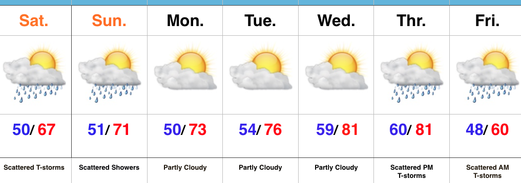
Slow Improvements…The “cut off” upper low that’s plagued the region for the past few days will slowly begin to lift north this weekend. Eventually it’ll get absorbed into the westerlies and get outta’ here! The end result will be a slowly improving weekend. Rain coverage will be greater today than Sunday, but less than Friday! 🙂 Slow moving showers and embedded thunder will be most numerous this afternoon before slowly diminishing tonight. While we’ll have to maintain mention of a shower Sunday, most folks will remain dry.
The work week will get off to a dry start along with moderating temperatures. Highs by mid week will reach the lower 80s as a southwesterly air flow dominates ahead of an approaching strong autumn front.
While timing still needs to be fine tuned, we’re focusing in on the cold front passing through central IN Friday morning. Ahead of the boundary, scattered showers and thunderstorms can be expected followed by an abrubt NW wind shift and a MUCH cooler air mass for the weekend. Speaking of cool, it wouldn’t surprise us to see some neighborhood lows into the upper 30s next weekend.
It is October, after all…
Upcoming 7-Day Precipitation Forecast: