Category: T-storms

Severe Threat Tonight For Portions Of The Region…

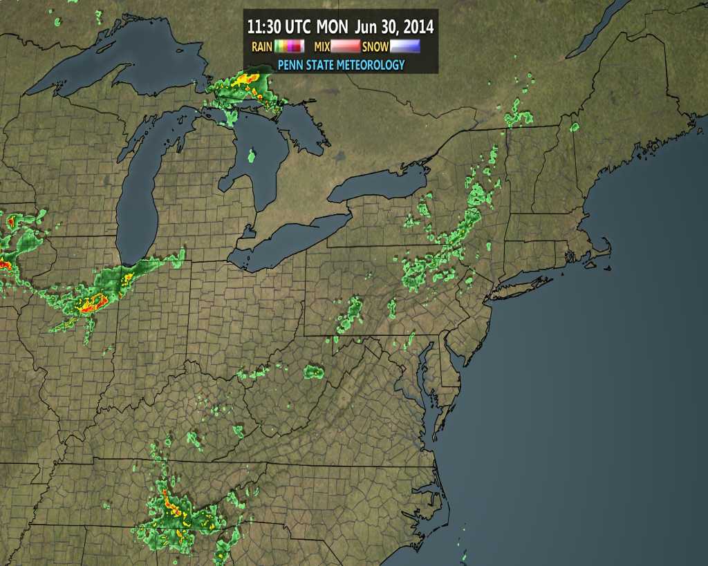
We spoke Sunday of a couple complexes of thunderstorms potentially impacting the region today.  The first complex of thunderstorms is moving into northwestern portions of the state as we write this and short-term modeling is already struggling on the track of this complex.  Note the forecast radar, via the HRRR and 4km NAM, valid 8am versus the actual radar snapped at 7:30am.

hrrr_ref_mw_4


hires_ref_mw_7


nerad25

The first complex of thunderstorms will likely blow through north-central Indiana counties later this morning.

The Storm Prediction Center has outlined portions of the region under a slight risk of severe today, including a heightened moderate risk across Iowa, MO, and IL.  All modes of severe weather are in play, including potential tornadoes, large hail, and damaging straight line winds.

day1otlk_1200


The latest 4km NAM shows complex number 2 erupting over Iowa later this afternoon.

hires_ref_mw_13

This is the complex of storms that could pose a rather active time of things across Indiana tonight.

Moisture and energy will be plentiful, meaning storms will likely remain strong to severe as they push into central Indiana.  Additionally, locally heavy downpours are a good bet.

Forecast CAPE is to be around 3500-4500 J/kg tonight when complex number 2 is eyeing the region.  In short, this means “energy” will be plentiful for storms to remain strong to severe as they blow into the region.  Think of CAPE as fuel for storms.

hires_cape_mw_21

Forecast PWAT, or precipitable water, shows a ribbon of 2″ streaking through the central portions of the state and suggests torrential downpours with any storm.

hires_pwat_mw_26

Bottom line, it’ll be important to have a means of getting your latest weather information and radar trends later this evening.  The greatest severe threat to our immediate region appears to be with a straight line wind component, but as stated above, we’ll have to be on guard for all modes of severe weather.

Now casting will be key later tonight as we eye another round of potential severe weather impacting the state.  While the first complex of storms will impact northern counties this morning, it’s complex number 2 late tonight that could pack a punch across a more widespread portion of the region.  More later this afternoon!

Permanent link to this article: https://indywx.com/severe-threat-tonight-for-portions-of-the-region/

Storm Chances Remain Before We Turn Much Cooler…

Sun.

Mon.

Tue.

Wed.

Thr.

Independence Day

Sat.

 Status-weather-showers-day-icon

 Status-weather-showers-day-icon

 Status-weather-showers-day-icon

 Status-weather-showers-day-icon

 Status-weather-clouds-icon

 Status-weather-clouds-icon

 Status-weather-clouds-icon

70/ 83

72/ 88

72/ 85

63/ 78

59/ 74

51/ 77

54/ 82 

Light

Light

Light

Light

– – –

– – –

– – –

Most of today will be dry and though we’ll be continued warm and humid, we’ll have just enough breeze to make it feel comfortable out.  Better rain chances will remain down state late morning into the afternoon.  While a scattered shower or storm is possible across central Indiana, most will remain rain-free today we think.  We’re going to have to monitor a couple of complexes of strong to severe thunderstorms late tonight and again Monday night off to our northwest.  Short-term modeling keeps both complexes just to our north, but we’ll keep a close eye on things moving forward.  Rain chances remain through mid week before a big push of cooler, drier air blows into town for the long holiday weekend.  Temperatures will run much cooler than average and provide a taste of early fall during what traditionally is the dog days of summer!

Permanent link to this article: https://indywx.com/storm-chances-remain-before-we-turn-much-cooler/

Humid Weekend; Severe Potential Monday.

Sat.

Sun.

Mon.

Tue.

Wed.

Thr.

Independence Day

 Status-weather-showers-day-icon

 Status-weather-showers-day-icon

 Status-weather-storm-night-icon

 Status-weather-showers-day-icon

 Status-weather-clouds-icon

 Status-weather-clouds-icon

 Status-weather-clouds-icon

69/ 83

70/ 83

71/ 88

70/ 84

60/ 75

56/ 76

53/ 80 

Light

Light

Light

Light

– – –

– – –

– – –

A warm front is lifting north through the region this morning and rain will continue to expand in coverage this morning as the front lifts north.  Sunshine will then quickly build back into central Indiana this afternoon, along with plenty of humidity.  We’ll get back into the scattered afternoon/ evening “splash and dash” thunderstorm regime later today and again Sunday.  Looking further ahead, concern is growing about a potential severe weather event here Monday and we’ll have an additional post later this weekend discussing this potential in more detail.  For now, plan to pay special close attention to Monday’s forecast with damaging severe weather potential in play (all modes of severe weather at hand).  We still forecast a MUCH cooler, drier regime building in mid week and remaining in place through the upcoming holiday weekend.

Permanent link to this article: https://indywx.com/humid-weekend-severe-potential-monday/

Quick Friday Evening Video Update

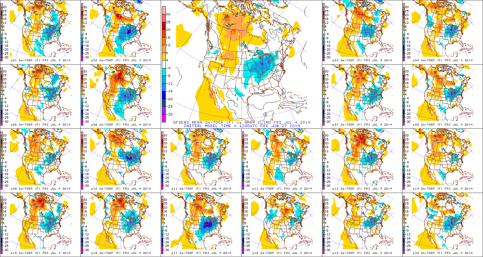
Seems like a broken record, but more showers and thunderstorms dot the central Indiana landscape this evening and will continue over the weekend, though no all day rains are anticipated.  Additionally, we’re still tracking well below normal air for the all-important holiday weekend next week.  Details in a quick Friday evening video update below!

A cooler than average pattern continues to look likely for the all-important July 4th weekend.

A cooler than average pattern continues to look likely for the all-important July 4th weekend.

Permanent link to this article: https://indywx.com/quick-friday-evening-video-update/

“Summery” Weekend, But Eyeing A Cool 4th!

Fri. Sat. Sun. Mon. Tue. Wed. Thr.               65/ 85 69/ 82 69/ 85 71/ 87 72/ 85 63/ 81 54/ 75  Light Light…

You must be logged in to view this content. Click Here to become a member of IndyWX.com for full access.  Already a member of IndyWx.com All-Access?  Log-in here.

Permanent link to this article: https://indywx.com/summery-weekend-but-eyeing-a-cool-4th/