Transitional Week Of Weather…
 Highlights:
- Warming back up
- Storms around Tuesday-Wednesday
- Colder late week
- Windy warm-up next weekend
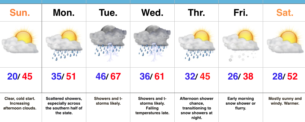
Don’t Blink…The second half of the weekend has gotten off to a frosty, but bright start! Unfortunately, clouds will begin to increase this afternoon. Thankfully, the increasing clouds won’t keep temperatures from getting a significant boost this afternoon compared to the frigid air of Saturday.
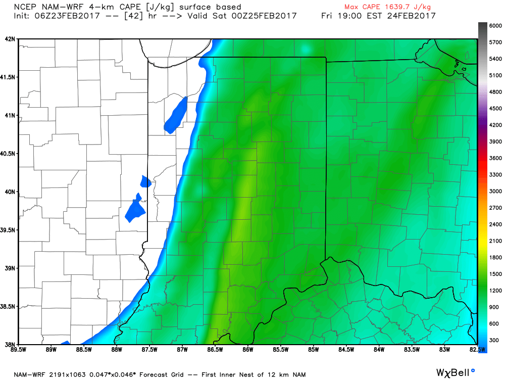
A few showers will scoot through the state Monday, but most of these will be confined to the southern third of Indiana and most neighborhoods should remain rain-free. A more significant storm system will lift northeast Tuesday and this will provide better coverage of showers and thunderstorms Tuesday (especially late in the day) into Wednesday. After a midnight high, temperatures will fall through the daytime hours Wednesday.
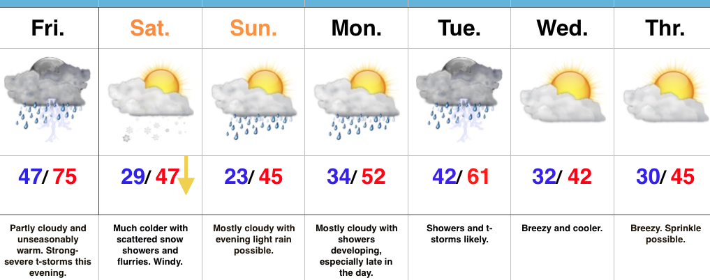
Another fast-moving, weak, weather maker will impact us Thursday evening into Friday morning. Scattered showers Thursday PM will transition to light snow showers overnight into early Friday morning. Friday will be chilly, but moderating conditions return as early as Saturday, along with a strong and gusty southwest flow by the afternoon!
Upcoming 7-Day Precipitation Forecast:
- Snowfall: Trace – Dusting
- Rainfall: 1.00″ – 1.25″
 Highlights:
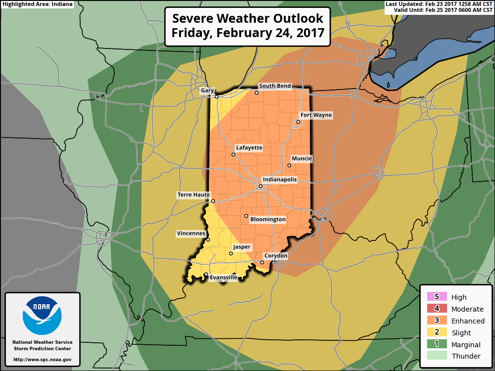 Summary:
 Threats and Timing:
 Highlights:
 Highlights: