
The daytime Thursday will be dominated by a summer-like feel as highs approach the 80 degree mark, along with an increasingly gusty SW wind ahead of an approaching cold front. We’ll stay dry through the day and it’s not until we get to the overnight hours when storm chances will begin to increase.
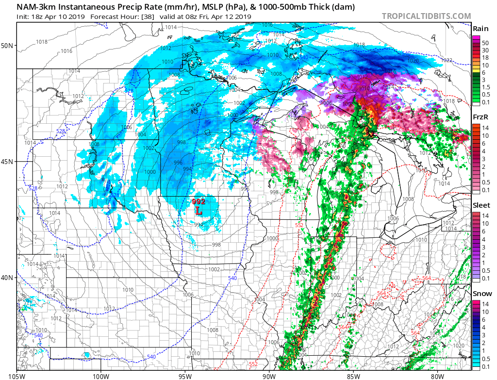
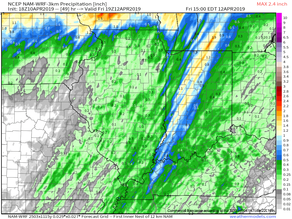
More specifically, we think the hours between 12a and 5a will offer up the best chance of a slow moving line of storms to track across central Indiana. A couple of these storms could produce damaging winds. Locally heavy rainfall can also be expected with widespread amounts of 0.50″ to 1″ with a few 1″+ totals likely by the time we get to sunrise Friday. The rain will be well to our east by lunchtime Friday and a dry close to the day is on tap.
On the heels of this storm will come another wet weather maker Saturday night and Sunday and tomorrow morning’s video update will have more details around timing and rainfall amounts with that system.
Early Summer Ideas
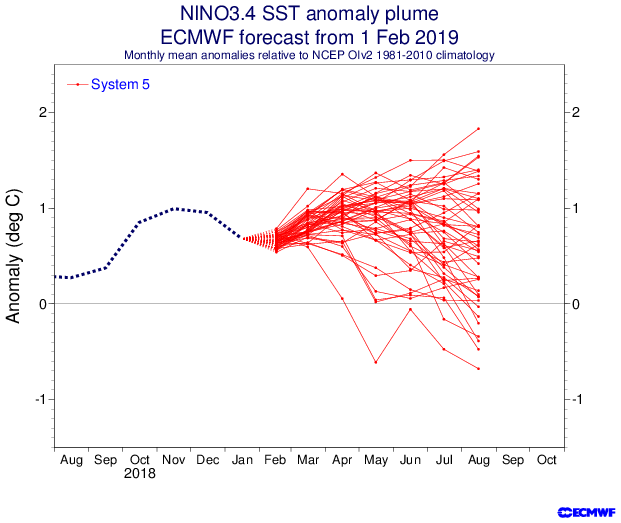
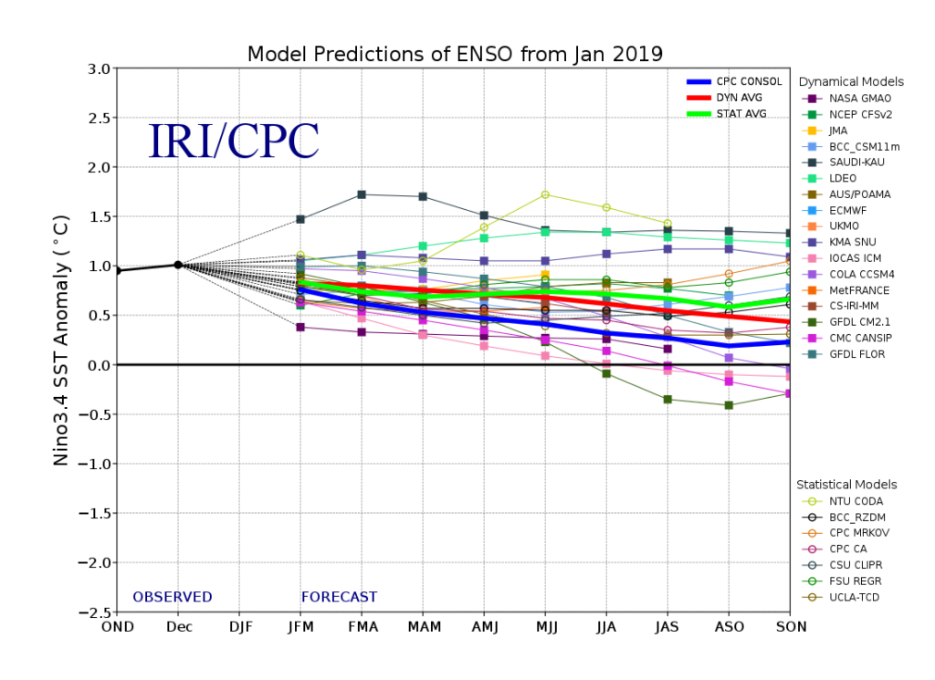
I. Weak El Nino anticipated to persist through the Summer of 2019.
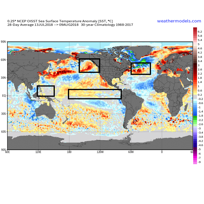
II. Warm SSTs in the Gulf of Mexico and off the Southeast Coast.
We’ll have our complete official Summer Outlook posted during the first week of May, but wanted to share our early thoughts. Overall, a warmer than average summer is expected with average to slightly above normal rainfall, locally.
The warmer than average sea surface temperatures (SSTs) raise concern for the potential of well above average precipitation across the Southeast and MidAtlantic regions. Additionally, those warm water conditions also mean we’ll need to keep close eyes on the potential of tropical activity early on in the season in the Gulf or off the SE coastline.
Much more next month, including graphics!
Talk with you bright and early in the AM!


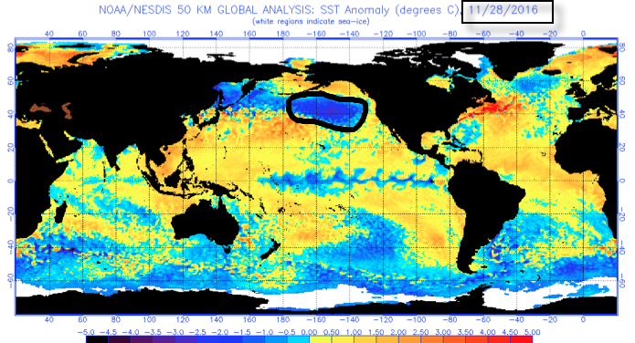
 The early “baseline” of our ideas focuses on the likelihood of El Nino returning for the upcoming winter season. As we’ve stated many times in the past, each Nino event is different from one another and other ingredients (highlighted above) can play a significant role in ultimately determining the eventual outcome.
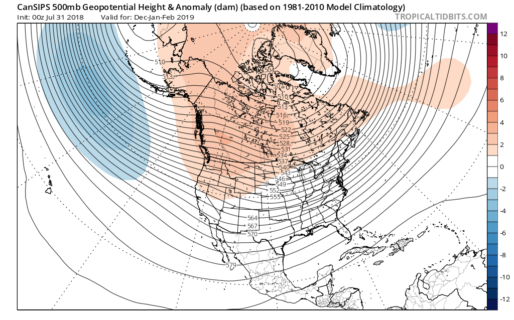

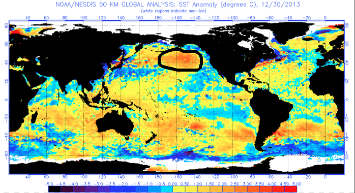
 That sea surface temperature configuration in the northern Pacific argues for western Canada ridging and downstream troughiness such as the JAMSTEC, European, and CanSIPS would imply.
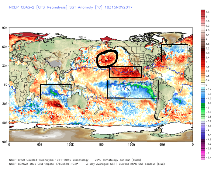
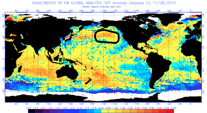
 What makes seasonal forecasting so challenging (and fun :-)) are the multiple features that can impact a forecast. We’ve talked about the importance of ENSO (various types of Nino and Nina events) in past updates, as well as low solar and QBO. All of these moving parts and pieces are coming together in a manner that seems to be favoring more of a cold, wintry regime, locally, this year. Is that us saying another blockbuster 2013-2014 winter awaits? Absolutely not (there are other differences noted above with the SST configuration). However, it is suggesting that this winter will be absolutely nothing like the past couple…
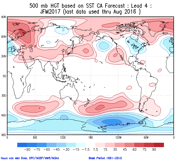
 In addition to the central PAC anomalies, we also are keying in on some other items of interest in the overall SST configuration:
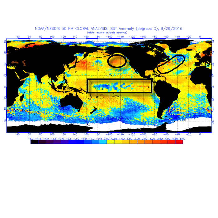 The SST CA model is quickly becoming one of our more trusted seasonal forecast models. We note how it becomes increasingly bullish on a central and eastern trough as winter wears on (by the way, this is likely to go deep into spring this year, too).
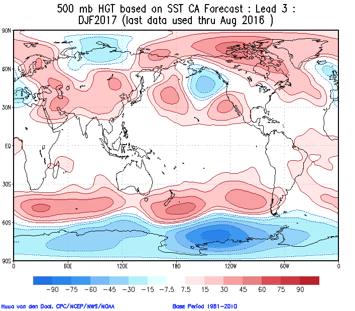
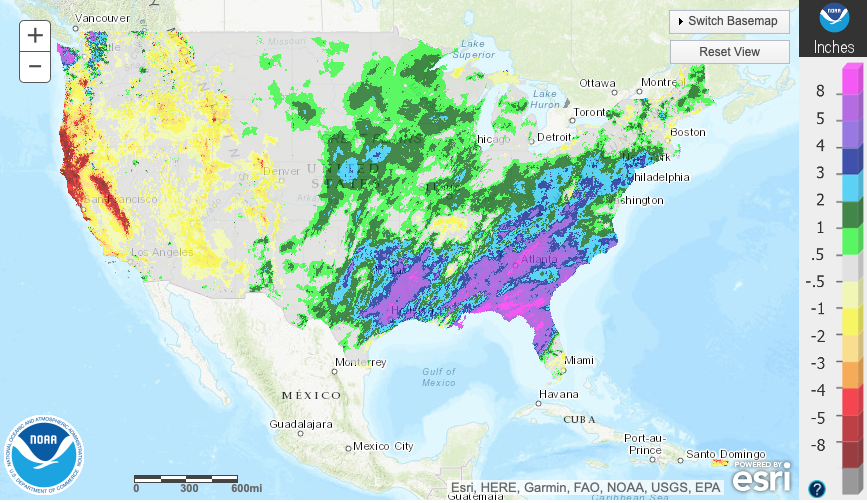
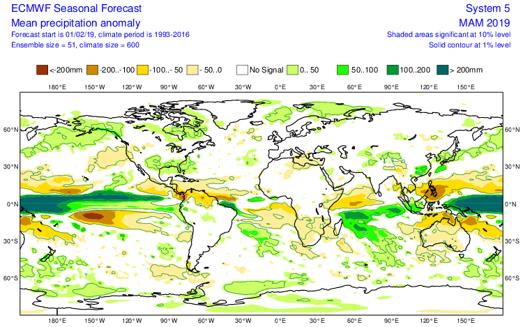
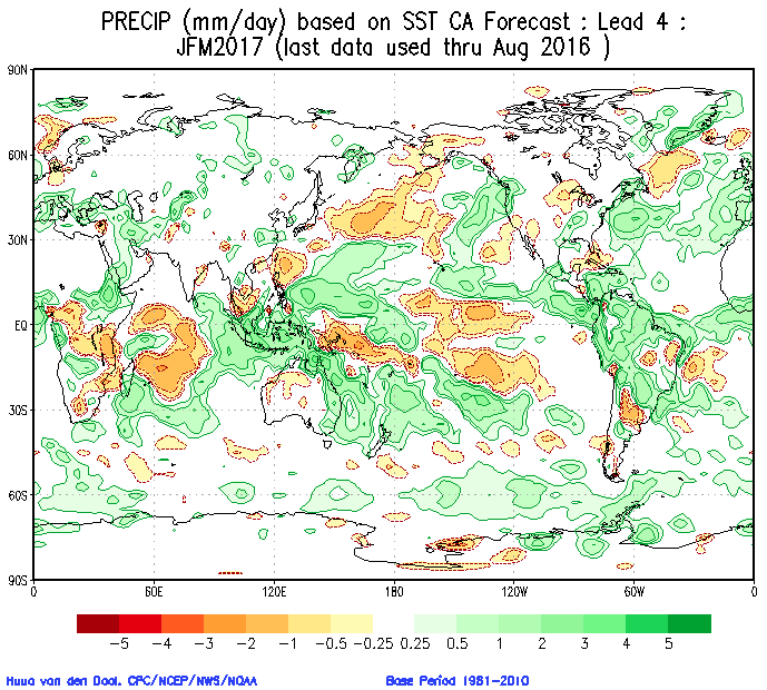
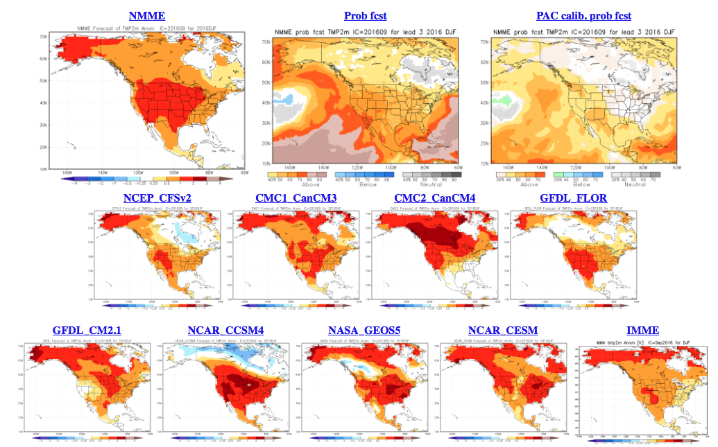
 Cold overwhelms the pattern and when you combine it with the active storm track (noted by the green hues, suggesting above normal precipitation through our neck of the woods), confidence is continuing to grow for an above normal snow season.
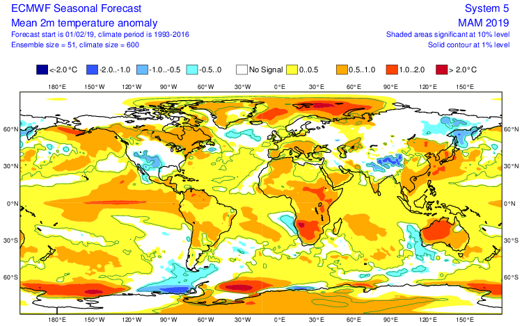
 The SST configuration on the JAMSTEC would suggest a cold, stormy set-up, locally. That said, while it sees the above average precipitation, it’s awfully warm at the surface.
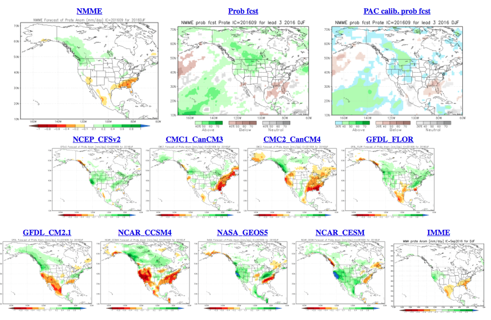
 The NMME (to no surprise…) would suggest a very warm, wet winter.
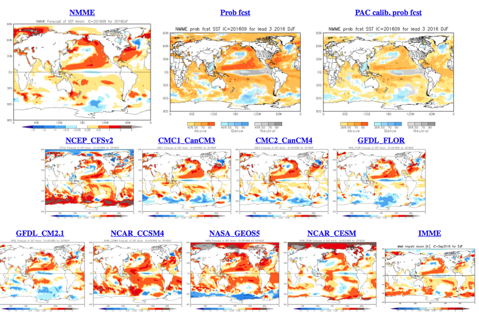
 As a reminder, our complete and final annual winter outlook will be posted here during the second half of October. That will include additional model data, along with several other points behind our reasoning for our winter forecast. As we always do, we’ll put “pen to paper” when it comes to our winter forecast, including our expected temperature and snowfall anomalies. Given the data above, including the warm JAMSTEC and NMME, it’s going to be very, very hard to see a warm winter here. In fact, our idea is for the exact opposite, given the SST configuration, and lines up more closely with the SST CA idea at this point. We’re also in the camp of a very, very active storm track through the Ohio Valley. “Big-hitter” potential is present from a winter storm perspective, especially given that we are likely to see resistance from the SE ridge.