Well here we are on the eve of meteorological fall and, right on cue, there’s a change on the horizon in the overall weather pattern. Does the quick start to a more autumn-like feel early and mid September continue into late month, or for that matter October and November? Let’s look at September first:
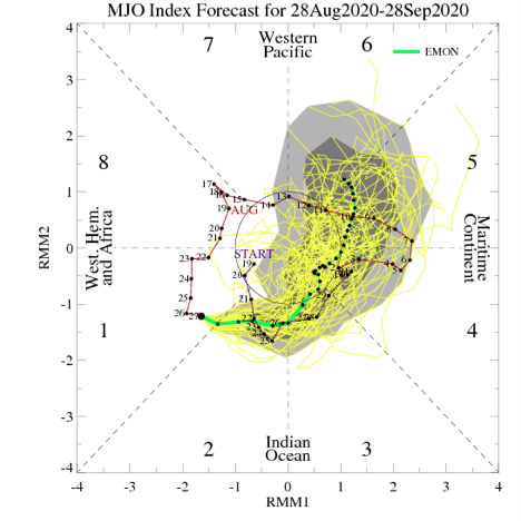
I. MJO will remain active- moving out of Phase 2 and into 3, 4, 5, and 6.
II. Tropics should remain busy with more of an East Coast threat.
III. West looks to remain hot and dry.
Note the precipitation and temperature patterns associated with the MJO phases this time of year:
The next couple of weeks will feature multiple cold fronts sliding through the region and each will provide progressively cooler air. The front coming through around Labor Day may even result in the hoodies having to be pulled out for the first time, including an early October-like feel. BUT- note how the MJO wants to rumble into Phases 5-6 towards late month. These will likely lead to a warmer pattern around Sept. 20th (give or take a day or two) through the remainder of the month.
As we broaden the spectrum a bit and focus on September through November, let’s start by taking a look at how the oceans may impact the pattern:
Most models suggest La Nina will peak late fall or early winter before giving way to La Nada by spring.
Aside from the upwelling associated with Laura, most of the Gulf of Mexico and certainly off the East Coast remains much warmer than normal. Unfortunately, this, along with other favorable conditions in the main development region (MDR) will likely continue to promote a hyperactive 2nd half of the tropical season. The other impact will likely be a warmer than normal fall season along the eastern seaboard, bleeding back into areas west of the Appalachians. Furthermore, we think the MJO will lean more towards Phases 6-8 for mid and late autumn.
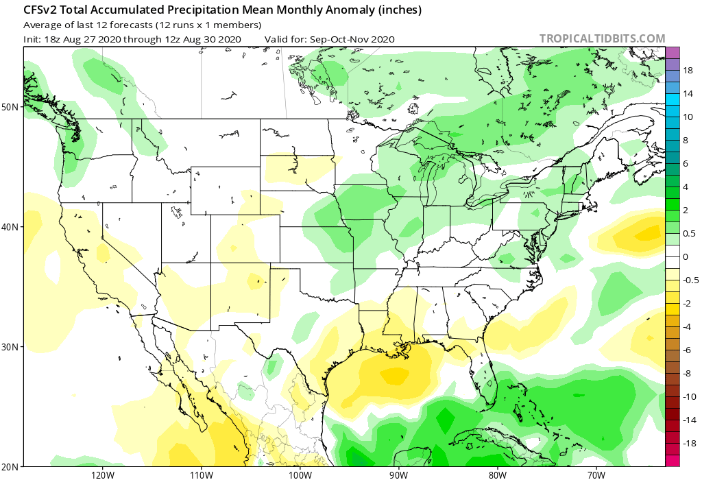
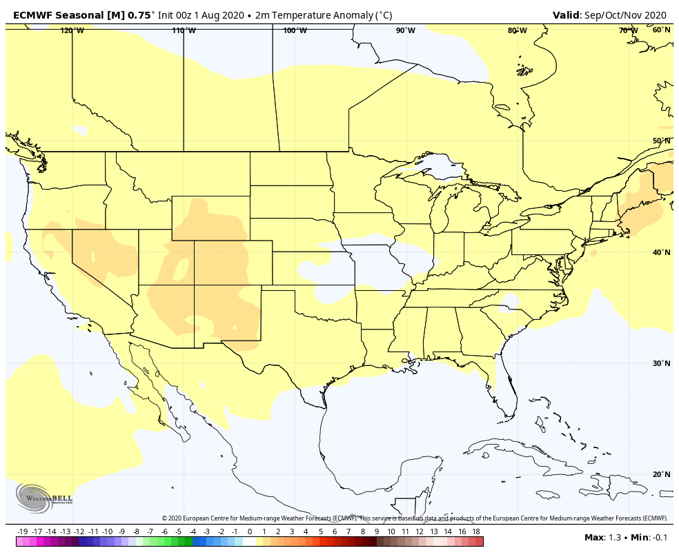
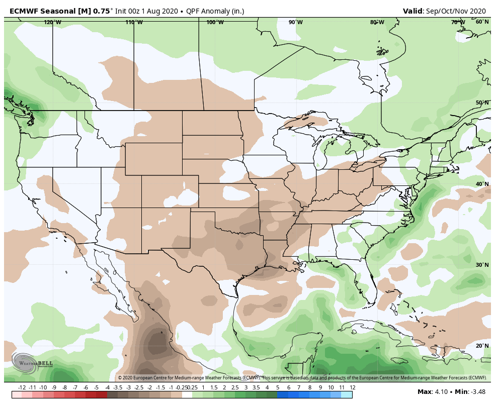
The blend of the CFSv2 and European seasonal data sees a similar forecast to what we have out for September for the autumn, as a whole:
We believe fall 2020 will run slightly warmer than normal for our immediate region with the greatest spot for cooler anomalies to show up throughout the central Plains. After what we believe will be a wet September, things may take a turn for the drier in October before flipping back to wet in November. We prefer the way the CFSv2 handles the precipitation pattern compared to the European.
Next seasonal outlook we produce? Our annual winter package. Tick tock…