Bitter Cold Settles In; Looking At Snow Chances In The Week Ahead…
Updated 01.13.24 @ 6:57a
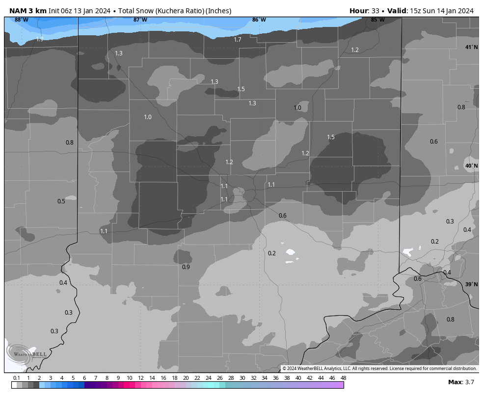
We’re waking up to light snow this morning in the wake of our departing strong storm. As a new (albeit much, much weaker) disturbance moves across the Ohio Valley tonight, snow will increase in coverage and intensity this evening, continuing into early Sunday morning. At times, snow may fall at moderate intensity. This is all a byproduct of maximizing every bit of available moisture as the true bitter arctic air rolls into town. We’ll also need to be prepared for blowing and drifting issues.
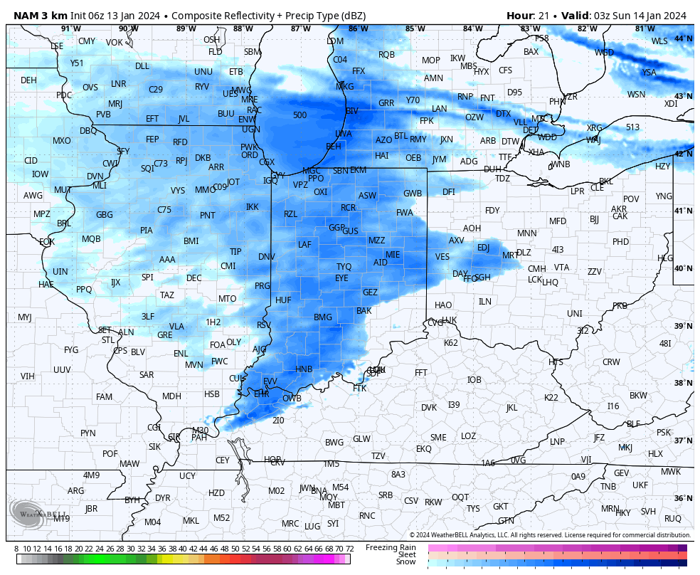
A fresh 0.5” to 1.5” (may see a couple local reports of 2”) of snow can be expected with this system.
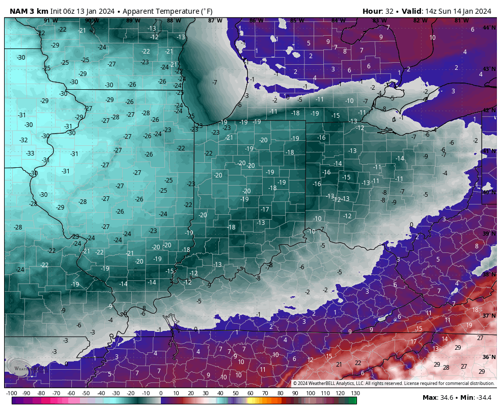
By tomorrow morning, dangerous wind chill values of 20° to 25° below zero can be expected.
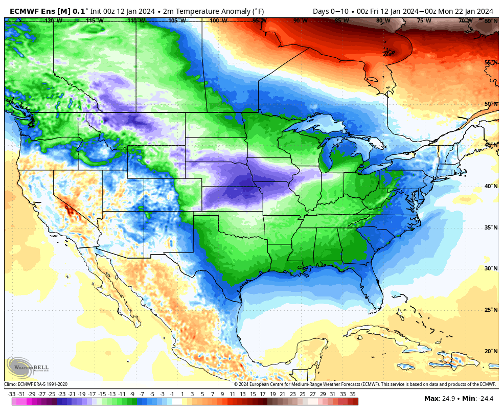
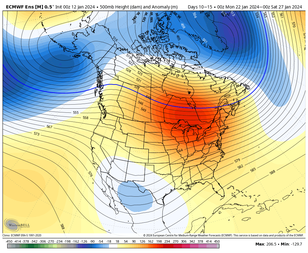
“Cold” is the word in the week ahead but we’ll also monitor a couple of quick moving opportunities of additional snow. While it still doesn’t appear that anything overly heavy is on the table, it won’t take much for these systems to overachieve in the bitter arctic air (“fluff factor” will be present in the upcoming week). With the cold, even light snow events will make a mess of area roadways, so be sure to allow extra time to safely reach your destination.
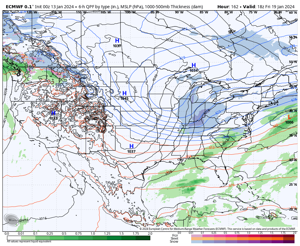
It continues to appear that the system Monday into Tuesday will take a more suppressed route. We don’t expect much, if anything, here across central Indiana from a snow standpoint. Our eyes continue to focus in on Thursday/ Friday. The jet may buckle just enough to allow energy to slow down and organize a bit more to generate a more widespread snow event across our neck of the woods, but even this is admittedly tricky from this distance- just something we’ll continue to closely monitor in the week ahead.

One thing is for sure, whatever snow does fall in this pattern won’t be going anywhere as frigid as we’re going to be. Stay safe (and warm), friends!