Updated 01.18.24 @ 7:22a We continue to eye an accumulating snow event to close out the work week and this will precede arctic reinforcements that once again will take us…
You must be logged in to view this content. Click Here to become a member of IndyWX.com for full access. Already a member of IndyWx.com All-Access? Log-in here.
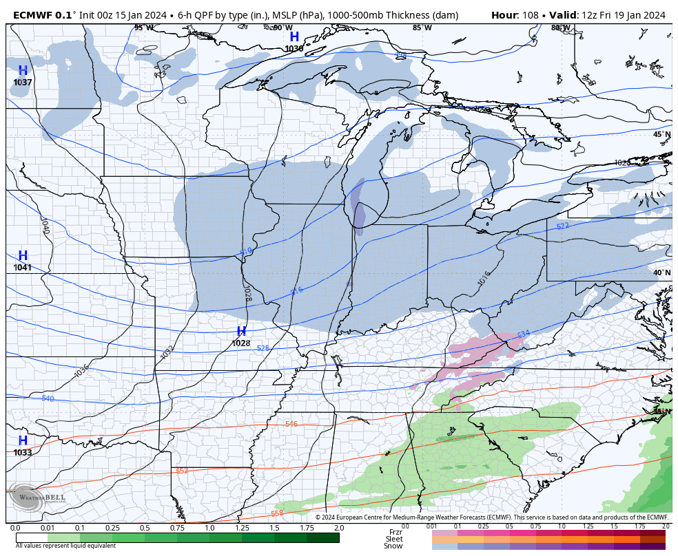
While we’ll still contend with a couple of rounds of accumulating snow to close out the work week, latest model guidance is trending drier with both systems- at least across most of central Indiana. The Thursday morning snow band will lead to a couple inches of powder across north-central and northern IN tomorrow morning, but the majority of this band should fall apart before reaching Indianapolis. We’ll continue to keep close eyes on overnight trends, but travel impacts aren’t likely until once north of Kokomo as of now tomorrow morning.
The next round of snow will arrive Thursday night- now likely well after the evening rush hour. While this still doesn’t appear to be a particularly heavy event (2″-3″ north of Indianapolis, including northern ‘burbs and 1″ to 2″ from Indy and points south), the cold surface will allow this light snow event to create slick road conditions overnight and into our Friday. Snow removal clients, we still recommend planning to activate salting and plowing overnight and through Friday.
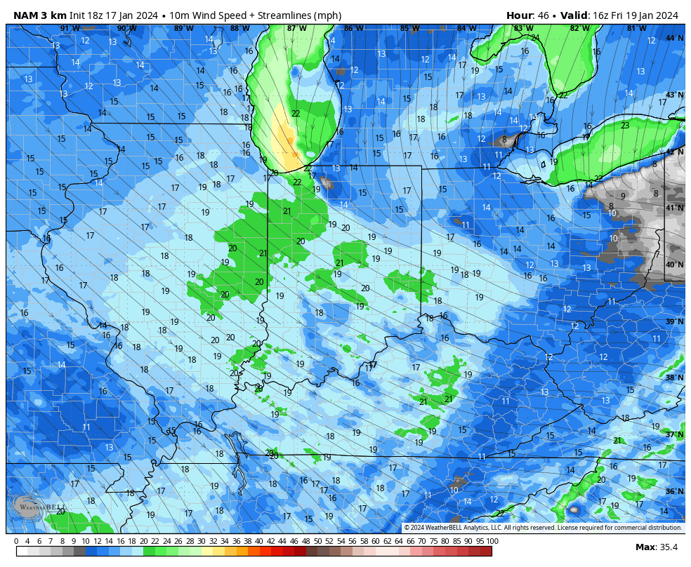
We also continue to closely monitor a localized, but heavier snow band that will likely oscillate through a portion of central Indiana through the afternoon Friday. Localized heavier snow accumulations and gusty winds will be associated within this snow band and we’ll have to treat this more as a “nowcast” situation once that LES band gets organized.
Even outside of this LES band, gusty northwesterly winds of 20-30 MPH will lead to considerable blowing and drifting snow, especially on west-east roadways and in the open country. Drifting and blowing snow will continue through Saturday in these areas.
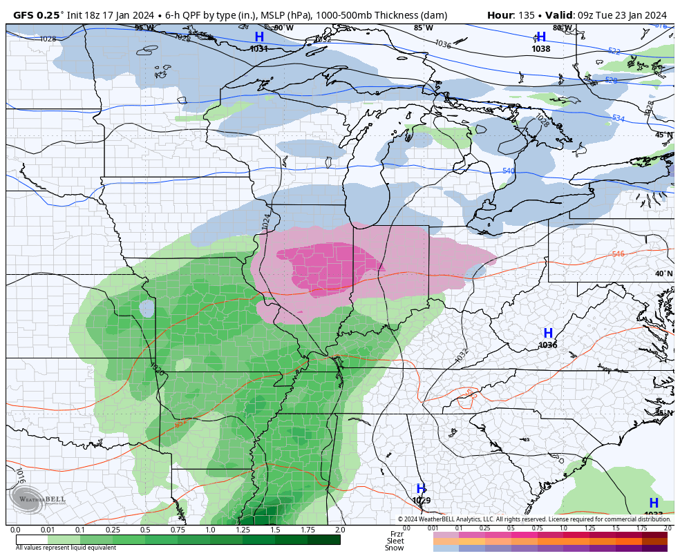
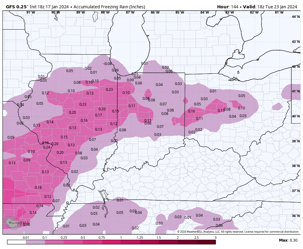
After another bitterly cold weekend, a significant warming trend will get underway next week. That’s not before we likely have to deal with a round of freezing rain Monday night and into Tuesday. Many times, forecast guidance can be too aggressive in dislodging true arctic air and I’m afraid that will be the case in this instance. Today’s trends have likely started to pick up on this icy threat to open the work week and while we likely aren’t talking about a true ice storm, travel impacts should be expected Monday night into Tuesday morning before we transition to a plain ole rain event.
A freezing rain event is becoming increasingly likely Mon evening into Tuesday.
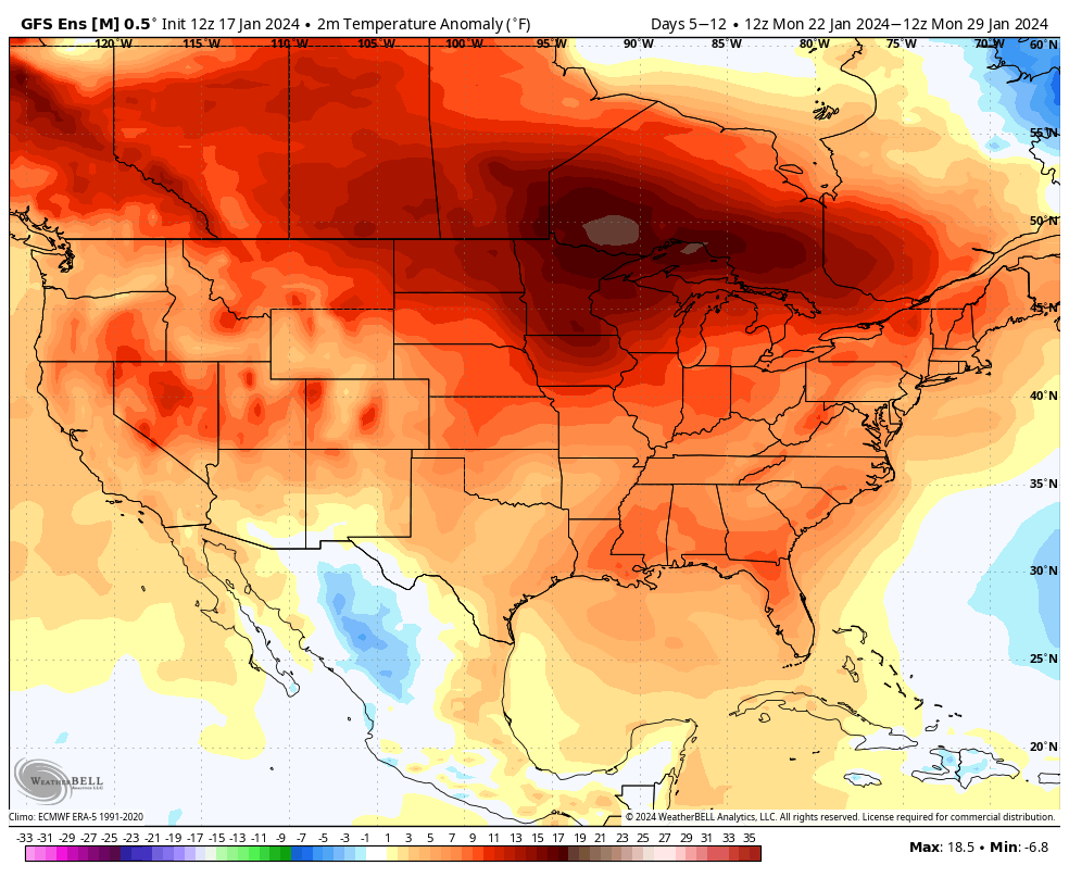
Thereafter it’s “game, set, match” for much milder, but wet times through the rest of the week and on into next weekend.
Updated 01.17.24 @ 6:58a A band of snow will drop south into north-central IN Thursday morning, likely making it as far south as the Indianapolis-area proper before falling apart. This…
You must be logged in to view this content. Click Here to become a member of IndyWX.com for full access. Already a member of IndyWx.com All-Access? Log-in here.
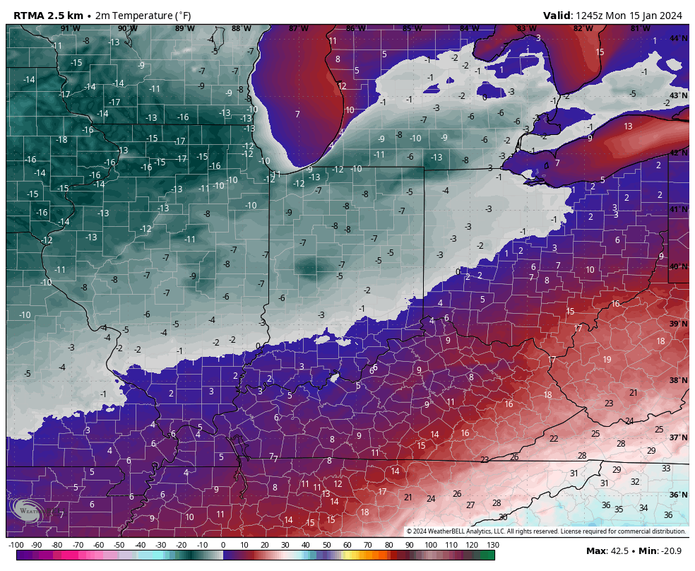
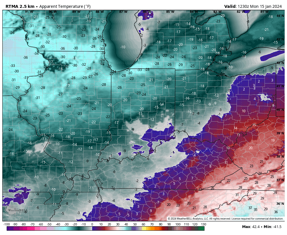
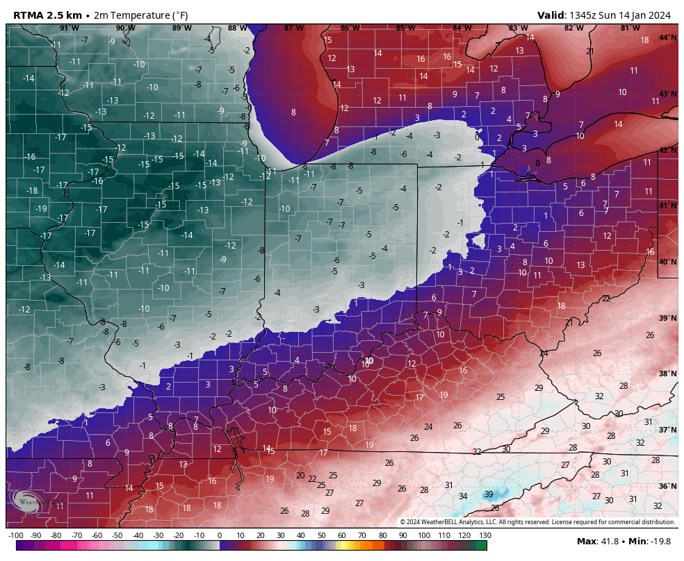
Officially, IND dipped to 4° below zero Sunday morning with a high of only 12°. We’re even colder this morning across the area, including double digit below zero readings north and 6° to 9° below zero for most central IN neighborhoods.
It’s another frigid start to the morning across central Indiana. Monday morning wind chill values
Another round of light snow will scoot through central IN tonight, accumulating anywhere from 0.50” to just under an inch.
The next chances of snow come late week, in advance of arctic reinforcements for the weekend (we think we go back below zero over the weekend). We’re tracking Wednesday night into Thursday morning and Thursday night into early Friday for the next rounds of snow- both of which should be light events but will add up to a couple if not several inches when all is said and done (2”-4” for most is a reasonable call from this distance).
Wednesday night – Thursday morning Thursday night – Friday
That fresh snowpack will lay the ground for a renewed batch of arctic air for the weekend, including lows back to below zero and highs in the 10s.
Hoosiers are waking up to subzero temperatures this morning. We note double digit below zero readings now penetrating into northwest parts of the state. Wind chill values are dangerously cold.
Highs today will barely sneak into the single digits as the true arctic air mass continues to have a tight grip on the region.
Some light snow may scoot through the area Monday evening into Tuesday morning. This won’t amount to much even if it does materialize. (Dusting to half inch of snow if that).
The next opportunity for potentially more meaningful snow arrives late week – in the Thursday PM through Friday timeframe, preceding another intrusion of bitter arctic air to open next weekend.
For folks longing for milder times, hang in there. A pattern change still seems afoot come late month. This January thaw may even take highs back into the 40s and 50s ahead of a reloading of cold times as we flip the page to February.