
You must be logged in to view this content. Click Here to become a member of IndyWX.com for full access. Already a member of IndyWx.com All-Access? Log-in here.
Category: GFS
Permanent link to this article: https://indywx.com/video-friday-opens-quiet-but-ends-stormy-for-some/
Jul 26
VIDEO: Cold Front Inbound; Soaking Rains Early Next Week?
You must be logged in to view this content. Click Here to become a member of IndyWX.com for full access. Already a member of IndyWx.com All-Access? Log-in here.
Permanent link to this article: https://indywx.com/video-cold-front-inbound-soaking-rains-early-next-week/
Jul 06
VIDEO: Hint Of Fall The Next Couple Mornings…
You must be logged in to view this content. Click Here to become a member of IndyWX.com for full access. Already a member of IndyWx.com All-Access? Log-in here.
Permanent link to this article: https://indywx.com/video-hint-of-fall-the-next-couple-mornings/
May 29
Light At The End Of The Tunnel From The Recent Dry Regime?
In our JMA Weekly recap from last week, we noted the model was transitioning towards a wetter pattern for early and mid June.
It’s encouraging to see the latest ensemble data from the American GFS and European (courtesy of TropicalTidbits.com) support this idea, as well.
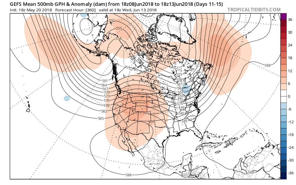
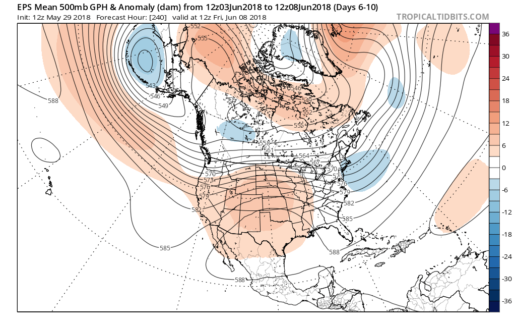 In addition to a wetter pattern, we would also want to pay attention to the potential of a gusty storm complex or two riding southeast around the hot dome off to our southwest.
After an unusually dry May (- 3.44″ as of this post), Alberto’s remnant moisture will help us, at the very least, cut into the rainfall deficit tomorrow. Longer term, it sure is nice to see the medium range guidance in agreement on a wetter time of things. As we’re all aware, this is a crucial time to determine the overall long-standing summer pattern. Dry ground and early warmth can easily “feedback” on itself, and it’s easy to understand some of the concern, particularly AG-related over the past few weeks. With that said, it’s certainly not too late to try and at least ease some of the worry a bit.
When we look at the MJO, we note the amplitude and it’s forecast to swing through the wetter phases, at least locally, (4,5,6) through the month of June:

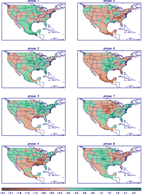 In closing, the JMA Weeklies led the charge in the idea of more active times returning in June, and the combination of GFS and European ensemble data suggests they had merit. With the added bonus of having the MJO on our side, it’ll be hard to avoid a change of the guard towards an overall wetter pattern in the weeks ahead. Perhaps Alberto’s remnant moisture is only the beginning…
Permanent link to this article: https://indywx.com/light-at-the-end-of-the-tunnel-from-the-recent-dry-regime/
Dec 19
VIDEO: Cooler For Midweek; Discussing Christmas Snow…
You must be logged in to view this content. Click Here to become a member of IndyWX.com for full access. Already a member of IndyWx.com All-Access? Log-in here.
Permanent link to this article: https://indywx.com/video-cooler-for-midweek-discussing-christmas-snow/