VIDEO: Cold Front Inbound; Soaking Rains Early Next Week?
You must be logged in to view this content. Click Here to become a member of IndyWX.com for full access. Already a member of IndyWx.com All-Access? Log-in here.
You must be logged in to view this content. Click Here to become a member of IndyWX.com for full access. Already a member of IndyWx.com All-Access? Log-in here.
You must be logged in to view this content. Click Here to become a member of IndyWX.com for full access. Already a member of IndyWx.com All-Access? Log-in here.
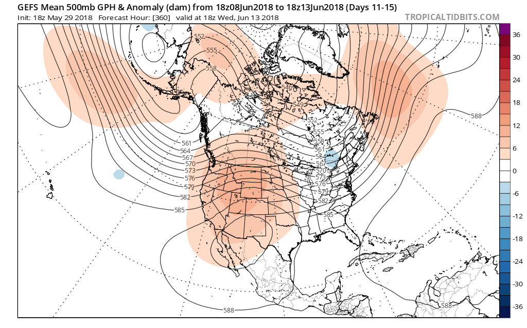
In our JMA Weekly recap from last week, we noted the model was transitioning towards a wetter pattern for early and mid June.
It’s encouraging to see the latest ensemble data from the American GFS and European (courtesy of TropicalTidbits.com) support this idea, as well.
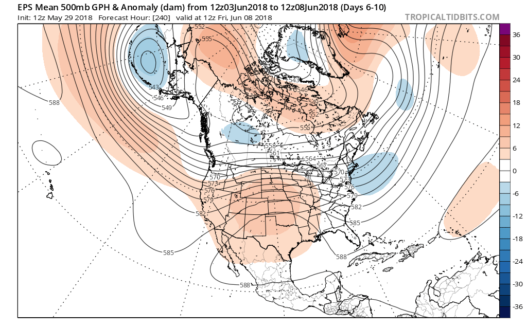 In addition to a wetter pattern, we would also want to pay attention to the potential of a gusty storm complex or two riding southeast around the hot dome off to our southwest.
After an unusually dry May (- 3.44″ as of this post), Alberto’s remnant moisture will help us, at the very least, cut into the rainfall deficit tomorrow. Longer term, it sure is nice to see the medium range guidance in agreement on a wetter time of things. As we’re all aware, this is a crucial time to determine the overall long-standing summer pattern. Dry ground and early warmth can easily “feedback” on itself, and it’s easy to understand some of the concern, particularly AG-related over the past few weeks. With that said, it’s certainly not too late to try and at least ease some of the worry a bit.
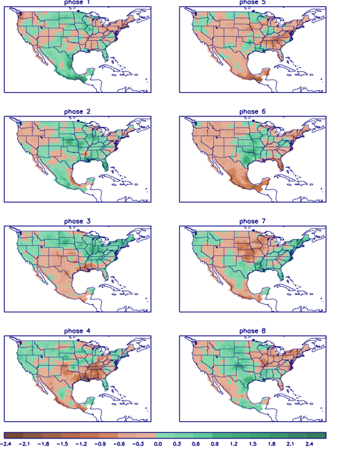
When we look at the MJO, we note the amplitude and it’s forecast to swing through the wetter phases, at least locally, (4,5,6) through the month of June:

 In closing, the JMA Weeklies led the charge in the idea of more active times returning in June, and the combination of GFS and European ensemble data suggests they had merit. With the added bonus of having the MJO on our side, it’ll be hard to avoid a change of the guard towards an overall wetter pattern in the weeks ahead. Perhaps Alberto’s remnant moisture is only the beginning…
You must be logged in to view this content. Click Here to become a member of IndyWX.com for full access. Already a member of IndyWx.com All-Access? Log-in here.
Temperatures will attempt to approach seasonal norms Monday (average high this time of year is 40°) before arctic reinforcements blow into town Monday night and Tuesday.
 This will keep highs in the middle 20s Tuesday with wind chill values in the single digits and teens most of the day.
Scattered snow showers and embedded lake-generated squalls will accompany this arctic surge Tuesday. As the wind trajectory sets up shop Tuesday afternoon, lake effect snow bands will impact portions of northeast and east-central Indiana.
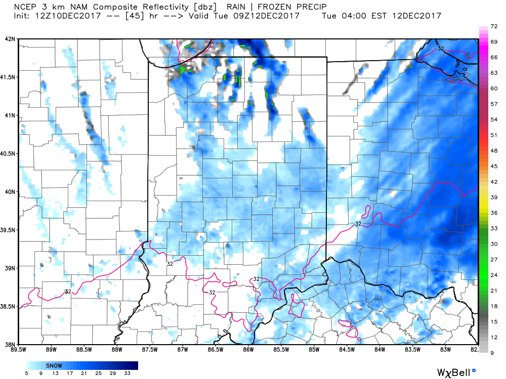
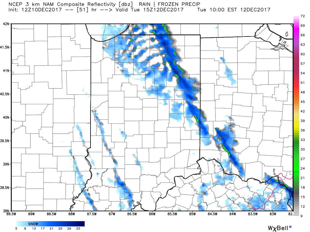
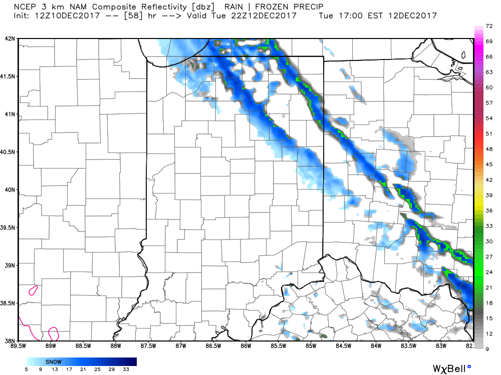
Cold weather will continue to dominate through the work week and an additional upper level disturbance may try to ignite snow showers Thursday.
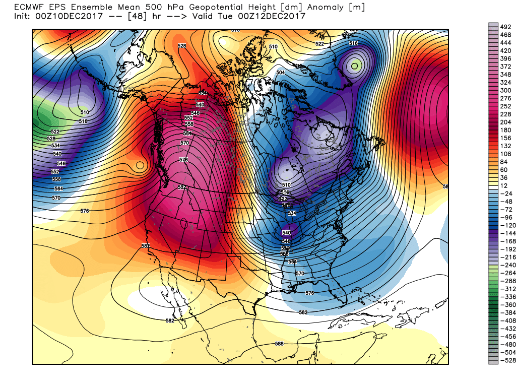
As we push into the 8-10 day time frame, a “relaxation” of the cold is anticipated, but, as we’ve been discussing, any sort of moderation will be brief in this weather pattern. Cold looks to continue to dominate, overall. With that said, there will be a window of opportunity early next week where temperatures will go above normal for a change and the European ensemble shows this brief moderation nicely.
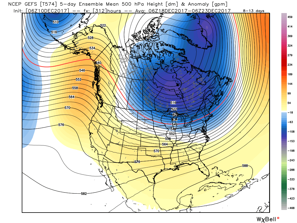
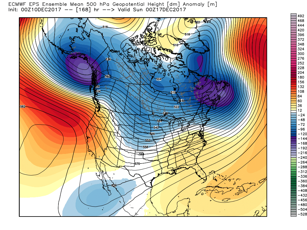 This doesn’t last long as the pattern begins to reload as Christmas week approaches. As the evolution to a fresh cold pattern takes place, there’s a window of opportunity present for a more significant wintry system to potentially impact the Ohio Valley into the Mid Atlantic region. Notice the relatively “flat” ridge across the southern tier and associated tight thermal gradient. This look suggests we need to be on guard for the chance of a storm system to ride the thermal gradient in a west-to-east fashion, and has wintry implications for our region. Far too early for specifics; just know the possibility looms of a wintry event, locally, as Christmas week nears.
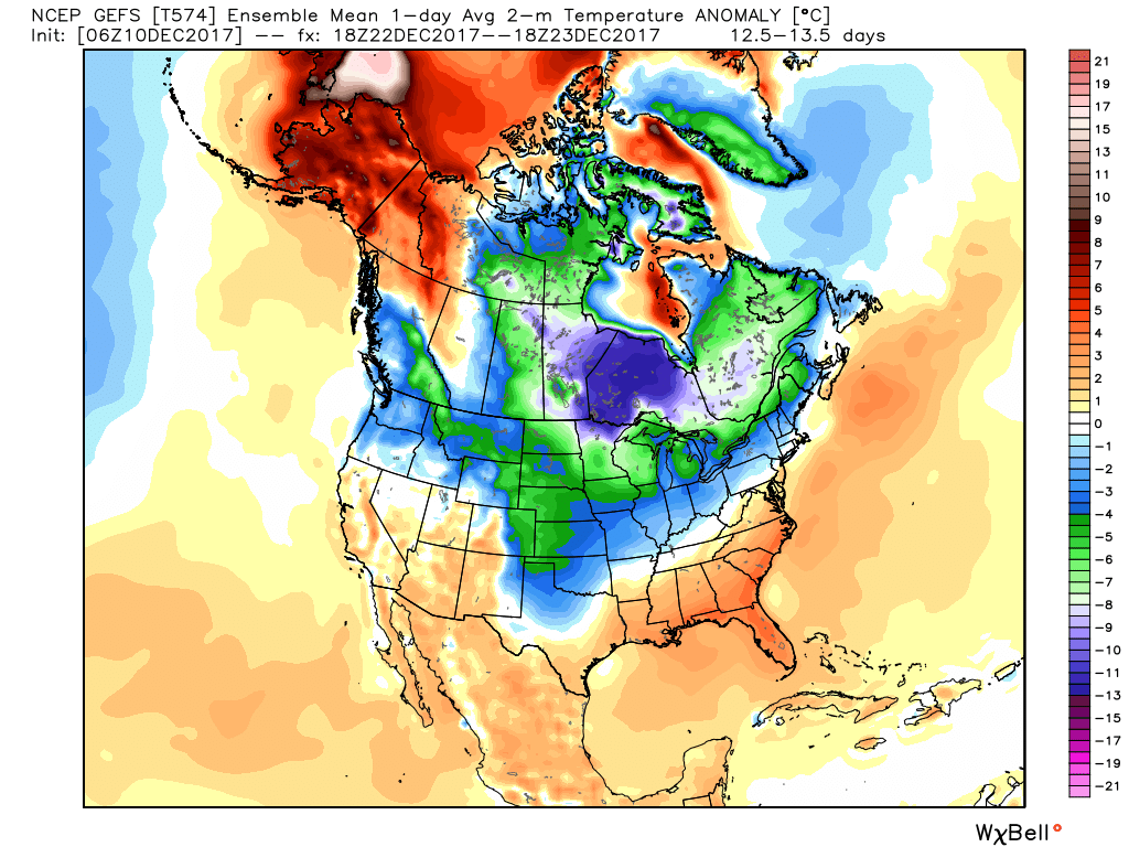 Speaking of Christmas, it sure appears as if cold will overwhelm the pattern for Christmas, itself, and the overall cold regime doesn’t show signs of letting up (with the exception of potentially a day or two) into the new year.