Putting The Cold Into Perspective…
An impressive shot of early season arctic air will come at us in a 1-2 punch format to wrap up the week and head into early next week. Before we dig deeper into the details, let’s keep in mind averages for November 9th-15th include lows in the middle 30s and highs in the middle 50s. Multiple days during that time frame will feature highs where our average lows should be (if not even colder a couple days) and overnight lows deep into the 20s (10s perhaps on a couple nights).
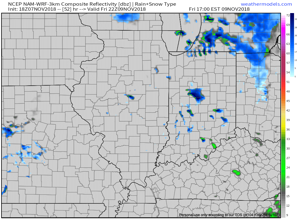
The initial blast of cold air will blow into town Thursday night and Friday and will be accompanied by a chilly rain ending as a touch of wet snow across central Indiana. This will be a “novelty” level event for most across the region, but there could be a couple of slushy accumulation reports- especially north of the city.
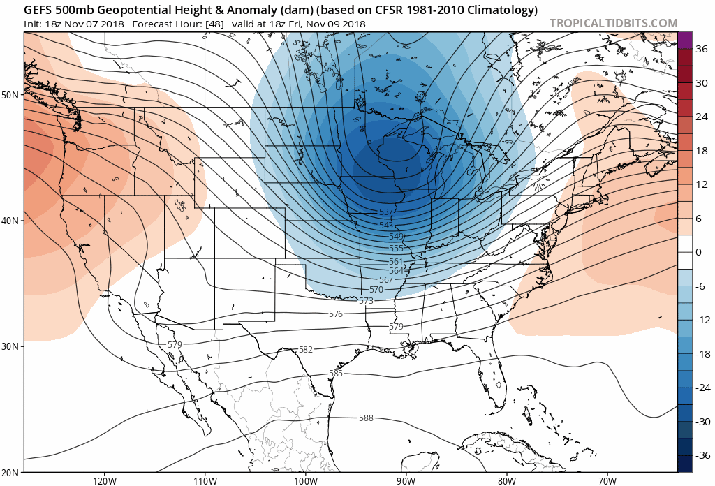 The bigger story will be localized, but intense snow bursts that will likely develop as the true push of arctic air arrives Friday evening. These will be accompanied by strong and gusty winds, as well.
 We’ll awake to temperatures in the lower 20s across most of central Indiana Saturday morning. By this point in time, attention will shift to what awaits during early stages of the new work week. While details are murky with respect to the specifics associated with an eastern storm, cold air will be reinforced Monday night into Tuesday.
 Keep a note in the back of your mind to check back often over the weekend concerning the forecast for early next week. Model bias (“progressive” GFS; “sluggish” Euro) appears to be running rampant from this distance and what will likely be the ultimate result is something in between. The sensible weather that would result is the opportunity for perhaps a better chance of more widespread accumulating snow across portions of the Ohio Valley Monday night into Tuesday.
Snow prospects aside, confidence remains high that the upcoming cold pattern will be the most significant so early since the early season bitter blast of air in November ’14!
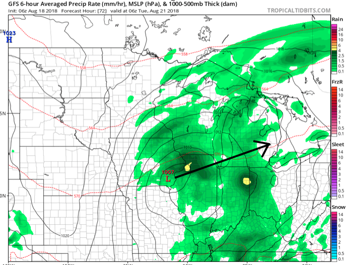
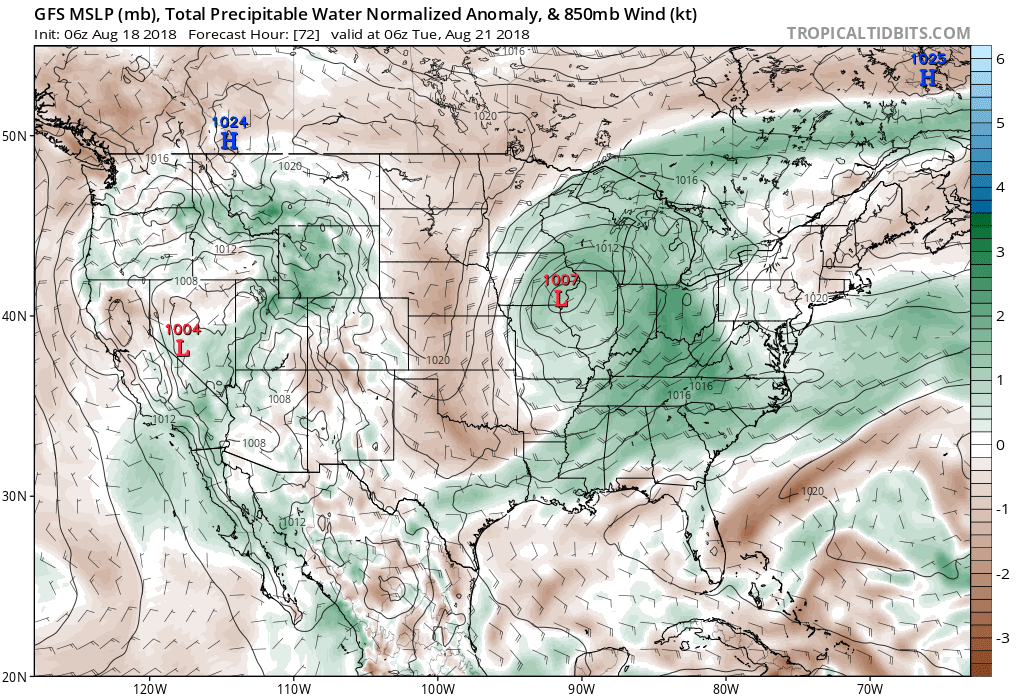 Scattered thunderstorms will return as early as Monday afternoon, but more widespread shower and thunderstorm activity is expected Tuesday. While not a textbook set-up for widespread severe weather by any means, enough ingredients are in place to at least raise an eyebrow for a few severe storms ahead of the cold frontal passage. Don’t be surprised if the ‘marginal’ risk is upgraded to a ‘slight’ risk for Tuesday in future updates from the Storm Prediction Center.
 Once the cold front moves through, a rather abrupt wind shift will drive a much drier and cooler air mass southeast and it’ll feel like early autumn around these parts as we progress through the second half of the work week. Not only will the significant drop in humidity be nice, but some outlying areas away from the city will likely fall into the 40s for overnight lows Thursday and Friday mornings. Highs will only top out in the mid to upper 70s.
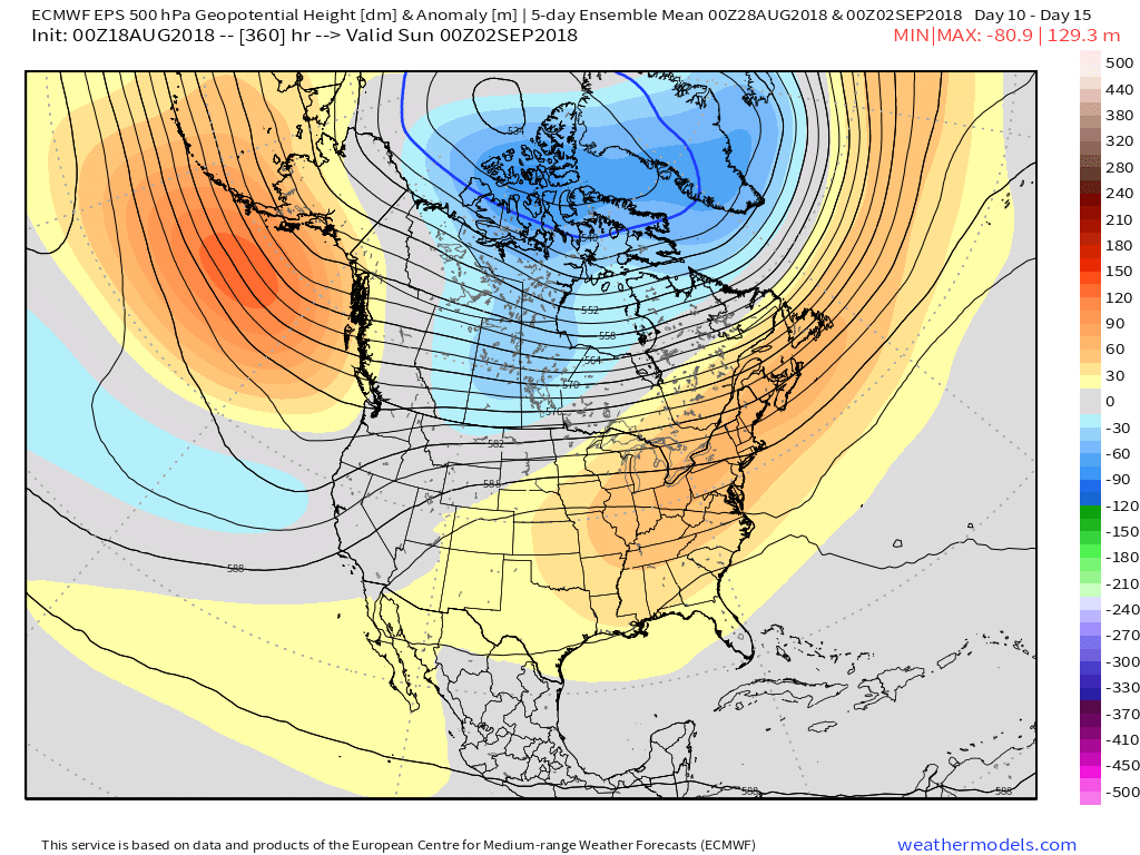
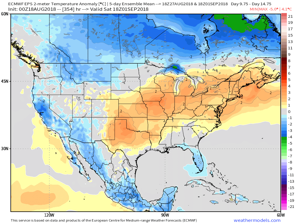
 Looking longer term, summer isn’t finished just yet. Ridging will return for the Labor Day weekend and support building warmth as we put a wrap on August and open September.