Category: Forecast Models

Ice Storm For Some Sunday Evening; Late Night Thoughts…

Just a quick update to give you some fresh thoughts on the next winter storm that will impact central Indiana.

We bracket the hours of 1p-3p for the onset of sleet and freezing rain across central Indiana.

hires_ref_indy_19

Coverage and intensity of freezing rain will increase as we progress through the evening hours.  We suggest hunkering down at home (or at a loved ones home) for the Colts game, as roadways will likely become hazardous during the game.

hires_ref_indy_24

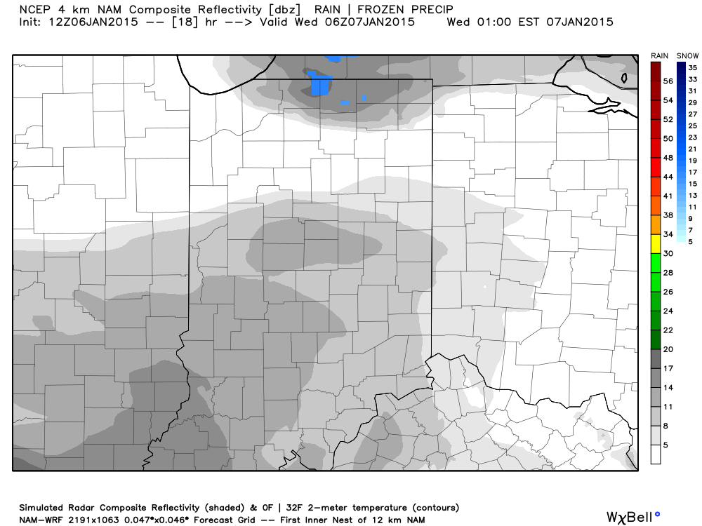
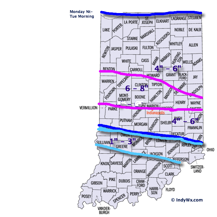
Early data hot off the press this evening is suggesting Ice Storm Warning criteria (freezing rain amounts of 0.25″, or greater) is met through the heart of central Indiana.

hires_ptype_acc_indy_15

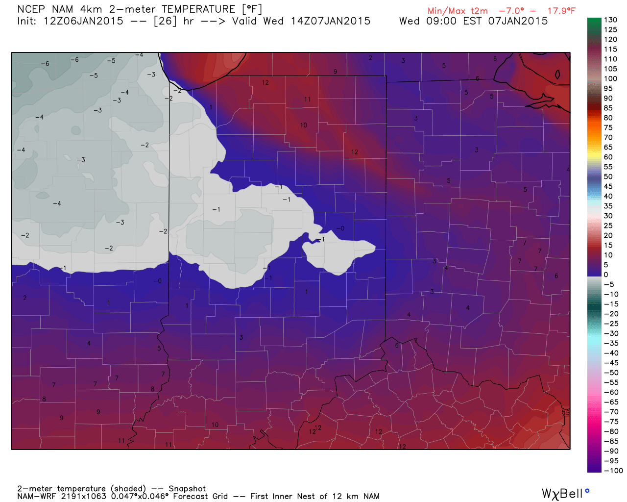
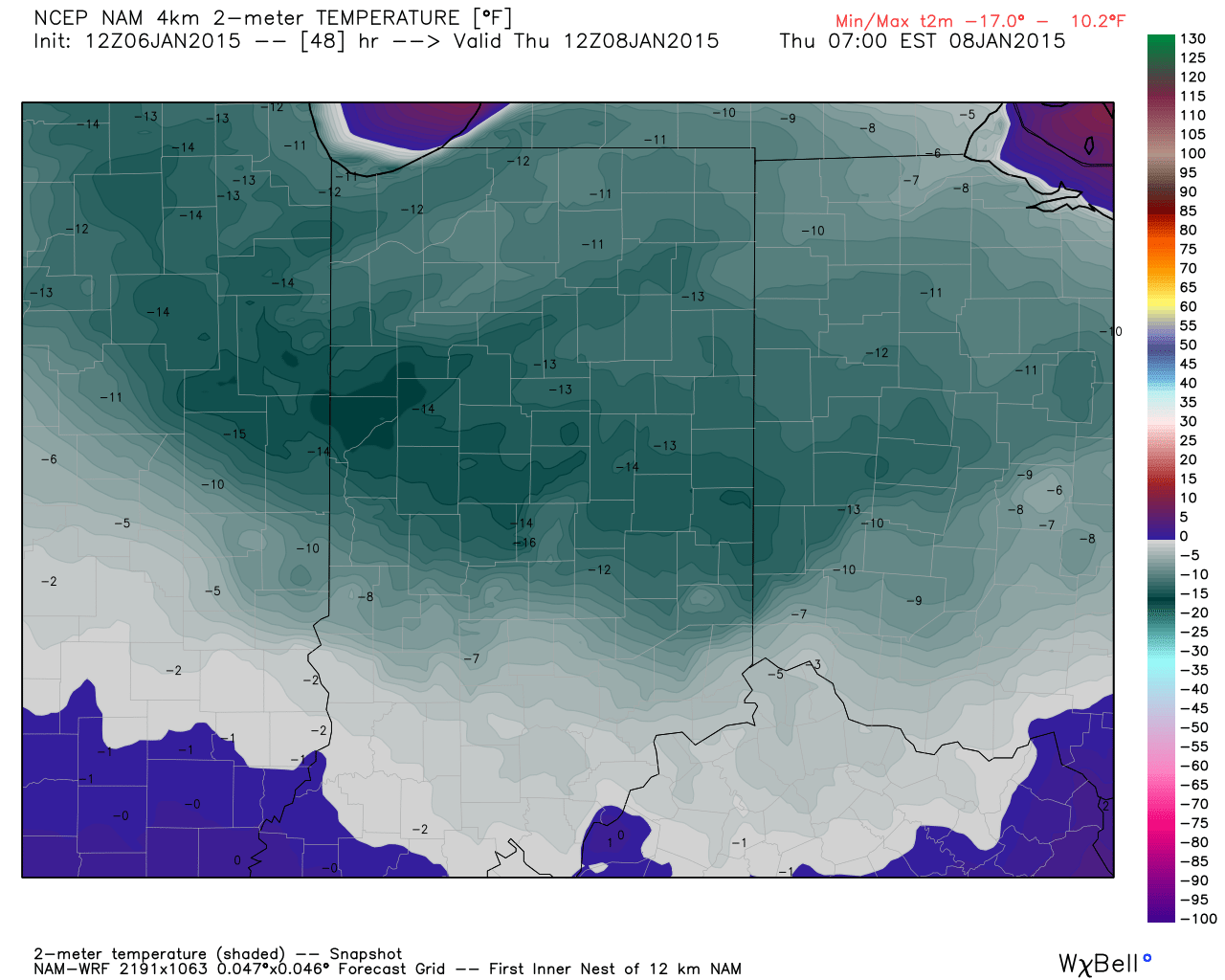
A fresh push of cold, arctic, air will ooze back into central Indiana during the day Monday. We think overnight lows head back into the single digits Tuesday morning and below zero Wednesday morning.  Needless to say, should power outages take place, a nasty situation will develop with the new push of cold air.

Please stay tuned to your favorite media or means of obtaining weather information, as this will be an impactful event for central Indiana tomorrow afternoon into Monday.

Permanent link to this article: https://indywx.com/ice-storm-for-some-sunday-evening-late-night-thoughts/

Dangerous Cold; More Snow Ahead Thursday And Eyeing Sunday-Monday…

Tonight’s video update focuses on the dangerous cold, more accumulating snow Thursday afternoon, and looks ahead to another winter event looming Sunday night and Monday.

Your latest snowfall forecast brought to you by the fine folks at indysportsreport.com:

1815Snow

Permanent link to this article: https://indywx.com/dangerous-cold-more-snow-ahead-thursday-and-eyeing-sunday-monday/

Dangerous Cold Coming Along With Significant Blowing And Drifting…

The snow storm that moved through northern and central Indiana deposited half a foot, or more, of “champaign powder” for the northern Indianapolis suburbs overnight into this morning with amounts tapering dramatically further south.

Left behind will be a day that will provide “decent” conditions for digging out.  We’ll introduce sunshine and temperatures will be downright “balmy” when compared to what blows into town tonight.  Though well below average, today’s high in the lower 20s will feel like a heat wave when we look ahead to the upcoming couple days.

Things begin to change in a big way tonight as arctic air invades.  Additionally, winds will increase and lead to all sorts of blowing and drifting concerns.  This dry/ powdery snow will be blown about quite easily and lead to reduced visibilities tonight and Wednesday along with significant drifting.  Some additional light snow will accompany the initial arctic push tonight.

2

Note the temperature crash that’s coming:

Temperatures fall into the single digits by 10pm.

Temperatures fall into the single digits by 10pm.

Wednesday morning lows.

Wednesday morning lows.

Modeled forecast lows Thursday morning.

Modeled forecast lows Thursday morning.

Officially we forecast the following:

  • Wednesday morning low: -2
  • Wednesday high: 2
  • Thursday morning low: -13

* Wind chill values will fall to 25 to 30 degrees below zero Wednesday into Thursday morning.

Permanent link to this article: https://indywx.com/dangerous-cold-coming-along-with-significant-blowing-and-drifting/

Monday Evening Snowstorm Video Update:

Our going snowfall forecast stands, brought to you by the fine folks at the Indiana Sports Report (indysportsreport.com):

15141614SnowfallForecast2

IndyWx.com was featured on WIBC today with Ray Steele.  You can listen here:

http://www.wibc.com/news/local-news/here-comes-snow-followed-bitter-cold

Permanent link to this article: https://indywx.com/monday-evening-snowstorm-video-update/

Brrrrr…. Cold Pattern Continues

Many across the Lower 48 are running MUCH colder than average this morning. Take a look a temperature departures from normal this morning: Mind you this is in the face…

You must be logged in to view this content. Click Here to become a member of IndyWX.com for full access.  Already a member of IndyWx.com All-Access?  Log-in here.

Permanent link to this article: https://indywx.com/brrrrr-cold-pattern-continues/