Category: Forecast Models

Pleasant Weekend Gives Way To A Stormy Week Ahead…

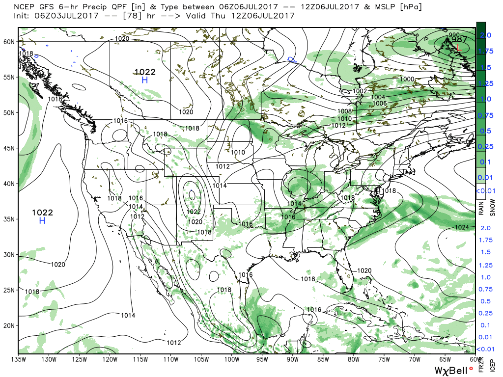
It was a stormy Friday across central Indiana, including hail, damaging winds, and localized flash flooding.  Thankfully, as we open the weekend, weather conditions are much more pleasant.  The surface front that helped trigger the bumpy close to the work week has pushed south and is allowing a much more pleasant (much drier and slightly cooler) air mass to ooze into the region.  With the exception of patchy fog across southern Indiana, skies are mostly sunny.

Patchy fog will burn off by 10a across southern Indiana.

A cooler and less humid feel is greeting us out the door this morning.

Pleasant weather will remain through the majority of Sunday, but we’ll begin to notice an uptick in humidity late in the day.  This is a harbinger of things to come as a true tropical feel lifts back north.  Factor in the increasing moisture levels (it’ll feel oppressive by mid-week) with increasing amounts of energy and instability and big storms will likely result.

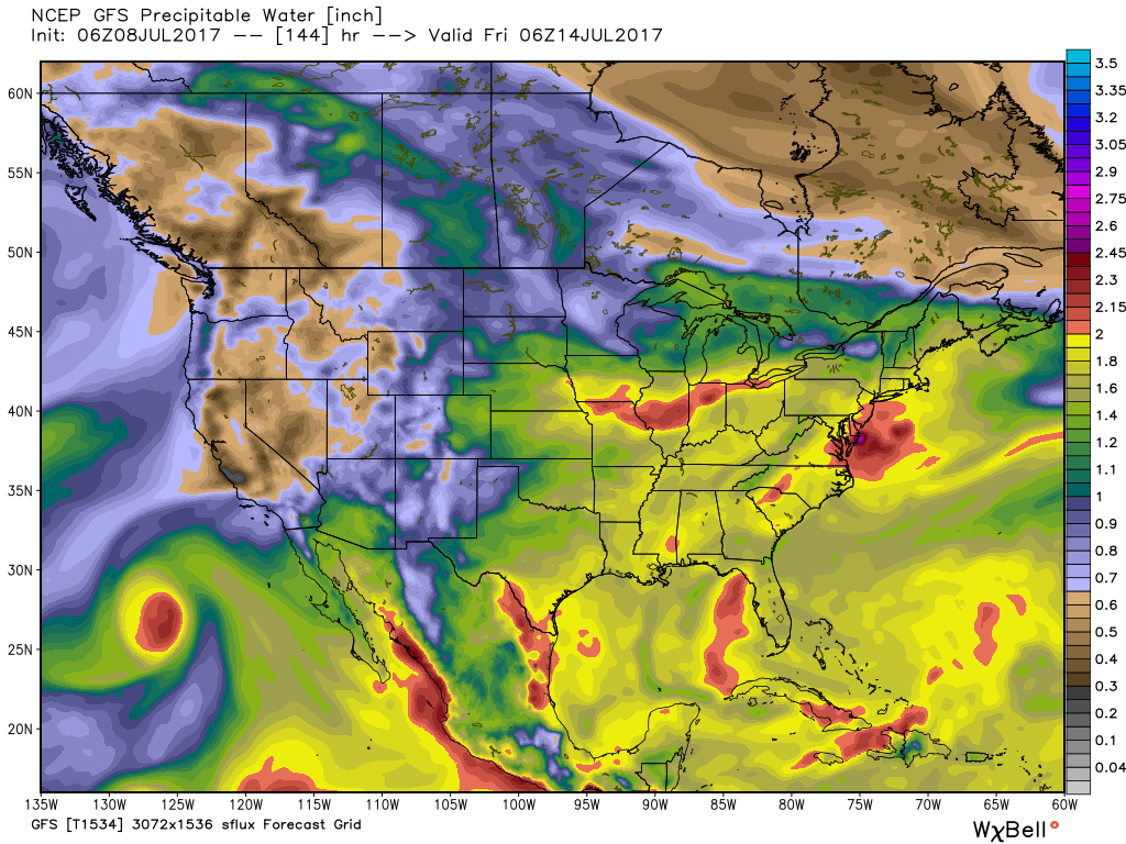
A moisture-rich air mass will engulf the region much of the upcoming work week.

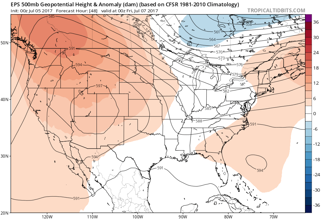
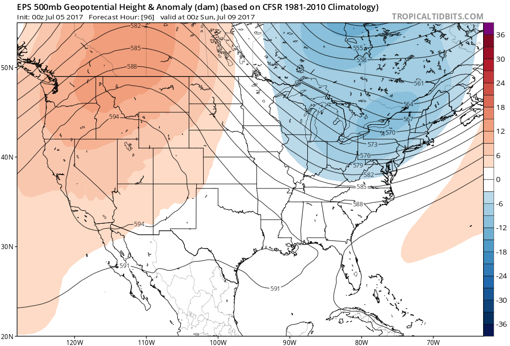
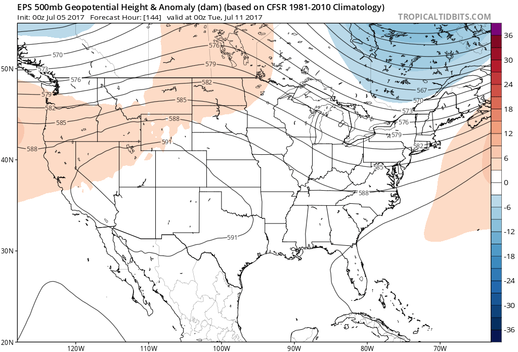
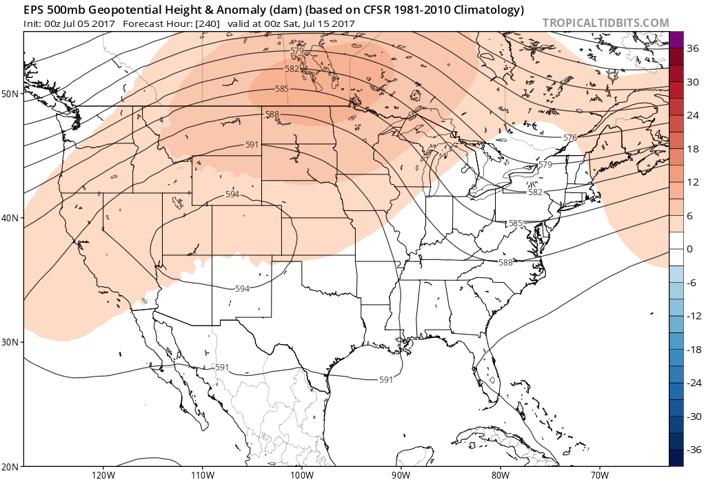
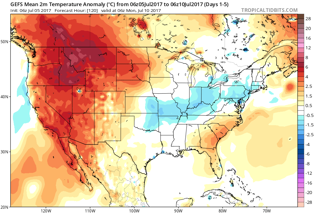
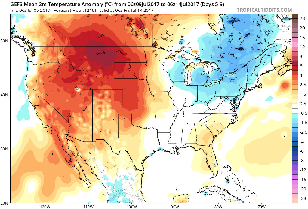
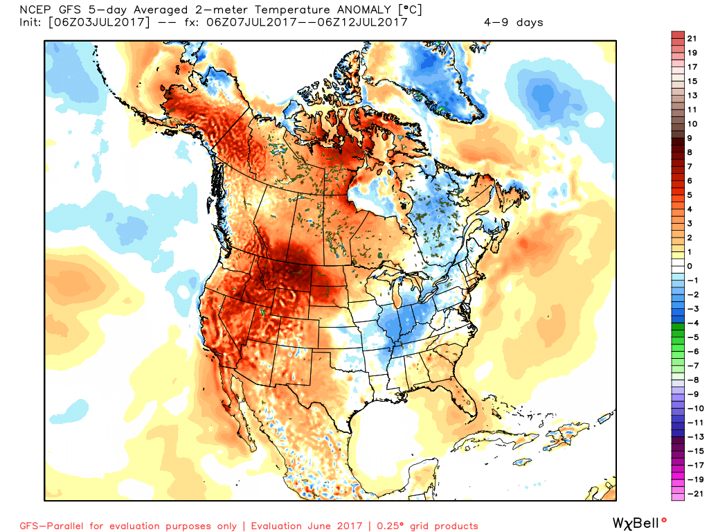
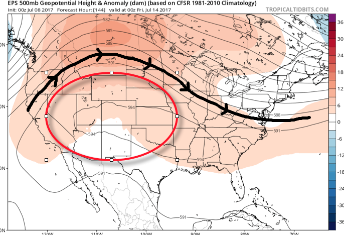
The core of the heat will be centered over the western half of the country next week and with a northwest flow aloft, we’ll have to remain on guard for individual disturbances tracking southeast into the Mid West and Ohio Valley.  These will help trigger more widespread storm coverage from time-to-time through the week.  Similar to the storms yesterday, large hail, damaging winds, and flash flooding are the biggest concerns with these storm complexes.  7-day rainfall totals through late-week will feature widespread 2″-3″ across central Indiana, including locally heavier amounts of 3″-6″ in spots where storms train.  We’ll have to sure-up specific storm timing as we get closer.

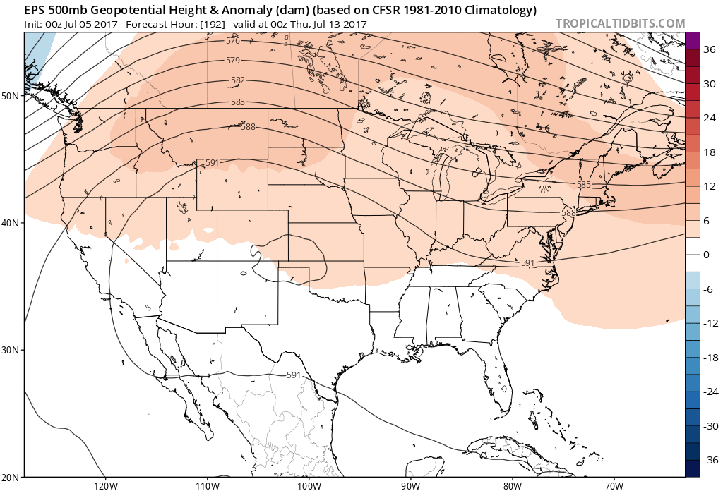
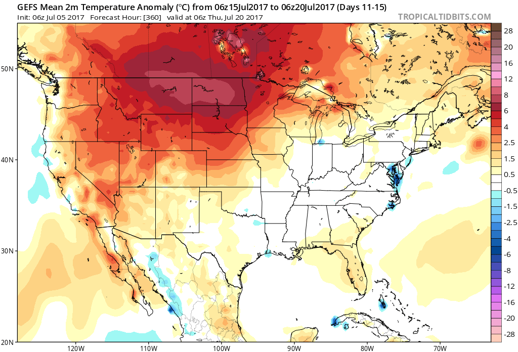
As we look ahead, timing, once again, may be our friend, as modeling currently suggests a drier regime returns by next weekend.

Make it a great Saturday, friends!  More later!

Permanent link to this article: https://indywx.com/pleasant-weekend-gives-way-to-a-stormy-week-ahead/

VIDEO: Stormy Afternoon Ahead For Some; Active Pattern Remains…

You must be logged in to view this content. Click Here to become a member of IndyWX.com for full access.  Already a member of IndyWx.com All-Access?  Log-in here.

Permanent link to this article: https://indywx.com/video-stormy-afternoon-ahead-for-some-active-pattern-remains/

“Rinse & Repeat” Pattern…

As we look deeper into mid and late July, the one item that continues to stand out in our weather pattern is a lack of any serious heat, relative to average. It’s obvious that the “hot dome” really wants to set up shop over the Rocky Mountain region and while brief “spurts” of warmer air will try to eject out towards our region, the balance of the medium and longer range looks to be dominated by a northwest flow aloft and seasonal to slightly below average conditions. 


At least through mid-July, this will keep the west and Rocky Mountain region well above average and promote seasonal to cooler than average conditions, overall, for our region. 


Permanent link to this article: https://indywx.com/rinse-repeat-pattern/

Monday Morning Rambles…

An early look at the radar this morning shows a couple of lone storms near Decatur and Blufton. These are moving off to the east. 

While we’ll maintain mention of a widely scattered thunderstorm today and Independence Day, the majority of both days will remain rain-free. 

A wave of low pressure will track through the Ohio Valley Wednesday night into Thursday and this will result in an uptick in storm coverage. Locally heavy rainfall will be possible. While some localized totals could be higher, we think widespread rains of 1″-1.5″ is a good bet Wednesday night into Thursday. 

High pressure will build in over the weekend and aid in a drier and cooler theme.

Lows will return to the 50s across central Indiana Sunday morning and refreshing (upper 50s at night and upper 70s to lower 80s during the day) air will remain with us into early next week. 

Permanent link to this article: https://indywx.com/monday-morning-rambles-4/

VIDEO: Closing Out June And Heading Into July…

You must be logged in to view this content. Click Here to become a member of IndyWX.com for full access.  Already a member of IndyWx.com All-Access?  Log-in here.

Permanent link to this article: https://indywx.com/video-closing-out-june-and-heading-into-july/