
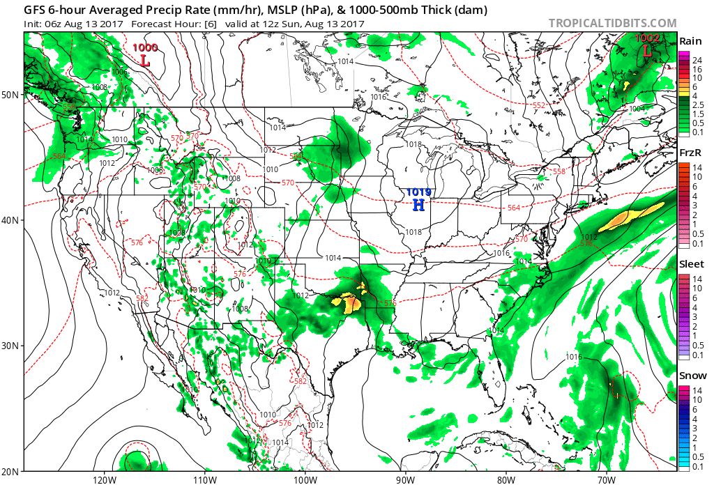
August, month-to-date, is running bone-dry. Officially, IND has only accumulated 0.18″ of rain, but that may be changing as early as this afternoon and evening.
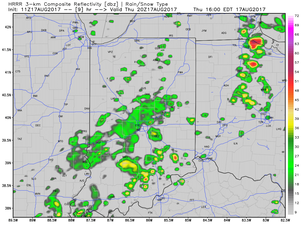
We note high resolution, short-term data is becoming more aggressive with the development of showers and thunderstorms this afternoon and evening. Initially, storms will impact w-central parts of the state before encompassing more of central Indiana. The following are images of what the local radar may look like at 4p, 6p, and 8p.
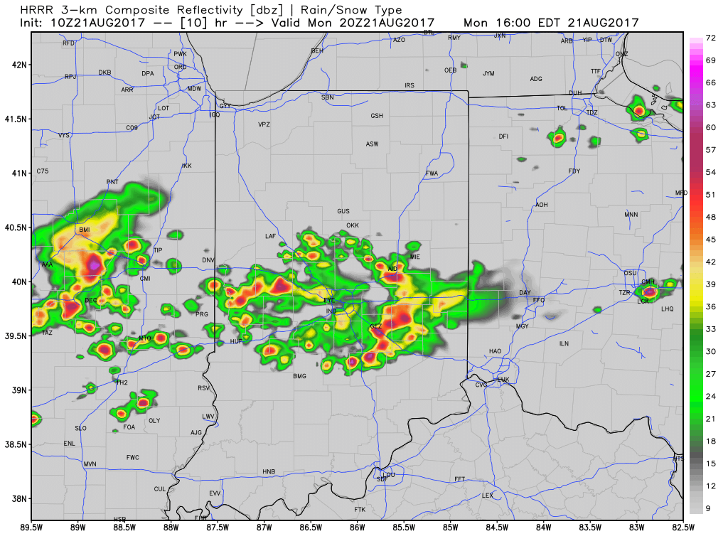
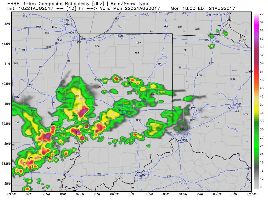
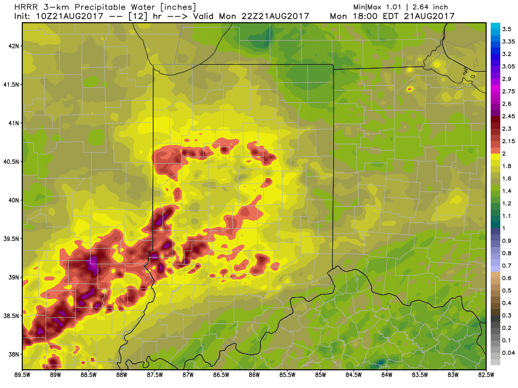
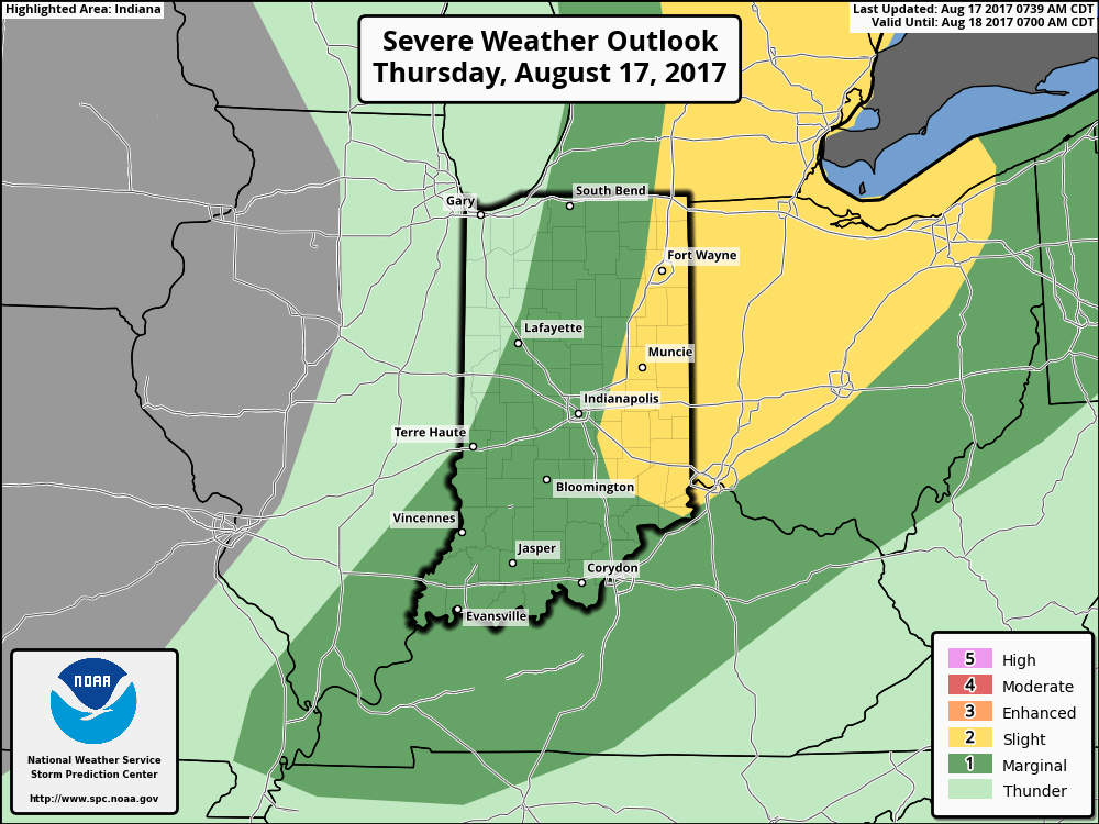
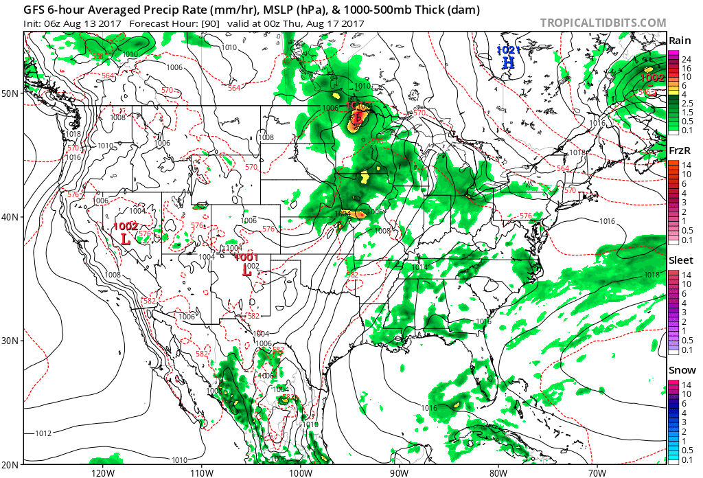
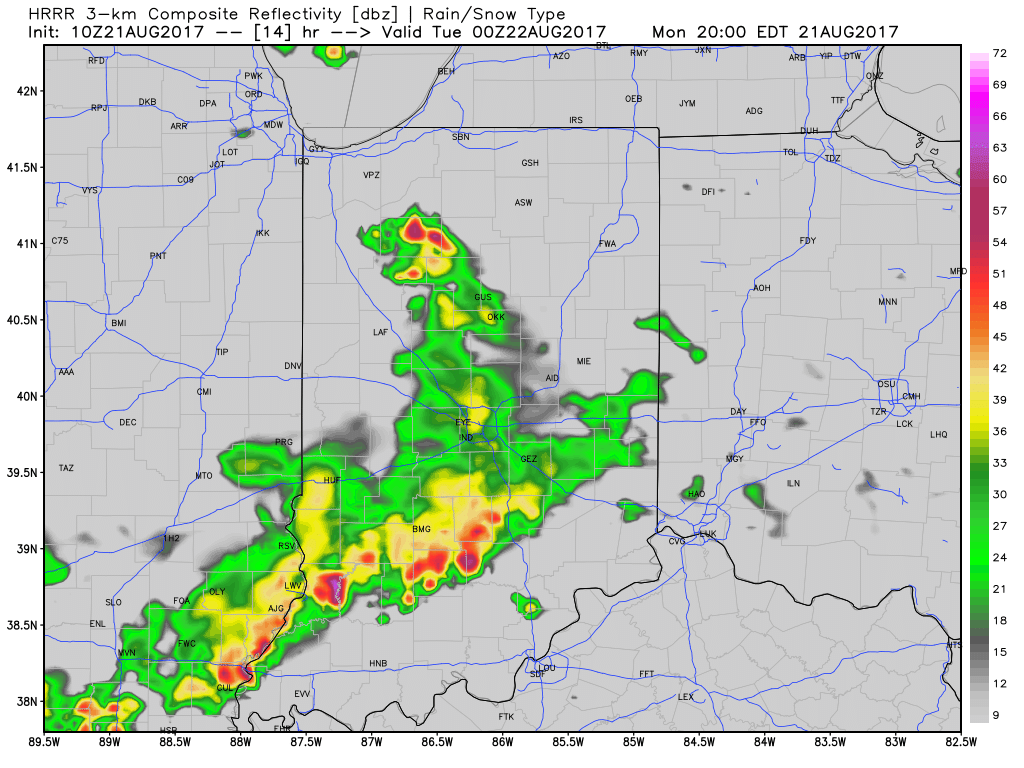 With leftover boundaries from early morning storms across northern parts of the state (likely will serve as a “trigger” for PM storm development), combined with a hot and muggy airmass, confidence is increasing on numerous showers and thunderstorms across central Indiana this afternoon and evening. Widespread heavy rain isn’t expected this afternoon, but localized hefty downpours are a good bet with precipitable water values (PWATs) approaching 2″ this afternoon.
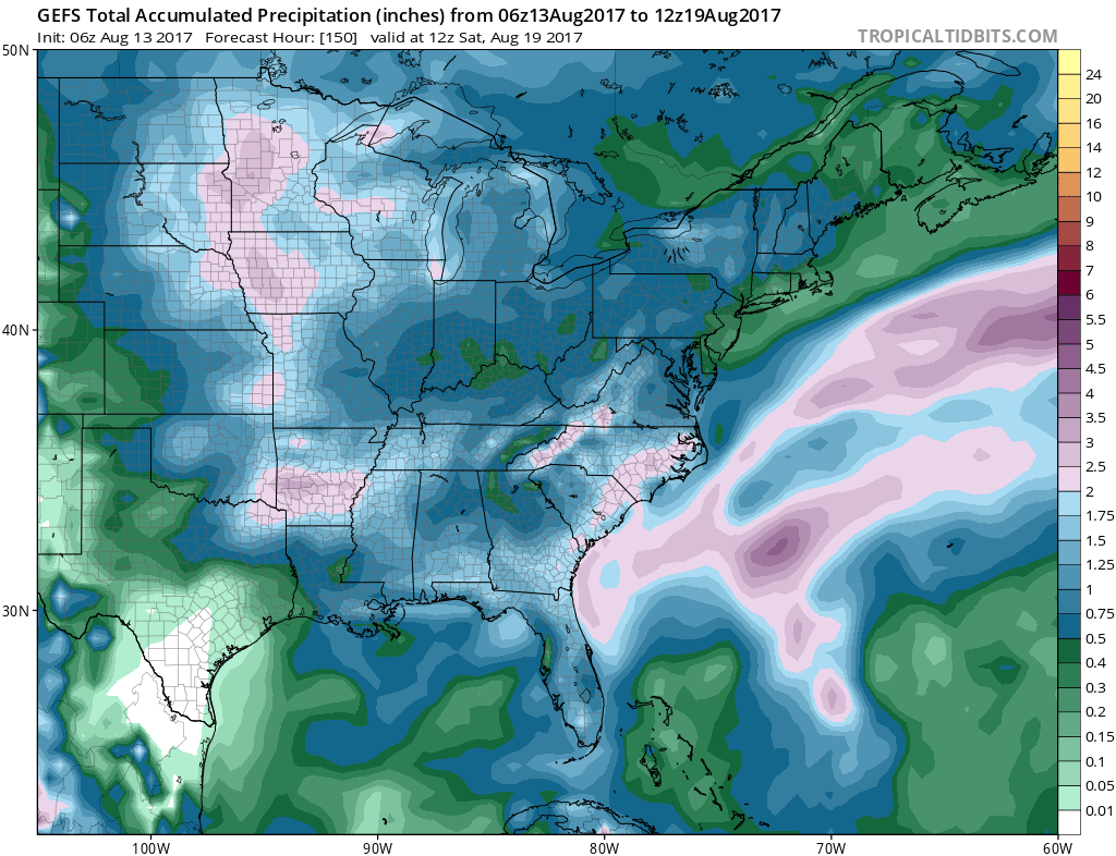
 Unsettled times remain Tuesday before a much cooler regime looms for the second half of the week…
 III. Ridging will return early next week and, though brief, a shot of late-summer heat will eject northeast across the Mid West and Ohio Valley. Sunday through Tuesday will feature temperatures that top out in the upper 80s to around 90°.
 IV. A cold front will drop in by the middle of next week. Scattered showers and thunderstorms will accompany the frontal boundary, but the bigger story will be a dramatic change to a much cooler regime as we get set to put a wrap on the month of August. In fact, temperatures may grow cool enough to allow some 40s to develop across central and northern parts of the state at night. Meteorological summer sure looks like it’ll end with more of a fall-like feel…
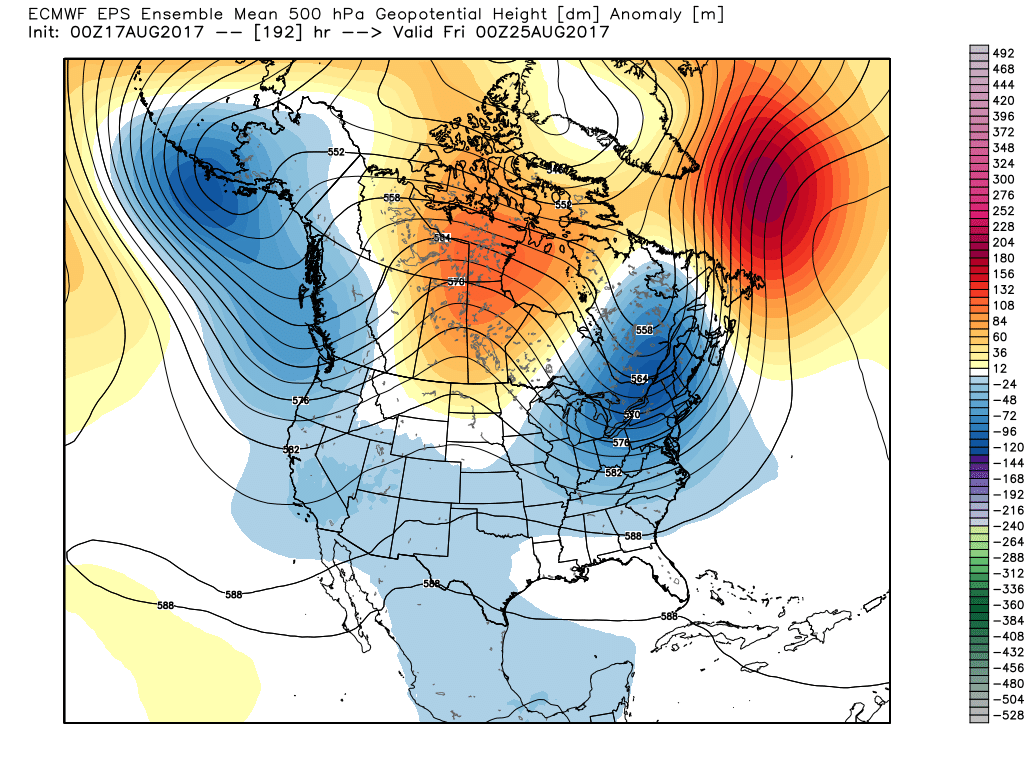
 As of now, we think the cold front will pass Friday evening and set-up another pleasant weekend with seasonable temperatures. The stretch of gorgeous August weekends’ appears to roll along.