
I. Drier air will work into the region and limit rain chances today and Wednesday (isolated coverage at best). Highs will also warm back up to seasonal levels during the time.
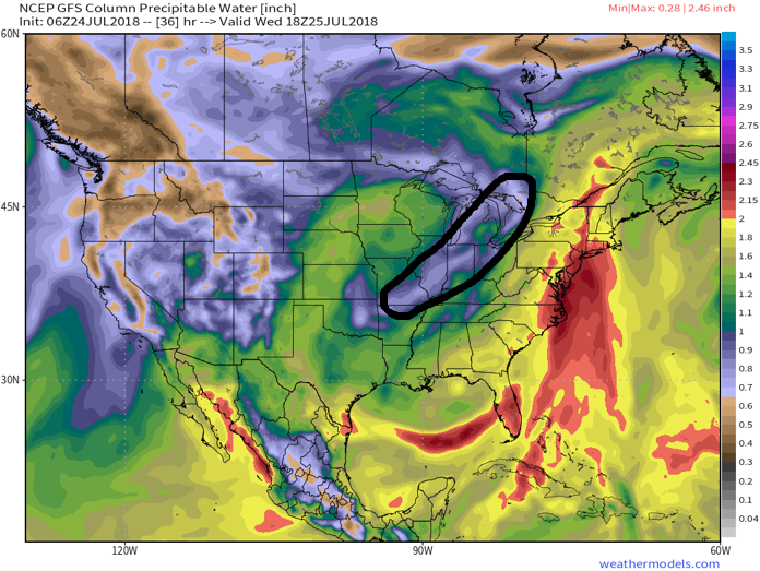
Drier air will work into the Ohio Valley today and Wednesday. Image courtesy of weathermodels.com.
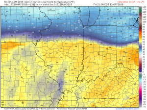
II. Our next frontal boundary will arrive Thursday afternoon. Scattered showers and a few thunderstorms are expected ahead of the front during the afternoon and evening hours. Behind the boundary, cooler and refreshing air will return to wrap up the work week.
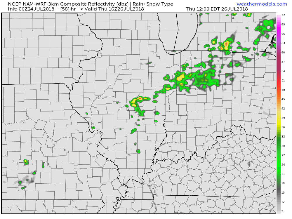

Cooler, more refreshing air will return to wrap up the work week. Image courtesy of weathermodels.com.
III. We’re timing out our next storm system for a weekend arrival. While the weekend won’t be a wash out, rain chances will return late Saturday into Sunday. Forecast models differ on the specifics with respect to timing, track, and rainfall amounts and all will have to be fine tuned over the next few days.
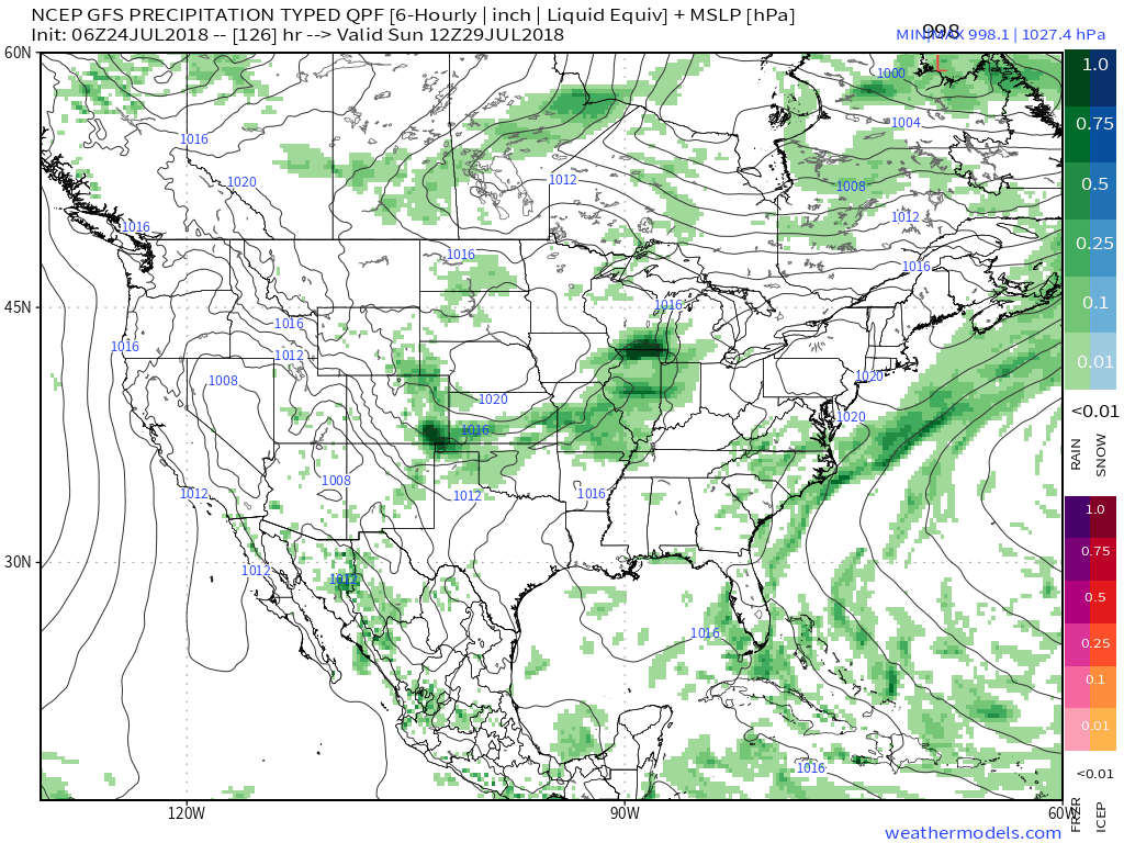
The GFS is faster and more aggressive on weekend rain. Image courtesy of weathermodels.com.

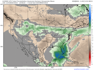
Meanwhile, the European is slower with rain, bringing the bulk of precipitation in AFTER the weekend. Image courtesy of weathermodels.com.
IV. Longer range, we don’t see any significant heat on the immediate horizon. On that note, while we aren’t saying additional hot days won’t occur the rest of the way in, we continue to believe the hottest weather of the summer is behind us. The new European Weeklies in last night continued a seasonal to cooler than average theme for August into early September. All images below are courtesy of weathermodels.com.
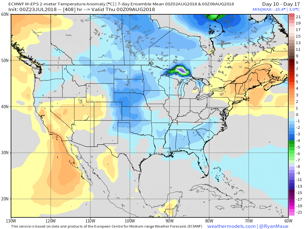
Days 10-17

Days 18-25

Days 25-32

Days 32-39
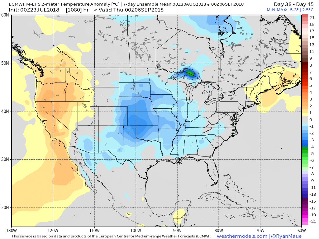
Days 38-45
 In addition to a wetter pattern, we would also want to pay attention to the potential of a gusty storm complex or two riding southeast around the hot dome off to our southwest.
 In closing, the JMA Weeklies led the charge in the idea of more active times returning in June, and the combination of GFS and European ensemble data suggests they had merit. With the added bonus of having the MJO on our side, it’ll be hard to avoid a change of the guard towards an overall wetter pattern in the weeks ahead. Perhaps Alberto’s remnant moisture is only the beginning…
 2.) Sunshine will develop as the day progresses Friday and we’ll notice an increasingly muggy feel through the afternoon and evening. A true taste of summer can be expected as we put a wrap on the work week, including highs in the middle 80s and dew points climbing into the mid and upper 60s.
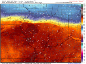
 Also note the tight temperature gradient across the state. That temperature gradient will serve as the focal point between a mostly dry central Indiana through the first half of the weekend and “busier” times across northern parts of the state into the southern Great Lakes region. Locally heavy rain will fall at times with storms for our friends “up north!” We’ll remain very summer-like here into next week.
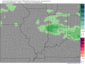 4.) The balance of next week will run significantly warmer than normal and feature an almost daily threat of showers and thunderstorms. While there will be some “haves and have nots,” most area rain gauges should accumulate 1″ to 2″ of rain by the end of next week.

 5.) Speaking of rain, the new European Weeklies in tonight, courtesy of weathermodels.com, also point towards wetter times in our future. This is encouraging as it supports the going idea shown this morning from the JMA Weeklies, CFSv2 Weeklies, and GEFS. Needless to say, despite the recent dry shift, we’re not concerned for long term moisture issues (or lack thereof ;-)).