Mild And Relatively Quiet Week Before Cold Changes For Christmas…
 Highlights:
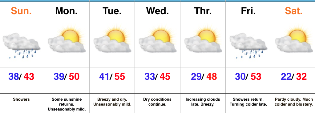
- Light showers later today
- Mostly quiet weather week awaits
- Much colder as Christmas nears
Sunday Showers…A weak weather system is approaching the state as we type this forecast update. That system will deliver light showers through the afternoon hours, but this won’t be a major weather event by any stretch of the imagination- more of a nuisance than anything.
Our next “event” will come Tuesday night in the form of a dry frontal passage. This will trend us cooler Wednesday, but still above seasonal norms. Quiet times will persist with sunshine through midweek, allowing last minute shoppers (no finger pointing here :-)) to at least not have any weather worries as they finish checking off the list!
A more significant cold front will approach as we close the work week. This will provide showers and gusty winds, followed by a colder feel late in the day.
Looking ahead towards Christmas Eve and Christmas Day, confidence continues to remain high on a much colder pattern taking hold. However, it’s purely speculative at this point whether we’ll be enjoying “white” for the big day. Stay tuned.
Upcoming 7-Day Precipitation Forecast:
- Snowfall: 0.00″
- Rainfall: 0.20″ – 0.40″
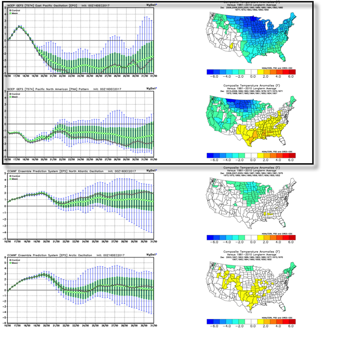 As we’d expect, as these two fight it out, a battle will ensue across the central and eventually eastern portion of the country. The negative EPO is a widespread cold pattern, while a negative PNA favors south-central and southeastern ridging (a warmer pattern).
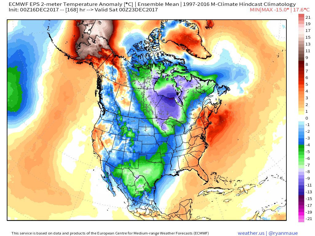
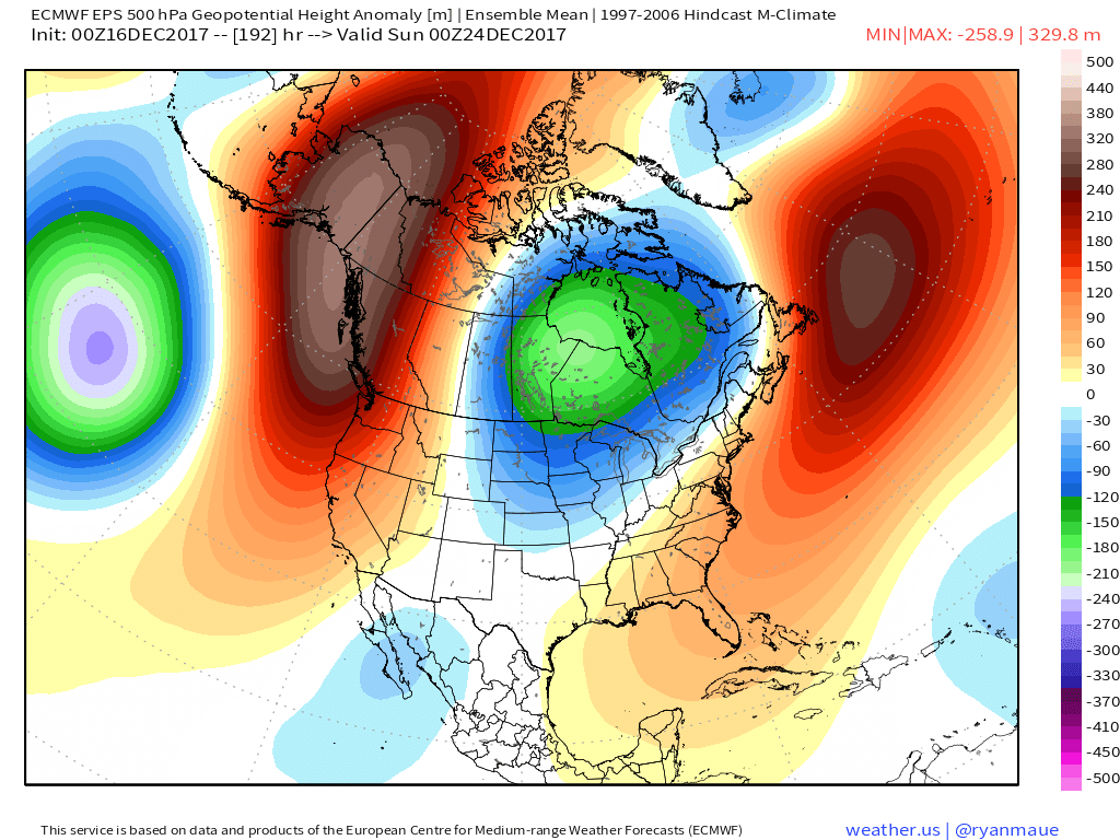 Eventually, we expect the deeply negative EPO to take control and overwhelm the pattern with cold. However, as this transition of power takes place, the negative PNA won’t go down without a fight and will likely play a role in the weather leading up to Christmas.
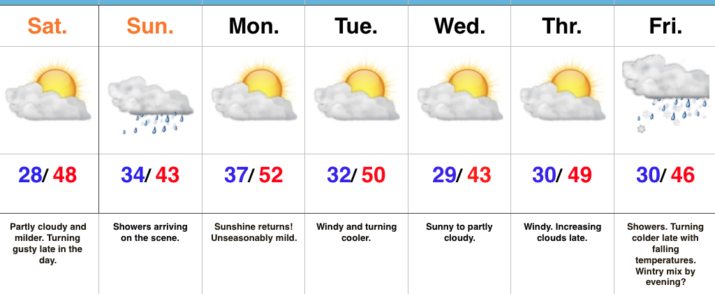 Highlights:
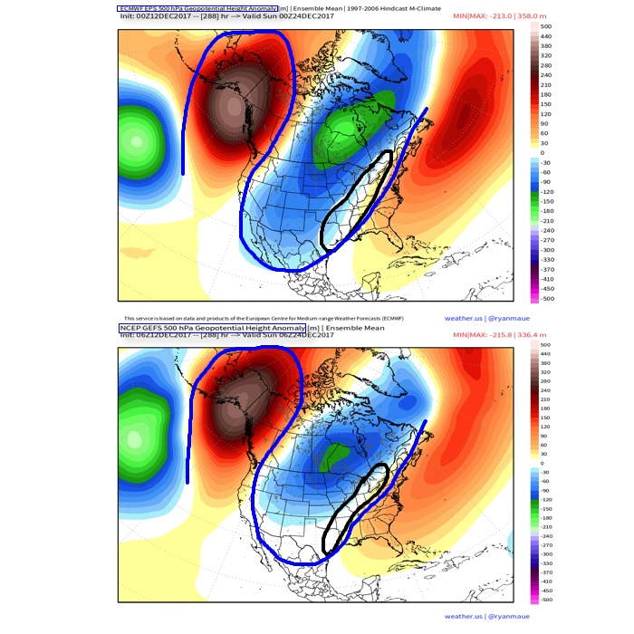
 III. A period of brief moderation will come in this pattern early Christmas week, but all eyes continue to focus on the period between December 22nd through December 26th for the potential of impactful weather across our region. For model “worshipers” out there, we suggest paying more attention to overall trends, and a blend of ensemble data, as opposed to specifics associated with operational runs. It’s a “jailbreak” pattern of sorts as true arctic air will be pouring down the Plains while the southeastern ridge tries to fight for a time. The resistance from the southeastern ridge and associated tight thermal gradient should promote a very stormy regime for the interior (Ohio Valley into the interior northeast) as we head into the true holiday/ Christmas stretch. As of now, we favor the idea of multiple waves along the pressing arctic boundary, as opposed to one big storm. Looking back through the records shows some of the heaviest snows at IND have come from similar set-ups. Understanding each set-up is unique, the overall pattern does have to raise an eye brow for potential of wintry weather in, or around, our region as Christmas approaches…