“It’s Beginning To Look A Lot Like Christmas…”
 Highlights:
- Wet snow today
- New snow maker for Christmas Eve
- Turning bitterly cold
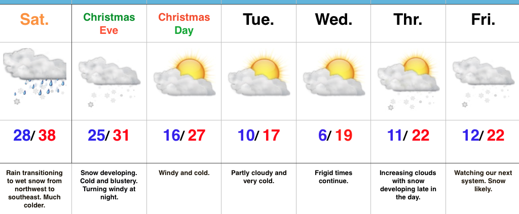
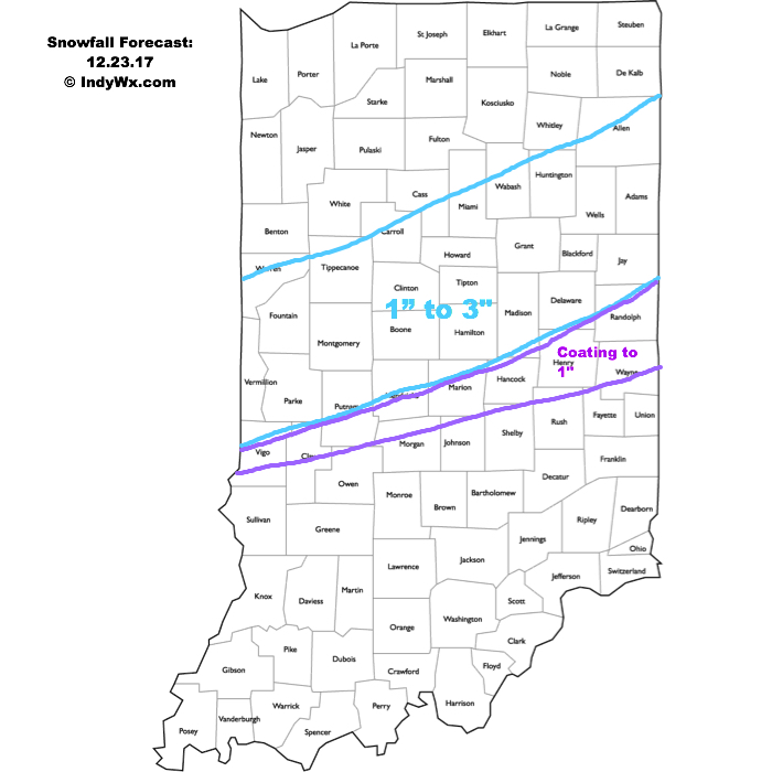
Festive Forecast…Rain changed to wet snow for northwestern ‘burbs between 4a-5a and the transition from wet to white will continue to progress southeast through the morning. A period of heavy, wet snow will fall through mid and late morning before precipitation begins to taper off. Our going snowfall forecast from yesterday continues to work with this event (for most it’s a slushy coating to 1″ in and around Indianapolis, increasing to a couple inches north). We experienced our high temperature for the day shortly after midnight.
Attention will then quickly shift to a new snow maker arriving Christmas Eve. The day will start dry, but snow will quickly develop as we progress into the afternoon. At times, snow will come down at a moderate clip and provide a classic setting for your festivities tomorrow evening. (We’ll have a fresh discussion posted later this afternoon for this event). Travel safely and leave extra time to reach your destination, as snow will accumulate on roadways. Additionally, we’ll add wind into the mix tomorrow night into Christmas Day with fresh cold air advection.
Speaking of Christmas, if you’re anticipating Santa to deliver outdoor gifts, you’ll want to plan to bundle up as you head out to enjoy the new toys. It’ll be a dry, but very cold Christmas.
Cold will remain the weather word to sum up next week and we’ll target the end of next week for the potential next winter event. It’s a busy, fun pattern if you like winter!
Upcoming 7-Day Precipitation Forecast:
- Snowfall: 3″ – 5″
- Rainfall: 0.00″
 A more widespread, “uniform” (easier to forecast, as well :-)) snow event will arrive Christmas Eve. Upper level energy will cross the Ohio Valley and combine with arctic air in place to maximize moisture production. We expect an expanding area of snow to encompass most of the state Christmas Eve, likely becoming most widespread Christmas Eve afternoon. With cold air in place, roads will likely get slick in spots so plan accordingly with your travels.
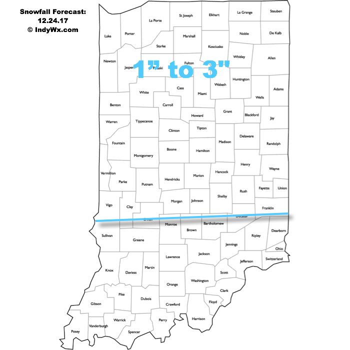 The hits keep coming as we progress into next week. An additional accumulating snow event may arrive Christmas night into Tuesday, followed by a more widespread and potentially major event late next week…
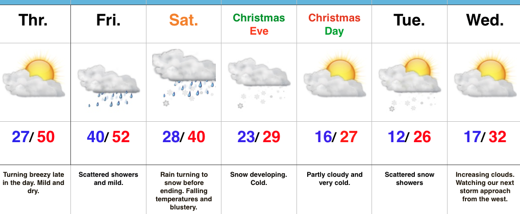 Highlights:
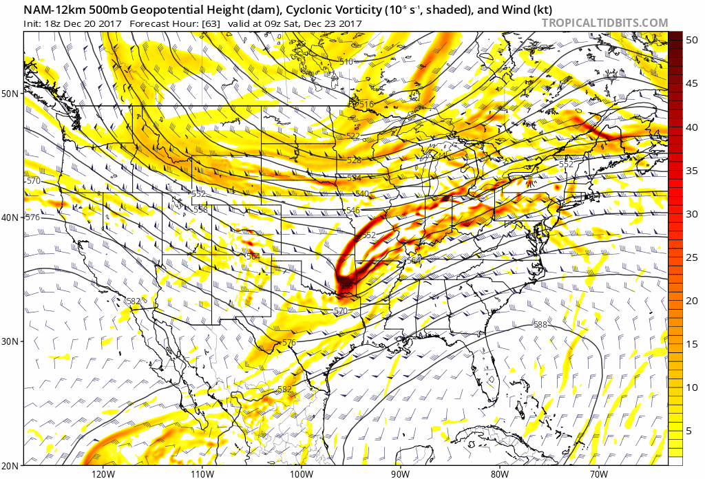 II.) Additional upper level energy will rotate across the Ohio Valley Christmas Eve and this, combined with arctic air pushing into the region, should maximize moisture production and lead to a period of snow and snow showers Christmas Eve afternoon into early Christmas Day. This energy should feature some Christmas “magic” and be enough to provide a more widespread light accumulation across the region (when compared to Saturday).
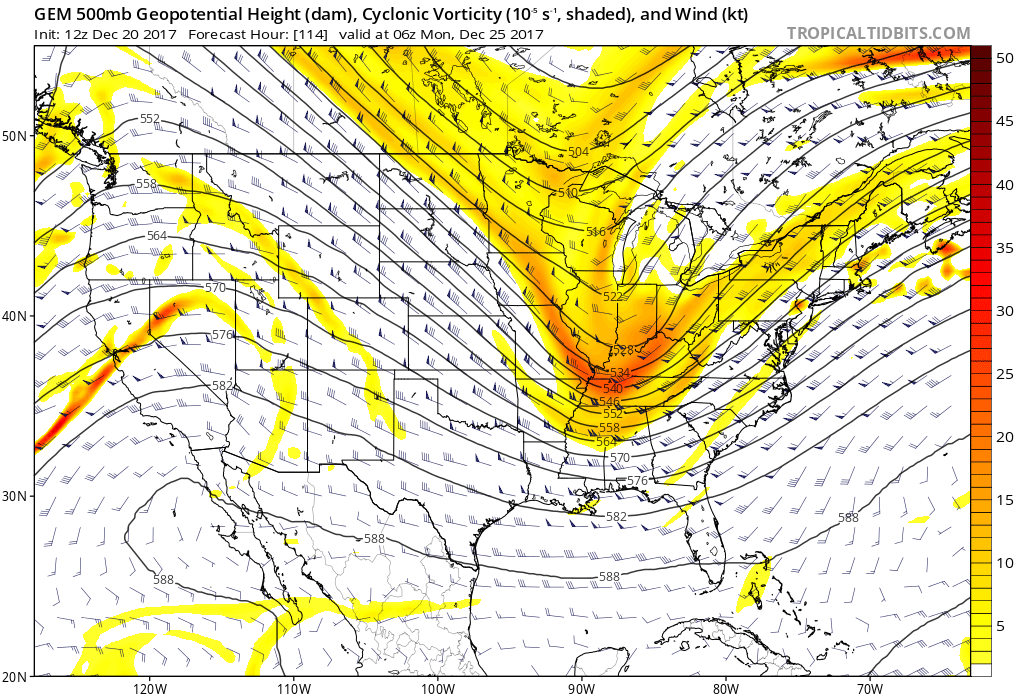 III.) As we look forward to middle and latter parts of next week, the pattern screams potential is on the table for a more widespread, significant winter storm (Plains to the Northeast). While obviously early on in the game, the overall pattern does back up the idea presented by modeling.