
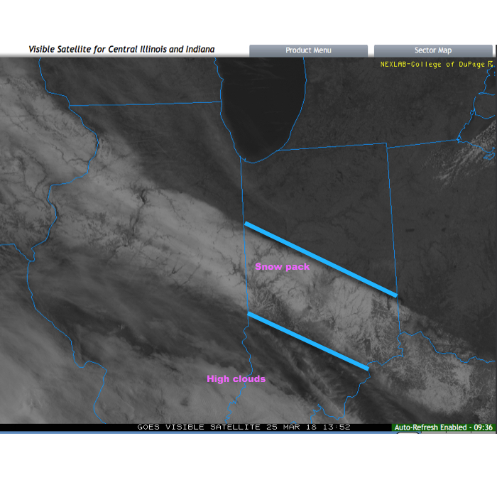
Before we discuss some of what has our attention as we move through the next couple of weeks, check out this cool visible satellite image from this morning. The snowpack shows up nicely. It’s also neat to see the high resolution modeling understand where that snow pack is and the associated cooler forecast highs compared to areas south and north that didn’t see the heavy snow Saturday.
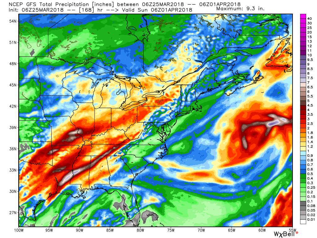
 As we look ahead, a wet week is in store for the region. Periods of widespread rain, heavy at times, will come at us in waves:
- Monday evening-Tuesday
- Thursday
- Next weekend, including Easter
When totaled up, widespread 2″ totals can be expected, with locally heavier amounts.
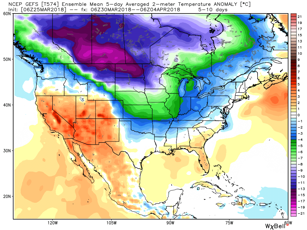
 After a brief relaxation in the unseasonably cold regime, well below average temperatures are expected to return as we move through early April. It’ll feel more like winter than spring through the better part of the first half of the month.
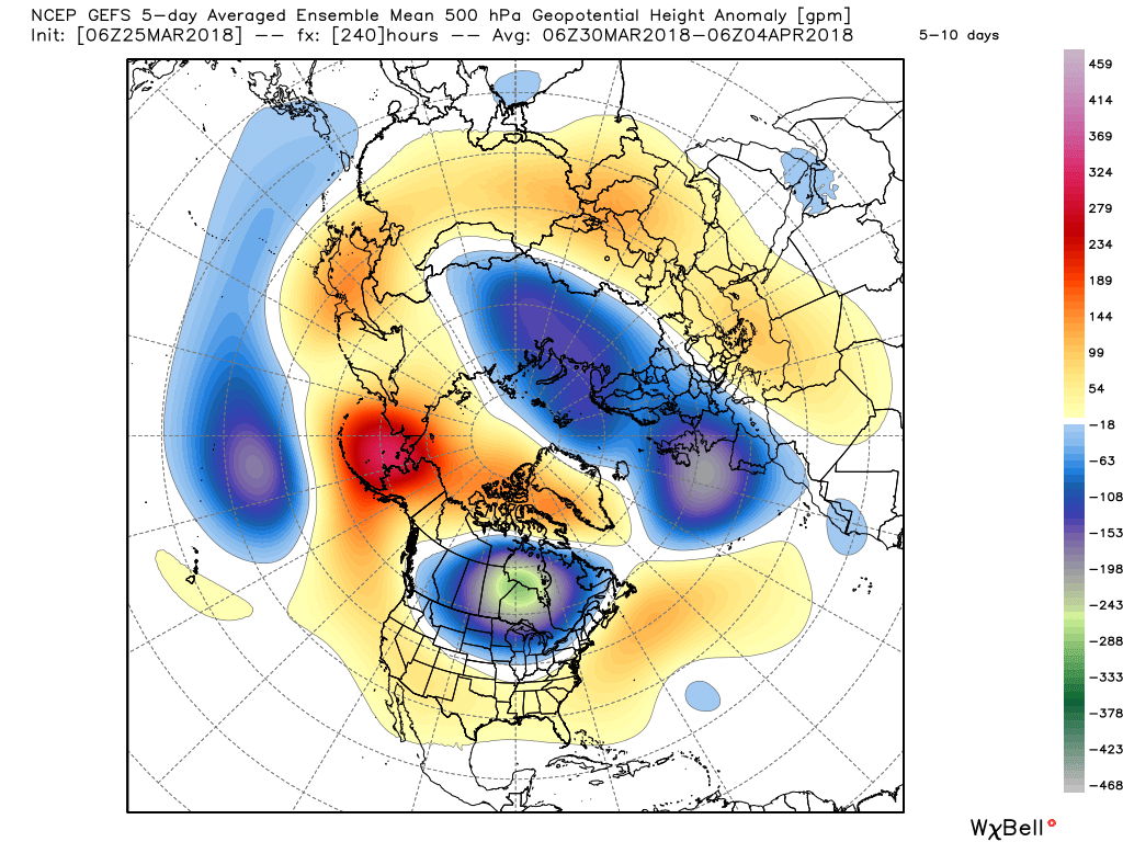
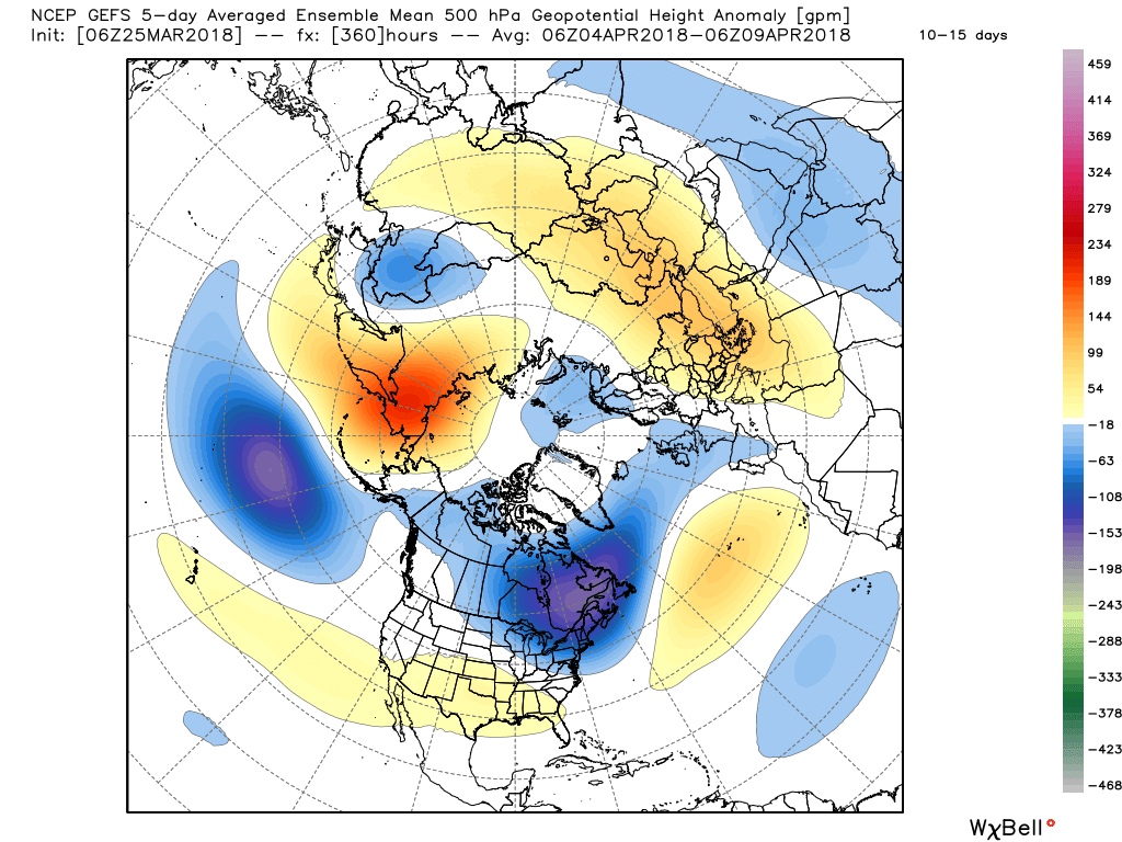
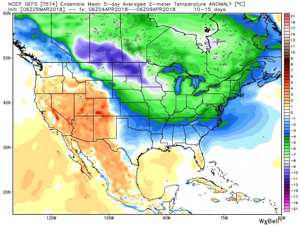 It’s also too early to think about yesterday as the last snow of the season. Given the early April look, it wouldn’t surprise us if an additional snow event or two came along…
(As a reminder, you can always catch our most up-to-date 7-day forecast in the top left of the homepage).
 Steadiest rains will fall across the northern third of the state Tuesday with scattered downpours through the morning and afternoon hours across central Indiana.
 After a quieter time of things most of Thursday, we’re tracking three additional waves of moisture Friday and through the weekend. At times, rain will be heavy, and we’ll certainly have to be on guard for water rise and increasing flooding issues as the weekend arrives.
 By the time all is set and done Monday morning, we forecast additional widespread 3.5″ to 5″ rainfall totals with locally heavier amounts.
 II. We’re hopeful for much needed sunshine Sunday as we’ll be in between storm systems, however any sun that we see won’t last long.
 While this is an unseasonably warm pattern (we forecast highs of 50°, or above, 5 out of 7 of the upcoming days, and at least 2 60°+ days), it’s one that will likely result in periods of heavy rain not only next week, but in waves over the upcoming 10 days.
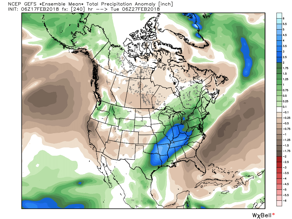 Widespread 10-day rainfall numbers of 3″ to 4″ will be likely in this setup, including locally heavier amounts of 5″ to 6″ in spots. Certainly, if you live near waterways we suggest having a plan in place as it’s not a matter of if, but when flooding takes place in spots across the region with such a setup.