Summer has been dry, thus far, for central Indiana. With the last month of meteorological summer on the doorstep, will that continue?
Before we discuss further, let’s check-up on precipitation anomalies at IND (through July 28th).
- June: finished the month 0.26″ below average
- July: 2.69″ below average, month-to-date
- (This comes after a May that featured a 3.63″ deficit).
We have discussed the upcoming shift to a wetter regime that will develop Sunday into the first half of next week. A Saturday evening update continues to point towards increasing rain chances arriving as we rumble into Sunday evening. As expected, this morning’s high resolution NAM was likely a bit too excited on the initial wave of moisture and has come around to a “more realistic” idea in our opinion.
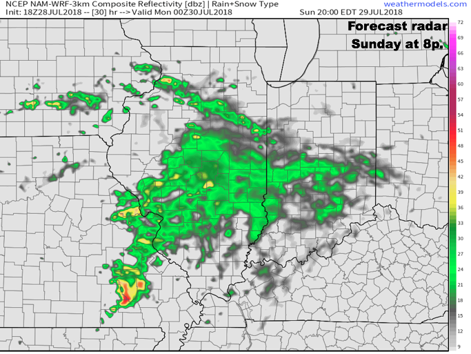 Rain and embedded thunder will likely be rather widespread early Monday, especially across the southern half of the state.
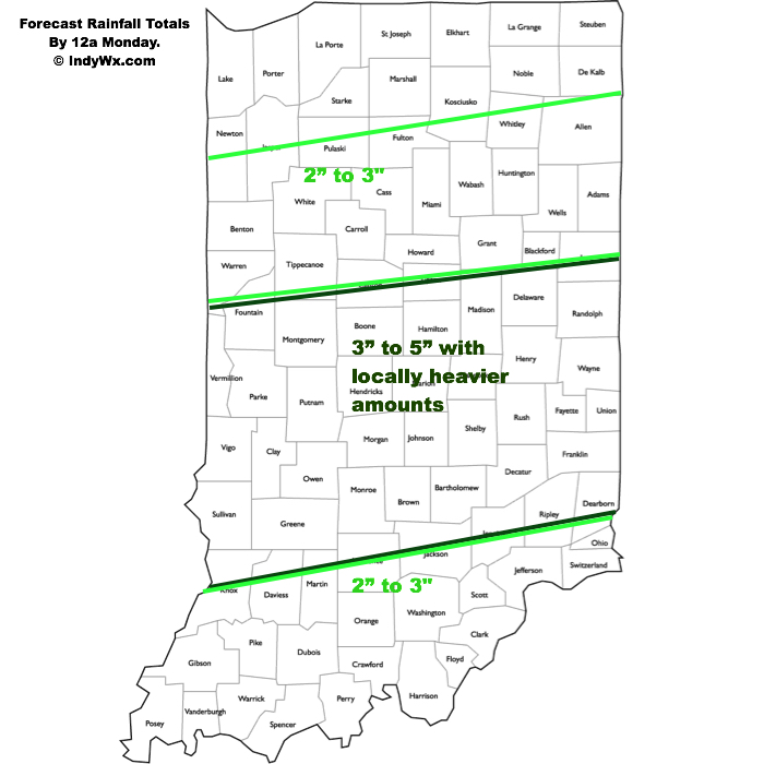
 Data continues to point towards the greatest coverage of rainfall arriving Monday night and Tuesday. We still expect a widespread 1″ to 2″ rain for central Indiana before things begin to wind down mid to late week. There will be locally heavier totals.
As we look ahead, we think the balance of the month of August will feature an upper ridge across the western portion of the country that will keep our immediate region in an active northwesterly flow aloft. Perhaps the GEFS is seeing this best at the moment (important to note the model has been consistent with respect to run-to-run updates as of late). This is a wet signal this time of year…
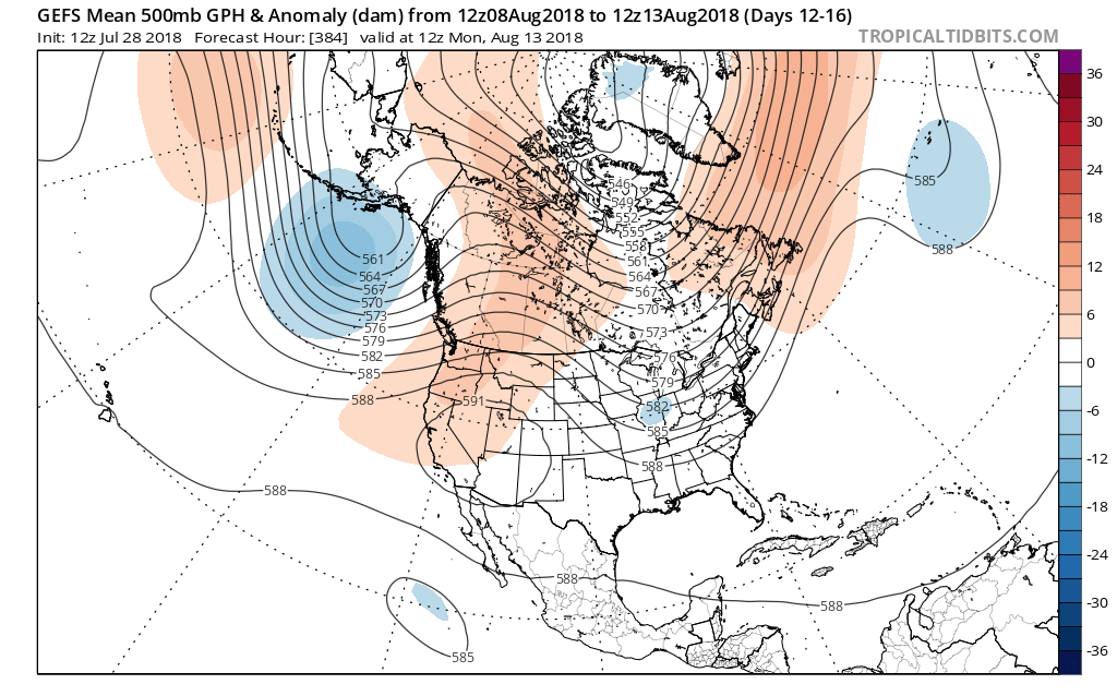
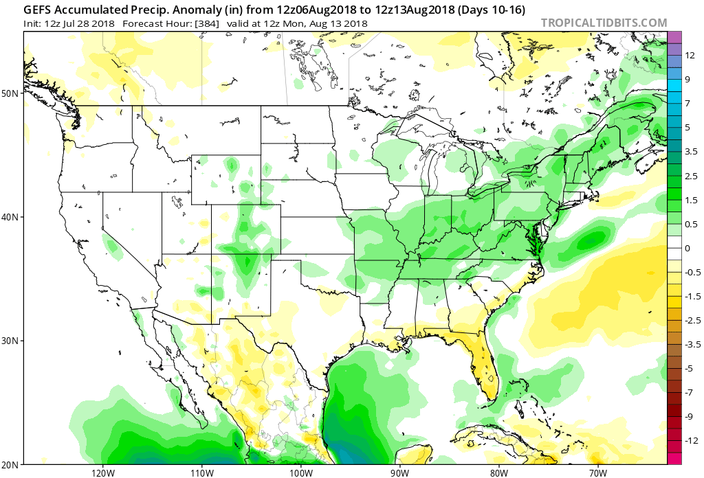 The model has support of a return to wetter times as noted from the latest JMA Weeklies, CFSv2, and European ensemble.
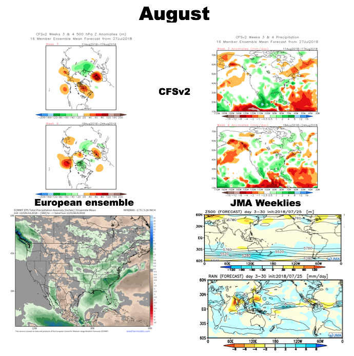 While the cool will relax as we rumble past the first couple days of the month (we’re in the “dog days” after all), I still think the worst of the heat is over for the summer and the headline for August will likely be a situation where we begin to make up for lost time in the precipitation department. That upper ridge centered to our west in the means will likely result in a continuation of rather active times from a precipitation perspective through the month and our idea is that we finish August with above normal precipitation across central Indiana for the first time since April…
 II.) After a windy and warm Wednesday, scattered showers and thunderstorms will return Thursday. Not everyone will get wet, but a few locally heavy downpours can be expected.
 III.) The ridge will “flex its muscle” into early and middle parts of next week and promote an extended (and unusual) stretch of 80s. Don’t put those shorts away just yet…
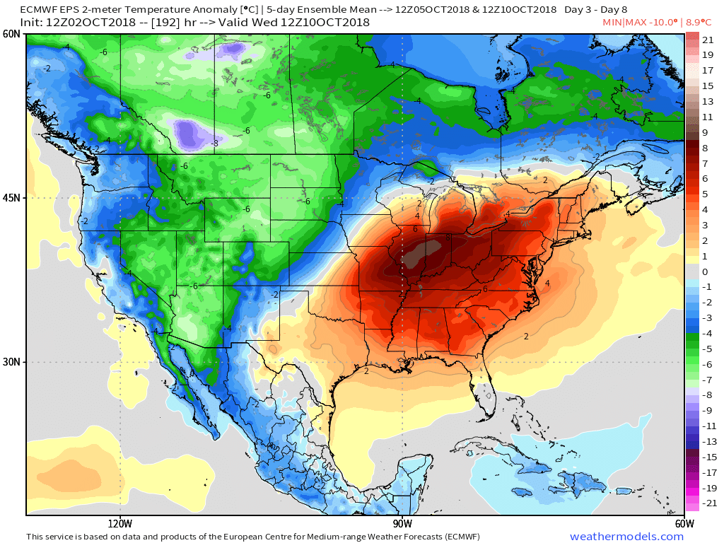 IV.) A “game changer” of a cold front will approach late next week with better chances of organized rain and storms followed by a return of more seasonal times…
 V.) Ingredients are in place for a significant shift in the pattern around the middle of October and colder times continue to look like they will return as we flip the page into Weeks 2-3.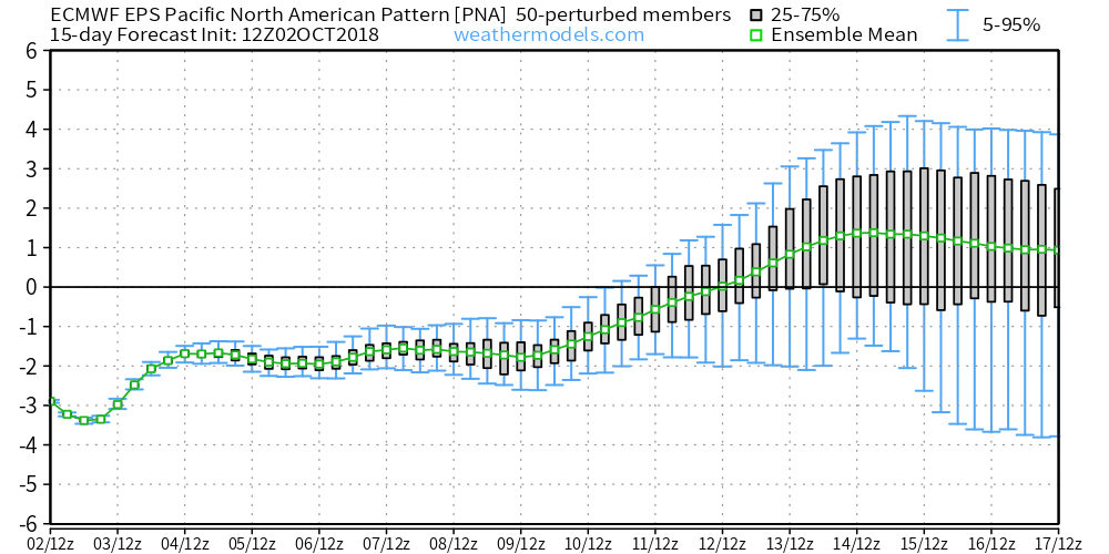
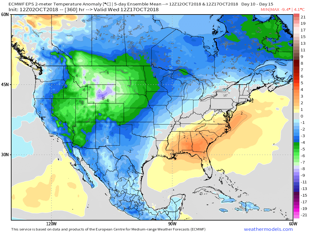
 The culprit? A persistent strong eastern ridge (the same ridge that trapped Florence across the Carolinas after she made landfall).
 A positive PNA typically leads to an eastern trough- especially during the fall months into the spring. Something like this kind of upper level pattern usually results.
 Sure enough, the models are going to this look.
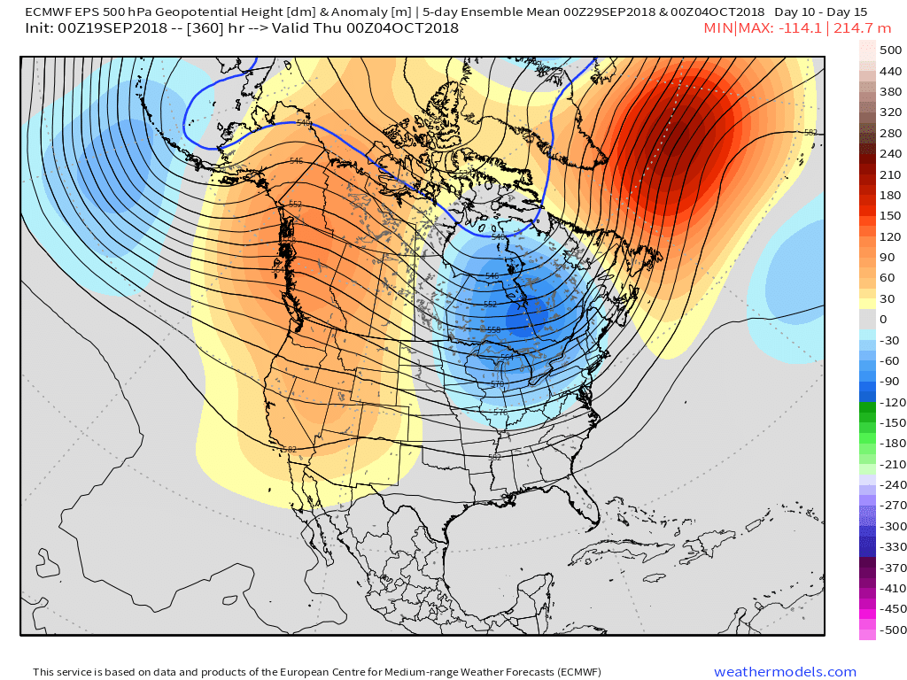 At the surface, the eastern warmth is reversed in a significant fashion with well below average temperatures. In fact, temperatures will grow cold enough to support high ground snow in the Rockies and northern Great Lakes and the threat of an early frost into the upper Mid West and perhaps portions of the Ohio Valley during the period.
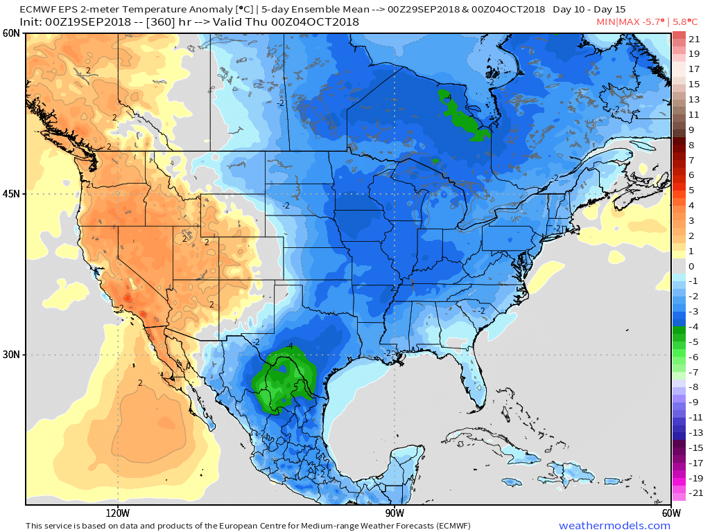 Ah, true pumpkin spice season is right around the corner. 😉
 I. Slow-moving showers and thunderstorms will begin to dissipate this evening and tonight with the loss of daytime heating. Some area rain gauges have already picked up between 0.50″ and 1″ of rain this afternoon and this will only serve to lay the ground work for further problems moving forward.