Category: AG Report

Timing Arrival Of Our Late Month Storm Systems…

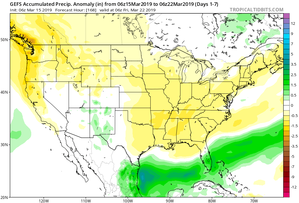
A beautiful open to the weekend awaits and while we’re currently enjoying calmer times, we wanted to go ahead and time out the arrival of storm systems as we move through next week and the end of March.

Sunday, 3.24.19 into Monday, 3.25.19

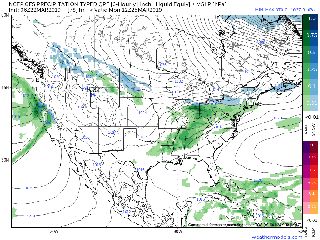
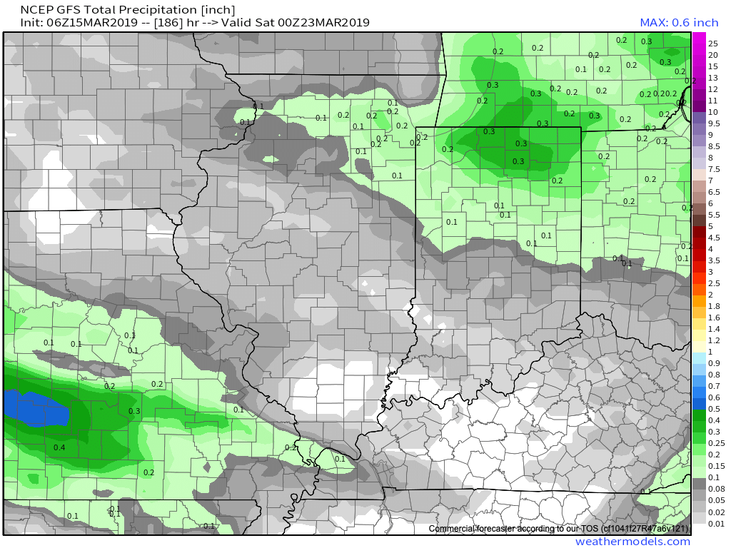
Clouds will increase Saturday night and precipitation will follow Sunday in the form of light rain that will continue into Monday. As colder air presses south, rain may mix with or change to light snow across northern areas before ending, but this doesn’t appear to be a major deal (more of a nuisance than anything else). Rainfall totals around half an inch on average can be expected with this system before drier air arrives (and sunshine) Tuesday.

Thursday, 3.28.19 into Saturday, 3.30.19

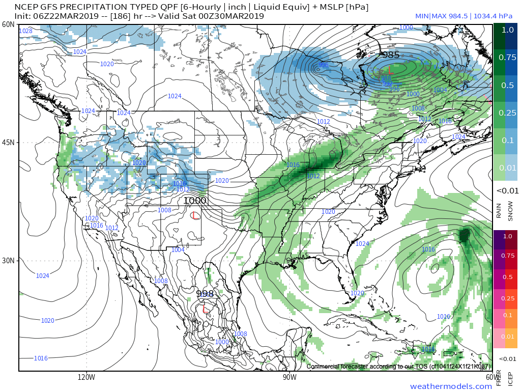
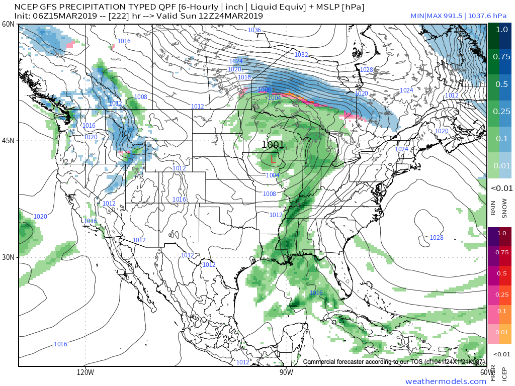
After a drier stretch of weather the middle of next week, rain will return Thursday evening into early next weekend. There are differences with the way models handle the frontal passage next weekend (couple of solutions stall the front to our south and bring another wave of moisture up along the boundary that would potentially lead to renewed wet conditions next Sunday into next Monday). The early call here is that this system will have more moisture to work with than it’s predecessor.

Yet another storm system will approach the middle parts of Week 2.

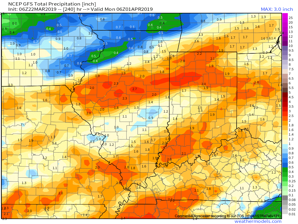
Current projected rainfall totals off of the latest GFS forecast model look decent from this distance over the upcoming (10) days.

Permanent link to this article: https://indywx.com/timing-arrival-of-our-late-month-storm-systems/

Quiet Pattern Turns Much More Active As We Close March…

This week is about as boring as it gets around these parts in mid to late March. With the active pattern as of late, we’ll gladly take it.

While we have a weak system that will deliver raw conditions and light rain Wednesday (touch of light snow and, or sleet across northern and east-central Indiana), that’s about it for “excitement” between now and early next week. High pressure will return as we get set to close the work week and head into the weekend, along with increasing sunshine and moderating temperatures. We still forecast highs to reach the 50s Thursday and Friday and 60s over the weekend.

It’d be wise to enjoy the “lull” in the action now, as things turn much more active as we flip the page forward to Week 2.

First up, in what will be a series of storm systems to impact the area as we close March and open April, will be a coast-to-coast storm that tracks east during the early portions of the Week 2 time frame. More specific to our area, this would likely be a system that begins to impact central Indiana during the early to middle parts of next week.

We’ve highlighted a couple of the items that have our attention, and if they come to fruition, will result in one more wintry “setback” before we say spring has officially sprung.

This is a bullish signal for an ominous spring storm, including the risk of severe weather to the south of the storm’s track and late season wintry potential to the north. It’s, obviously, far too early to get specific with this event, but it’s worth keeping a close eye on. Note that as the surface low (SL) is tracking east, a late season arctic high is pegged to be dropping southeast.

By the time we get to the middle of next Tuesday, the surface low is deepening across the TN Valley region. Despite the strong high nosing into New England, I’d expect a northward trend in the system as time gets closer, especially considering we’ll be in late March by this time. Stay tuned.

Thereafter, the pattern is set to remain quite active as we head into the 4th month of the year (2019 is flying by already). Buckle up; the well deserved quiet times now won’t last much longer…

By the way, despite what may be one last push of wintry conditions early next week, data remains in excellent agreement of a significant warmup as we flip the page to April. We continue to believe the month, overall, will average above normal in the temperature department.

Permanent link to this article: https://indywx.com/quiet-pattern-turns-much-more-active-as-we-close-march/

Now We’re Talking…

Meteorological Spring has gotten off to a cold start- to the tune of nearly 5 degrees below average at IND through 3/15.

Note the brutal cold across the Northern Plains and Rockies.

The upcoming week will feature a positive PNA pattern and associated cooler than average theme to open, before beginning to moderate mid-to-late in the work week.

That said, time is limited on the chilly pattern and an overall significant shift to more of a sustained spring-like pattern awaits to close March and as we head into April.

Note the warmth that follows:

This will result in many more days in the 60s and 70s as we put a wrap on March and open April.

While weak systems will continue to impact the area (tomorrow, Wednesday, and again next Sunday), the deeper, moisture-laden storms will take a “backseat” during the fast-moving northwest flow. That begins to change during the last few days of the month and on into April. The latest ensemble guidance sees the return of a more active pattern, likely complete with heavier rain events and the potential of stronger storms.

Permanent link to this article: https://indywx.com/now-were-talking-4/

Cooler, “Calmer” Weather Pattern Into Next Week…

Out the door, it feels much colder when compared to this time yesterday.

Temperatures will continue to fall through the day today, and eventually turn cold enough for a little wet snow to mix with the leftover showers this afternoon- especially from the city and points north.

Looking ahead, after a dry Saturday, an upper level disturbance will dive southeast and lead to a mixture of rain and snow across the northern half of the state. Across northern Indiana, mostly snow is expected- where a light, slushy accumulation is possible.

Thereafter, high pressure will build in for early portions of the new week, supplying dry and chilly conditions.

It’s not until late next weekend when the next weather system of significance begins to impact the region with rain.

Overall, the upcoming (7) days will run cooler than average and drier than average for a large portion of the region from the Northern Plains into the eastern portion of the country. After the “bumpy” past few days, we’ll certainly enjoy the overall calmer period.

7-day precipitation numbers are paltry to say the least (on average only expecting around 1/10 of an inch of liquid for central Indiana). Most of what’s painted below is what is expected to fall with this Sunday’s system.

Permanent link to this article: https://indywx.com/cooler-calmer-weather-pattern-into-next-week/

Long Range Update: Cool “Set Back” Doesn’t Last; Looking Ahead To April…

You must be logged in to view this content. Click Here to become a member of IndyWX.com for full access.  Already a member of IndyWx.com All-Access?  Log-in here.

Permanent link to this article: https://indywx.com/long-range-update-cool-set-back-doesnt-last-looking-ahead-to-april/