Stormy Evening Is Replaced With Cooler And Drier Air; Looking Ahead To The Busy Weekend On Deck…

A line of strong to severe thunderstorms will continue to march east across the state this evening. As has already been the case, the primary concern with this line of storms will be damaging straight line winds and the NWS has been busy issuing warnings this evening.

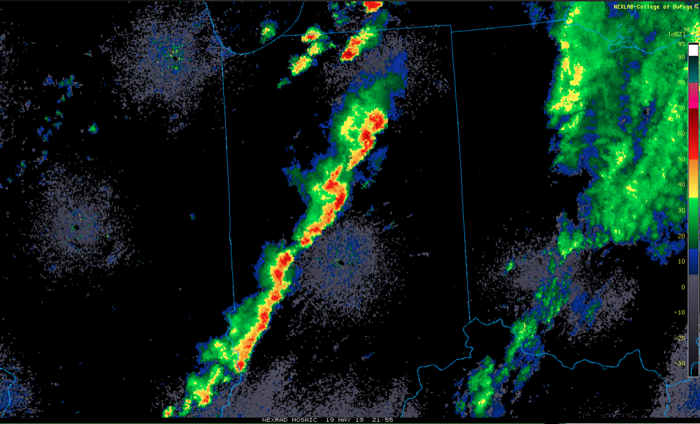
The line will pass into eastern Indiana over the next hour, or so, before weakening as it rumbles into Ohio.

Much cooler and drier air will work in overnight and you’ll certainly notice the difference out the door in the morning. Lows will fall into the lower 50s by morning. We’ll go even lower than that Tuesday morning with widespread middle 40s expected.

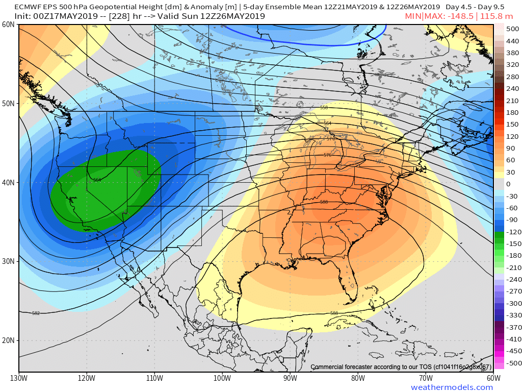
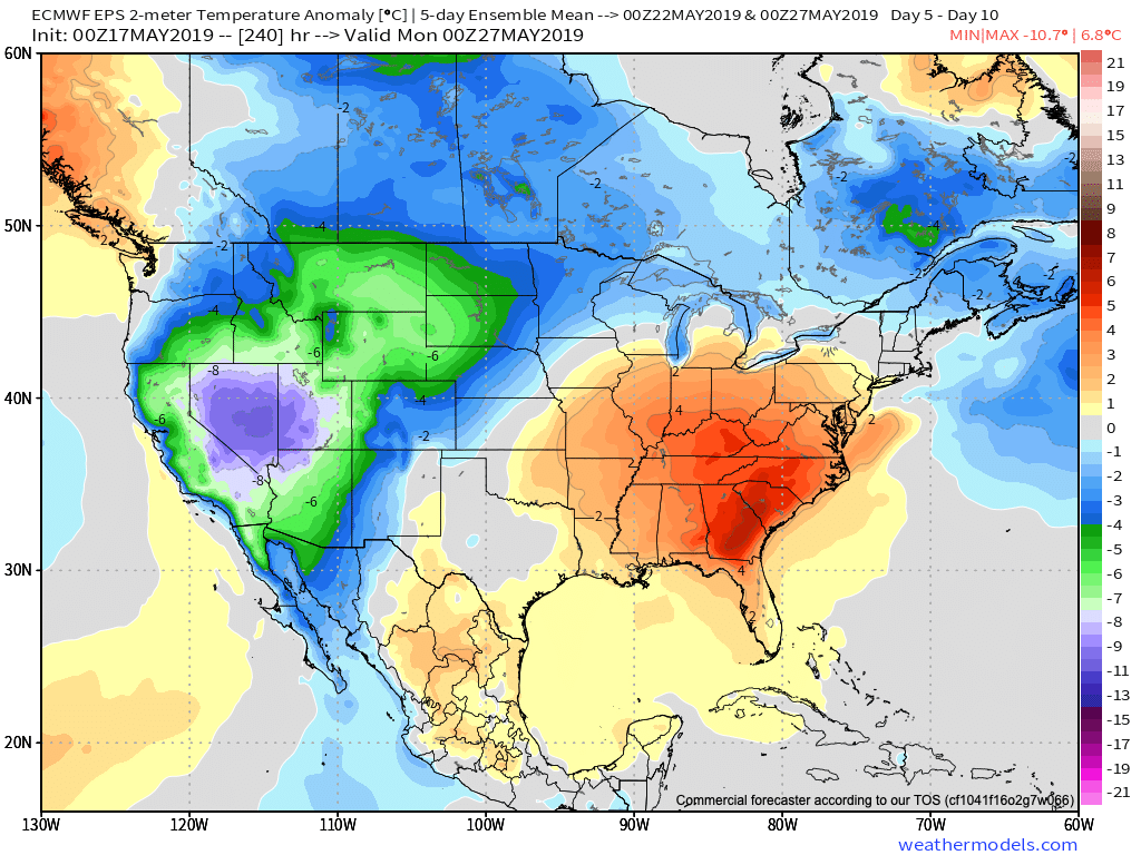
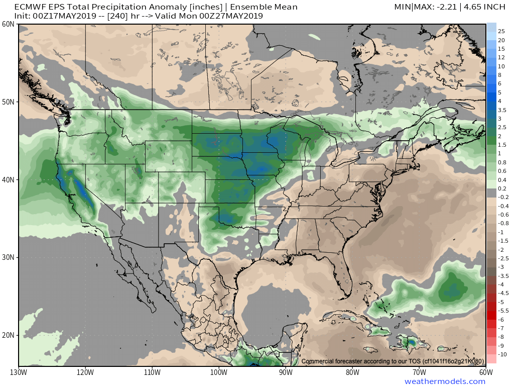
Resurgent warmth and humidity will make a return for the 2nd half of the week and with it will come that sultry feel. As a new heat ridge takes up residence across the region, storm systems will “flirt” with the area from time to time. Accordingly, we expect unsettled conditions not only for the 2nd half of the work week, but continuing into the Indy 500/ Memorial Day weekend. It certainly won’t rain and storm the entire time, but the threat for a passing storm at any time will be high.

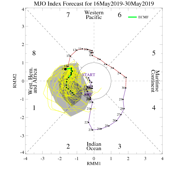
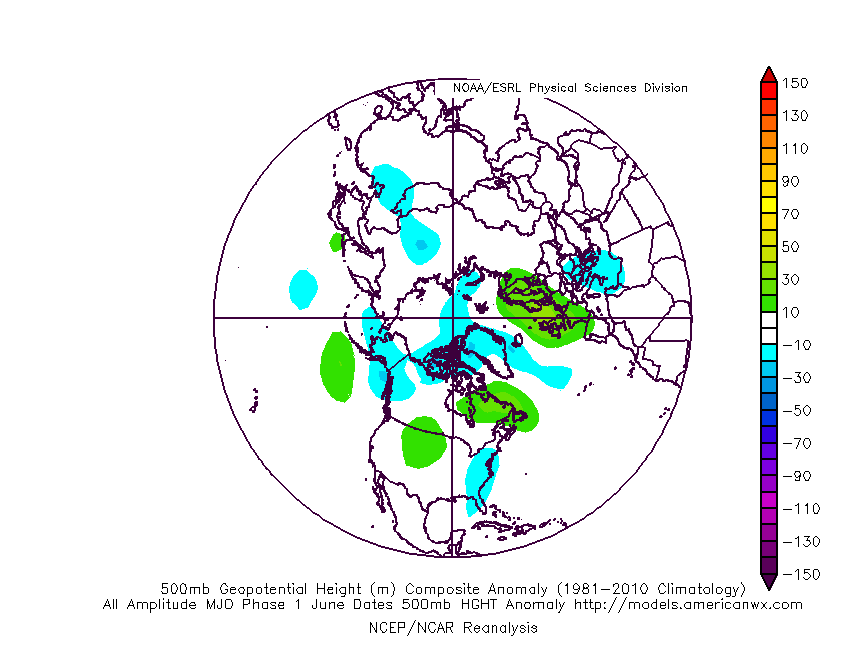
More in the morning around the pattern evolution into early-June, but we continue to believe the MJO will have it’s say and that things will transition towards an eastern trough as we put a wrap on May and open June.

Sudden “Stick And Hold” Summer? Think Again…

The upcoming couple of weeks sure will feel like summer has arrived. After “pulling teeth” to get any sort of sustained warmth, the flip to warm/ hot and humid conditions is upon us.

This kind of pattern will keep heaviest rain to our northwest, but that’s not to say we won’t deal with storm complexes from time to time that will be plenty capable of depositing a quick hefty amount of water in a short period (case in point yesterday evening).

As we look ahead, the MJO continues to look like it’ll roll right into Phase 1 as we get set to close May and open June. This should ultimately mean the eastern ridge is replaced with more troughiness (may be tough to erode the southeastern ridge- where anomalous heat will likely continue for the foreseeable future) and an associated cooler pattern as we move towards early-June across our region.

As this transition takes shape, the heaviest precipitation totals will likely shift east, including more of our immediate region, as we progress through late-May and into early June. The modeling sees this taking shape nicely.

Though we’ll likely back away from the anomalous warmth and replace things will cooler air as we move into the half-way point of the year, the same ole song and dance is expected from a precipitation perspective: wetter than average, and, at times, excessively so…

#AGwx And Weekly Severe Weather Outlook…

Forecast Period: 05.12.19 through 05.19.19

7-Day Precipitation: Rainfall is expected to run below average through the period.

7-Day Temperatures: A period of transition awaits during the week. While we’ll start significantly cooler than normal, a major warming trend will take hold late in the period. Overall, the 7-day period will run very close to average, but we get there through unseasonably chilly air giving way to a summer-like feel late in the week.

Severe Weather: A quiet period awaits from a severe perspective.

Summary: While we’ll have to deal with a couple of weak and moisture-starved systems this week, overall, we’re looking at a much quieter time of things compared to recent weeks past. Nuisance variety showers will remain today and Monday, but most rain gauges will pick up a tenth of an inch or less. Another system will deliver light showers Wednesday. Perhaps a “more exciting” system will arrive Thursday night-Friday with thunderstorms. This will come on the nose of the much warmer and more humid air surging north into the Ohio Valley. Next weekend will feel like summer around central Indiana…

#AGwx And Weekly Severe Weather Outlook…

Forecast Period: 05.05.19 through 05.12.19

7-Day Precipitation: Rainfall is expected to run above average through the period.

7-Day Temperatures: Above average temperatures are expected through the early portion of the period before things trend cooler than average by late week into next weekend.

Severe Weather: While a major, widespread severe weather outbreak isn’t expected, we’ll have to keep close eyes on Wednesday evening into Thursday as a surface low tracks into the Great Lakes and drags an associated cold front into a warm and rather muggy air mass in place. Though still several days out, the potential is present for a few strong to severe storms, including large hail and damaging wind threats.

Summary: Another active week is ahead, including a couple rounds of more widespread shower and thunderstorm activity. Most concentrated storm activity should come Wednesday evening into Thursday and feature the potential of locally heavy rainfall. Widespread rainfall this week should total 1″ to 1.5″ with locally heavier totals. The bulk of this rain will fall Wednesday into Thursday. Looking further ahead, the good news here is that high pressure looks to build in as we get set to wrap up the work week and head into next weekend, helping to supply a period of dry weather Friday and throughout the weekend. (Fingers are crossed).

Wet Pattern Not Just An OHV Problem…

Rain has been dominating the weather pattern lately. A widespread portion of the Ohio Valley is running 125% to 175% of mean over the past (30) days. More specific to central Indiana, the bulk of this fell during the back half of April.

When we broaden out the scale, we note this wet pattern isn’t just an Ohio Valley problem, but focusing the heaviest rain on the Ark-La-Tex region.

Unfortunately, when we look ahead to the upcoming couple of weeks, the pattern will continue to favor heavier than normal rainfall- not only locally, but especially centered in the area just mentioned- eastern TX, AR, and LA.

The reason behind this active and wet pattern? A persistent southeast ridge and mean trough digging into the southwest. This, combined with unseasonably cold air across the northern tier, helps set up a battle “in between” (from the s-central Plains into the Ohio Valley). Factor in the broad southwest flow aloft, and multiple disturbances will track in a southwest to northeast fashion next week, enhancing rain intensity and coverage at times. In parts of the Ark-La-Tex region, as much as 8″ to 10″ of rain may fall over the upcoming 10-days.

The excessive rainfall can also impact the upcoming season and we’ll dig in deeper here next week with our 2019 Summer Outlook.