Short-Medium Range Update: More On The Negative NAO…
You must be logged in to view this content. Click Here to become a member of IndyWX.com for full access. Already a member of IndyWx.com All-Access? Log-in here.
You must be logged in to view this content. Click Here to become a member of IndyWX.com for full access. Already a member of IndyWx.com All-Access? Log-in here.
You must be logged in to view this content. Click Here to become a member of IndyWX.com for full access. Already a member of IndyWx.com All-Access? Log-in here.
You must be logged in to view this content. Click Here to become a member of IndyWX.com for full access. Already a member of IndyWx.com All-Access? Log-in here.
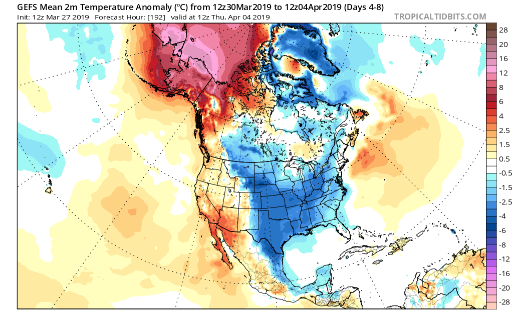
After a cold March (Indianapolis ran 4 F below average) and open to April, changes are on the horizon.
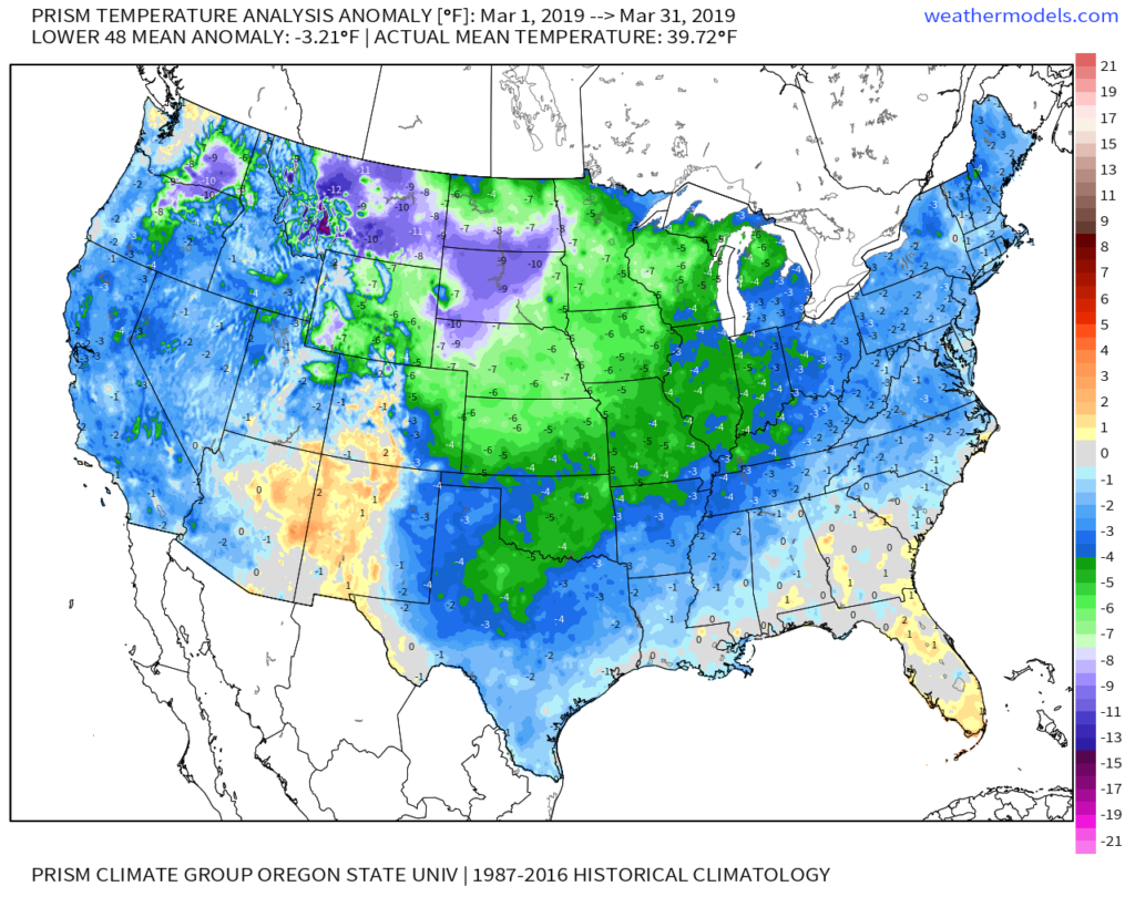
Before going further, March was always expected to be the coldest month (relative to average) of meteorological spring. For new subscribers, you can find our Spring Outlook here.
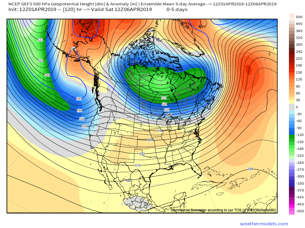
Looking ahead, note the rather dramatic shift that takes place at 500mb from the immediate term (image 1) to the medium range (or 6-10 day) period in image 2 below. Say goodbye to that AK ridge and subsequent downstream trough/ associated cooler than normal conditions.

This will likely result in the warmest air since October by the time we get to this weekend. High temperatures into the lower to middle 70s are a good bet this weekend. Saturday looks mostly dry before a few t-storms enter into the picture by Sunday.
As we look forward, additional unsettled conditions are a good bet early next week, along with seasonable to warmer than average conditions continuing.
Averages for April are as follows:
*High: 63.4
*Low: 42.7
*Rainfall: 3.81″
*Snowfall: 0.2″
By the time all is said and done, this is how we see April shaping up:
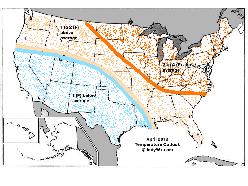

Modeling continues to show April opening cooler than normal and we agree that this will be the case, including a wetter than normal pattern, as well.
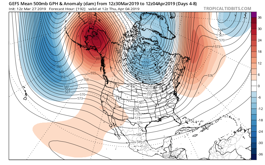

With that said, the persistent AK ridge begins to break down by the 2nd week of the month. This will lead to the early month chill being transient in nature and a significant flip to warmer than normal conditions during said timeframe, as well.
Note by the middle part of the month, a ridge is now forecast to be in the exact position the ‘mean’ trough position will locate itself for early month.
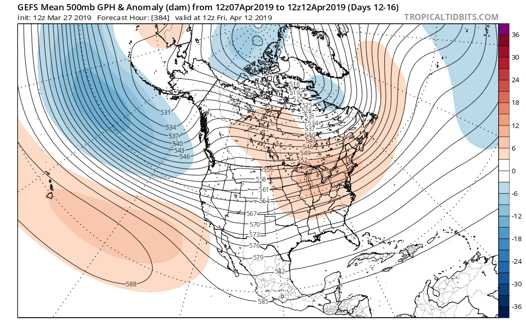
To no shock, it’s a vastly different temperature profile, as well. Now above normal warmth dominates. It’s easy to argue the model may not be warm ‘enough’ by this time over the OV and Northeast, with cooler anomalies across the SW.

The active pattern to open the month is expected to “settle down” for mid and late month as an upper level ridge dominates.
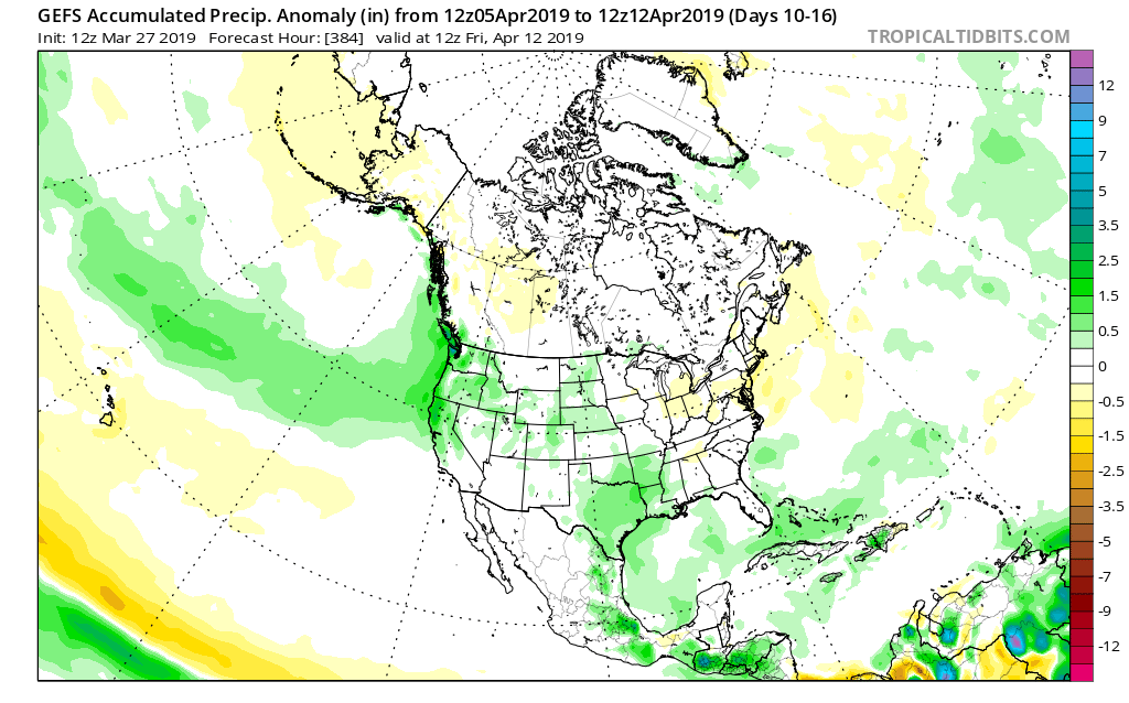
While the first week of April will likely run cooler and wetter than average, a rather significant flip in the pattern will result in drastically improved weather around these parts by mid and late April. By the time we get to month’s end, we think drier than normal conditions will rule across the northern Plains with warmer than average weather taking up shop across the Ohio Valley. A corridor of wetter than normal conditions is expected across the Intermountain West into the Lower MS River Valley.