VIDEO: Potential Of A Higher Impact Winter Event Next Week…
Updated 01.28.22 @ 7a
You must be logged in to view this content. Click Here to become a member of IndyWX.com for full access. Already a member of IndyWx.com All-Access? Log-in here.
Updated 01.28.22 @ 7a
You must be logged in to view this content. Click Here to become a member of IndyWX.com for full access. Already a member of IndyWx.com All-Access? Log-in here.
Updated 12.18.21 @ 6:30a
You must be logged in to view this content. Click Here to become a member of IndyWX.com for full access. Already a member of IndyWx.com All-Access? Log-in here.
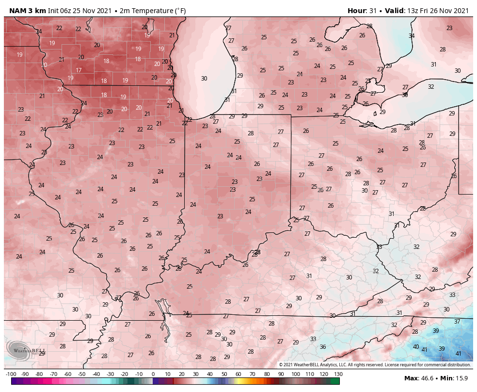
Updated 11.25.21 @ 6:53a
Our Thanksgiving morning is off to a wet start but the rain won’t last all day. A cold front will push across the state this afternoon (arriving into Indianapolis around noon) putting an end to the rain and allowing much colder air to blow in. Before that takes place, anywhere from 0.25” – 0.50” of rain is expected through the morning hours.

The airmass will grow cold enough by evening to allow snow showers and squalls to fire up off Lake Michigan and track into north and east central parts of the state (not expecting any significant accumulation).
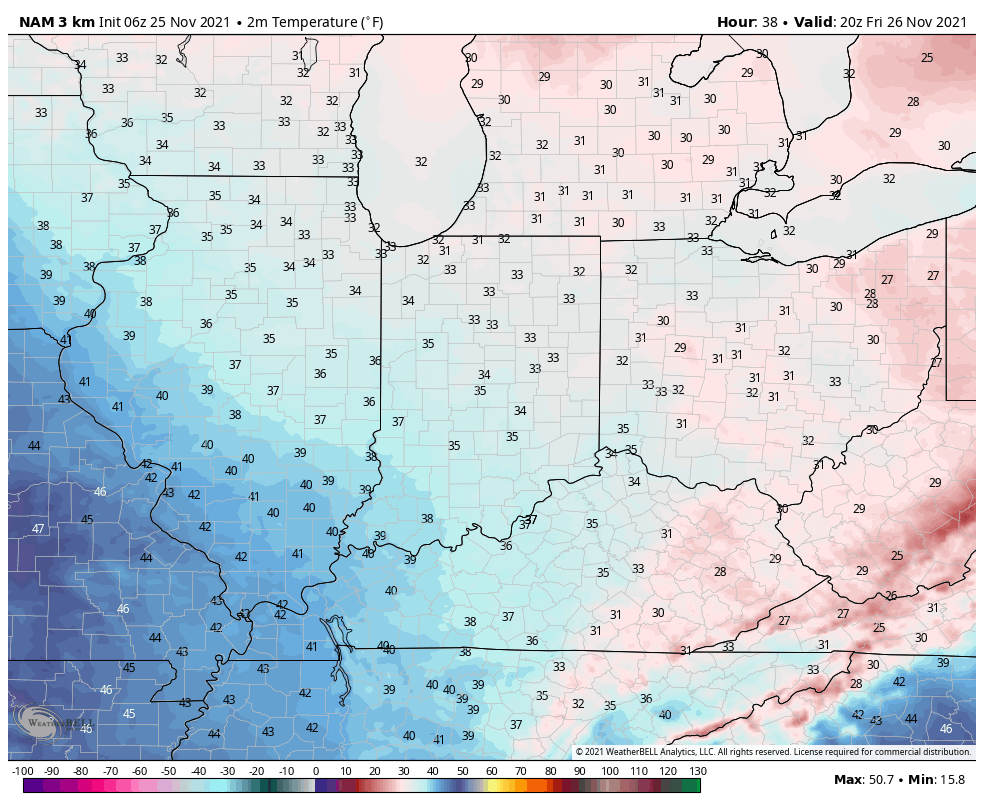
Black Friday will feature a return of dry and sunny conditions but it’ll be cold. A gusty northwest wind will mean you’ll want to grab the heavier coat out the door as temperatures that start out in the lower 20s won’t rise out of the 30s Friday afternoon.
The upcoming week will showcase a series of storm systems zipping by across the northern tier but most, if not all, of those systems will remain north of our immediate area. A generally quiet week of weather is forecast for now, once we get the upcoming 12-24 hours behind us.
From our family to yours, have a safe, happy, and blessed Thanksgiving.
Updated 10.16.21 @ 8:10a
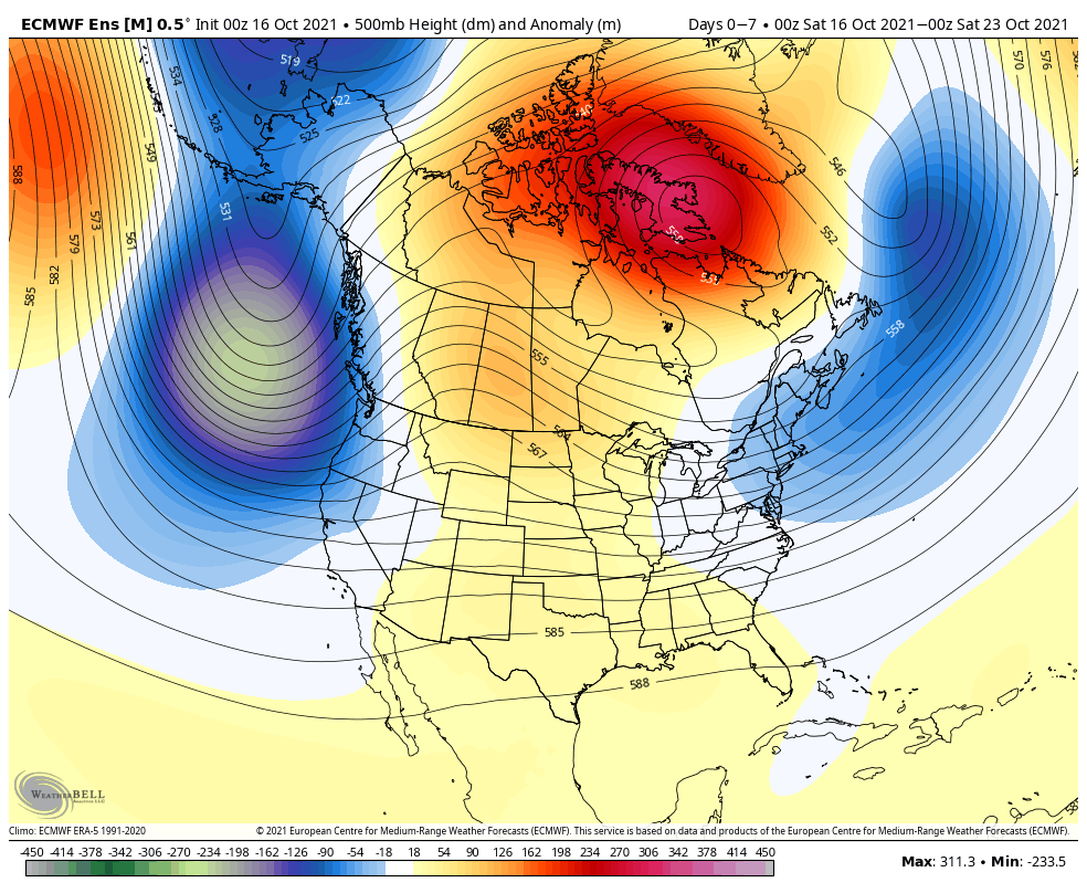


Forecast Period: 10.16.21 through 10.23.21
A true fall cold front blew through the region during the overnight. You can certainly feel the difference out the door this morning as northwest winds blow the chilly, much drier air into the region. Highs today will struggle to crack the 60° mark. “Sweater weather, anyone?!” We’ll prep for the first round of patchy frost in outlying areas by Sunday morning as temperatures dip into the mid and upper 30s, winds go calm, and skies are clear.
As we head into the new week, much needed dry time can be expected to open things up as high pressure dominates. Look for a string of sunny days and cool, clear nights. This will give the “nudge” needed to ignite what’s otherwise been a delayed and sluggish fall foliage season.
Our next system of note will arrive Thursday in the form of a low pressure system and trailing cold front. Showers are expected to arrive Thursday morning from the west. We’re not talking about impressive rainfall numbers with the front, itself (on the order of 0.10″ to 0.20″ Thursday), but the period heading into next weekend remains in limbo between forecast models duking it out with the wetter GFS and drier European. We’ll see if we can get more agreement over the next day or two.
Updated 09.05.21 @ 8a

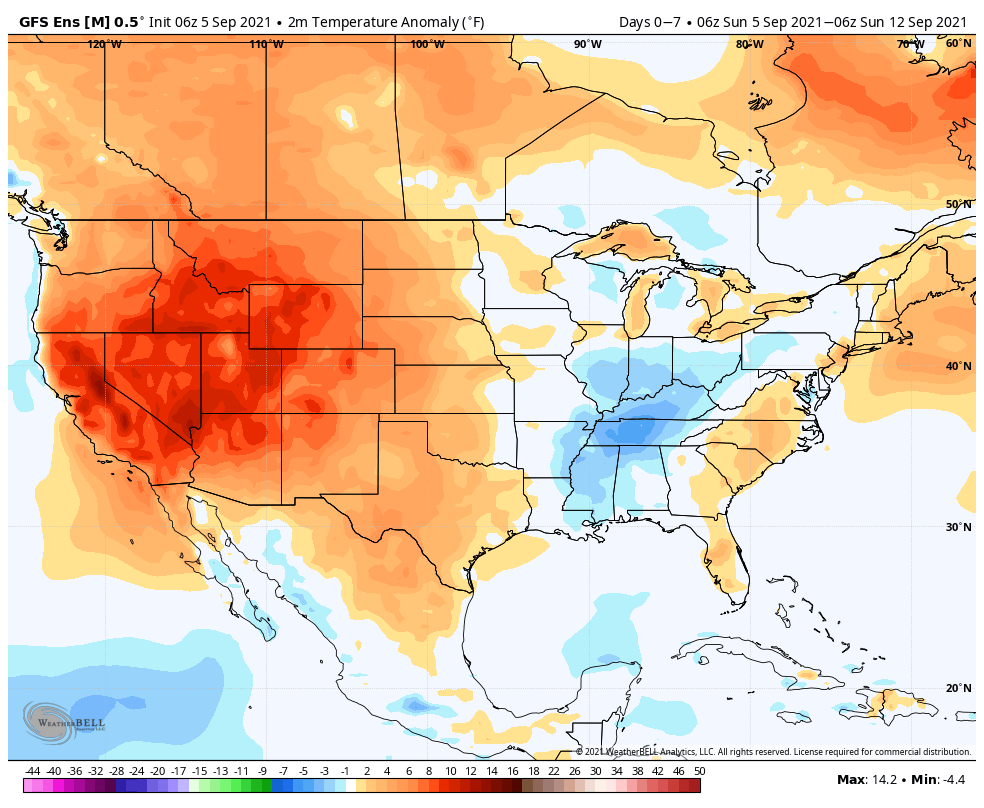


Forecast Period: 09.05.21 through 09.12.21
A very quiet weather pattern will settle into the region as we go through the upcoming week. The one exception to that is Tuesday night as a cold front quickly passes through the area. Moisture levels will return ever so slightly ahead of the boundary and may be enough to produce a couple of storms Tuesday evening (widely scattered coverage). The front will help to reinforce the dry airmass in place, along with provide cooler temperatures for mid and late week. As we look ahead beyond this week, indications are that things will moderate and turn a bit more active (though that’s admittedly not saying much, considering just how quiet things will be this week).