Updated 09.22.23 @ 10:41a
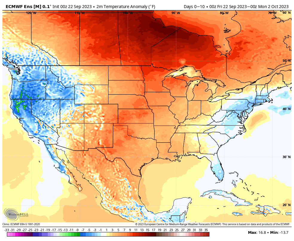
The pattern over the next 10 days will continue the same warmer than normal theme we’ve grown accustomed to as of late. Keep in mind that “normals” have now fallen into the lower to middle 70s for highs and lower 50s at night. Certainly far from a “blow torch,” but temperatures will run 5° to 10° above the norm as we put a bow on September.

Short-term rain chances will be handled in our daily videos. Guidance continues to differ widely on our mid week system. Needless to say, we’re not overly optimistic on the wetter solutions as of now, but will closely monitor to see if more consistency develops down the road.
As a whole, the pattern continues to look drier than normal over the next couple weeks overall.
Week 1

Week 2

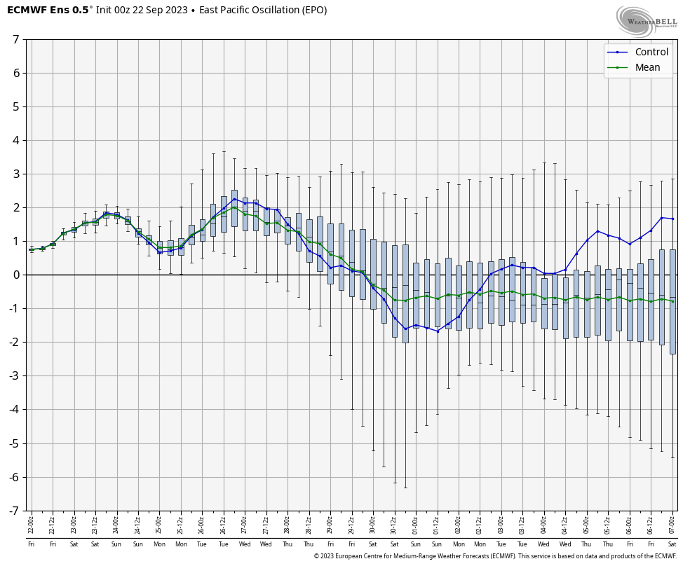
While guidance continues to look warm into early and mid October, I have to raise an eyebrow based on the latest teleconnection trends. We note the EPO trending negative while the PNA pops positive. These drivers should force a colder look Week 2 into Week 3 and I would suspect guidance will cool significantly as we get closer.


Further down the road, it’ll be important to keep tabs on western Pacific typhoon activity and the Madden Julian Oscillation. There are signs we may finally start to see the MJO become more of a player in the pattern towards mid October. Time will tell.

In the meantime, keep a close eye on guidance Week 2 into Week 3 as this will be the first real test case to revisit so far this meteorological fall season…
